Wikimedi'Òc
Modes d'emploi

Cet album fait partie des albums
Cet album photos contient les sous-albums suivants :


Carrick Roads Panorama.jpg - EvaK

Carrick Roads May 2004.jpg - EvaK
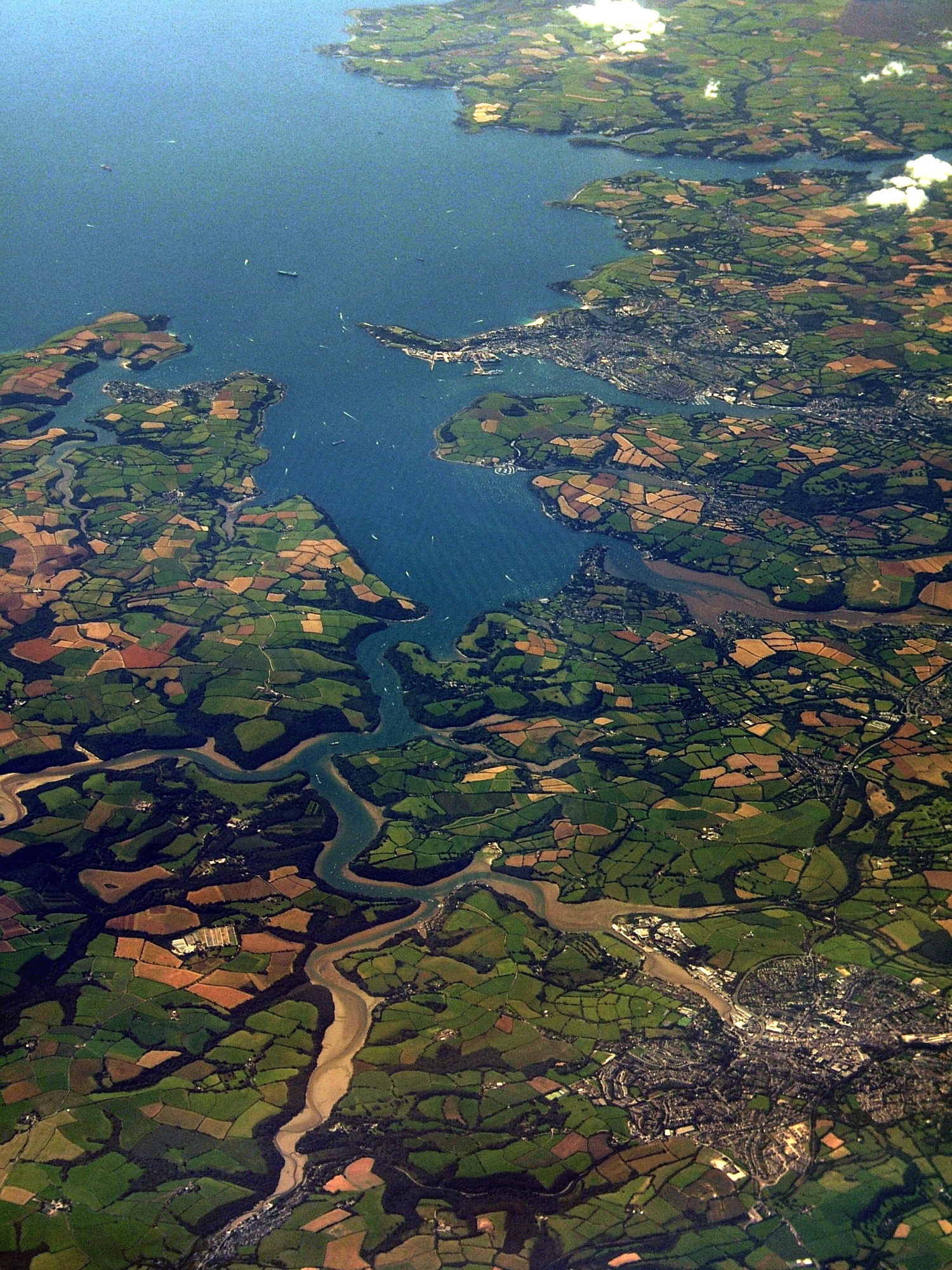
TruroFalmouthAerial.jpg - Smalljim

St Just in Roseland.jpg - File Upload Bot (Magnus Manske)

Castle Cove, St Mawes - geograph.org.uk - 29070.jpg - GeographBot

St Mawes - geograph.org.uk - 29327.jpg - GeographBot

Carrick Roads - geograph.org.uk - 51846.jpg - GeographBot

Pill Creek - geograph.org.uk - 148712.jpg - GeographBot

Carrick Roads from near Tregear Vean - geograph.org.uk - 232416.jpg - GeographBot

Ships anchored in the River Fal - geograph.org.uk - 1597838.jpg - File Upload Bot (Magnus Manske)
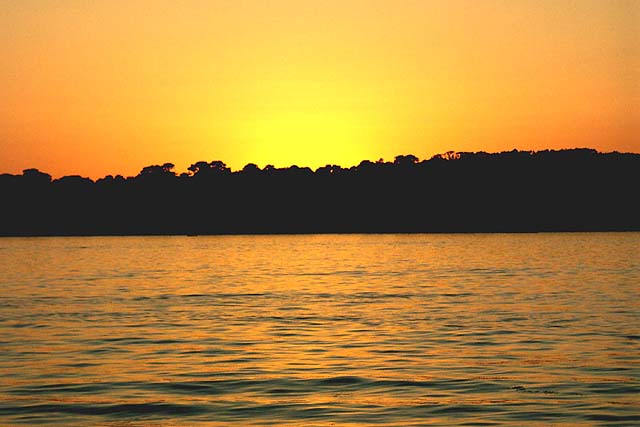
Sunset on Carrick Roads - geograph.org.uk - 320991.jpg - File Upload Bot (Magnus Manske)

Pine at Great Molunan.jpg - Nilfanion

Aerial view from Paramotor of Roseland Peninsula - geograph.org.uk - 305639.jpg - GeographBot

Footpath to Mylor - geograph.org.uk - 304866.jpg - GeographBot

Ship at Falmouth Docks - geograph.org.uk - 308137.jpg - GeographBot

Carrick Roads. The Foreshore below Porthgwidden. - geograph.org.uk - 371708.jpg - GeographBot

Carrick Roads from St Anthony - geograph.org.uk - 476583.jpg - GeographBot

Carrick Roads from St Anthony Head - geograph.org.uk - 476578.jpg - GeographBot

Carrick Roads from Trelissick gardens - geograph.org.uk - 473974.jpg - GeographBot

Percuil River - geograph.org.uk - 476588.jpg - GeographBot

Confluence of the River Fal and Truro Rivers - geograph.org.uk - 485770.jpg - GeographBot

The rocky shore of the Carrick Roads - geograph.org.uk - 527096.jpg - GeographBot

The Carrick Roads (East) in the Falmouth Estuary - geograph.org.uk - 601294.jpg - GeographBot

The Carrick Roads (West) in the Falmouth Estuary - geograph.org.uk - 601291.jpg - GeographBot

The Carrick Roads in the Falmouth Estuary - geograph.org.uk - 601417.jpg - GeographBot

The Coastline to the East of the Carrick Roads in the Falmouth Estuary - geograph.org.uk - 601297.jpg - GeographBot

The Coastline to the East of the Carrick Roads in the Falmouth Estuary - geograph.org.uk - 601302.jpg - GeographBot

Oyster boats, Carrick Roads - geograph.org.uk - 625045.jpg - GeographBot

Turnaware Bar, Carrick Roads - geograph.org.uk - 623017.jpg - GeographBot

Carrick Roads - geograph.org.uk - 715950.jpg - GeographBot

Falmouth Docks and Carrick Roads - geograph.org.uk - 715924.jpg - GeographBot

Commerrans Farm, St Just in Roseland - geograph.org.uk - 780729.jpg - GeographBot

Fal Estuary, St Just in Roseland - geograph.org.uk - 780630.jpg - GeographBot

Greatwood Quay - geograph.org.uk - 780956.jpg - GeographBot

Messack, St Just in Roseland - geograph.org.uk - 780306.jpg - GeographBot

Tolcarne Creek and Camerance Wood - geograph.org.uk - 780928.jpg - GeographBot

Kilnquay Wood Flushing - geograph.org.uk - 826946.jpg - GeographBot

Trefusis Point Flushing - geograph.org.uk - 826800.jpg - GeographBot

Woodland NE of Trefusis point - geograph.org.uk - 826958.jpg - GeographBot

Looking up Lamouth Creek from near Round Wood - geograph.org.uk - 855178.jpg - GeographBot

Peace and quiet - geograph.org.uk - 882659.jpg - GeographBot

Carrick Roads from Penarrow Point - geograph.org.uk - 922010.jpg - GeographBot

Cormorant drying off after an afternoon's fishing - geograph.org.uk - 945823.jpg - GeographBot

Governor buoy - geograph.org.uk - 962756.jpg - GeographBot

St Mawes from St Anthony Head - geograph.org.uk - 978202.jpg - GeographBot

Harcourt, near Feock. - geograph.org.uk - 1124933.jpg - GeographBot

Falmouth, Carrick Roads, and Roseland Peninsula from near Trenoweth Lane - geograph.org.uk - 1192773.jpg - GeographBot

Ponsharden Creek and the Park and Ride - geograph.org.uk - 1232346.jpg - GeographBot

Pill Creek - geograph.org.uk - 1280229.jpg - GeographBot

Carrick Roads and the foreshore below Messack Farm - geograph.org.uk - 1377860.jpg - GeographBot

Fields at Commerans Farm on Carrick Roads - geograph.org.uk - 1378121.jpg - GeographBot

Mussel farm on the River Fal - geograph.org.uk - 1378600.jpg - GeographBot

Northbank buoy in Carrick Roads - geograph.org.uk - 1377900.jpg - GeographBot

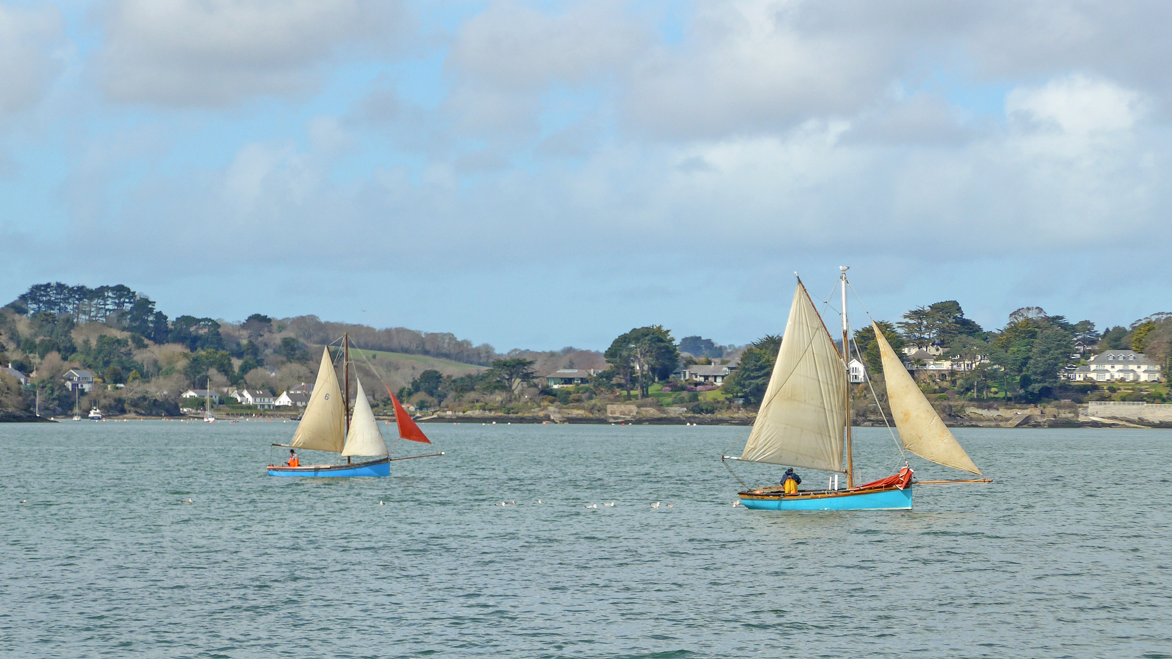
Yachts racing on Carrick Roads - geograph.org.uk - 1375348.jpg - GeographBot

Coombe. An inlet off Cowlands Creek - geograph.org.uk - 1533228.jpg - GeographBot

Methane Princess moored on the River Fal - geograph.org.uk - 1625678.jpg - SteKrueBe
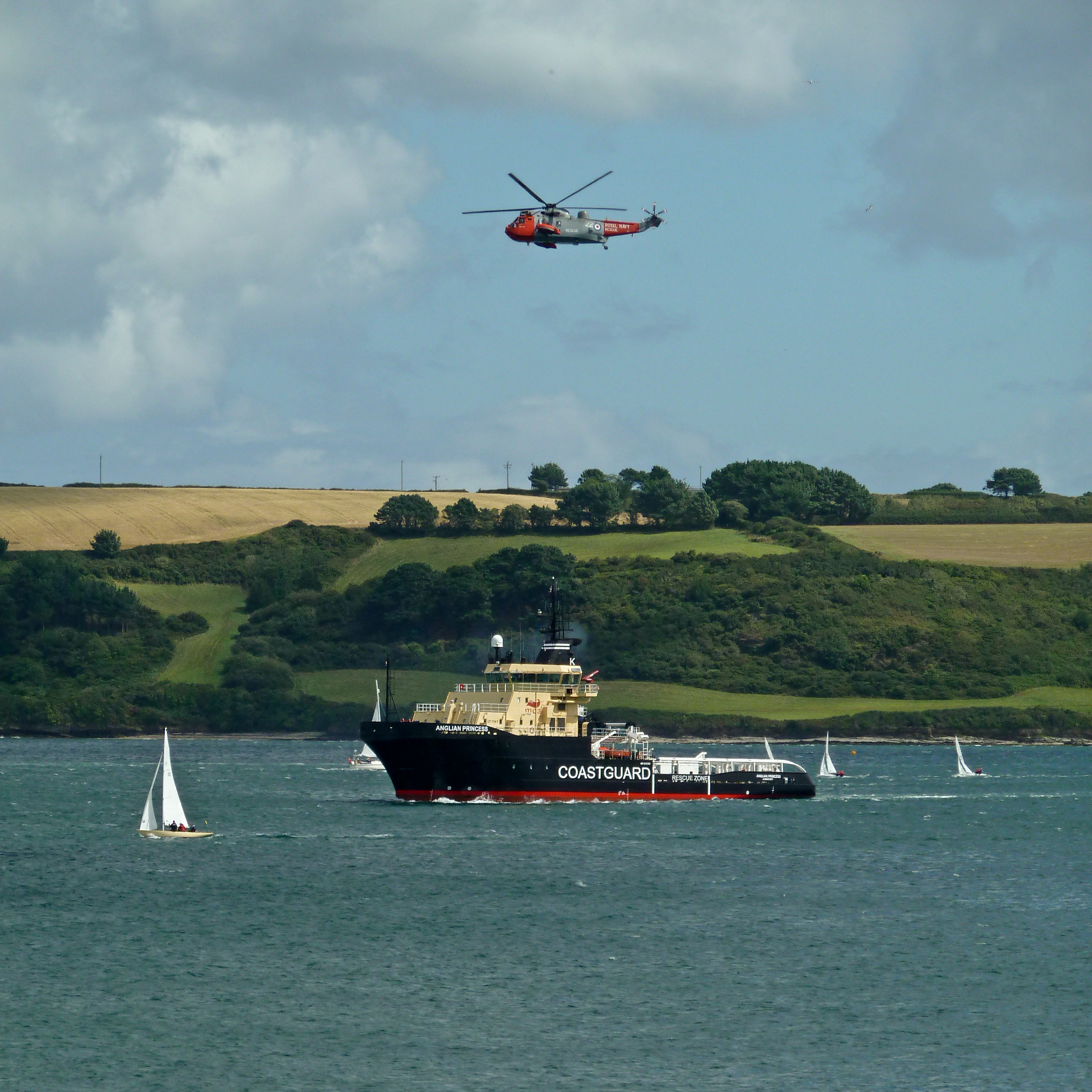
Emergency Tow Vessel Anglian Princess and Royal Navy Search and Rescue Helicopter -22 in Carrick Roads.jpg - Geo Swan

Henry Scott Tuke - Two French barques at their anchorage in Carrick Roads.jpg - Botaurus

Henry Scott Tuke - Shipping at anchor, Carrick Roads.jpg - Botaurus

Henry Scott Tuke - Windjammers lying in the Carrick Roads above Falmouth.jpg - Botaurus

00023j79144 Yul cdg 20140624-015803.00.jpg - Emdx

J79154 Yul cdg 20140624-044343.15 Angleterre.jpg - Emdx

Carrick Roads from below Pendennis Castle (8749).jpg - KTC

Carrick Roads (8972).jpg - KTC

Carrick Roads (8978).jpg - KTC

Norman Bridge in Carrick Roads (8748).jpg - KTC

Norman Bridge in Carrick Roads (8973).jpg - KTC

St Just Creek from Carrick Roads (8976).jpg - KTC

Carrick Roads (29103455910).jpg - INeverCry

Trefusis Point (29357395866).jpg - INeverCry

Carrick Roads (28726359693).jpg - INeverCry

Carrick Roads (28745616743).jpg - INeverCry

Carrick Roads (29194903861).jpg - INeverCry

Carrick Roads (28568346533).jpg - INeverCry

Sailing in Carrick Roads (28567916573).jpg - INeverCry

Carrick Roads, from Greatwood (28411252814).jpg - INeverCry

Carrick Roads, from Greatwood (28745547680).jpg - INeverCry

Long Bright (28973143806).jpg - INeverCry

Peter John II (FH690) (28916223235).jpg - INeverCry

Carrick Roads (28883710816).jpg - INeverCry

Carrick Roads (26403531656).jpg - INeverCry

Carrick Roads (25808621823).jpg - INeverCry
Working Boats in Carrick Roads (26241466092).jpg - INeverCry

Path by Carrick Roads (26041671870).jpg - INeverCry

Working boats in Carrick Roads (26186444142).jpg - INeverCry

Carrick Roads (26100521752).jpg - INeverCry

Sailing in Carrick Roads (25556786223).jpg - INeverCry

Carrick Roads (25554285804).jpg - INeverCry
Wake (25470178194).jpg - INeverCry

View of Falmouth Bay from Trewen (4298552788).jpg - INeverCry

Rix Hawk (2811967032).jpg - INeverCry

View from Little Dennis (4253399161).jpg - INeverCry

Carrick Roads (3469337962).jpg - INeverCry

Carrick Roads in Cornwall (33352520133).jpg - DatGuy

Admiralty Chart No 154 Approaches to Falmouth, Published 1943.jpg - Kognos

Carrick Roads boundary stone.jpg - Jowaninpensans

Flushing - Flushing and Mylor Pilot Gig boathouse.jpg - Jowaninpensans

Carrick Roads (6011773673).jpg - Blue Elf

Passing Little Dennis (4935202281).jpg - JotaCartas

Sailboat Carrick Roads.jpg - Kmtextor

'Sea Worker' platform jack-up rig - geograph.org.uk - 2152387.jpg - GeographBot

Looking down the Carrick Roads towards Falmouth - geograph.org.uk - 2204600.jpg - GeographBot
Carrick Roads.jpg - Murgatroyd49

The entrance to Carrick Roads - geograph.org.uk - 2556064.jpg - GeographBot

Falmouth, defending Carrick Roads - geograph.org.uk - 3707480.jpg - GeographBot

Winter early morning on Carrick Roads - geograph.org.uk - 4798196.jpg - GeographBot

Carrick Roads, St Mawes Ferry Passing Trefusis Point - geograph.org.uk - 5479931.jpg - GeographBot

St Mawes ferry.jpg - Murgatroyd49

Carrack Roads and Pencarrow Point - geograph.org.uk - 5599067.jpg - GeographBot

Carrick Roads, from above St Mawes (9497839682).jpg - INeverCry