Wikimedi'Òc
Modes d'emploi

Cet album fait partie des albums
Cet album photos contient les sous-albums suivants :


1747 Bowen Map of North America - Geographicus - NorthAmerica-bowen-1747.jpg - BotMultichill

French and indian war map.svg - Sémhur

Furber & James A New Map of Mexico, California & Oregon 1847-1848 UTA.jpg - Michael Barera

Moll Map of the West-Indies or the Islands of America in the North Sea c. 1715 UTA.jpg - Michael Barera
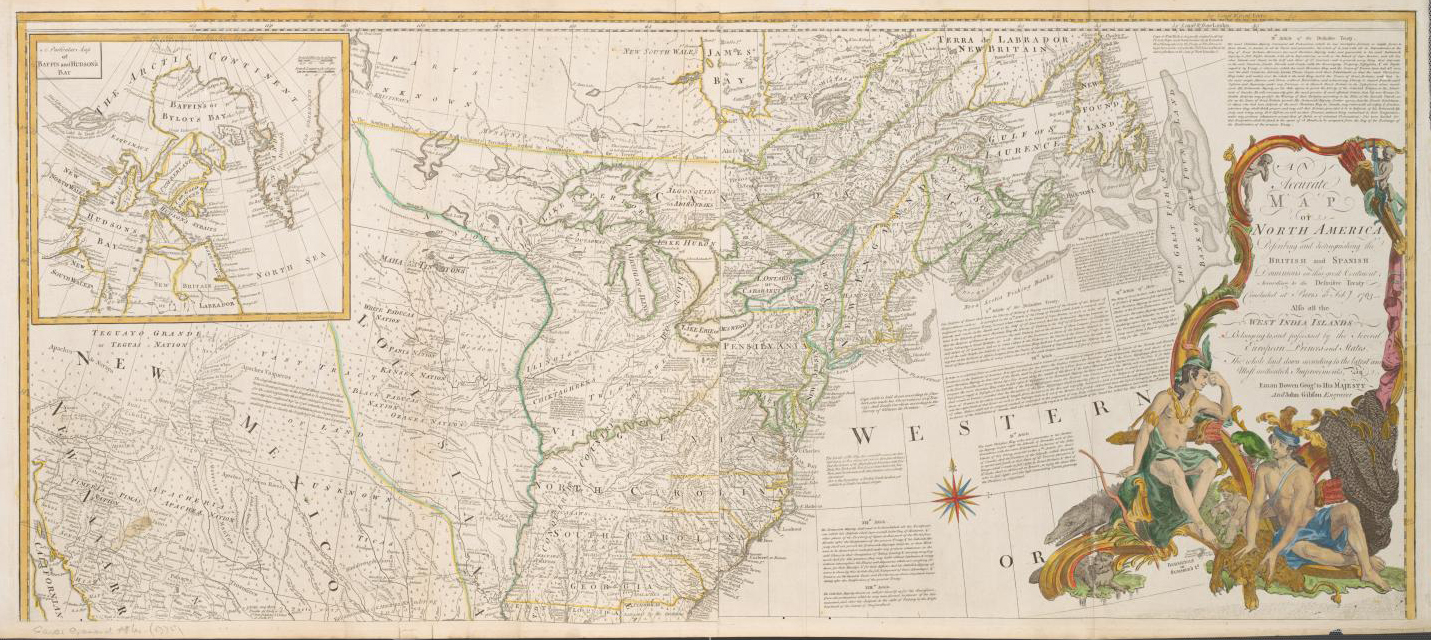
Sayer Accurate Map of North America 1775 UTA (top).jpg - Michael Barera

Sayer Accurate Map of North America 1775 UTA (bottom).jpg - Michael Barera

Ice shields during the Pleistocene period in North America.svg - Lallint

Map of North America, reduced from map on scale of 1-5.000.000 - compiled by the U. S. Geological Survey - btv1b53209991f.jpg - Gzen92Bot

International airline operations in the Middie American area as of January 1, 1949 - btv1b53192772d.jpg - Gzen92Bot

Nicaragua-Costa Rica - Panama Land Use - DPLA - 781bc7345dccb86b218ae89cecd31c99.jpg - DPLA bot

Pan American Highway - DPLA - 7f0fcead9e4524c25c1d3efc9dde78b7.jpg - DPLA bot

Life expectancy map -Americas -2019 -with names.png - Lady3mlnm

Life expectancy map -Americas -2020 -with names.png - Lady3mlnm

Life expectancy map -Americas -2021 -with names.png - Lady3mlnm

Life expectancy map -Caribbean -2019 -with names.png - Lady3mlnm

Life expectancy map -Caribbean -2020 -with names.png - Lady3mlnm
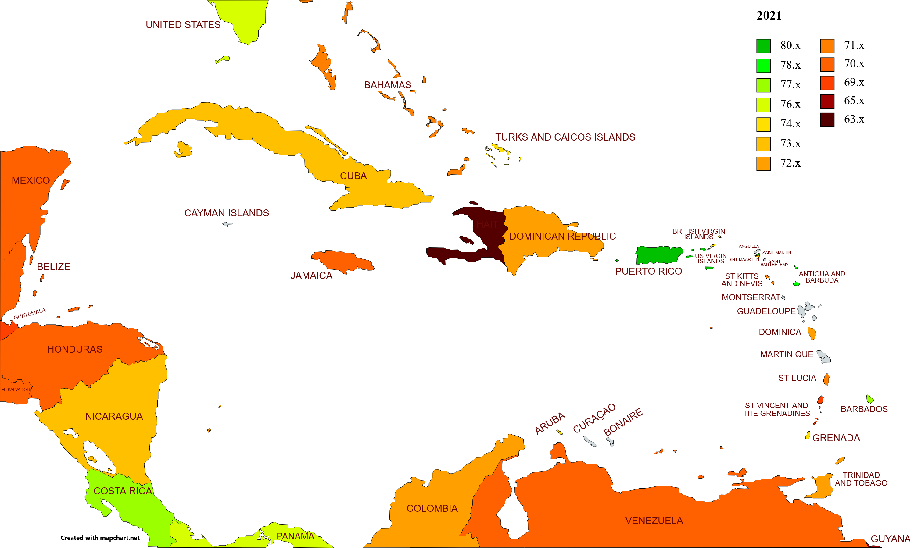
Life expectancy map -Caribbean -2021 -with names.png - Lady3mlnm

Life expectancy map -North America -2019 -with names.png - Lady3mlnm

Life expectancy map -North America -2021 -with names.png - Lady3mlnm

Life expectancy map -North America -2020 -with names.png - Lady3mlnm

Life expectancy map -Central America -2020 -with names.png - Lady3mlnm

Life expectancy map -Central America -2019 -with names.png - Lady3mlnm

Life expectancy map -Central America -2021 -with names.png - Lady3mlnm