Wikimedi'Òc
Modes d'emploi

Cet album fait partie des albums
Cet album photos contient les sous-albums suivants :


Map showing the change in population (increases & decreases) of Punjab Province, British India, published in 'The Panjab, North-West Frontier Province and Kashmir' (1916).jpg - MaplesyrupSushi

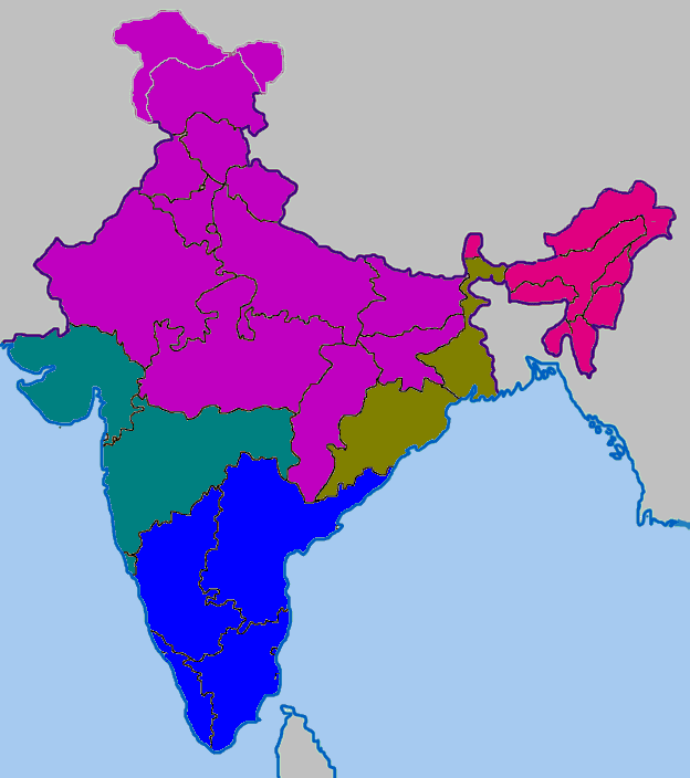
Cultural regional areas of India.png - Miljoshi
Demoindien 2.jpg - Nicke L

India sex ratio map en.svg - Planemad
Saivism-india-advaita.png - File Upload Bot (Magnus Manske)

Maps of india1.PNG - Pradeep90

Maps of india2.PNG - Pradeep90

Maps of india3.PNG - Pradeep90

India-states-population.svg - Arna11420

2001nian Yindu Renlei Fazhan Zhishu.png - Shibo77
1991nian Yindu Renlei Fazhan Zhishu.png - Shibo77

2005nian Yindu Renlei Fazhan Zhishu.png - Shibo77
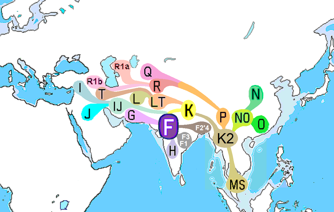
Haplogroup F (Y-DNA).PNG - Рагин1987

India Top 10 Biggest Cities.png - Taylorluker~commonswiki
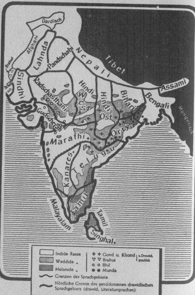
India-races.jpg - Uktebenizer

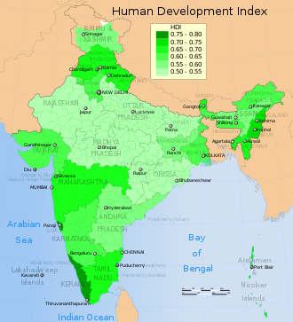
Indian States - HDI MAP.png - Sajanpaul9

2006 Human Development Index for India map by states, HDI data by GoI and UNDP India.svg - Mr. Ibrahem

2011 Census sex ratio map for the states and Union Territories of India Boys to Girls 0 to 1 age group.svg - M Tracy Hunter

2011 Census Scheduled Caste caste distribution map India by state and union territory.svg - Aishik Rehman

2011 Census Scheduled Tribes distribution map India by state and union territory.svg - C1MM

2012 Crime rate against Scheduled Tribes per 100000 in India by States and Union Territories.svg - M Tracy Hunter

2012 Crime rate against Scheduled Castes per 100000 in India by States and Union Territories.svg - M Tracy Hunter

2012 Crime Rate against Women per 100000 in India by its States and Union Territories, VAW Map.svg - M Tracy Hunter

Chamar Population by Stae Percentage.png - GifTagger

Chamar Population by State 1.png - GifTagger
Culturemapindia.png - GifTagger

FE-India-Map-2014.jpg - Alokibees
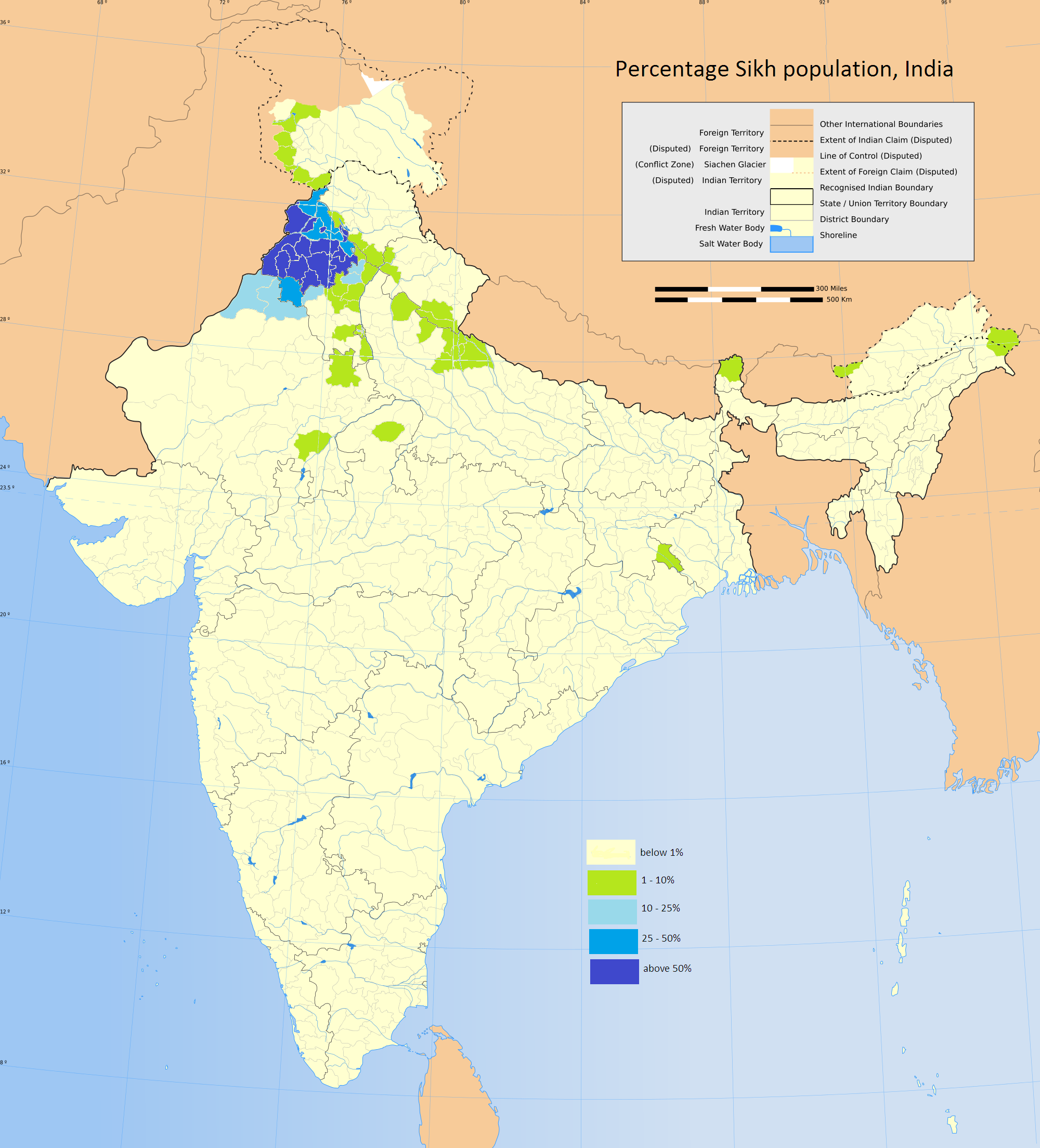
Percentage Sikh population, India.png - फ़िलप्रो

2011 Census Scheduled Caste caste distribution map India by state and union territory de.svg - Furfur

2011 Census Scheduled Tribes distribution map India by state and union territory de.svg - Furfur

Indian tribes between the Indus and the Ganges.jpg - पाटलिपुत्र

Rates of sexual offences against women in Indian states - 2015.png - Nirinsanity

Sexual offences against women in Indian cities - 2015.png - Nirinsanity

1931 Boundaries of States in Rajputana.png - Deccantrap

2011 Census sex ratio map for the states and Union Territories of India Boys to Girls 0 to 1 age group-ar.svg - باسم

Indian states and union territories by population, 2011.png - Radom1967

Level of Urbanisation in India 2021.png - Kronocracy

India TFR data.svg - C1MM

Population density of India states and union territories.png - Austiger

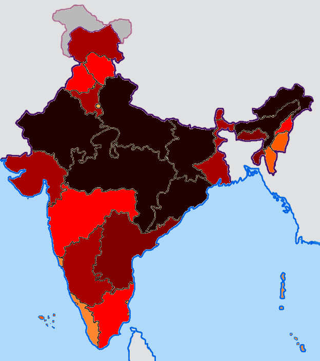
2006 India HDI-ar.svg - Mr. Ibrahem

2006 India HDI-ar.png - Mr. Ibrahem
Mayurbhanj State map 1931.jpg - MaxA-Matrix

1931, Mayurbhanj state's population immigration map.jpg - MaxA-Matrix

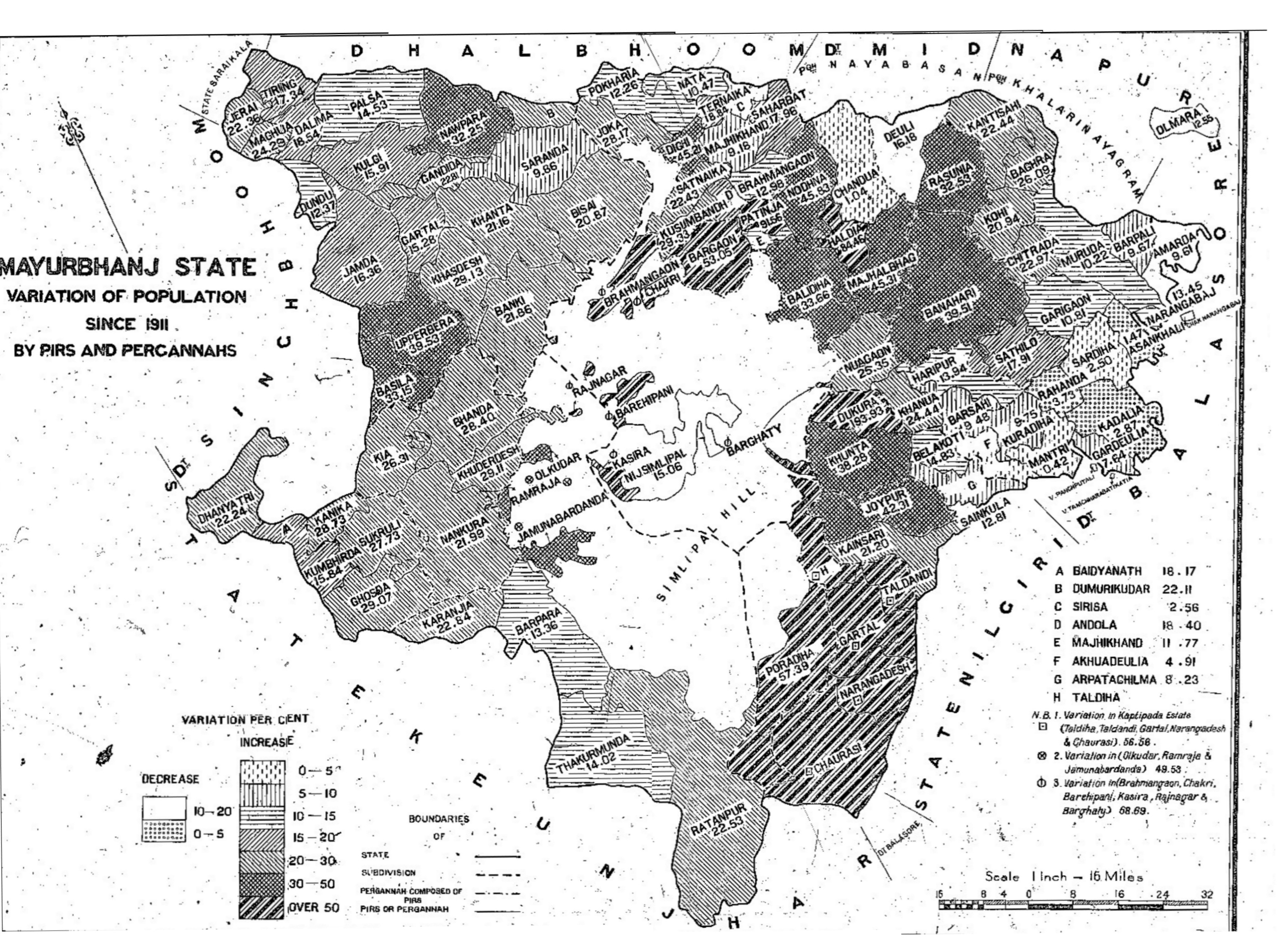
1931, Mayurbhanj state's population variation map.jpg - MaxA-Matrix

Percent of scheduled tribes in India by tehsils by census 2011.png - Kaiyr

Percent of scheduled tribes in India-tehsils-census 2011.svg - Goran tek-en