Wikimedi'Òc
Modes d'emploi

Cet album fait partie des albums
Cet album photos contient les sous-albums suivants :


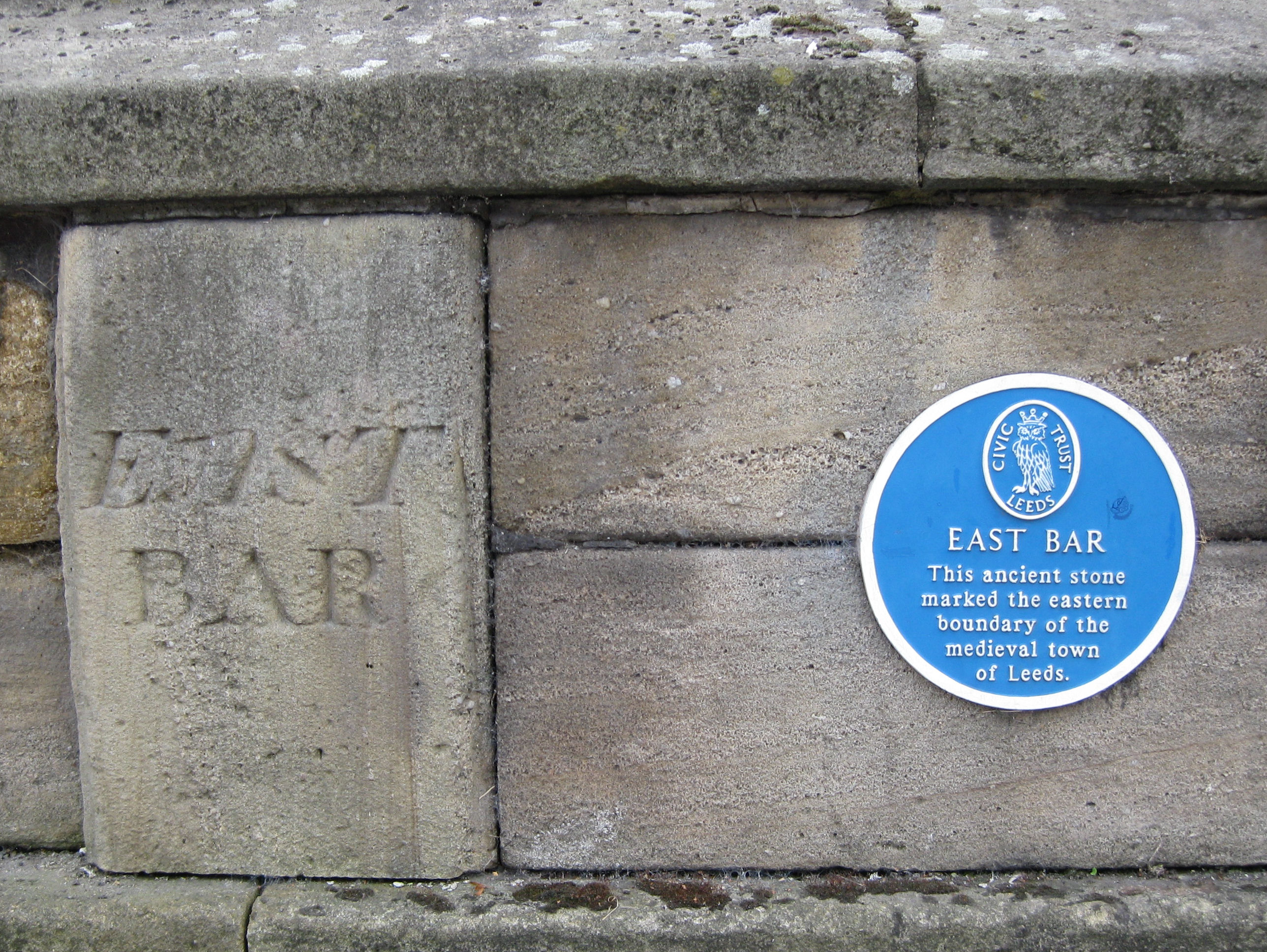
East Bar Stone plaque.jpg - Chemical Engineer

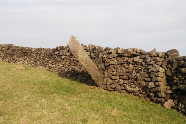
The Greenwood Stone, Midgley Moor - geograph.org.uk - 16670.jpg - Geograph Update Bot

Boundary stone, Flints - geograph.org.uk - 38120.jpg - GeographBot

Boundary stone, Rastrick and Fixby - geograph.org.uk - 39556.jpg - GeographBot

Boundary stone - geograph.org.uk - 38142.jpg - GeographBot

Boundary stone, Blackstone Edge - geograph.org.uk - 105937.jpg - Geograph Update Bot

LYR stone, Tofts Road, Cleckheaton - geograph.org.uk - 104731.jpg - GeographBot

Boundary Stone - geograph.org.uk - 135106.jpg - GeographBot

Boundary Stone - geograph.org.uk - 135109.jpg - GeographBot

Boundary stone, Carr House Road (A6036),Shelf - geograph.org.uk - 208645.jpg - GeographBot

Boundary stone, Middle Moor Flat - geograph.org.uk - 225607.jpg - Geograph Update Bot

The Stump Cross, Stump Cross Lane, Pontefract - geograph.org.uk - 241019.jpg - GeographBot

Boundary stone at Peat Ponds Farm, Lindley Moor Road, Old Lindley - geograph.org.uk - 262273.jpg - GeographBot

Boundary stone, Scammonden - geograph.org.uk - 289607.jpg - GeographBot

County Boundary Stone - geograph.org.uk - 280123.jpg - GeographBot

Ackworth Plague Stone - geograph.org.uk - 303586.jpg - GeographBot

Looking south east from Oxenhope Stoop Hill - geograph.org.uk - 364858.jpg - GeographBot

Northowram and Shelf Parish Boundary - geograph.org.uk - 386585.jpg - GeographBot

Boundary Stone, Hawksworth Moor - geograph.org.uk - 394471.jpg - Geograph Update Bot

Boundary stone, Shelley - Kirkburton - geograph.org.uk - 393876.jpg - GeographBot

Boundary Stone, Lanshaw - geograph.org.uk - 401233.jpg - Geograph Update Bot

Boundary stone on Deanhead Moor - geograph.org.uk - 450626.jpg - GeographBot

Boundary Stone on Langfield Common. - geograph.org.uk - 502011.jpg - GeographBot

Boundary stone - geograph.org.uk - 563977.jpg - GeographBot

Boundary stone, Halifax - Queensbury - geograph.org.uk - 591528.jpg - GeographBot

Boundary stone, Brighouse and Denholme Gate Road, Shelf - geograph.org.uk - 613857.jpg - GeographBot

Boundary stone, Brighouse and Denholme Gate Road, Shelf - geograph.org.uk - 613874.jpg - GeographBot

Boundary Stone marked "JC" - geograph.org.uk - 646402.jpg - GeographBot

Boundary Stone, Woodhead Road, Steps, Honley - geograph.org.uk - 724218.jpg - GeographBot

Boundary stone, Emley - Kirkburton - geograph.org.uk - 786008.jpg - GeographBot

Boundary stone, Shelley - Kirkburton, Penistone Road A629 - geograph.org.uk - 785896.jpg - GeographBot

Boundary stone, Shelley Bank Bottom - geograph.org.uk - 786614.jpg - GeographBot

Boundary stone, Turvin Road B6138, Mytholmroyd - geograph.org.uk - 843397.jpg - GeographBot

Boundary stone, Wham Head, Marsden - geograph.org.uk - 851110.jpg - GeographBot
Pole Stoop - geograph.org.uk - 975243.jpg - GeographBot

Sutton Stoop. - geograph.org.uk - 975263.jpg - GeographBot

Boundary stone, Sowerby - geograph.org.uk - 987046.jpg - GeographBot

The boundary stone between Stainland and Greetland. - geograph.org.uk - 1023513.jpg - GeographBot

Boundary stone on Erringden Moor - geograph.org.uk - 1102986.jpg - GeographBot

Boundary stone, Moor Lane B6107, Meltham - geograph.org.uk - 1112962.jpg - GeographBot

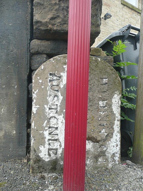
Highway boundary stone, Holmbridge, Austonley - geograph.org.uk - 1112612.jpg - GeographBot

Boundary Stone, Deep Lane, Luddenden Foot - Warley - geograph.org.uk - 1170058.jpg - GeographBot

Boundary stone, Balkram Edge - geograph.org.uk - 1221038.jpg - GeographBot

Boundary Stone, Ovenden - geograph.org.uk - 1238833.jpg - GeographBot

Boundary Stone at Three Nuns, Mirfield - geograph.org.uk - 1245046.jpg - GeographBot

Boundary Stone at Three Nuns, Mirfield - geograph.org.uk - 1245054.jpg - GeographBot

Boundary Stone, Oxenhope Stoop Hill - geograph.org.uk - 1251919.jpg - GeographBot
Boundary Stone, Woodhead Road, Holmfirth - geograph.org.uk - 1339734.jpg - GeographBot

Boundary stone - geograph.org.uk - 1359458.jpg - GeographBot

Boundary stone, Meltham Moor - geograph.org.uk - 1373908.jpg - GeographBot

Boundary stone, Woodhead Road, Holme - geograph.org.uk - 1412955.jpg - GeographBot

Boundary stone, Blackstone Edge Road - geograph.org.uk - 1470534.jpg - GeographBot

Boundary stone, Erringden Moor, Mytholmroyd - geograph.org.uk - 1524994.jpg - GeographBot

Little Bradley Boundary Stone - geograph.org.uk - 1572586.jpg - GeographBot

Boundary Stone, Exley Lane, Elland - geograph.org.uk - 1725805.jpg - GeographBot

Boundary Stone, Oxenhope Stoop Hill - geograph.org.uk - 1751760.jpg - GeographBot

Boundary Stone and Dick Delf Hill - geograph.org.uk - 1751736.jpg - GeographBot

Boundary stone (16405469838).jpg - INeverCry
NQ1889 (2436628447).jpg - INeverCry

Boundary (2581956068).jpg - INeverCry

CN (2527883473).jpg - INeverCry

O-C (2611336500).jpg - INeverCry

CN (3772257379).jpg - INeverCry

East Bar (5034518862).jpg - INeverCry

Boundary Stone, Addingham (5603763429).jpg - INeverCry
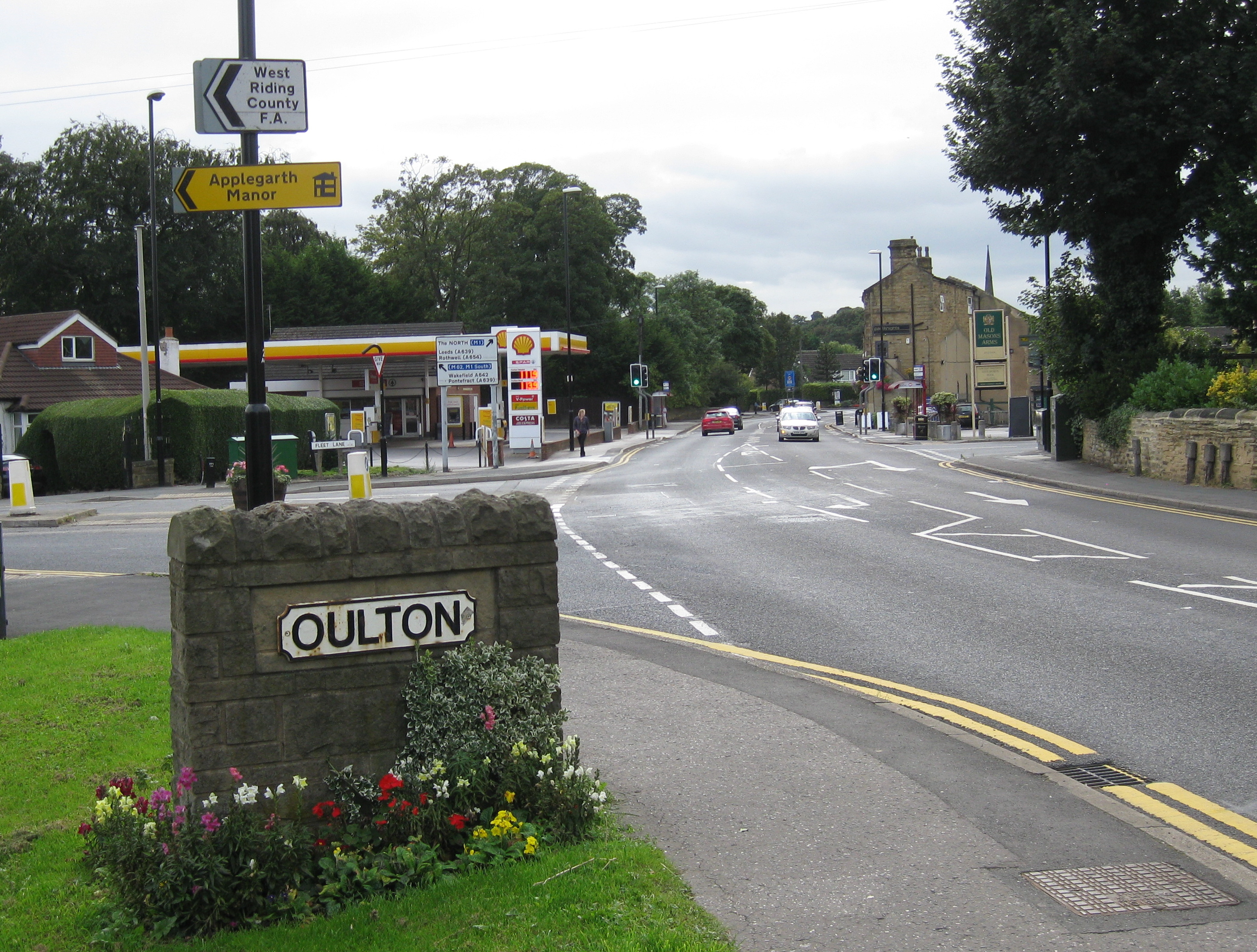
Oulton Aberford Road 2016.jpg - Chemical Engineer
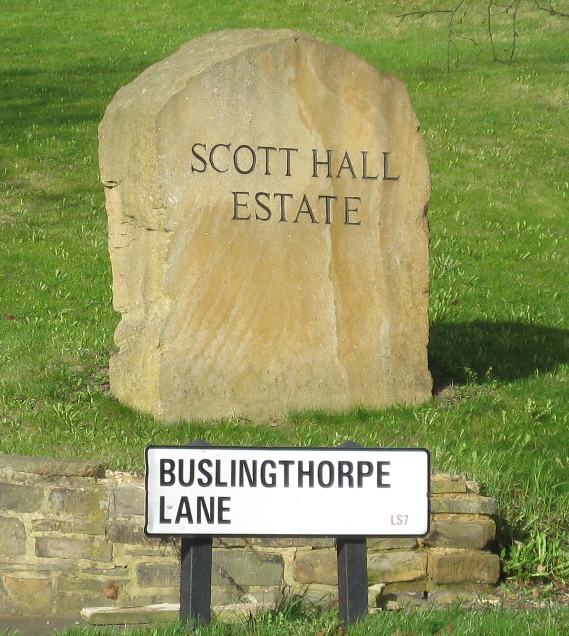
Scott Hall Estate South Boundary Marker.jpg - Chemical Engineer

Welcome to Swarcliffe Stanks Garth.jpg - Chemical Engineer

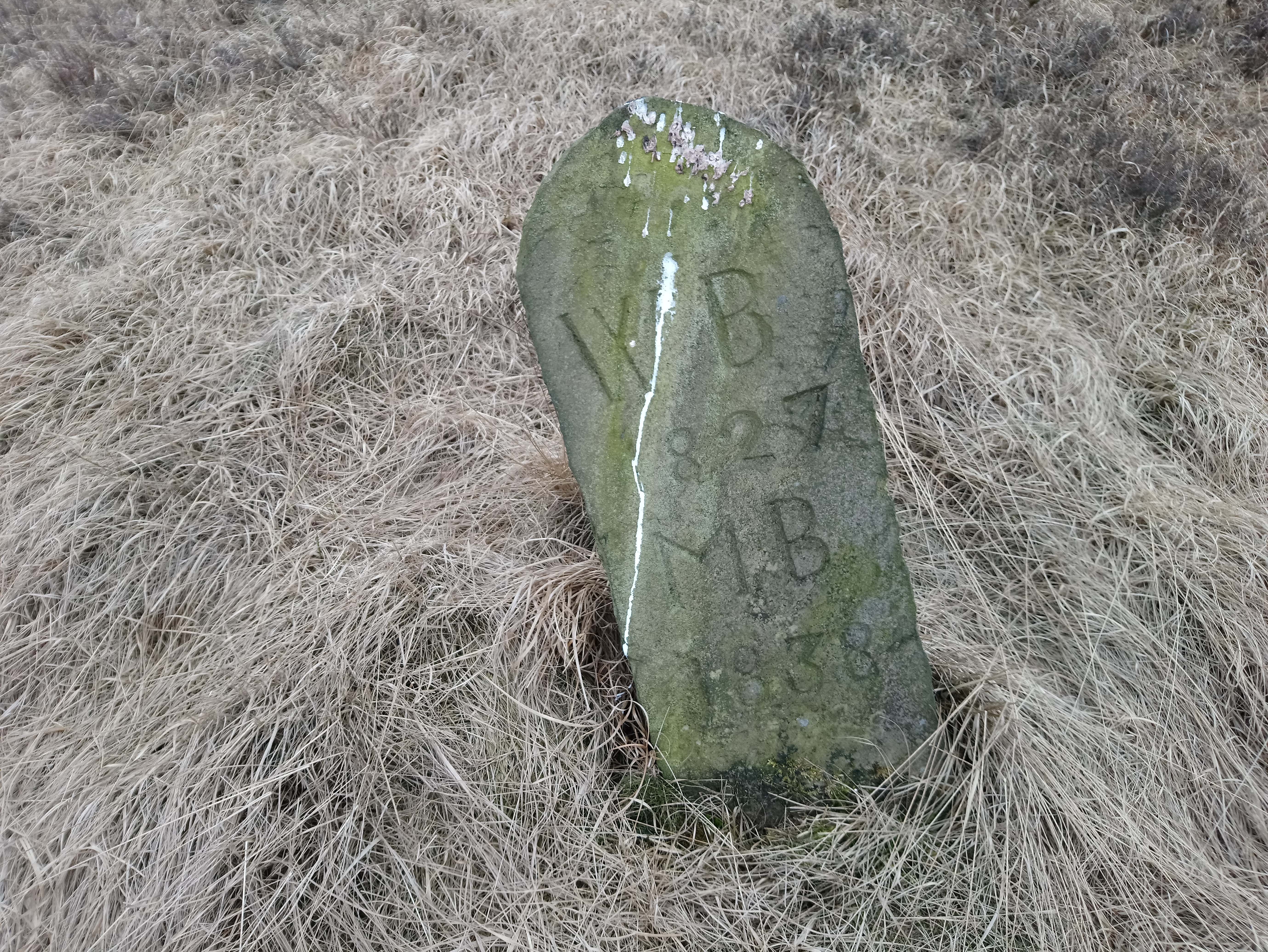
Boundary stone Whiteholme reservoir.jpg - Paulsofcholes

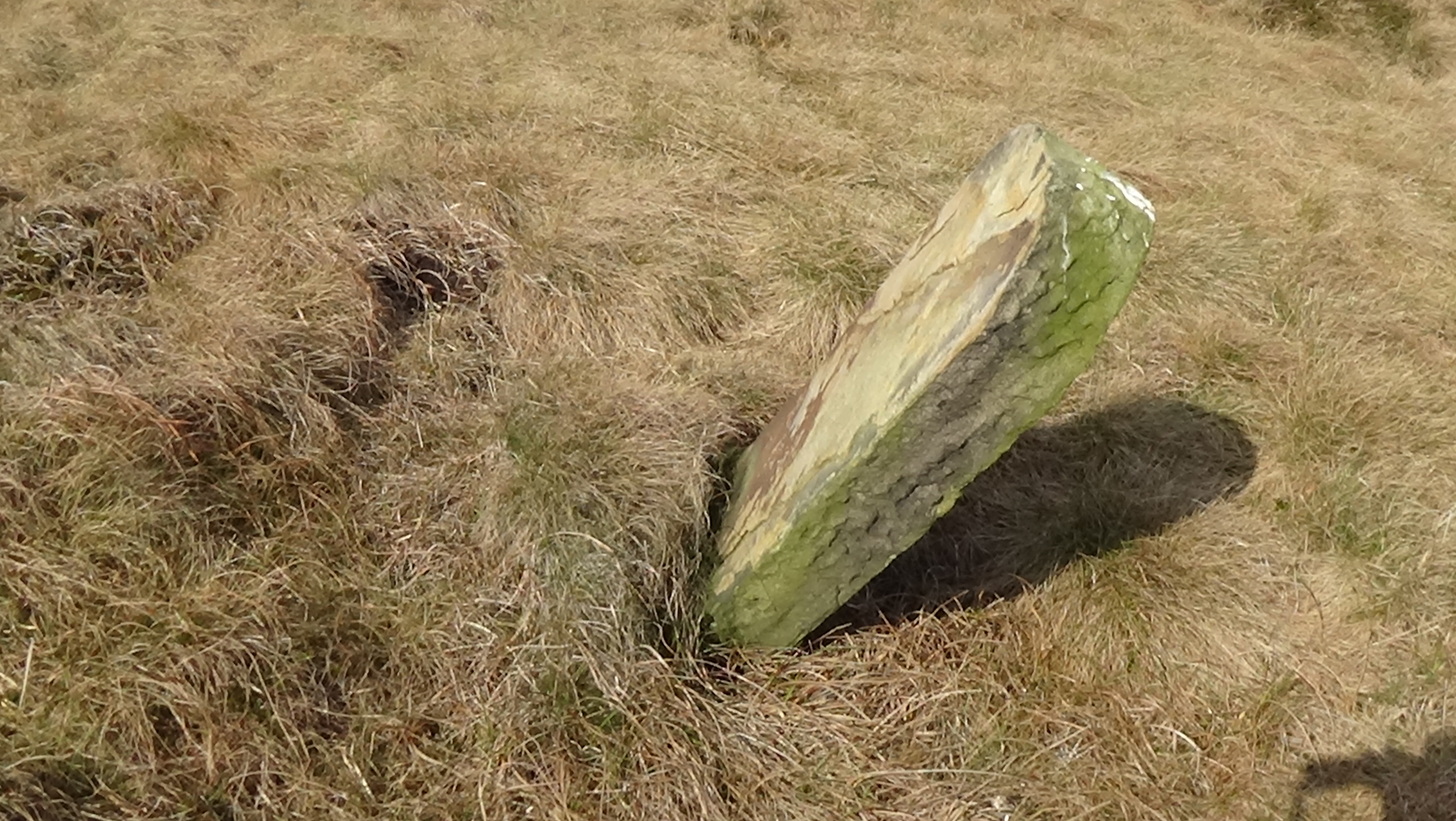
Fallen boundary stone near Whiteholme reservoir.jpg - Paulsofcholes

Boundary stone White Holme Moss.jpg - Paulsofcholes

Boundary stone White Holme Moss 2.jpg - Paulsofcholes

Boundary stone White Holme Moss 3.jpg - Paulsofcholes

Boundary stone between Alcomden stones and Crow Hill.jpg - Paulsofcholes

Boundary stone located near Blackstone Edge reservoir.jpg - Paulsofcholes

Boundary stone on Blackstone Edge Moor.jpg - Paulsofcholes
Boundary stone without inscriptions on Blackstone Edge Moor.jpg - Paulsofcholes

Blackstone Edge boundary stone.jpg - Paulsofcholes
Byron Edge boundary stone.jpg - Paulsofcholes
Byron Edge boundary stone near White Holme reservoir.jpg - Paulsofcholes

Boundary stone on Deanhead Moor.jpg - Paulsofcholes

Deanhead Moor stone.jpg - Paulsofcholes

Another fallen stone on Deanhead Moor.jpg - Paulsofcholes

18th century boundary stone above the modern M62 motorway.jpg - Paulsofcholes

A fallen boundary stone above the M62 motorway.jpg - Paulsofcholes

Deanhead Moss boundary stone on the Calderdale Kirklees boundary.jpg - Paulsofcholes

Boundary stone at the modern boundary fence on Deanhead Moss.jpg - Paulsofcholes

Boundary stone near Deanhead Moss.jpg - Paulsofcholes

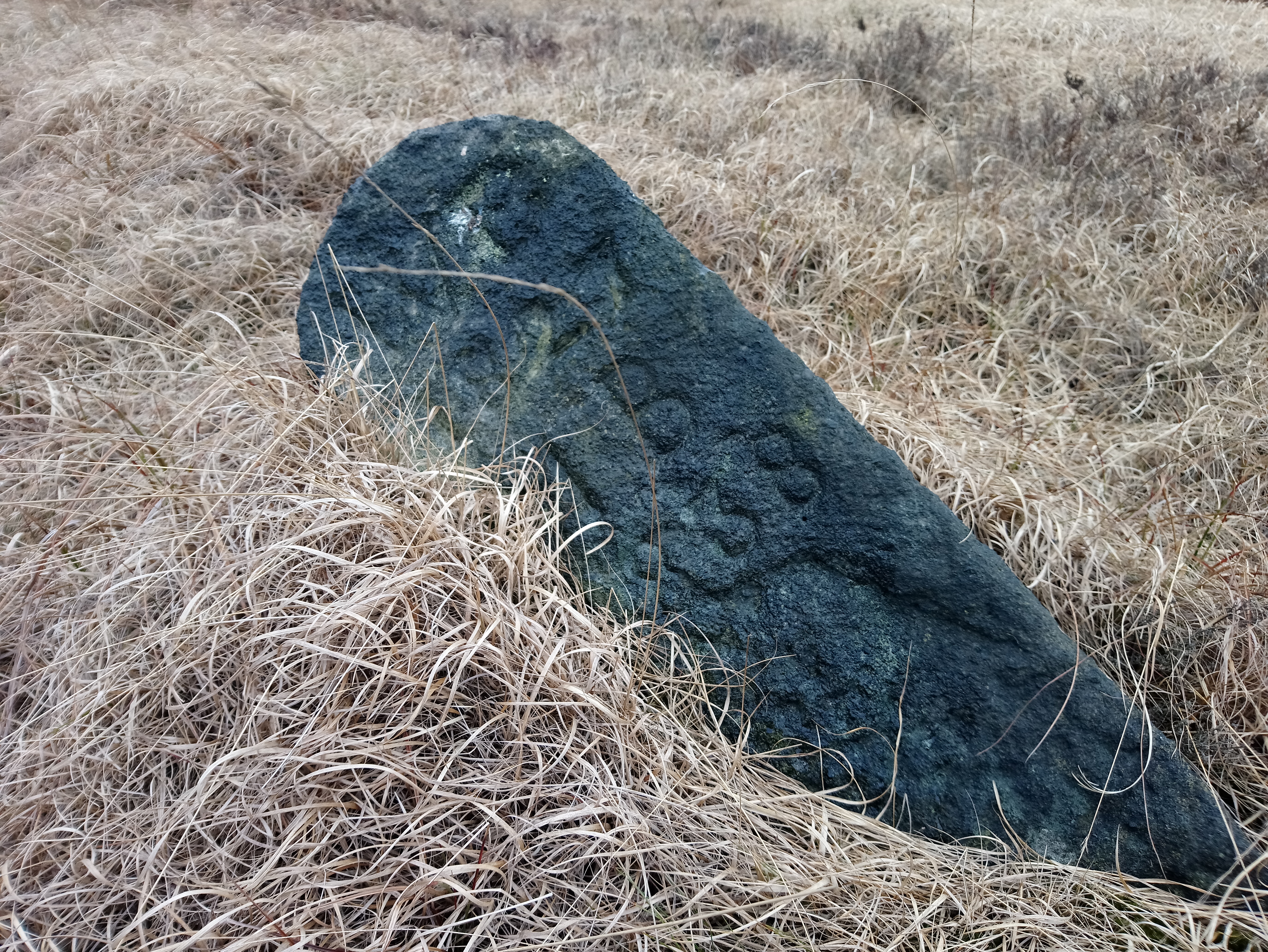
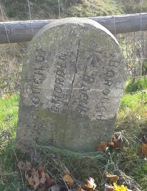
Rossendale Todmorden boundary stone.jpg - Paulsofcholes

Boundary stone next to the A681 main road.jpg - Paulsofcholes

Yorkshire Lancashire boundary stone.jpg - Paulsofcholes

Roadside boundary stone.jpg - Paulsofcholes

Cliviger and Portsmouth boundary stone.jpg - Paulsofcholes

Dumb stone on Foxstone Moss.jpg - Paulsofcholes

Fallen stone on Foxtone Moss.jpg - Paulsofcholes

Dumb stone on Foxtone Moss near the Kirklees and Calderdale boundary.jpg - Paulsofcholes

Dumb Foxstone Moss boundary stone next to boundary fence.jpg - Paulsofcholes
Another dumb stone on Foxstone Moss.jpg - Paulsofcholes

Foxstone Moss boundary stone near the A640.jpg - Paulsofcholes

Foxstone Moss 'dumb' boundary stone.jpg - Paulsofcholes

Boundary stone on Foxstone Moss next to the A640.jpg - Paulsofcholes

Yorkshire Lancashire Boundary stone on Bacup old road.jpg - Paulsofcholes

Boundary stone north of the Irwell sculpture trail.jpg - Paulsofcholes

Boundary Stone, Sand Bed Bridge.jpg - Peter I. Vardy

Boundary Stone at NGR SD 897265.jpg - Peter I. Vardy
Boundary Stone at NGR SD 887245.jpg - Peter I. Vardy

Boundary Stone at NGR SD 943193.jpg - Peter I. Vardy

Boundary Stone at SD 996213.jpg - Peter I. Vardy

Old Boundary Marker - geograph.org.uk - 6045126.jpg - BotMultichill

Boundary Stone at Junction of Marsh Lane.jpg - Peter I. Vardy

Boundary Stone opposite Burnlee Road.jpg - Peter I. Vardy

Boundary Stone, Hall Ing Road.jpg - Peter I. Vardy

Boundary Stone, Hagg Wood.jpg - Peter I. Vardy

Boundary Stone, Wickleden.jpg - Peter I. Vardy

Boundary Stone, Dean Head.jpg - Peter I. Vardy

Boundary Stone, Brockholes.jpg - Geograph Update Bot

Boundary Stone, Wilshaw Road.jpg - Peter I. Vardy

Boundary Stone, Dogley Lane.jpg - Peter I. Vardy

Boundary Stone near Snowgate Head.jpg - Peter I. Vardy

Boundary Stone, Flake Moss.jpg - Peter I. Vardy

Boundary Stone, Mirfield.jpg - Peter I. Vardy

Boundary stone No. 4, Batley.jpg - Peter I. Vardy
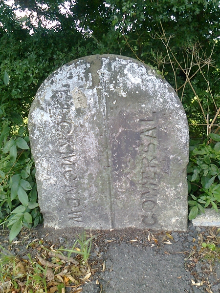
Boundary Stone, Oxford Road, Gomersal.jpg - Peter I. Vardy

Boundary Stone, Freakfield Road, Hartshead.jpg - Geograph Update Bot

Ferrand's Stone.jpg - Peter I. Vardy

Sutton Stoop.jpg - Peter I. Vardy

Boundary Stone and Bus Stop, Sandbed, Calderdale - geograph.org.uk - 1929342.jpg - GeographBot

Boundary stone, Windhill Old Road Thackley - geograph.org.uk - 1978078.jpg - GeographBot

Boundary stone, Halifax Road (A629) - geograph.org.uk - 2039390.jpg - GeographBot

Boundary stone, Blackstone Edge Road - geograph.org.uk - 2358791.jpg - GeographBot

Boundary stone, Blackstone Edge Road - geograph.org.uk - 2358810.jpg - GeographBot

Boundary Stone between Farsley ^ Calverley - Calverley Lane - geograph.org.uk - 2397469.jpg - GeographBot

Railway boundary stone at the Anchor Pit canal lock, Bradley - geograph.org.uk - 2413293.jpg - GeographBot

Railway boundary stone at the Anchor Pit canal lock, Bradley - geograph.org.uk - 2413298.jpg - GeographBot

Canal boundary (^) stone, Luddendenfoot - geograph.org.uk - 2445323.jpg - GeographBot

Boundary stone, Greave Road, Soyland - geograph.org.uk - 2470137.jpg - GeographBot

Boundary stone, Flints, Soyland - geograph.org.uk - 2470146.jpg - GeographBot

Boundary stone, Flints, Soyland - geograph.org.uk - 2470158.jpg - GeographBot

Site of old Kippax railway station (geograph 7020124).jpg - Lamberhurst

The Sowerby Bridge boundary stone at Washer Lane Steps - geograph.org.uk - 3264262.jpg - GeographBot

Boundary stone, Burnley Road - geograph.org.uk - 3330626.jpg - GeographBot

Boundary stone, Burnley Road - geograph.org.uk - 3330650.jpg - GeographBot

Old Boundary Marker (geograph 6487624).jpg - Sic19

Old Boundary Marker (geograph 6442394).jpg - Sic19

Old Boundary Marker (geograph 6442397).jpg - Sic19

Old Boundary Marker (geograph 6442399).jpg - Sic19

Old Boundary Marker (geograph 6442401).jpg - Sic19

Boundary Stone Leeds & Liverpool Canal (geograph 6932777).jpg - Sic19

Boundary stone on the A58 - geograph.org.uk - 3467203.jpg - GeographBot

Estate boundary stone, Blackley Road - geograph.org.uk - 3681915.jpg - GeographBot