Wikimedi'Òc
Modes d'emploi

Cet album fait partie des albums
Cet album photos contient les sous-albums suivants :


Sherbourne Arms, Aldsworth - geograph.org.uk - 147036.jpg - GeographBot

Farmland near Conygree Farm - geograph.org.uk - 214958.jpg - GeographBot

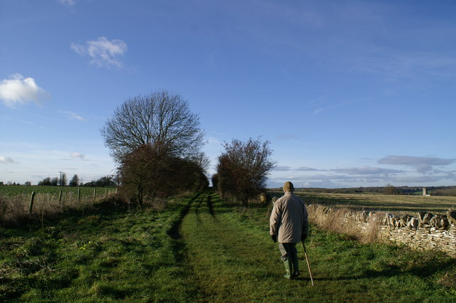
Approaching Snowbottom Belt - geograph.org.uk - 296569.jpg - GeographBot

Coltsmoor Farm - geograph.org.uk - 296612.jpg - GeographBot

Cotswold hedgerow - geograph.org.uk - 296581.jpg - GeographBot

Cotswold view - geograph.org.uk - 296582.jpg - GeographBot

Cotswolds open country - geograph.org.uk - 296613.jpg - GeographBot

Edge of Bratch Copse - geograph.org.uk - 296560.jpg - GeographBot

Fine stone cottages - geograph.org.uk - 296567.jpg - GeographBot

Glinting below the parapet - geograph.org.uk - 296566.jpg - GeographBot

Kilkenny Cottages - geograph.org.uk - 296558.jpg - GeographBot

Kilkenny Farm House, through the trees. - geograph.org.uk - 296557.jpg - GeographBot

Ladbarrow Farm - geograph.org.uk - 296574.jpg - GeographBot

Lane junction by Bratch Copse - geograph.org.uk - 296562.jpg - GeographBot

Magnificent Cotswold village house - geograph.org.uk - 296572.jpg - GeographBot

Overgrown reservoir - geograph.org.uk - 296570.jpg - GeographBot

Pylon by Cocklebarrow Lane - geograph.org.uk - 296555.jpg - GeographBot

Swyre Farm - geograph.org.uk - 296564.jpg - GeographBot

Track into the woods - geograph.org.uk - 296577.jpg - GeographBot

Upper River Leach - geograph.org.uk - 296556.jpg - GeographBot

View across the fields near the Lad Barrow - geograph.org.uk - 296575.jpg - GeographBot
North Cotswold Diamond Way near Northleach - geograph.org.uk - 305218.jpg - GeographBot

Bridleway - geograph.org.uk - 387544.jpg - GeographBot

Budgehill Belt - geograph.org.uk - 384902.jpg - GeographBot

Building at Dean Farm - geograph.org.uk - 387538.jpg - GeographBot
Fieldscape - geograph.org.uk - 387561.jpg - GeographBot

Horse in a field - geograph.org.uk - 385491.jpg - GeographBot

Kilkenny Farm - geograph.org.uk - 387405.jpg - GeographBot

Ladbarrow Farm - geograph.org.uk - 387568.jpg - GeographBot

Looking towards Lappingwell Wood - geograph.org.uk - 387534.jpg - GeographBot

Macaroni Downs Farm - geograph.org.uk - 387549.jpg - GeographBot

Power lines - geograph.org.uk - 385479.jpg - GeographBot

Shabbington Plantation - geograph.org.uk - 384904.jpg - GeographBot

Sheep near Larkethill Wood - geograph.org.uk - 386205.jpg - GeographBot

Sheepwash - geograph.org.uk - 387402.jpg - GeographBot

Snowbottom Belt - geograph.org.uk - 384903.jpg - GeographBot

Spinney - geograph.org.uk - 387543.jpg - GeographBot

Spinney - geograph.org.uk - 387558.jpg - GeographBot

Spinney and Copse - geograph.org.uk - 387541.jpg - GeographBot

From the edge of Longdown Plantation - geograph.org.uk - 392347.jpg - GeographBot

The Eastern edge of Longdown Plantation - geograph.org.uk - 392338.jpg - GeographBot

The Western edge of Longdown Plantation - geograph.org.uk - 392341.jpg - GeographBot

Farmland north of Hatherop - geograph.org.uk - 714398.jpg - GeographBot

Aldsworth village - geograph.org.uk - 1609945.jpg - GeographBot

Path to Aldsworth church - geograph.org.uk - 1609958.jpg - GeographBot

The B4425 towards Aldsworth - geograph.org.uk - 1609933.jpg - GeographBot

Autumn colour on a Cotswold country lane - geograph.org.uk - 1610038.jpg - GeographBot

Coming into Aldsworth - geograph.org.uk - 1610008.jpg - GeographBot

Driveway to Wall Farm - geograph.org.uk - 1610000.jpg - GeographBot

Junction to the west of Aldsworth - geograph.org.uk - 1610029.jpg - GeographBot

Looking east on the B4425 - geograph.org.uk - 1613822.jpg - GeographBot

Looking north from the road by Hollybush plantation - geograph.org.uk - 1610046.jpg - GeographBot

Farmland, Aldsworth - geograph.org.uk - 2122313.jpg - GeographBot

Road junction south of Lodge Park - geograph.org.uk - 2449160.jpg - GeographBot

Gate into fields near Aldsworth - geograph.org.uk - 2449704.jpg - GeographBot

Road junction by Aldsworth - geograph.org.uk - 2449716.jpg - GeographBot

Arable field near Aldsworth - geograph.org.uk - 2449727.jpg - GeographBot

Arable field north of Aldsworth - geograph.org.uk - 2449735.jpg - GeographBot

The Leach valley - geograph.org.uk - 2700347.jpg - GeographBot

New Cottage - geograph.org.uk - 7503948.jpg - GeographBot

The B4425 at Aldsworth - geograph.org.uk - 2808144.jpg - GeographBot

The Sherborne Arms, Aldsworth - geograph.org.uk - 2808157.jpg - GeographBot

The Sherborne Arms, Aldsworth - geograph.org.uk - 2808159.jpg - GeographBot

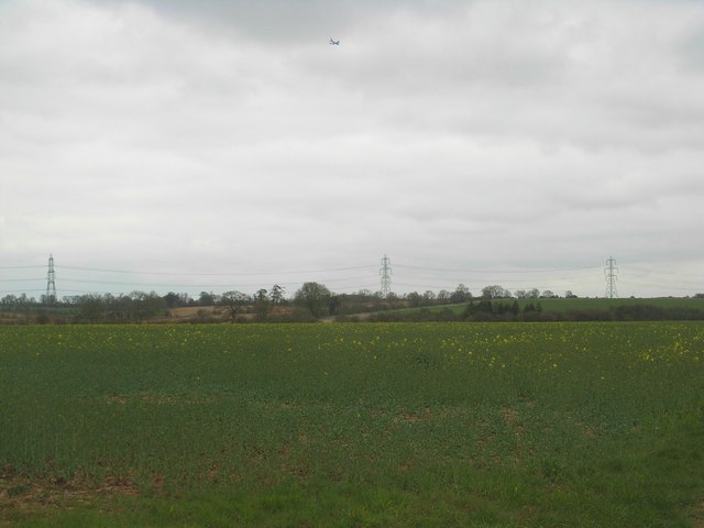
Pylons and a barley field - geograph.org.uk - 3010870.jpg - GeographBot

Arable land near Aldsworth - geograph.org.uk - 3010880.jpg - GeographBot

Barley field and Longdown Plantation - geograph.org.uk - 3011151.jpg - GeographBot

Wet field entrance - geograph.org.uk - 3011156.jpg - GeographBot

Field south of Lodge Park - geograph.org.uk - 3011512.jpg - GeographBot

Unnamed lane within Larkethill Wood - geograph.org.uk - 3165366.jpg - GeographBot

Unnamed lane south of Larkethill Wood - geograph.org.uk - 3165367.jpg - GeographBot

Silage field northwest of Wall Farm - geograph.org.uk - 3165369.jpg - GeographBot

Unnamed road junction west of Aldsworth - geograph.org.uk - 3165383.jpg - GeographBot

B4425 south of Aldsworth - geograph.org.uk - 3165500.jpg - GeographBot

I always thought that would happen eventually - geograph.org.uk - 3165502.jpg - GeographBot

Bridleway across arable land - geograph.org.uk - 3782329.jpg - GeographBot

Rear elevation, Lodge Park, Aldsworth, Gloucestershire - geograph.org.uk - 3915979.jpg - GeographBot

The Sherborne Arms pub, Aldsworth - geograph.org.uk - 3931334.jpg - GeographBot

Green Farm - geograph.org.uk - 3941524.jpg - GeographBot

Track to Aldsworth Manor - geograph.org.uk - 3941550.jpg - GeographBot

Unnamed lane inside Larkethill Wood - geograph.org.uk - 3942018.jpg - GeographBot

Un-named lane crosses the River Leach - geograph.org.uk - 3942031.jpg - GeographBot

Towards the Start - geograph.org.uk - 3966843.jpg - GeographBot

Looking to the Start - geograph.org.uk - 3968096.jpg - GeographBot

The Garage - geograph.org.uk - 3968103.jpg - GeographBot

Along the Course - geograph.org.uk - 3968105.jpg - GeographBot

Road junction near Aldsworth - geograph.org.uk - 4026536.jpg - GeographBot

Minor Road to Aldsworth - geograph.org.uk - 4026538.jpg - GeographBot

Houses in Aldsworth - geograph.org.uk - 4026556.jpg - GeographBot

Bus shelter in Aldsworth - geograph.org.uk - 4026558.jpg - GeographBot

Bus shelter in Aldsworth - geograph.org.uk - 4026563.jpg - GeographBot

Lane alongside Larkethill Wood - geograph.org.uk - 4135754.jpg - GeographBot

Road across the Leach - geograph.org.uk - 4423747.jpg - GeographBot

River Leach - geograph.org.uk - 4423761.jpg - GeographBot

Sheep wash by the Leach - geograph.org.uk - 4423790.jpg - GeographBot

Bridleway along the Leach valley ^1 - geograph.org.uk - 4423908.jpg - GeographBot

Bridleway along the Leach valley ^2 - geograph.org.uk - 4423928.jpg - GeographBot

Bridleway along the Leach valley ^3 - geograph.org.uk - 4424029.jpg - GeographBot

Bridleway by Larkethill Wood - geograph.org.uk - 4424143.jpg - GeographBot

Larkethill Wood - geograph.org.uk - 4424151.jpg - GeographBot

Coach House, Lodge Park - geograph.org.uk - 4427930.jpg - GeographBot

Coach House, Lodge Park - geograph.org.uk - 4428132.jpg - GeographBot

Barn near Lodge Park - geograph.org.uk - 4428336.jpg - GeographBot

Lodge Park Buildings - geograph.org.uk - 4429106.jpg - GeographBot

Lodge Park Buildings - geograph.org.uk - 4429118.jpg - GeographBot

Field at Lodge Park - geograph.org.uk - 4592150.jpg - GeographBot

Lane past Conygree Cottages - geograph.org.uk - 4592286.jpg - GeographBot

Larkethill Wood - geograph.org.uk - 4592294.jpg - GeographBot

Junction by Larkethill Wood - geograph.org.uk - 4592313.jpg - GeographBot

Sheep wash by the Leach - geograph.org.uk - 4696324.jpg - GeographBot

Bridleway near the Leach - geograph.org.uk - 4696355.jpg - GeographBot

Sheep above the River Leach - geograph.org.uk - 4697017.jpg - GeographBot

In the Leach valley - geograph.org.uk - 4697033.jpg - GeographBot

Leach valley - geograph.org.uk - 4697131.jpg - GeographBot

Bridleway down the Leach valley - geograph.org.uk - 4697150.jpg - GeographBot

Leach valley - geograph.org.uk - 4697180.jpg - GeographBot

Bridleway by Larkethill Wood - geograph.org.uk - 4697328.jpg - GeographBot

Bridleway by Larkethill Wood - geograph.org.uk - 4697334.jpg - GeographBot

Larkethill Wood - geograph.org.uk - 4697338.jpg - GeographBot

Larkethill Wood - geograph.org.uk - 4697353.jpg - GeographBot

Track leading east from Stone Barn, near Aldsworth - geograph.org.uk - 5364505.jpg - GeographBot

Road to Ladbarrow Farm - geograph.org.uk - 5461062.jpg - GeographBot

A large barley field - geograph.org.uk - 5461065.jpg - GeographBot

Approaching Ladbarrow Farm - geograph.org.uk - 5461071.jpg - GeographBot

Power lines crossing the Cotswolds - geograph.org.uk - 5461077.jpg - GeographBot

Road junction on the B4425 - geograph.org.uk - 5462163.jpg - GeographBot

The village of Aldsworth - geograph.org.uk - 5462216.jpg - GeographBot

The centre of Aldsworth - geograph.org.uk - 5541237.jpg - GeographBot

Lane between Aldsworth and Eastington - geograph.org.uk - 5541241.jpg - GeographBot

Cottage in Aldsworth - geograph.org.uk - 5546639.jpg - GeographBot

Unnamed road in Aldsworth - geograph.org.uk - 5546642.jpg - GeographBot

Unnamed road in Aldsworth - geograph.org.uk - 5546646.jpg - GeographBot

Lad Barrow long barrow (geograph 6553403).jpg - Sic19

The Sherborne Arms, Aldsworth - geograph.org.uk - 6095439.jpg - GeographBot

Outside the Sherborne Arms, Aldsworth - geograph.org.uk - 6095440.jpg - GeographBot

Car park at The Sherborne Arms, Aldsworth - geograph.org.uk - 6095441.jpg - GeographBot

The B4425 approaching Leach Bridge - geograph.org.uk - 6418223.jpg - GeographBot

Pylons walking across Aldsworth - geograph.org.uk - 6487447.jpg - GeographBot

Ladbarrow Farm - geograph.org.uk - 6495239.jpg - GeographBot

Bridleway towards Eastleach Downs Farm - geograph.org.uk - 6495476.jpg - GeographBot

Barns near Ladbarrow Farm - geograph.org.uk - 6496139.jpg - GeographBot

Field west of Aldsworth - geograph.org.uk - 6554180.jpg - GeographBot

The B4425 passing New Cottages - geograph.org.uk - 6554188.jpg - GeographBot

Pear Tree Cottages, Aldsworth - geograph.org.uk - 6555598.jpg - GeographBot

Road to Cocklebarrow Farm - geograph.org.uk - 6555604.jpg - GeographBot

Farm building, Cocklebarrow Farm - geograph.org.uk - 6555619.jpg - GeographBot

Barn undergoing restoration, Cocklebarrow Farm - geograph.org.uk - 6555627.jpg - GeographBot

Barns, Cocklebarrow Farm - geograph.org.uk - 6555631.jpg - GeographBot

Converted barn and Cocklebarrow Farm house - geograph.org.uk - 6555636.jpg - GeographBot

Arable land near Aldsworth - geograph.org.uk - 6960603.jpg - GeographBot

Blackpits Copse - geograph.org.uk - 6960609.jpg - GeographBot

Drive to Stone Barn - geograph.org.uk - 6960637.jpg - GeographBot

Stone Stile, Aldsworth - geograph.org.uk - 7297697.jpg - GeographBot

Stone Stile, Aldsworth - geograph.org.uk - 7297700.jpg - GeographBot

Stone Stile, Aldsworth - geograph.org.uk - 7297729.jpg - GeographBot

Stone Stile, Aldsworth - geograph.org.uk - 7297730.jpg - GeographBot

Stone Stile, Aldsworth - geograph.org.uk - 7297751.jpg - GeographBot

Stone Stile, Aldsworth - geograph.org.uk - 7297752.jpg - GeographBot

Stone Stile, Aldsworth - geograph.org.uk - 7297768.jpg - GeographBot

Stone Stile, Aldsworth - geograph.org.uk - 7297769.jpg - GeographBot

Stone Stile, Aldsworth - geograph.org.uk - 7297848.jpg - GeographBot

Stone Stile, Aldsworth - geograph.org.uk - 7299530.jpg - GeographBot

Stone Stile, Aldsworth - geograph.org.uk - 7299535.jpg - GeographBot

Stone Stile, Aldsworth - geograph.org.uk - 7299837.jpg - GeographBot

Stone Stile, Aldsworth - geograph.org.uk - 7299843.jpg - GeographBot

Stone Stile, Aldsworth - geograph.org.uk - 7299845.jpg - GeographBot

Junction on the B4425, Aldsworth - geograph.org.uk - 7558200.jpg - GeographBot