Wikimedi'Òc
Modes d'emploi

Cet album fait partie des albums
Cet album photos contient les sous-albums suivants :


Map of the Republic of Texas and the Adjacent Territories, 1841.jpg - Mdd
Mexico and the United States; a study of subjects affecting their political, commercial, and social relations, made with a view to their promotion- (1898) (14760035076).jpg - Fæ

Travels amongst American Indians - their ancient earthworks and temples - including a journey in Guatemala, Mexico and Yucatan, and a visit to the ruins of Patinamit, Utatlan, Palenque and Uxmal (14596836159).jpg - Fæ

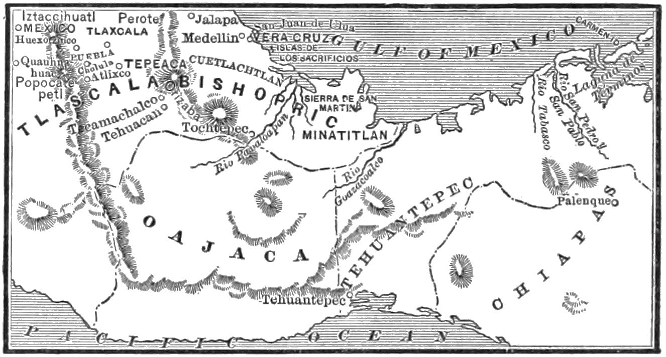
Young folks' history of Mexico (1883) (14784525005).jpg - SteinsplitterBot
Reports and recommendations, together with the messages of the President and the letters of the secretary of state transmitting the same to Congress (1890) (14595068029).jpg - Fæ

Old Mexico and her lost provinces; a journey in Mexico, southern California, and Arizona, by way of Cuba (1883) (14781294485).jpg - SteinsplitterBot

History of the United States, or, Republic of America - with a chronological table and a series of progressive maps (1857) (14743832566).jpg - Fæ

The lives and campaigns of Grant and Lee. A comparison and contrast of the deeds and characters of the two great leaders in the civil war (1895) (14576056538).jpg - Fæ

Commerce of the Prairies; or, The journal of a Santa Fe trader, during eight expeditions across the great western prairies, and a residence of nearly nine years in northern Mexico (1850) (14577370190).jpg - Fæ

Old Mexico and her lost provinces; a journey in Mexico, southern California, and Arizona, by way of Cuba (1883) (14778983714).jpg - Fæ

Mexico from Court Game of Geography MET DP862927.jpg - Pharos

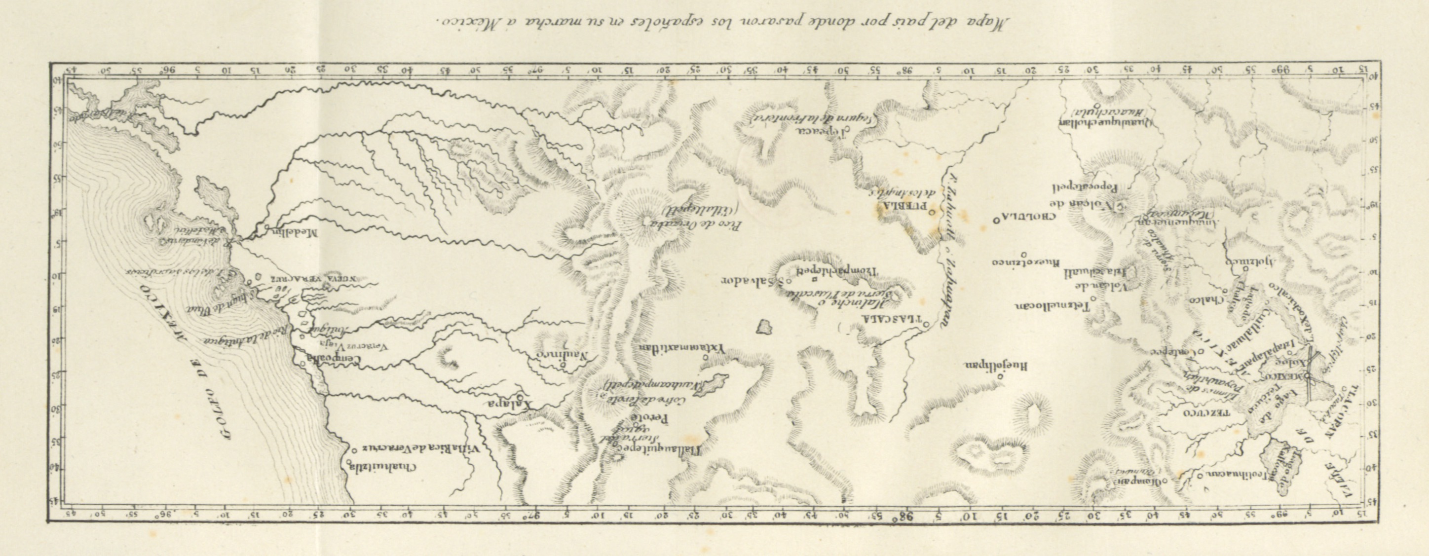
MOM D137 Spanish route from the sea to Mexico.jpg - Ineuw

MOM D199 Mexico city, the valley and its sourrounding.jpg - Ineuw

503 of 'Curso elemental de geografia universal' (11090685546).jpg - Artix Kreiger 2

428 of 'A Peep at Mexico- narrative of a journey across the Republic from the Pacific to the Gulf in December 1873 and January 1874 ... Illustrated by ... maps and ... photographs' (11104037825).jpg - Artix Kreiger 2

67 of 'Michoacán. Paisajes, tradiciones y leyendas. 2 ser' (11210223784).jpg - Artix Kreiger 2

66 of 'Michoacán. Paisajes, tradiciones y leyendas. 2 ser' (11209216673).jpg - Artix Kreiger 2

465 of 'Reisen in Mexico in den Jahren 1845-1848. Mit ... Karten ... Holzschnitten, etc' (11042618536).jpg - Artix Kreiger 2

282 of 'Reisen in den Vereinigten Staaten, Canada und Mexico' (11066756025).jpg - FlickreviewR 2

310 of 'Reisen in den Vereinigten Staaten, Canada und Mexico' (11066451045).jpg - FlickreviewR 2

44 of 'History of the Conquest of Mexico, with a preliminary view of the ancient Mexican civilization and the life of Hernando Cortes' (11021445414).jpg - Artix Kreiger 2
406 of 'Historia de la Conquista de Mejico ... traducida al Castellano por D. M. Gonzalez de la Vega y anotada por D. L. Alaman' (11023291136).jpg - FlickreviewR 2

405 of 'Le Mexique tel qu'il est aujourd'hui ... Deuxième édition' (11210323483).jpg - Artix Kreiger 2

204 of 'The War with Mexico' (11029980134).jpg - Artix Kreiger 2

129 of 'Michoacán. Paisajes, tradiciones y leyendas. 2 ser' (11209356726).jpg - Artix Kreiger 2
Plano topografico de fuerte de los remedios vulgarmente Sn. Gregorio y de los terrenos que lo circundan, defendido pr. la gavilla del rebelde cura forres, situiado en 1o. de septiembre de 1817 pr. las LOC 2005632501.tif - Fæ

Plano topografico de fuerte de los remedios vulgarmente Sn. Gregorio y de los terrenos que lo circundan, defendido pr. la gavilla del rebelde cura forres, situiado en 1o. de septiembre de 1817 pr. las LOC 2005632501.jpg - Fæ
Map of that part of Coahuila, Mexico, occupied by the American Army, Decr. 1846 (Genl. Wool's Division) LOC 2001622589.tif - Fæ

Map of that part of Coahuila, Mexico, occupied by the American Army, Decr. 1846 (Genl. Wool's Division) LOC 2001622589.jpg - Fæ

Map depicting battle against Isidro Barradas in vicinity of Tampico, Mexico, in 1829 LOC 2001620540.jpg - Fæ

Croquis del terro, camino, bosques, barrancas, cerro y beredas de Cerro-gordo con las posiciones de las topas Mejicanas y Americanas con sus respectivos Generales Cuerpos y Baterias el dis 18 de Abril LOC gm72002050.jpg - Fæ
Plan of Genl. Wool's camp at Buena-Vista, August 1847. LOC 2001622532.tif - Fæ

Plan of Genl. Wool's camp at Buena-Vista, August 1847. LOC 2001622532.jpg - Fæ
Operations of Genl. Scott's Army on 8th, 12th & 13th Sep. 1847 - (Mexico City) LOC 2001620537.tif - Fæ

Operations of Genl. Scott's Army on 8th, 12th & 13th Sep. 1847 - (Mexico City) LOC 2001620537.jpg - Fæ
Sketch of the route of Genl. Worth's column from Chapultepec to the Alemeda in the attack upon the city of Mexico, 13th & 14th Sept. 1847. LOC 2001622415.tif - Fæ

Sketch of the route of Genl. Worth's column from Chapultepec to the Alemeda in the attack upon the city of Mexico, 13th & 14th Sept. 1847. LOC 2001622415.jpg - Fæ

MA D035 Map of the valley of Mexico.jpg - Ineuw

HHBHM V1 D119 New Spain map left side.jpg - Ineuw

HHBHM V1 D120 New Spain map right side.jpg - Ineuw

HHBHM V1 D442 Rivers containing some gold.jpg - Ineuw

HHBHM V1 D518 Mexican volcanoes.jpg - Ineuw

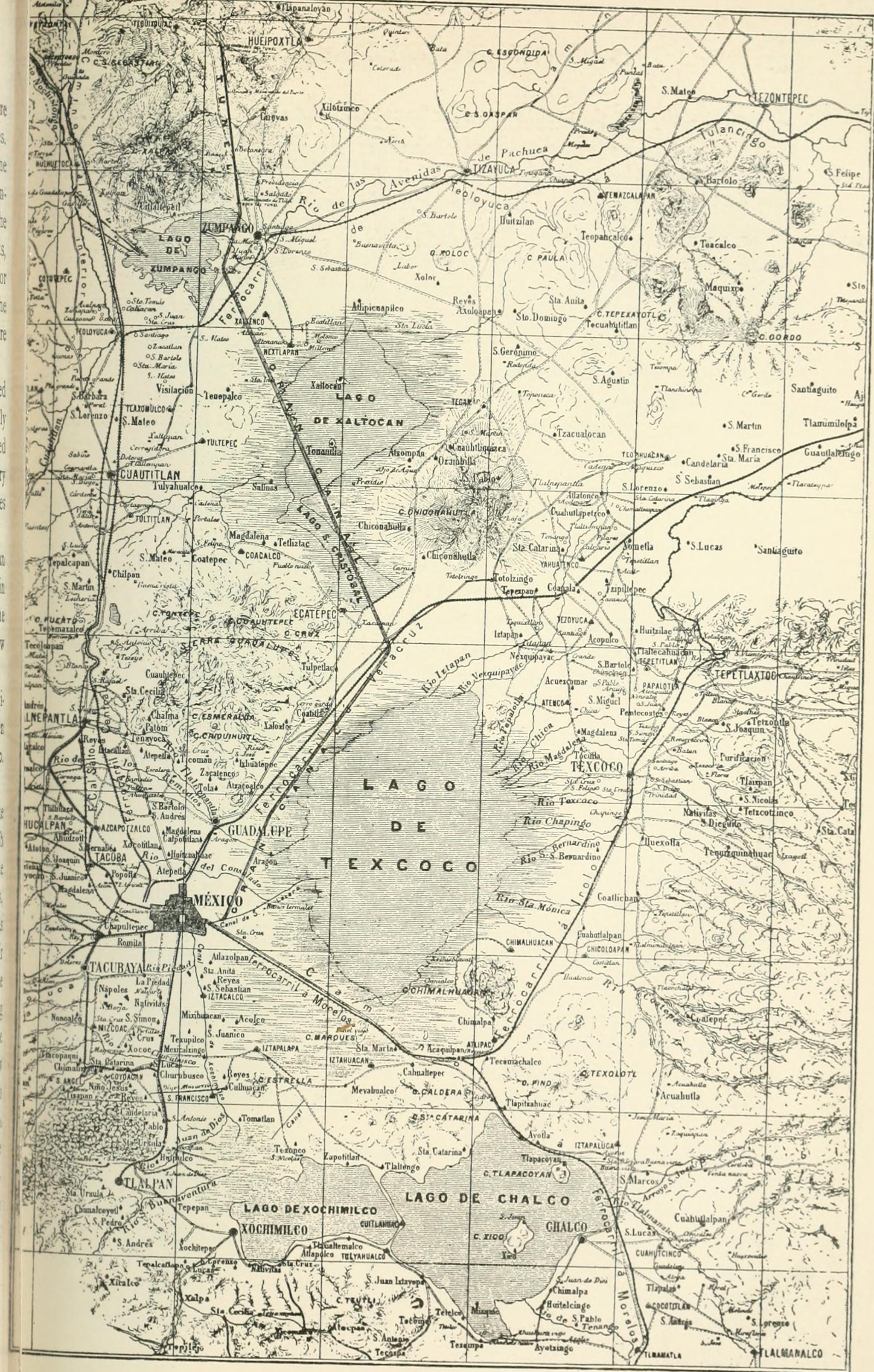
HHBHM V1 D612 Towns surrounding Mexico City.jpg - Ineuw

HHBHM V2 D118 Pánuco.jpg - Ineuw

HHBHM V2 D363 Michoacan and Colima.jpg - Ineuw
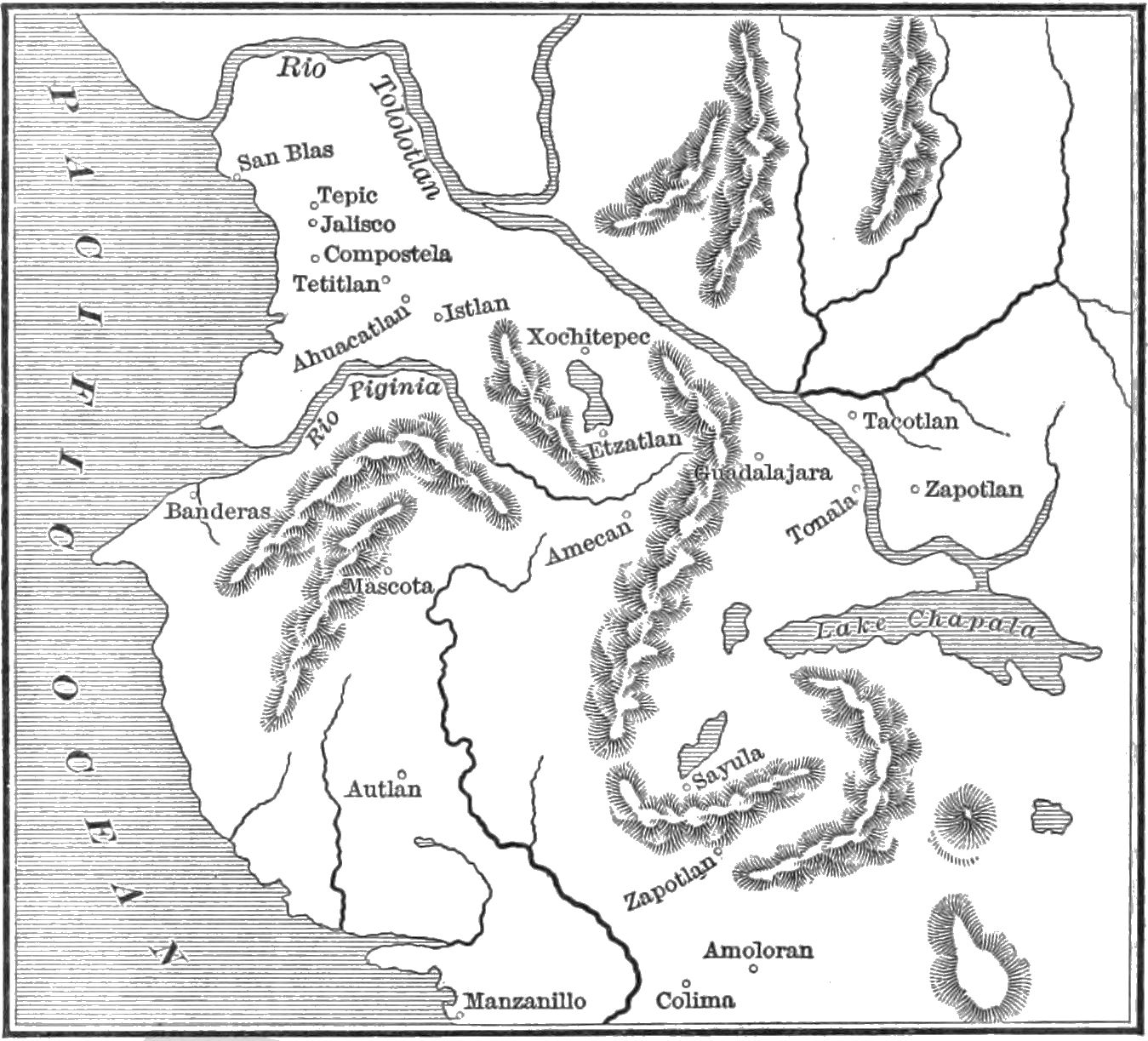
HHBHM V2 D372 Nueva Galicia.jpg - Ineuw

HHBHM V2 D452 Yucatan.jpg - Ineuw
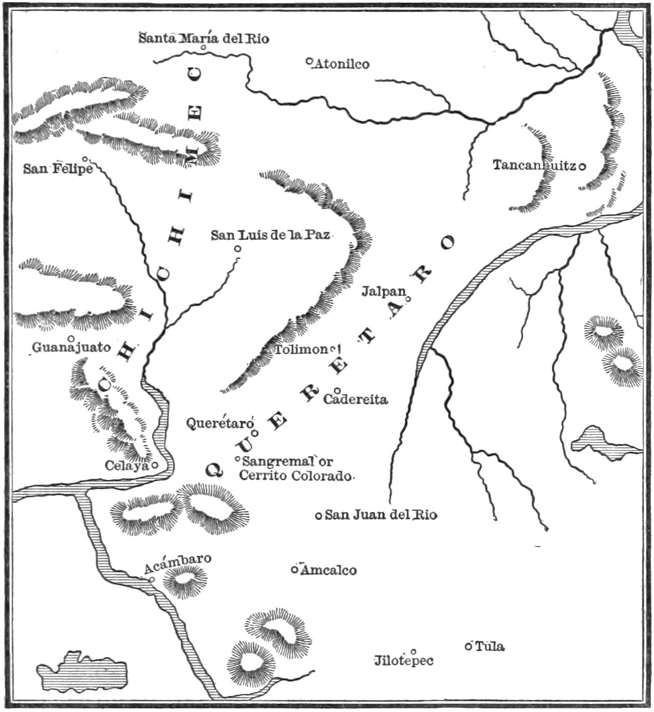
HHBHM V2 D561 Chichimec war.jpg - Ineuw

HHBHM V2 D575 Central Mexico and the City.jpg - Ineuw

HHBHM V2 D710 Nueva Galicia.jpg - Ineuw

HHBHM V2 D712 Michoacan.jpg - Ineuw

HHBHM V2 D714 Oajaca.jpg - Ineuw
HHBHM V2 D716 Tlascala.jpg - Ineuw

HHBHM V1 D119 & D120 Map of Mexico.jpg - Ineuw

HHBHM V1 D316 Central and eastern Mexico map.jpg - Ineuw

HHBHM V1 D522 Area surrounding Mexico City.jpg - Ineuw

Admiralty Chart No 1936 Islands in the North Pacific Ocean, Published 1849.jpg - Kognos

Lienzo de Metlatoyuca (BM Am2006,Ptg.30088).jpg - Copyfraud

Lienzo de Metlatoyuca (BM Am2006,Ptg.30088 1).jpg - Copyfraud

Lienzo de Metlatoyuca (BM Am2006,Ptg.30088 2).jpg - Copyfraud

Lienzo de Metlatoyuca (BM Am2006,Ptg.30088 3).jpg - Copyfraud

Lienzo de Metlatoyuca (BM Am2006,Ptg.30088 4).jpg - Copyfraud

Admiralty Chart No 439 Ports and Anchorages on the West Coast of Central America, Published 1883.jpg - Kognos

Guatulco Santa Cruz and Tangola Tangola Cropped from Admiralty Chart No 439 Ports and Anchorages on the West Coast of Central America, Published 1883.jpg - Kognos