Wikimedi'Òc
Modes d'emploi

Cet album fait partie des albums
Cet album photos contient les sous-albums suivants :


Mexico 1860.jpg - Dr Brains

1862 Stieler Map of the United States - Geographicus - USA-perthes-1862.jpg - BotMultichill

1860 Mitchell's Map of the West Indies, Mexico and Central America - Geographicus - WestIndies-m-1860.jpg - BotMultichillT

1866 Mitchell Map of Mexico and the West Indies - Geographicus - WestIndies-mitchell-1866.jpg - BotMultichillT
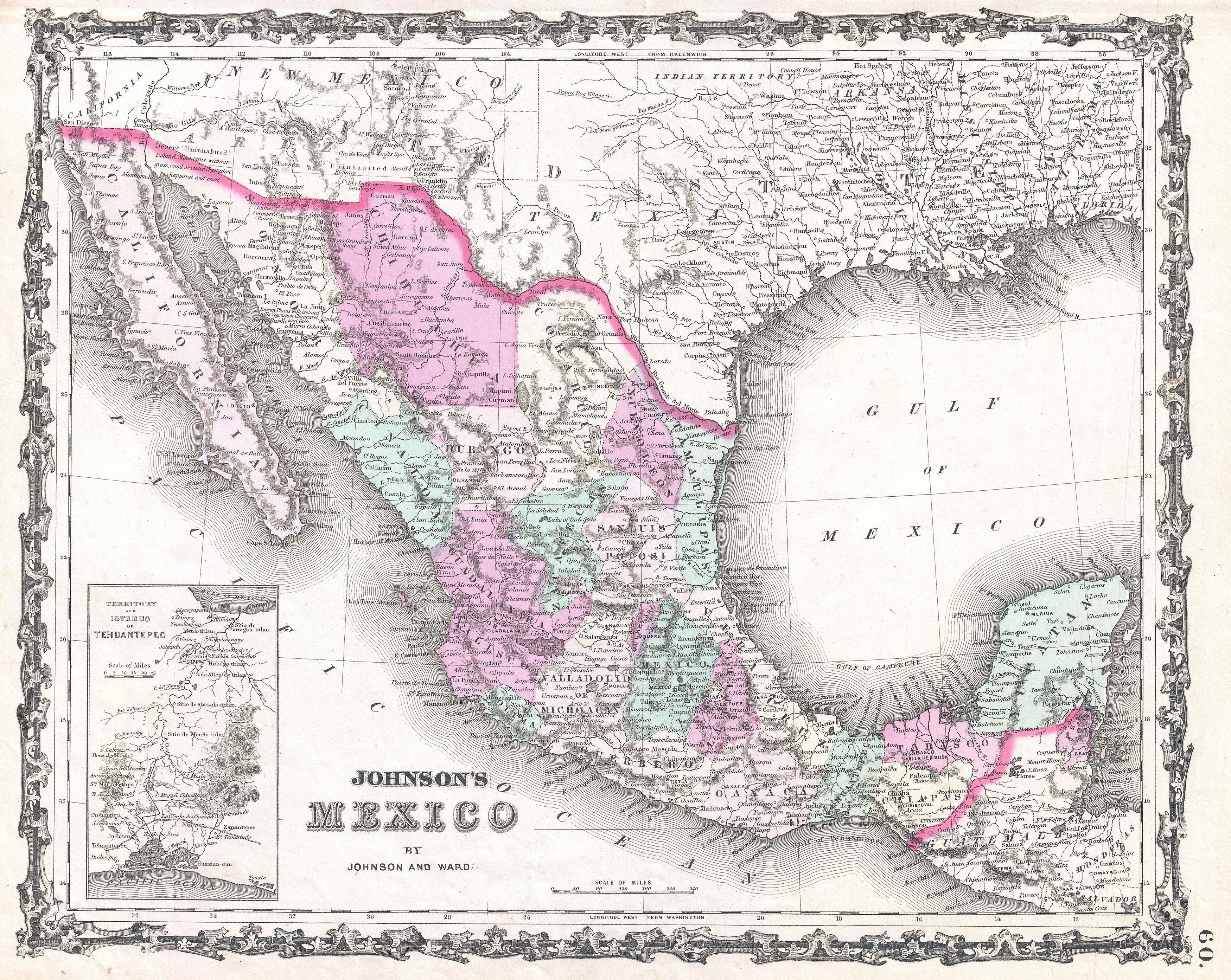
1862 Johnson Map of Mexico and Texas - Geographicus - Mexico-johnson-1862.jpg - BotMultichillT

Bouillet - Atlas universel, Carte 86.png - Pibewiki
Map of Mexico, Central America, and the West Indies; Map of the Island of Cuba (inset); Map of the Island of Jamaica (inset); Map of the Bermuda Islands (inset); Map of the Panama Railroad NYPL1510823.tiff - Fæ

New reference atlas for the use of colleges, libraries, families, and counting houses (1865) (14761153371).jpg - SteinsplitterBot

Map of Mexico, constructed from all available materials and corrected to 1862 (14937642336).jpg - Ser Amantio di Nicolao

Essai d'une carte ethnographique du Mexique (33746335414).jpg - Junior Jumper
Colton's rail-road and military map of the United States, Mexico, the West Indies, etc. LOC gm71000834.tif - Fæ

Colton's rail-road and military map of the United States, Mexico, the West Indies, etc. LOC gm71000834.jpg - Fæ

Carta general de la República Mexicana (Debray, 1867).jpg - FDRMRZUSA

Plano de Kanasin 1866.jpg - Infrogmation

Le Tour du monde-05-p339.jpg - Bzhqc

A040309156 0539.jpg - Strakhov

Richardson's New Map of Texas including Part of Mexico 1861 UTA.jpg - Michael Barera

Traveling & military map of Sonora (map) - from private field notes - by Cummings & James Cherry, geologists and mining engineers - DPLA - ce3508d8db3fd5aef3159fa9854bb9d8.jpg - DPLA bot

Mexique, Amerique Centrale et les Antilles 1862.jpg - Universalis
Content-P 02LYq8--transformed (1).jpg - Roberto-gc