Wikimedi'Òc
Modes d'emploi

Cet album fait partie des albums
Cet album photos contient les sous-albums suivants :


Bass Strait Port Phillip Bay detail 19th century.svg - Goran tek-en
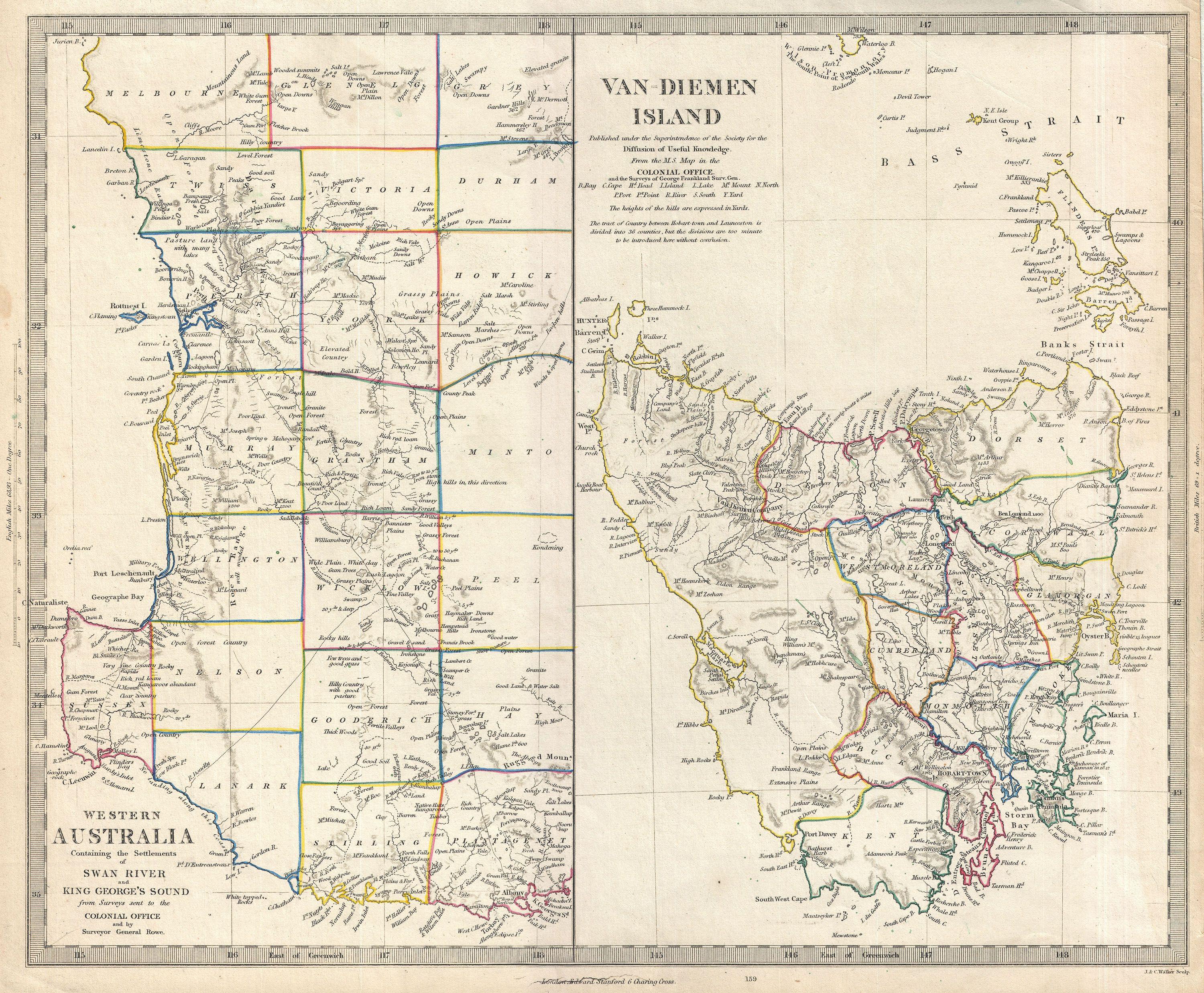
1849 S.D.U.K. Map of Tasmania or Van Diemen's Land and Western Australia - Geographicus - VanDiemen-sduk-1849.jpg - BotMultichillT

Egerton warburton exp.png - Toad's Tours

Map of Australia, New Zealand, Cook & Friendly Islands (1900) (18288648358).jpg - Vanished Account Byeznhpyxeuztibuo

157 of 'Map Modeling in Geography, including the use of sand, clay, putty, paper pulp, plaster of Paris ... Also Chalk Modeling in its adaptation to purposes of illustration. Fully illustrated' (11232382745).jpg - Artix Kreiger 2

604 of 'The International Geography. ... Edited by H. R. Mill' (11168932816).jpg - Artix Kreiger 2

145 of 'Journal of an expedition into the interior of tropical Australia, in search of a route from Sydney to the Gulf of Carpentaria' (11009638506).jpg - Artix Kreiger 2

116 of 'In Savage Isles and Settled Lands. Malaysia, Australasia, and Polynesia, 1888-1891 ... With numerous illustrations, etc' (11215681446).jpg - Artix Kreiger 2

Malvern Station Estate.jpg - Marshelec

Admiralty Chart No 2759b Australia Southern Portion, Published 1885, Large Corrections 1968.jpg - Kognos