Wikimedi'Òc
Modes d'emploi

Cet album fait partie des albums
Cet album photos contient les sous-albums suivants :


Nova Isthmi Americani, qui et Pananiensis item Dariensis, tabula, in qua urbes Porto Bello, Panana et Carthagena, verissimis suis locis positae, summo studio emendata, atque novissimis observationibus in lucem edita... - btv1b59731211.jpg - Gzen92Bot

Kartenblatt Florida Mexiko 9116.jpg - Joergens.mi

1788 Brion de la Tour Map of Mexico, Central America and the West Indies ( Antilles ) - Geographicus - Antilles-brion-1766.jpg - BotMultichill

1771 Bonne Map of Mexico (Texas), Louisiana and Florida - Geographicus - Mexico-bonne-1771.jpg - BotMultichillT

1762 Zannoni Map of Central America and the West Indies ( Caribbean ) - Geographicus - WestIndies-zannoni-1762.jpg - BotMultichillT

1780 Raynal and Bonne Map of the West Indies, Caribbean, and Gulf of Mexico - Geographicus - GolfeDuMexique-bonne-1780.jpg - BotMultichillT

A map of the West-Indies &c. Mexico or New Spain, also ye trade winds, and ye several tracts made by ye galeons and flota from place to place (4587178090).jpg - File Upload Bot (Magnus Manske)
Regni Mexicani seu Novae Hispaniae, Floridae, Novae Angliae, Carolinae, Virginiae et Pensylvaniae necnon insularum archipelagi Mexicani in America Septentrionali NYPL484217.tiff - Fæ
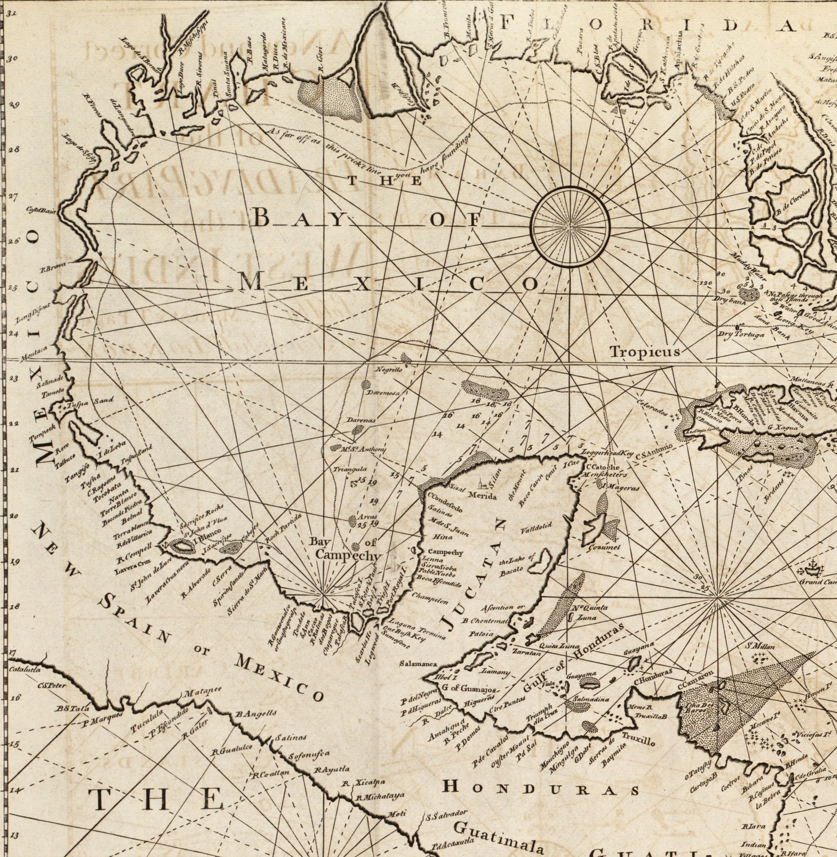
The English pilot. (cartographic material) - The fourth book. Describing The West-India navigation, from Hudson's Bay to the River Amazones. Particularly delineating The Sea Coasts, Capes, Headlands, (14780240045).jpg - Fæ

A map of the West-Indies or the Islands of Ameirca in the North Sea, with ye adjacent countries .. (NYPL b15369994-1630435).jpg - Fæ

An accurate map of the British, French & Spanish settlements in Nth. America and the West Indies - as stipulated by the preliminary articles of peace sign'd at Fontainebleau by the ministers (NYPL b15405509-465047).jpg - SteinsplitterBot

West Indies - Drawn and Engraved from the left - Maps and Charts (BM 1872,0113.1146).jpg - Copyfraud