Wikimedi'Òc
Modes d'emploi

Cet album fait partie des albums
Cet album photos contient les sous-albums suivants :


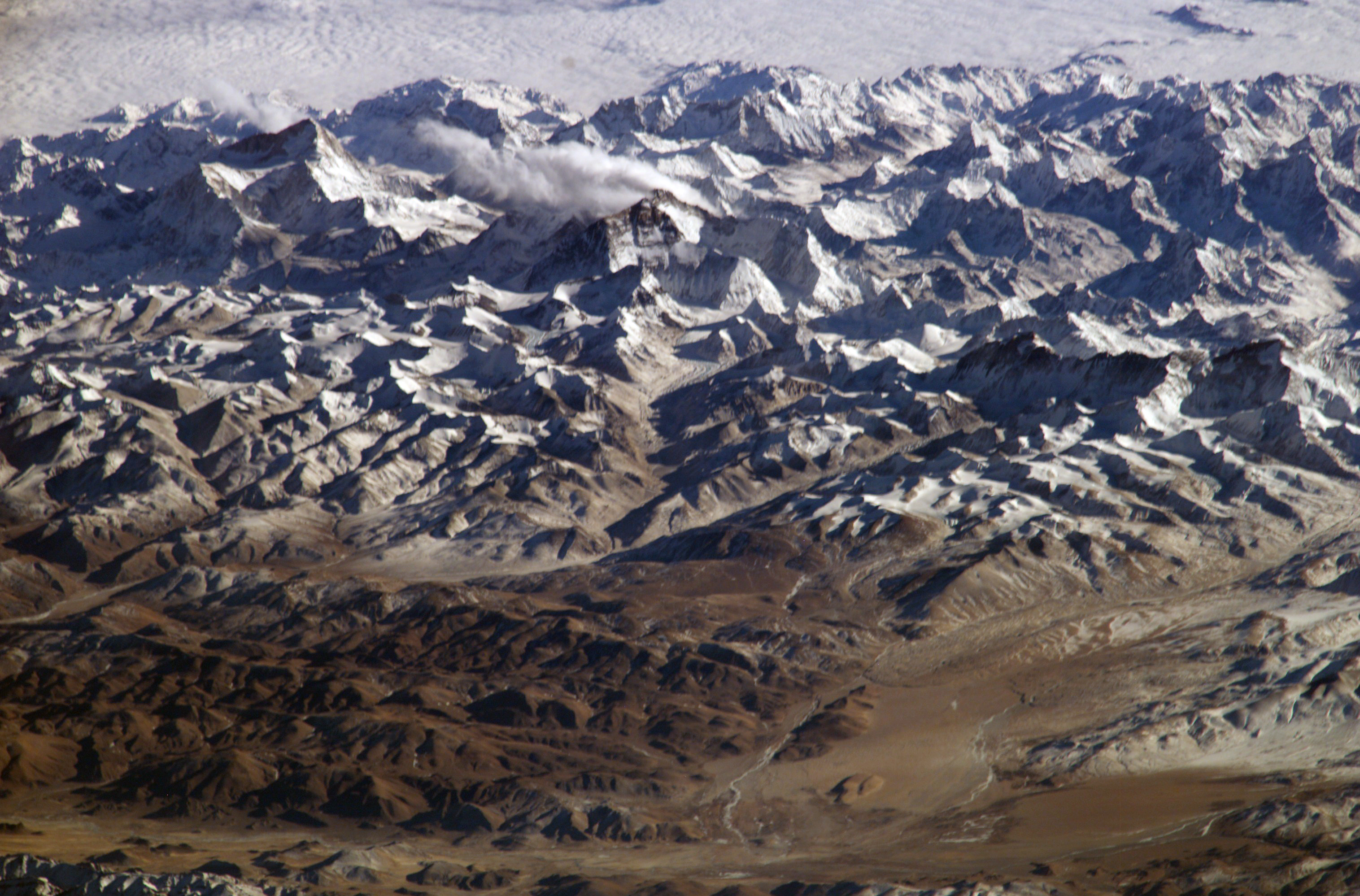
ISS061-E-145762 - View of China - Lake Paiku - Yarlung Tsangpo (Brahmaputra) - Tibet - Zurtso-Sangsang Glacier Mountains - Burtra mountain range (cropped).jpg - LudwigSebastianMicheler
Himalayas.jpg - Dschwen
YarlungZangbo3.jpg - Fanghong

YarlungZangbo4.jpg - Fanghong

YarlungZangbo5.jpg - Fanghong

Brahmaputra1.JPG - Ignat99

Brahmaputra2.JPG - Ignat99

Brahmaputra3.JPG - Ignat99

Brahmaputra4.JPG - Ignat99

Brahmaputra5.JPG - Ignat99

Brahmaputra6.JPG - Ignat99
Brahmaputra7.JPG - Ignat99

Brahmaputra8.JPG - Ignat99

Brahmaputra9.JPG - Ignat99

Brahmaputra10.JPG - Ignat99
Yarlong Tsangpo.jpg - Lucag
Tsangpo.gorge.GIF - Croquant

Yarlung Zangbo 1.jpg - Croquant
Yarlung Zangbo 2.jpg - Croquant
Yarlung Tsangpo river tibet.jpg - Denniss
ConflTsangpo.jpg - Richard D. Fisher

RickinTibet001.jpg - Richard D. Fisher
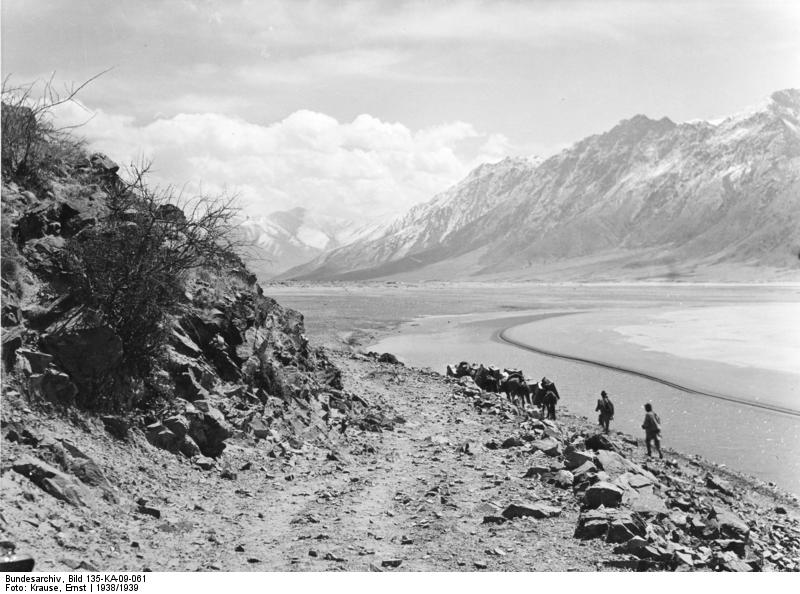
Bundesarchiv Bild 135-KA-09-061, Tibetexpedition, Blick ins Brahmaputratal.jpg - BArchBot

Bundesarchiv Bild 135-BB-081-12, Tibetexpedition, Floß bei Chagsam.jpg - BArchBot

Bundesarchiv Bild 135-BB-082-10, Tibetexpedition, Floß bei Chagsam.jpg - BArchBot

Bundesarchiv Bild 135-BB-082-12, Tibetexpedition, Floß bei Chagsam.jpg - Wvdp

Bundesarchiv Bild 135-S-12-26-38, Tibetexpedition, Überfahrt mit Floß.jpg - Sebastian Wallroth

Bundesarchiv Bild 135-S-15-07-37, Tibetexpedition, Entladen der Fähre.jpg - ReneeWrites

Bundesarchiv Bild 135-S-18-12-13, Tibetexpedition, Blick auf Dzong, See.jpg - BArchBot

Tsangpo Canyon.jpg - Polylepsis

Brahmaputra from ganden.jpg - Antoinetav

Brahmaputra from ganden2.jpg - Antoinetav

Brahmaputra from ganden3.jpg - Antoinetav
Yarlung 2.jpg - Himalayan Explorer
Yarlung Tsangpo skyview.jpg - Himalayan Explorer

Yaluzangbu river nimu bridge.jpg - Glabb

Brahmaputra River, Shigatse.jpg - File Upload Bot (Magnus Manske)
Chaksam (Iron Bridge in transliteration from Tibetan to English).png - Eselquinoa

Old Chain-Bridge at Chaksam.jpg - Tholme

Yarlung Tsangpo - Tibet - 01.jpg - Kadellar

Yarlung Tsangpo - Tibet - 02.jpg - Kadellar

TIB-yarlung-tsampo-lhatse.jpg - MGA73bot2

031 proti Gyantse-ju (3).JPG - File Upload Bot (Magnus Manske)

026 proti Tibetu (38).JPG - Sporti

Yarlung Zangbo River Bridge.jpg - Chlich

雅鲁藏布江 yaluzangbu river - panoramio.jpg - Panoramio upload bot

雅鲁藏布江 yaluzangbu river - panoramio - 白云悠悠.jpg - Panoramio upload bot

雅鲁藏布江 yaluzangbu river - panoramio - 白云悠悠 (1).jpg - Panoramio upload bot

雅鲁藏布江 yaluzangbu river - panoramio - 白云悠悠 (2).jpg - Panoramio upload bot

雅鲁藏布江 yaluzangbu river - panoramio - 白云悠悠 (3).jpg - Panoramio upload bot

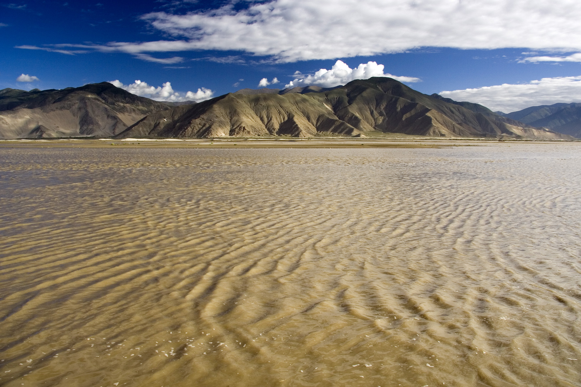
Sand dunes in Yarlung-Tsanbo River, Tibet - panoramio.jpg - Panoramio upload bot
Z cyklu Podivuhodné krajiny - Tibet (1993).jpg - Zdeněk Thoma
雅鲁藏布江边的田野 - panoramio.jpg - Panoramio upload bot

雅鲁藏布江风光 - panoramio.jpg - Panoramio upload bot

雅鲁藏布江边的沃野 - panoramio.jpg - Panoramio upload bot

雅鲁藏布江 - panoramio.jpg - Panoramio upload bot

雅鲁藏布江 - panoramio (1).jpg - Panoramio upload bot

Tibet-PHOTO-Satellite--NASA-Moderate Resolution Imaging Spectroradiometer(MODIS) show the high, arid, Tibetan Plateau in Asia. Tibet lies north of the Himalaya Mountains in Nepal---Tibet.A2002343.0445.1km.jpg - A ri gi bod

Mainling, Nyingchi, Tibet, China - panoramio (2).jpg - Panoramio upload bot

Mainling, Nyingchi, Tibet, China - panoramio (17).jpg - Panoramio upload bot
Nyemo Yarlung Tsangpo 2018.jpg - Esiymbro

1962-04 1962年 西藏喜马拉雅山脉马泉河畔.jpg - Walter Grassroot

Yarlung Tsangpo.jpg - H2v5o68z

Yarlung Tsangpo 2.jpg - H2v5o68z

Yarlung Tsangpo in Shigatse.jpg - H2v5o68z

Yarlung Tsangpo 8.jpg - H2v5o68z

Bridge over Yarlung Tsangpo at Shigatse.jpg - H2v5o68z

Bridge over Yarlung Tsangpo, Shigatse.jpg - H2v5o68z

Yarlung Tsangpo-Qüxü-Tsetang-04-2014-gje.jpg - Gerd Eichmann

Yarlung Tsangpo-Qüxü-Tsetang-06-2014-gje.jpg - Gerd Eichmann

Yarlung Tsangpo-Qüxü-Tsetang-02-2014-gje.jpg - Gerd Eichmann

Yarlung Tsangpo-Qüxü-Tsetang-08-2014-gje.jpg - Gerd Eichmann

Yarlung Tsangpo-Qüxü-Tsetang-10-2014-gje.jpg - Gerd Eichmann

Yarlung Tsangpo-Qüxü-Tsetang-12-Baeume-Spiegelung-2014-gje.jpg - Gerd Eichmann

Yarlung Tsangpo-Qüxü-Tsetang-14-Ginster-2014-gje.jpg - Gerd Eichmann

Yarlung Tsangpo-Qüxü-Tsetang-16-Kloster-2014-gje.jpg - Gerd Eichmann

Yarlung Tsangpo-Qüxü-Tsetang-18-Kloster-2014-gje.jpg - Gerd Eichmann

Yarlung Tsangpo-Qüxü-Tsetang-22-Wolken-2014-gje.jpg - Gerd Eichmann

Yarlung Tsangpo-Qüxü-Tsetang-24-2014-gje.jpg - Gerd Eichmann

Yarlung Tsangpo-Qüxü-Tsetang-20-2014-gje.jpg - Gerd Eichmann

Yarlung Tsangpo-Qüxü-Tsetang-28-2014-gje.jpg - Gerd Eichmann
Yarlung Tsangpo-Qüxü-Tsetang-26-Bruecke-2014-gje.jpg - Gerd Eichmann

Yarlung Tsangpo-Qüxü-Tsetang-30-Bruecke-2014-gje.jpg - Gerd Eichmann

Yarlung Tsangpo-Qüxü-Tsetang-34-2014-gje.jpg - Gerd Eichmann

Yarlung Tsangpo-Qüxü-Tsetang-32-Aufforstung-2014-gje.jpg - Gerd Eichmann

Yarlung Tsangpo-Qüxü-Tsetang-36-2014-gje.jpg - Gerd Eichmann

Yarlung Tsangpo-Qüxü-Tsetang-40-Aufforstung-2014-gje.jpg - Gerd Eichmann

Yarlung Tsangpo-Qüxü-Tsetang-38-Aufforstung-2014-gje.jpg - Gerd Eichmann

Yarlung Tsangpo-Qüxü-Tsetang-42-Sandduenen-2014-gje.jpg - Gerd Eichmann

Yarlung Tsangpo-Qüxü-Tsetang-44-Sandduenen-2014-gje.jpg - Gerd Eichmann

Yarlung Tsangpo-Qüxü-Tsetang-48-Vegetation-2014-gje.jpg - Gerd Eichmann

Yarlung Tsangpo-Qüxü-Tsetang-46-2014-gje.jpg - Gerd Eichmann

Yarlung Tsangpo-Qüxü-Tsetang-50-weites Bett-2014-gje.jpg - Gerd Eichmann

Yarlung Tsangpo-Qüxü-Tsetang-54-Pass-Sandduenen-2014-gje.jpg - Gerd Eichmann

Yarlung Tsangpo-Qüxü-Tsetang-52-Pass-Ausblick-2014-gje.jpg - Gerd Eichmann

Yarlung Tsangpo-Qüxü-Tsetang-56-Ginsterheide-Sandduenen-2014-gje.jpg - Gerd Eichmann

Yarlung Tsangpo-Qüxü-Tsetang-60-Samye-Sandduenen-2014-gje.jpg - Gerd Eichmann

Yarlung Tsangpo-Qüxü-Tsetang-58-Ginsterheide-Sandduenen-2014-gje.jpg - Gerd Eichmann

Yarlung Tsangpo-Qüxü-Tsetang-62-Sandduenen-2014-gje.jpg - Gerd Eichmann

Yarlung Tsangpo-Qüxü-Tsetang-66-Aufforstung-2014-gje.jpg - Gerd Eichmann

Yarlung Tsangpo-Qüxü-Tsetang-64-Sandduenen-2014-gje.jpg - Gerd Eichmann

Yarlung Tsangpo-Qüxü-Tsetang-68-Aufforstung-2014-gje.jpg - Gerd Eichmann

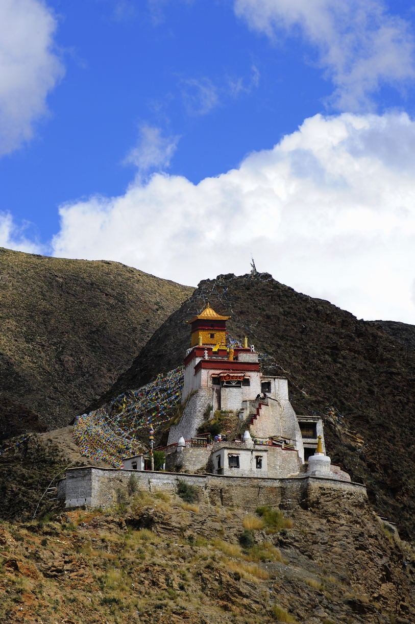
New Yumbulagang in 2008 after reconstruction, from- Yarlung 2 (cropped).jpg - Tibet Nation
雅鲁藏布3.jpg - Voidvector

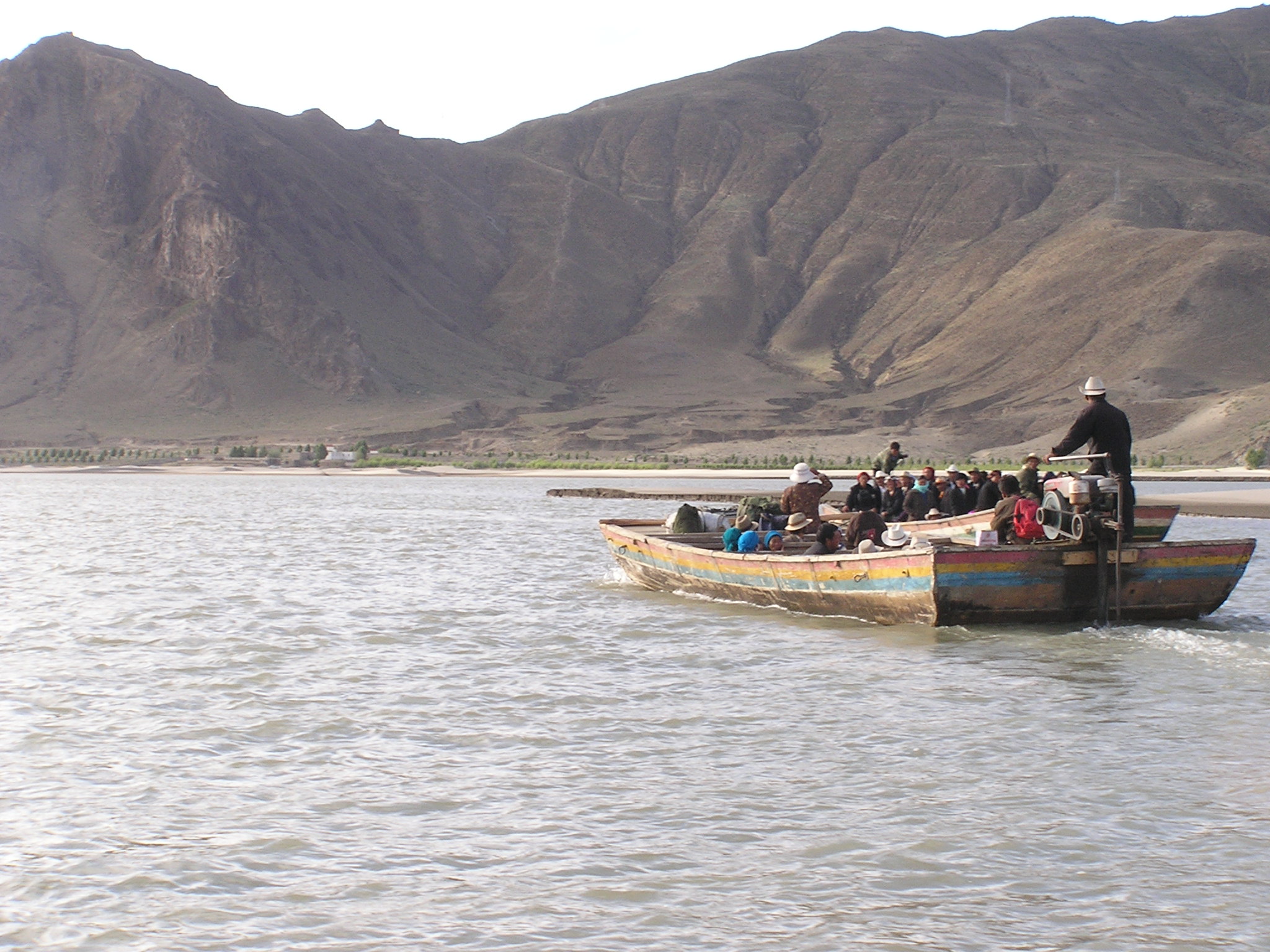
Tibet02SamyeFerry024.jpg - Tibet Nation

Tibet02SamyeFerry012.jpg - Tibet Nation
Tibet02SamyeFerry025.jpg - Tibet Nation

Trail along sand dunes in the Brahmaputra River (Tsangpo in Tibetan) between Samye and Tsetang, Tibet in 1938, Bundesarchiv Bild 135-KA-09-061, Tibetexpedition, Blick ins Brahmaputratal (cropped).jpg - Tibet Nation

ISS061-E-145717 - View of Earth.jpg - Askeuhd

ISS064-E-12604 - View of Earth.jpg - Askeuhd

ISS064-E-12577 - View of Earth.jpg - Askeuhd

ISS064-E-12603 - View of Earth.jpg - Askeuhd

Maquan River south of Gyagya, Saga.jpg - Voidvector

ISS064-E-12607 - View of China - Tibet - Yarlung Tsangpo (Yarlung Zangbo) Nyang Qu confluence - Xigazê (Shigatse) (cropped).jpg - LudwigSebastianMicheler

ISS061-E-145717 - View of China - Tibet - Yarlung Tsangpo (Yarlung Zangbo) - Xigazê (Shigatse) - river Nyang Qu - Gyangzê - lake Drumpa Yumtso (cropped).jpg - LudwigSebastianMicheler

ISS064-E-12606 - View of China - Yarlung Tsangpo (Brahmaputra) - Naxiong Zangbo - Saga Glacier Peak - Zhongba - Loinbo Kangri ridge - Tibet and the Zurtso-Sangsang Glacier Mountains (cropped).jpg - LudwigSebastianMicheler

ISS064-E-12604 - View of Nepal and China - Dhaulagiri Himal - Mustang Himal - Yarlung Tsangpo - Tibet (cropped).jpg - LudwigSebastianMicheler
ISS064-E-12584 - View of Tibet - Transhimalaya (left) - clouds and snow in Kailash Range (Gangdisê) - Yarlung Zangbo (source of Brahmaputra) - Changla Himal (Himalayas) - Nalakankar Himal - Lake Manosarovar - Nepal (cropped).jpg - LudwigSebastianMicheler

ISS064-E-12594 - View of Himalayas - Changla Himal - Ngangro Glacier - lake Rapgye Tso - Guneijiao Co - Dangkar Chu - Chemayungdung Chu - Gyaimayangzom Glacier - Dozam Khola valley - Kubi Kangri (cropped).jpg - LudwigSebastianMicheler

ISS064-E-12603 - View of China - Yarlung Tsangpo (Matsang Tsangpo) - Changla Himal - Gyaimayangzom Glacier - Chemayungdung Chu - lake Rapgye Tso - Dangkar Chu - Ngangser (Ansi) glacier in range Nalakankar Himal (cropped).jpg - LudwigSebastianMicheler

ISS064-E-12604 - View of China - North of Mustang Himal - Manshail - Matsang Zangbo - Zhongba - Yarlung Zangbo side valleys Gautam-Mustang and Lalung Zangbo - Kali Gandaki Valley - Higher Dzon (Lo Mathang) - Nepal Tibet (cropped).jpg - LudwigSebastianMicheler

ISS064-E-12585 - View of China - Tibet - Matsang Zangbo - Yarlung Zangbo side valleys between Gautam Himal and Mustang Himal - Lake Tso Honthor - Kali Gandaki Valley - Manshail - Chanmar Lek - Nepal (cropped).jpg - LudwigSebastianMicheler

ISS064-E-12588 - View of China - Yarlung Tsangpo - Naxiong Zangbo - Unnamed Saga County Glacier Peak (cropped).jpg - LudwigSebastianMicheler
ISS064-E-12588 - View of China - Yarlung Tsangpo - Naxiong Zangbo - unnamed Saga County Glacier Peak (Transhimalaya) - Loinbo Kangri ridge (cropped).jpg - LudwigSebastianMicheler

ISS061-E-145729 - View of China - Tibet - river Lhasa He - Qüxü (Chushul) - Yarlung Tsangpo (cropped).jpg - LudwigSebastianMicheler

ISS061-E-145731 - View of China - Tibet - river Yarlung Tsangpo West of Qüxü and Gongkar (cropped).jpg - LudwigSebastianMicheler

ISS064-E-12604 - View of Earth - Keheng and Polte Khola - Chanmar Lek - Chharka Tulsi Khola - Kali Gandaki Valley - Araniko Chuli (Mustang Himal) - Chanabolo (Gautam Himal) - Northern side valleys of river Yarlung Zangbo (cropped).jpg - LudwigSebastianMicheler

ISS064-E-12606 - View of China - Yarlung Tsangpo - Saga County - Himlung Peri Himal - Nar Khola - Ratna Chuli glaciers - Bhrikuti Shail (cropped).jpg - LudwigSebastianMicheler

ISS064-E-12589 - View of Earth - Yarlung Tsangpo - Saga County - Ratna Chuli and Bhrikuti Shail glaciers - Himlung Peri Himal Nimjung - Manaslu (cropped).jpg - LudwigSebastianMicheler
ISS061-E-145762 - View of China - Yarlung Tsangpo - Transhimalaya - Sangsang region - river Dogxung Zangbo - Lakes Takkyel Tso Tso Okma(cropped).jpg - LudwigSebastianMicheler

ISS061-E-145762 - View of China - Lhagoi Kangri mountains - Lake Tingmo Tso - Cogo Bum Chu Valley - Yairu Zangbo River - Umbak Himal - Tingri County - Lhaze - Yarlung Tsangpo - làng cuò, Angrenjin Lake and Tso Okma (cropped).jpg - LudwigSebastianMicheler