Wikimedi'Òc
Modes d'emploi

Cet album fait partie des albums
Cet album photos contient les sous-albums suivants :


Shanghai 121.45796E 31.22234N.jpg - Joowwww
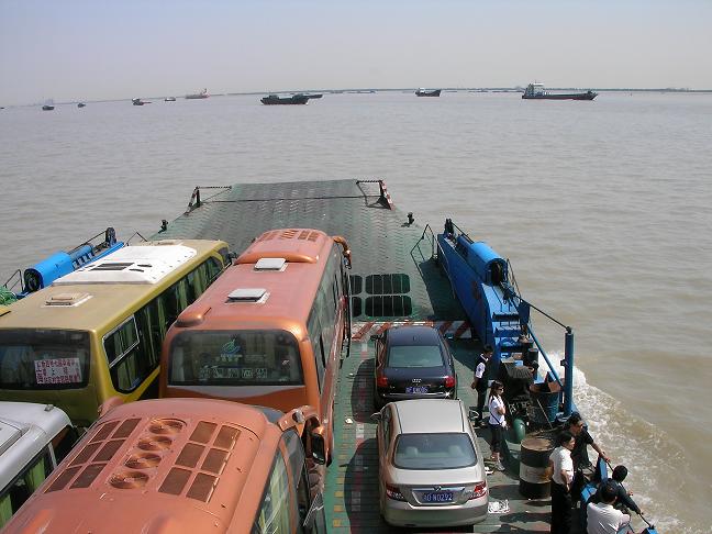
Ferry on the Yangtze near Nantong.JPG - Bdell555

Ships on the Yangtze at dawn.JPG - Bdell555

Maanshan Yushanhu lake.jpg - Hoolioh
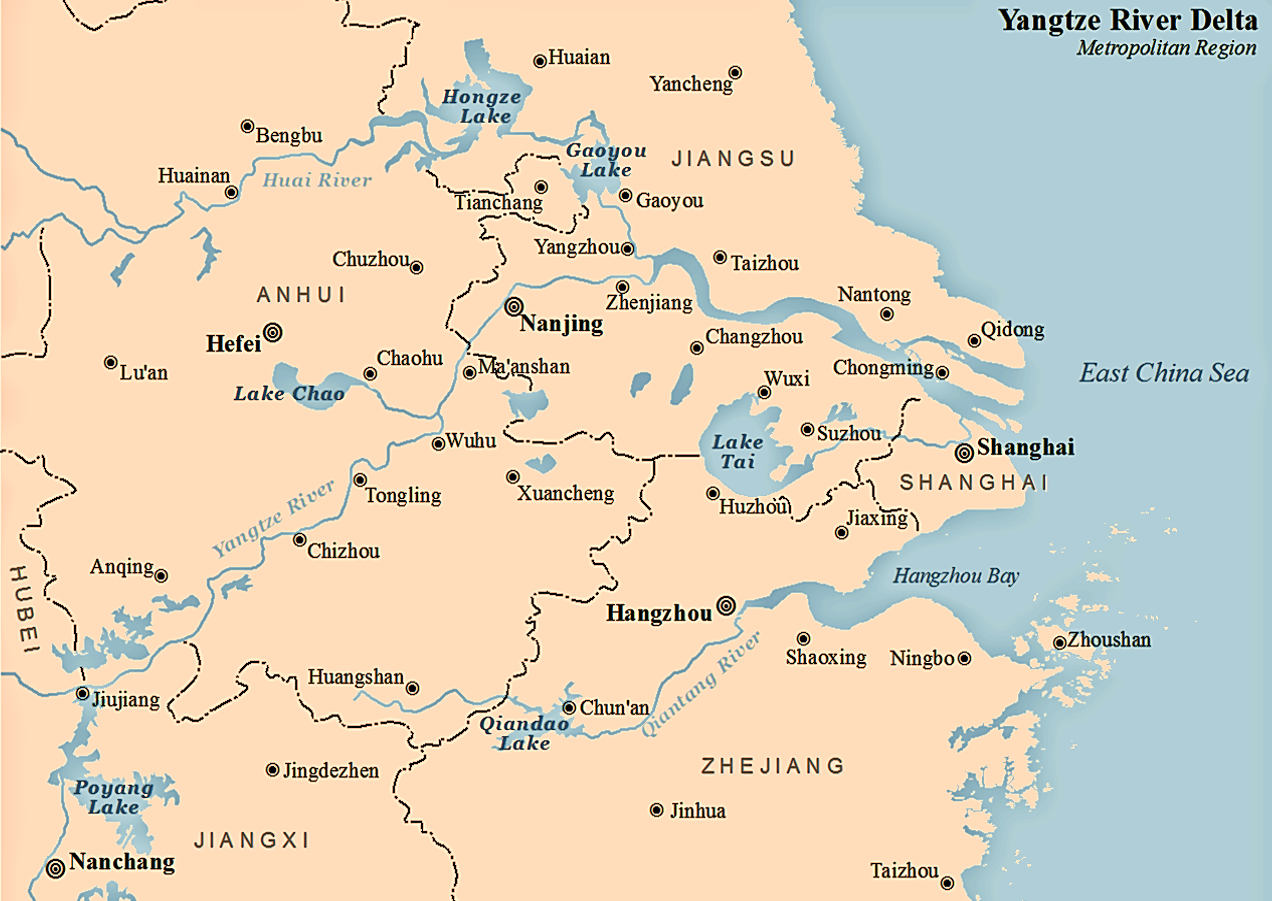
Yangtze River Delta.gif - Maanshen

20090425 Yangtze River near Shanghai 4989.jpg - Jakubhal

ดินดอนปากแม่น้ำแยงซี.jpg - Garam
Zh-Chang Jiang San Jiao Zhou.ogg - File Upload Bot (Magnus Manske)

Zhoushan cityview.jpg - Jonipoon

Musical instruments on display at the MIM (14165214980).jpg - Clusternote

Atlas Van der Hagen-KW1049B13 044-NANKING, SIVE KIANGNAN, IMPERII SINARVM PROVINCIA NONA.jpeg - OlafJanssen

"Nanking, sive Kiangnan, Imperii Sinarum provincia nona." (22065282160).jpg - Tm

MV Forest Frontier - panoramio.jpg - Panoramio upload bot

Breath Of Heaven - panoramio.jpg - Panoramio upload bot

East China Sea - panoramio (2).jpg - Panoramio upload bot

Coast - panoramio (12).jpg - Panoramio upload bot

River - panoramio (51).jpg - Panoramio upload bot

MODIS MOUTH OF THE YANGTZE.jpg - Wcam

Eastchina and Eastchina Sea tmo 2017313.jpg - Matthiasb

Eastchina and Eastchina Sea tmo 2017313 lrg.jpg - Matthiasb
Eastchina and Eastchina Sea tmo 2017313 geo.tif - Matthiasb
Yangtze River Delta.png - Seasonsinthesun

262 of 'The Earth and its Inhabitants. The European section of the Universal Geography by E. Reclus. Edited by E. G. Ravenstein. Illustrated by ... engravings and maps' (11126219483).jpg - LlywelynII

260 of 'The Earth and its Inhabitants. The European section of the Universal Geography by E. Reclus. Edited by E. G. Ravenstein. Illustrated by ... engravings and maps' (11123451054).jpg - LlywelynII
Novvs atlas Sinensis. LOC 2002625249-4.tif - Fæ

Novvs atlas Sinensis. LOC 2002625249-4.jpg - Fæ

Yangtze River Delta Economic Zone.png - NTooru
长江三角洲城市群发展规划.pdf - H2NCH2COOH

Nanking Sive Kiangnan - Atlas Maior, vol 11, map 21 - Joan Blaeu, 1667 - BL 114.h(star).11.(21).jpg - JhealdBot

Farmers of forty centuries - grave lands in the delta region of the Yangtse-kiang.jpg - Bob Burkhardt

Admiralty Chart No 1602 Approaches to the Yangtze Kiang. From the Chinese Maritime Customs Charts to 1928, Published 1881, Corrections to 1935.jpg - Balkanique
Carte-du-cours-inferieur-du-Yangzi-Jiang.png - GrandEscogriffe

ISS015-E-7479 - View of China.jpg - AskeBot

ISS015-E-7473 - View of China.jpg - AskeBot

ISS015-E-7462 - View of China.jpg - AskeBot

ISS015-E-7461 - View of China.jpg - AskeBot

ISS015-E-7475 - View of China.jpg - AskeBot

ISS015-E-7476 - View of China.jpg - AskeBot

ISS015-E-7459 - View of China.jpg - AskeBot

ISS015-E-7469 - View of China.jpg - AskeBot

ISS015-E-7477 - View of China.jpg - AskeBot

ISS015-E-7464 - View of China.jpg - AskeBot

ISS015-E-7467 - View of China.jpg - AskeBot

ISS015-E-7465 - View of China.jpg - AskeBot

ISS015-E-7460 - View of China.jpg - AskeBot

ISS015-E-7470 - View of China.jpg - AskeBot

ISS015-E-7480 - View of China.jpg - AskeBot

ISS015-E-7474 - View of China.jpg - AskeBot

ISS015-E-7478 - View of China.jpg - AskeBot

ISS015-E-7463 - View of China.jpg - AskeBot

ISS015-E-7472 - View of China.jpg - AskeBot

ISS015-E-7466 - View of China.jpg - AskeBot

ISS015-E-7468 - View of China.jpg - AskeBot

ISS015-E-7471 - View of China.jpg - AskeBot

Nanking sive Kiangnan imperii sinarum provincia nona - (tiré du P. Martini) ; J. Blaeu excud. - btv1b59630645.jpg - Gzen92Bot

Admiralty Chart No 2946 Ch'ang Chiang Sheet 1, Published 1954.jpg - Kognos

Yangtze River Delta Economic Region.jpg - Amongit
Yangtze River Delta map.png - Amongit

Yangtze Delta.jpg - LlywelynII

Yangtze River Delta (MODIS 2019-03-20).jpg - OptimusPrimeBot

Yangtze River Delta Carbon Fiber & Composite Innovation Center (1).jpg - Fumikas Sagisavas

Structure of Yangtze Estuary.svg - Nanhuajiaren

Physical Geography with the Boundaries of Ancient China.jpg - LlywelynII