Wikimedi'Òc
Modes d'emploi

Cet album fait partie des albums
Cet album photos contient les sous-albums suivants :


Impressive old tree - geograph.org.uk - 7435645.jpg - GeographBot

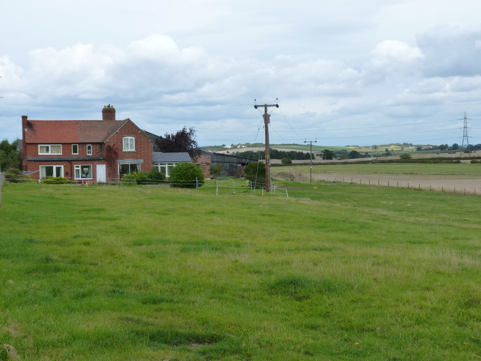
Fairview Farm - geograph.org.uk - 488026.jpg - GeographBot

Little Hill Farm - geograph.org.uk - 482758.jpg - GeographBot

Ripening wheat near Dryton - geograph.org.uk - 502424.jpg - GeographBot

Bridleway at Lower Dryton - geograph.org.uk - 723395.jpg - GeographBot

Approaching Little Hall Farm - geograph.org.uk - 738580.jpg - GeographBot

Quiet road alongside The Wrekin - geograph.org.uk - 738560.jpg - GeographBot

Pylons, cables and Haughmond Hill - geograph.org.uk - 786081.jpg - GeographBot

Tailback after an accident - geograph.org.uk - 786089.jpg - GeographBot

Pure English landscape - panoramio.jpg - Panoramio upload bot
Norton Cross Roads.jpg - Peter I. Vardy

Deer at Attingham Park - geograph.org.uk - 1840434.jpg - GeographBot

Herd of Deer at Attingham Park - geograph.org.uk - 1840451.jpg - GeographBot

View across the River Severn - geograph.org.uk - 1956155.jpg - GeographBot

River Severn - Alongside the Island at Wroxeter - geograph.org.uk - 2003239.jpg - GeographBot

River Severn South of Wroxeter - geograph.org.uk - 2003248.jpg - GeographBot

Footbridge over the River Tern at Botanybay Plantation - geograph.org.uk - 2051148.jpg - GeographBot

Track through Ashes - geograph.org.uk - 2064379.jpg - GeographBot

Fields on the slope of The Wrekin - geograph.org.uk - 2064418.jpg - GeographBot

Toward the Wrekin summit - geograph.org.uk - 2064614.jpg - GeographBot

The view over Fair View Farm - geograph.org.uk - 2064630.jpg - GeographBot

The Needle's Eye outcrop - geograph.org.uk - 2069986.jpg - GeographBot

The Needle's Eye outcrop - geograph.org.uk - 2070010.jpg - GeographBot

The River Tern - geograph.org.uk - 2078369.jpg - GeographBot

The footpath is here somewhere... - geograph.org.uk - 2078999.jpg - GeographBot

OK, so there's the waymark. Anyone seen the stile^ - geograph.org.uk - 2079004.jpg - GeographBot

New woodland planting near The Horseshoe - geograph.org.uk - 2079011.jpg - GeographBot

Stabling in field behind The Horseshoe Inn (1) - geograph.org.uk - 2079014.jpg - GeographBot

Stabling in field behind The Horseshoe Inn (2) - geograph.org.uk - 2079020.jpg - GeographBot

Bridleway across the Bell Brook - geograph.org.uk - 2079030.jpg - GeographBot
That's fairly clear, then - geograph.org.uk - 2079035.jpg - GeographBot

Beslow Cottage - geograph.org.uk - 2079039.jpg - GeographBot

Beslow Farm buildings - geograph.org.uk - 2079044.jpg - GeographBot

The Ivy House - geograph.org.uk - 2079058.jpg - GeographBot

Marshy area in the field south of the Ivy House - geograph.org.uk - 2079064.jpg - GeographBot

Bridleway towards Charlton Hill - geograph.org.uk - 2079074.jpg - GeographBot

Pond in the fields near Dryton - geograph.org.uk - 2079086.jpg - GeographBot

Pond and cattle near Dryton - geograph.org.uk - 2079087.jpg - GeographBot

Watch Oak cottage on the B4380 - geograph.org.uk - 2079095.jpg - GeographBot

Rocky outcrop on Charlton Hill - geograph.org.uk - 2080000.jpg - GeographBot

Charlton Hill Farm from the bridleway to the southeast - geograph.org.uk - 2080248.jpg - GeographBot

Bridleway at Charlton Hill - geograph.org.uk - 2080250.jpg - GeographBot

Charlton Hill farmhouse - geograph.org.uk - 2080254.jpg - GeographBot

Summit of Charlton Hill - geograph.org.uk - 2080261.jpg - GeographBot

OS benchmark on Charlton Hill - geograph.org.uk - 2080263.jpg - GeographBot

Harebells on Charlton Hill - geograph.org.uk - 2080271.jpg - GeographBot
Meadow Farm, Charlton Hill - geograph.org.uk - 2080272.jpg - GeographBot

Across farmland to The Wrekin - geograph.org.uk - 2080442.jpg - GeographBot

Cottage at Charlton Hill Gorse - geograph.org.uk - 2080446.jpg - GeographBot

Ridge and furrow in a field at Rushton - geograph.org.uk - 2080455.jpg - GeographBot

Barns at Lower Farm - geograph.org.uk - 2080456.jpg - GeographBot

Lower Farm, Rushton - geograph.org.uk - 2080459.jpg - GeographBot
Bridleway from Rushton to Uppington - geograph.org.uk - 2080461.jpg - GeographBot

Water bowser and a reservoir at Rushton - geograph.org.uk - 2080464.jpg - GeographBot

Bridleway into Uppington - geograph.org.uk - 2080473.jpg - GeographBot

Footpath southwest of Uppington - geograph.org.uk - 2080482.jpg - GeographBot

Farmland southwest of Uppington - geograph.org.uk - 2080485.jpg - GeographBot

Fieldside path at Charlton Hill Gorse - geograph.org.uk - 2084345.jpg - GeographBot

Watling Street and Attingham Park - geograph.org.uk - 2107472.jpg - GeographBot

The River Tern, Attingham Park - geograph.org.uk - 2140859.jpg - GeographBot

Suspension Bridge, Attingham Park - geograph.org.uk - 2142520.jpg - GeographBot

Farm buildings near Woodgreen - geograph.org.uk - 2143481.jpg - GeographBot

A footpath in a field - geograph.org.uk - 2143489.jpg - GeographBot

Another invisible footpath - geograph.org.uk - 2143494.jpg - GeographBot

Nothing to do with the Romans... - geograph.org.uk - 2143504.jpg - GeographBot

Rushton Cottage - geograph.org.uk - 2143518.jpg - GeographBot

The road junction near Neves Castle - geograph.org.uk - 2143521.jpg - GeographBot

Road junction at Bank Farm - geograph.org.uk - 2143539.jpg - GeographBot

A5 near Walcot Waste - geograph.org.uk - 2247593.jpg - GeographBot
A5 - B4394 overbridge - geograph.org.uk - 2247594.jpg - GeographBot

A5 - Duncote Farm accommodation bridge - geograph.org.uk - 2247595.jpg - GeographBot

A5 crosses the River Tern - geograph.org.uk - 2247598.jpg - GeographBot

Attingham Deer - geograph.org.uk - 2254737.jpg - GeographBot

Wrekin Deer - geograph.org.uk - 2254744.jpg - GeographBot

Lone Stag - geograph.org.uk - 2254750.jpg - GeographBot

Rushton Crossroad - geograph.org.uk - 2254931.jpg - GeographBot

Lane to Donnington - geograph.org.uk - 2254940.jpg - GeographBot

Charlton Hill View - geograph.org.uk - 2254947.jpg - GeographBot

River Tern, Attingham Park - geograph.org.uk - 2267987.jpg - GeographBot

The replica Roman villa at Wroxeter - geograph.org.uk - 2268714.jpg - GeographBot

The replica Roman villa at Wroxeter - geograph.org.uk - 2268725.jpg - GeographBot

The Severn west of The Wrekin from the air - geograph.org.uk - 2328611.jpg - GeographBot

B4390 at the junction of the B4380 near Wroxeter Roman City - geograph.org.uk - 2487125.jpg - GeographBot

B4390 at the junction of the B4380 near Wroxeter Roman City - geograph.org.uk - 2487131.jpg - GeographBot

B4380 at the junction of the B4390 near Wroxeter Roman City - geograph.org.uk - 2487142.jpg - GeographBot

B4380 at the junction of the B4390 near Wroxeter Roman City - geograph.org.uk - 2487150.jpg - GeographBot

Building at Wroxeter Roman City museum - geograph.org.uk - 2487204.jpg - GeographBot

Attingham on Tern - geograph.org.uk - 2513736.jpg - GeographBot

Wrekin Cloud - geograph.org.uk - 2528800.jpg - GeographBot

Part of the River Tern in Attingham Park - geograph.org.uk - 2727860.jpg - GeographBot

Banqueting House Rivet Benchmark - geograph.org.uk - 7503485.jpg - GeographBot

Entrance to Roman site - geograph.org.uk - 2817421.jpg - GeographBot

The summit of The Wrekin - geograph.org.uk - 2819890.jpg - GeographBot

Tern Bridge - geograph.org.uk - 2852792.jpg - GeographBot

Fallow Stag - geograph.org.uk - 2852813.jpg - GeographBot

Invisible Fence - geograph.org.uk - 2852867.jpg - GeographBot

The small Hamlet of Bluebell on the Uppington Junction - geograph.org.uk - 2939233.jpg - GeographBot

Looking along Watling Street towards Wales from the Uppington Junction - geograph.org.uk - 2939253.jpg - GeographBot

Rape field under electricity cables with a view of the Wrekin - geograph.org.uk - 2939273.jpg - GeographBot

Looking towards the Deer park from the bridge over the River Tern - geograph.org.uk - 2940010.jpg - GeographBot

Red Brick Farm buildings opposite Wroxeter Roman City museum - geograph.org.uk - 2940118.jpg - GeographBot

Duncote Farm bridge from eastbound A5 - geograph.org.uk - 3002425.jpg - GeographBot

Layby east of Duncote on A5 east - geograph.org.uk - 3002429.jpg - GeographBot

Lower Eyton from the Point-to-Point course - geograph.org.uk - 3028561.jpg - GeographBot

The Point-to-Point course east of Ferry Meadow - geograph.org.uk - 3028600.jpg - GeographBot

The Severn near Lower Dryton - geograph.org.uk - 3028622.jpg - GeographBot

A minor realignment of the Eyton Point-to-Point course - geograph.org.uk - 3028635.jpg - GeographBot

The Severn Way ^ the Point-to-Point course near Lower Dryton - geograph.org.uk - 3028640.jpg - GeographBot

The Dryton brook - geograph.org.uk - 3028647.jpg - GeographBot

City sheep, Wroxeter - geograph.org.uk - 3040780.jpg - GeographBot

Duncote Farm Bridge, A5 - geograph.org.uk - 3151986.jpg - GeographBot

A5, eastbound - geograph.org.uk - 3152120.jpg - GeographBot

B4394 Overbridge, A5 - geograph.org.uk - 3152127.jpg - GeographBot

A5, eastbound - geograph.org.uk - 3152133.jpg - GeographBot

A5, eastbound - geograph.org.uk - 3152152.jpg - GeographBot

Air Raid Shelter - geograph.org.uk - 3248074.jpg - GeographBot

Air Raid Shelter - interior - geograph.org.uk - 3256637.jpg - GeographBot

RAF Atcham runway - geograph.org.uk - 3275439.jpg - GeographBot

RAF Atcham runway - geograph.org.uk - 3275443.jpg - GeographBot

Attingham Park, view across River Tern to deer park - geograph.org.uk - 7509726.jpg - GeographBot

River Tern at Attingham Park, view through trees to deer park - geograph.org.uk - 7509730.jpg - GeographBot

A5 View East - geograph.org.uk - 3426033.jpg - GeographBot

Building foundations at Wroxeter - geograph.org.uk - 3688194.jpg - GeographBot

A5 crossed by B4394 - geograph.org.uk - 3709294.jpg - GeographBot

A5 overbridge to Duncote Farm - geograph.org.uk - 3709300.jpg - GeographBot

The River Tern at Attingham Park - geograph.org.uk - 4162387.jpg - GeographBot

The River Tern at Attingham Park - geograph.org.uk - 4162430.jpg - GeographBot

Cable-Stayed Footbridge over the River Tern - geograph.org.uk - 4162477.jpg - GeographBot

Tobruck Plantation, Attingham Park - geograph.org.uk - 4162491.jpg - GeographBot

New Plantation, Attingham Park - geograph.org.uk - 4162495.jpg - GeographBot

The Berwick Memorial, Attingham Park - geograph.org.uk - 4162519.jpg - GeographBot

Deer Park Walk, Attingham Park - geograph.org.uk - 4163327.jpg - GeographBot

Footpaths at Attingham Park - geograph.org.uk - 4163332.jpg - GeographBot

Deer Park Walk, Attingham Park - geograph.org.uk - 4163342.jpg - GeographBot

Pond in the Deer Park at Attingham - geograph.org.uk - 4163352.jpg - GeographBot

Deer in the Park at Attingham - geograph.org.uk - 4164654.jpg - GeographBot

View to Buildwas Power Station from the base of the Wrekin - geograph.org.uk - 4279761.jpg - GeographBot

Wooded path up the Wrekin - geograph.org.uk - 4279765.jpg - GeographBot

Wooded path up the Wrekin, nearing the top - geograph.org.uk - 4279770.jpg - GeographBot

Near the Needle's Eye on the Wrekin - geograph.org.uk - 4279773.jpg - GeographBot

View towards the Stretton Hills from the Wrekin - geograph.org.uk - 4279777.jpg - GeographBot

Near the top of the Wrekin - geograph.org.uk - 4279780.jpg - GeographBot

On top of the Wrekin, Shropshire - geograph.org.uk - 4279783.jpg - GeographBot

OS benchmark - Rushton Upper Farm - geograph.org.uk - 4282293.jpg - GeographBot

A5 just west of layby - geograph.org.uk - 4378484.jpg - GeographBot

Duncote Farm bridge - geograph.org.uk - 4378486.jpg - GeographBot

Tanker on the A5 - geograph.org.uk - 4411541.jpg - GeographBot

Botany Bay plantation - geograph.org.uk - 4618636.jpg - GeographBot

Alongside Repton's Wood - geograph.org.uk - 4618641.jpg - GeographBot

The north side of Little Egg Coppice - geograph.org.uk - 4618649.jpg - GeographBot

Military roadway on Attingham Park - geograph.org.uk - 4618667.jpg - GeographBot

Fallow deer on the Attingham Estate - geograph.org.uk - 4623570.jpg - GeographBot

Fallow deer buck at Attingham - geograph.org.uk - 4623589.jpg - GeographBot

OS benchmark - Attingham Park - geograph.org.uk - 4623603.jpg - GeographBot

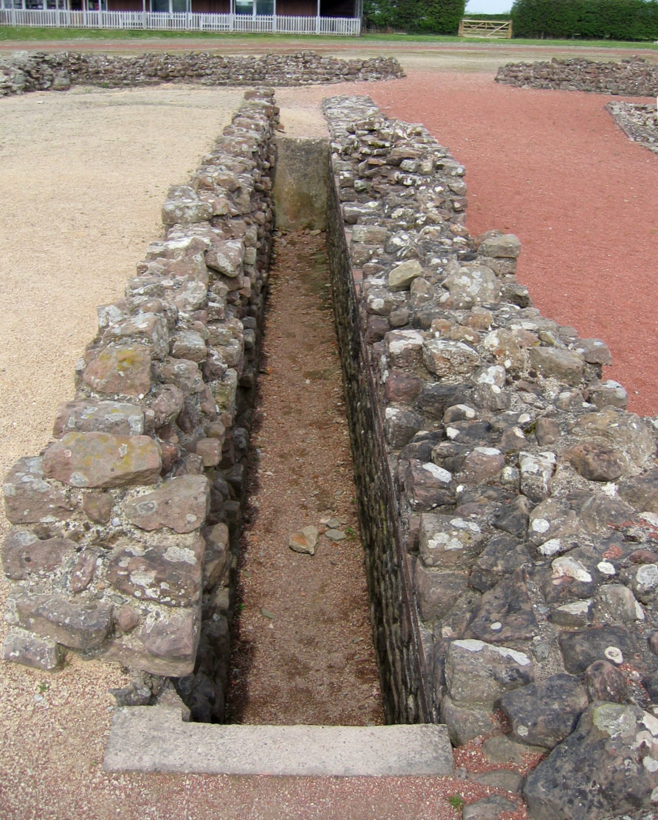
Roman Bath Remains at Viroconium Cornoviorum (Wroxeter Roman City) - geograph.org.uk - 4711052.jpg - GeographBot

Roman Bath Remains at Viroconium Cornoviorum (Wroxeter Roman City) - geograph.org.uk - 4711118.jpg - GeographBot

The "Old Work" at Viroconium Cornoviorum (Wroxeter Roman City) - geograph.org.uk - 4711210.jpg - GeographBot
Latrine Block at Viroconium Cornoviorum (Wroxeter Roman City) - geograph.org.uk - 4711229.jpg - GeographBot

Remains of the Forum at Viroconium Cornoviorum (Wroxeter Roman City) - geograph.org.uk - 4711288.jpg - GeographBot

OS benchmark - Attingham Park Lodge - geograph.org.uk - 4731203.jpg - GeographBot

South ridge of The Wrekin - geograph.org.uk - 4859267.jpg - GeographBot

Former Dukes Sunday School, Uppington - geograph.org.uk - 4896697.jpg - GeographBot

Former Dukes Sunday School, Uppington - geograph.org.uk - 4896698.jpg - GeographBot

Holy Trinity Church, Uppington - geograph.org.uk - 4896700.jpg - GeographBot

The Wrekin from Uppington - geograph.org.uk - 4896703.jpg - GeographBot

Holy Trinity Church, Uppington - geograph.org.uk - 4896704.jpg - GeographBot

Holy Trinity Church, Uppington - geograph.org.uk - 4896708.jpg - GeographBot

Road junction, Uppington - geograph.org.uk - 4896714.jpg - GeographBot

The Sheep Shed, Woodgreen - geograph.org.uk - 4896719.jpg - GeographBot

Cedar trees reflected in a river - geograph.org.uk - 5007328.jpg - GeographBot

Fallow deer in Attingham Park - geograph.org.uk - 5007332.jpg - GeographBot

Attingham Park - geograph.org.uk - 5012708.jpg - GeographBot

Bridge in Attingham Park - geograph.org.uk - 5012713.jpg - GeographBot

The Wrekin - View down ridge from Needle's Eye - geograph.org.uk - 5237109.jpg - GeographBot

The Wrekin - View down to Bank Farm ^ Little Hill Farm from SW ridge - geograph.org.uk - 5237115.jpg - GeographBot

The Wrekin - Tree on summit of Little Hill - geograph.org.uk - 5237123.jpg - GeographBot

View across valley of the R Severn, E of Eyton on Severn - geograph.org.uk - 5237135.jpg - GeographBot

Wroxeter - St Andrew's Church - geograph.org.uk - 5237141.jpg - GeographBot

Wroxeter - St Andrew's Church - geograph.org.uk - 5237146.jpg - GeographBot

Wroxeter - Reconstruction of Roman house - geograph.org.uk - 5237149.jpg - GeographBot

Field path approaching Uppington Church, Shropshire - geograph.org.uk - 5237153.jpg - GeographBot

Uppington, Shropshire - Holy Trinity Church - geograph.org.uk - 5237158.jpg - GeographBot

The Wrekin - geograph.org.uk - 5300683.jpg - GeographBot

Roman Remains Wroxeter - geograph.org.uk - 5444276.jpg - GeographBot

View southwest across Shropshire from the Wrekin - geograph.org.uk - 5486996.jpg - GeographBot

Littlehill Plantation - geograph.org.uk - 5492774.jpg - GeographBot

Little Hill Farm and Bank Farm - geograph.org.uk - 5492814.jpg - GeographBot

Path through Lane Plantation - geograph.org.uk - 5492878.jpg - GeographBot

Timber stacks at the Lane Plantation - geograph.org.uk - 5492879.jpg - GeographBot

Forestry track descending the Wrekin - geograph.org.uk - 5492881.jpg - GeographBot

Track on the southern slopes of the Wrekin - geograph.org.uk - 5495183.jpg - GeographBot

Viroconium - geograph.org.uk - 5651760.jpg - GeographBot

Scene at Wroxeter Roman remains - geograph.org.uk - 5780799.jpg - GeographBot

Wroxeter Roman City - May 2018 (1) - geograph.org.uk - 5793610.jpg - GeographBot

Wroxeter Roman City - May 2018 (2) - geograph.org.uk - 5793613.jpg - GeographBot

Wroxeter Roman City - May 2018 (3) - geograph.org.uk - 5793618.jpg - GeographBot

Tern Lodge - geograph.org.uk - 5873181.jpg - GeographBot

View to The Wrekin - geograph.org.uk - 5873857.jpg - GeographBot

Wroxeter Roman City, Viroconium - geograph.org.uk - 5881388.jpg - GeographBot

Wroxeter Roman City, Viroconium - geograph.org.uk - 5881395.jpg - GeographBot

View from Wroxeter - geograph.org.uk - 5881403.jpg - GeographBot

Wroxeter - St Andrew's Church - geograph.org.uk - 5881404.jpg - GeographBot

Saxon carving - geograph.org.uk - 5881410.jpg - GeographBot

Saxon carving - geograph.org.uk - 5881414.jpg - GeographBot

Saxon carving - geograph.org.uk - 5881418.jpg - GeographBot

Wroxeter Roman City - Roman Villa reconstruction - geograph.org.uk - 6010580.jpg - GeographBot

Wroxeter - Roman columns on church gate - geograph.org.uk - 6010588.jpg - GeographBot

View towards The Wrekin from Eyton on Severn - geograph.org.uk - 6010595.jpg - GeographBot

View southwestwards from the Wrekin - geograph.org.uk - 6100629.jpg - GeographBot

Direction Sign - Signpost by the B4380, The Coalpits - geograph.org.uk - 6102540.jpg - GeographBot

Direction Sign - Signpost by the B4380 at Wroxeter - geograph.org.uk - 6102822.jpg - GeographBot

Old Toll House, Wroxeter - geograph.org.uk - 6114703.jpg - GeographBot

Thatched timber framed cottage, Norton - geograph.org.uk - 6156359.jpg - GeographBot

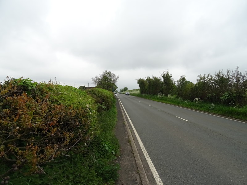
B5061 approaching Norton crossroads - geograph.org.uk - 6156364.jpg - GeographBot

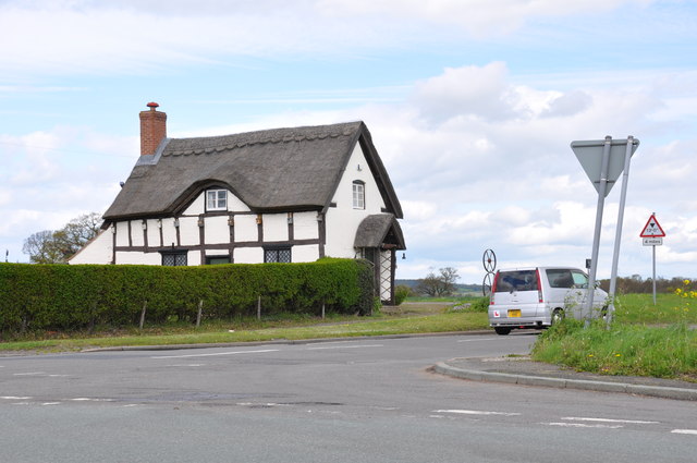
Thatched cottage on the Norton crossroads - geograph.org.uk - 6156371.jpg - GeographBot

Crop field and houses, Uckington Heath - geograph.org.uk - 6156375.jpg - GeographBot

B4394, Uckington - geograph.org.uk - 6156381.jpg - GeographBot

Farmland of the B4394, Uckington - geograph.org.uk - 6156384.jpg - GeographBot

B4394, Uckington - geograph.org.uk - 6156386.jpg - GeographBot

Track near Atcham Business Park - geograph.org.uk - 6156390.jpg - GeographBot

Large crop field off the B5061 - geograph.org.uk - 6156393.jpg - GeographBot
B5061 towards Wellington - geograph.org.uk - 6156399.jpg - GeographBot

Car dealers the B5061, Uckington - geograph.org.uk - 6156402.jpg - GeographBot

Crop field and hedgerow off Watling Street - geograph.org.uk - 6156476.jpg - GeographBot

Crop field and power lines - geograph.org.uk - 6156479.jpg - GeographBot

B5061 towards Wellington - geograph.org.uk - 6156482.jpg - GeographBot

Potato field beside hedgerow - geograph.org.uk - 6156484.jpg - GeographBot

B5061 towards Wellington - geograph.org.uk - 6156487.jpg - GeographBot

Oilseed rape crop near Uppington - geograph.org.uk - 6156490.jpg - GeographBot

B5061 towards Wellington - geograph.org.uk - 6156493.jpg - GeographBot

House on the B5061 - geograph.org.uk - 6156496.jpg - GeographBot

Elizabeth II postbox, Horseshoe Inn, Uckington - geograph.org.uk - 6157496.jpg - GeographBot

Attingham Park, River Tern - geograph.org.uk - 6178981.jpg - GeographBot

Gate to the Deer Park at Attingham Park - geograph.org.uk - 6178983.jpg - GeographBot

The Deer Park - geograph.org.uk - 6178985.jpg - GeographBot

Attingham Park Deer Park - geograph.org.uk - 6178988.jpg - GeographBot

Fallow Deer at Attingham Park - geograph.org.uk - 6178989.jpg - GeographBot

In the Attingham Deer Park - geograph.org.uk - 6178998.jpg - GeographBot

Pond in Attingham Park - geograph.org.uk - 6178999.jpg - GeographBot

Woodland Path at Attingham Park - geograph.org.uk - 6179033.jpg - GeographBot

Attingham Park, The Berwick Memorial - geograph.org.uk - 6179046.jpg - GeographBot

The Berwick Memorial (detail) - geograph.org.uk - 6179050.jpg - GeographBot

The Berwick Memorial and Garden, Attingham Park - geograph.org.uk - 6179053.jpg - GeographBot

Attingham Park, Suspension Bridge over The River Tern - geograph.org.uk - 6179062.jpg - GeographBot

Swans on the River Tern - geograph.org.uk - 6179070.jpg - GeographBot

River Tern Upstream from the Suspension Bridge at Attingham Park - geograph.org.uk - 6179072.jpg - GeographBot

The Site of the Roman Town of Wroxeter (Viroconium) - geograph.org.uk - 6179140.jpg - GeographBot

Wroxeter Roman City, Site of the Bath House - geograph.org.uk - 6179151.jpg - GeographBot

Wroxeter Roman City, The "Old Work" - geograph.org.uk - 6179186.jpg - GeographBot

Wroxeter Roman City - geograph.org.uk - 6179190.jpg - GeographBot

Reconstruction of a Roman Town House at Wroxeter (Viroconium) - geograph.org.uk - 6179195.jpg - GeographBot

Wroxeter, Brookside - geograph.org.uk - 6179198.jpg - GeographBot

Lane to Wroxeter Roman Vineyard - geograph.org.uk - 6179199.jpg - GeographBot

Eyton on Severn - geograph.org.uk - 6179203.jpg - GeographBot

Farm at Eyton on Severn - geograph.org.uk - 6179205.jpg - GeographBot

Minor Road towards Dryton - geograph.org.uk - 6179208.jpg - GeographBot

Footpath towards Lower Longwood - geograph.org.uk - 6179212.jpg - GeographBot

Minor Road near Dryton - geograph.org.uk - 6179213.jpg - GeographBot

Reused Roman Pillars, St Andrew's Church, Wroxeter - geograph.org.uk - 6241227.jpg - GeographBot

Tern Lodge, Attingham Park - geograph.org.uk - 6241235.jpg - GeographBot

Tern Lodge, Attingham Park - geograph.org.uk - 6265295.jpg - GeographBot

Bridge over the River Tern east of Atcham - geograph.org.uk - 7528208.jpg - GeographBot

At Needle's Eye, The Wrekin - view towards Wenlock Wood ^ Ironbridge - geograph.org.uk - 6337605.jpg - GeographBot

On the Wrekin Summit - view WSW towards flooded R Severn - geograph.org.uk - 6337608.jpg - GeographBot

Suspension bridge - geograph.org.uk - 6339063.jpg - GeographBot

River Tern - geograph.org.uk - 6339065.jpg - GeographBot

Deer park, Attingham Park - geograph.org.uk - 6339068.jpg - GeographBot

Deer park, Attingham Park - geograph.org.uk - 6339069.jpg - GeographBot

Deer park, Attingham Park - geograph.org.uk - 6339072.jpg - GeographBot
Deer park, Attingham Park - geograph.org.uk - 6339073.jpg - GeographBot

Deer Park Cottage - geograph.org.uk - 6339076.jpg - GeographBot

Deer park, Attingham Park - geograph.org.uk - 6339078.jpg - GeographBot

Deer park, Attingham Park - geograph.org.uk - 6339080.jpg - GeographBot

Deer park, Attingham Park - geograph.org.uk - 6339082.jpg - GeographBot

Deer park, Attingham Park - geograph.org.uk - 6339084.jpg - GeographBot

Deer park, Attingham Park - geograph.org.uk - 6339092.jpg - GeographBot

River Tern, Attingham Park - geograph.org.uk - 6339093.jpg - GeographBot

Scene near the summit trig on the Wrekin in January - geograph.org.uk - 6359594.jpg - GeographBot

Field margin at edge of Attingham parkland - geograph.org.uk - 6398096.jpg - GeographBot

Cracked concrete road - geograph.org.uk - 6398805.jpg - GeographBot

Wroxeter Roman City - geograph.org.uk - 6458853.jpg - GeographBot

Ticket office, Wroxeter - geograph.org.uk - 6458856.jpg - GeographBot

Wroxeter Roman City - geograph.org.uk - 6460594.jpg - SteinsplitterBot

Replica Villa Urbana, Wroxeter - geograph.org.uk - 6460601.jpg - GeographBot

St Andrew's Church, Wroxeter - geograph.org.uk - 6460605.jpg - GeographBot

Recently-felled woodland in Gibbons Coppice - geograph.org.uk - 6467478.jpg - GeographBot

Wroxeter Roman City - geograph.org.uk - 6489950.jpg - GeographBot

Wroxeter Roman City - geograph.org.uk - 6489951.jpg - GeographBot

In the eye of The Needle - geograph.org.uk - 6499421.jpg - GeographBot

Paragliders above The Wrekin - geograph.org.uk - 6499434.jpg - GeographBot

Decaying trees on Attingham Park NT estate - geograph.org.uk - 6645988.jpg - GeographBot

Needle's Eye - geograph.org.uk - 6873610.jpg - GeographBot

Path down from the Wrekin - geograph.org.uk - 6873744.jpg - GeographBot

Path to the summit of the Wrekin - geograph.org.uk - 6873835.jpg - GeographBot

Roman Altar - geograph.org.uk - 6874396.jpg - GeographBot

Wroxeter Roman City - geograph.org.uk - 6883792.jpg - GeographBot

OS benchmark - Dryton, Lower Dryton Farm - geograph.org.uk - 6898285.jpg - GeographBot

Nos 3 ^ 4, Dryton - geograph.org.uk - 6898326.jpg - GeographBot

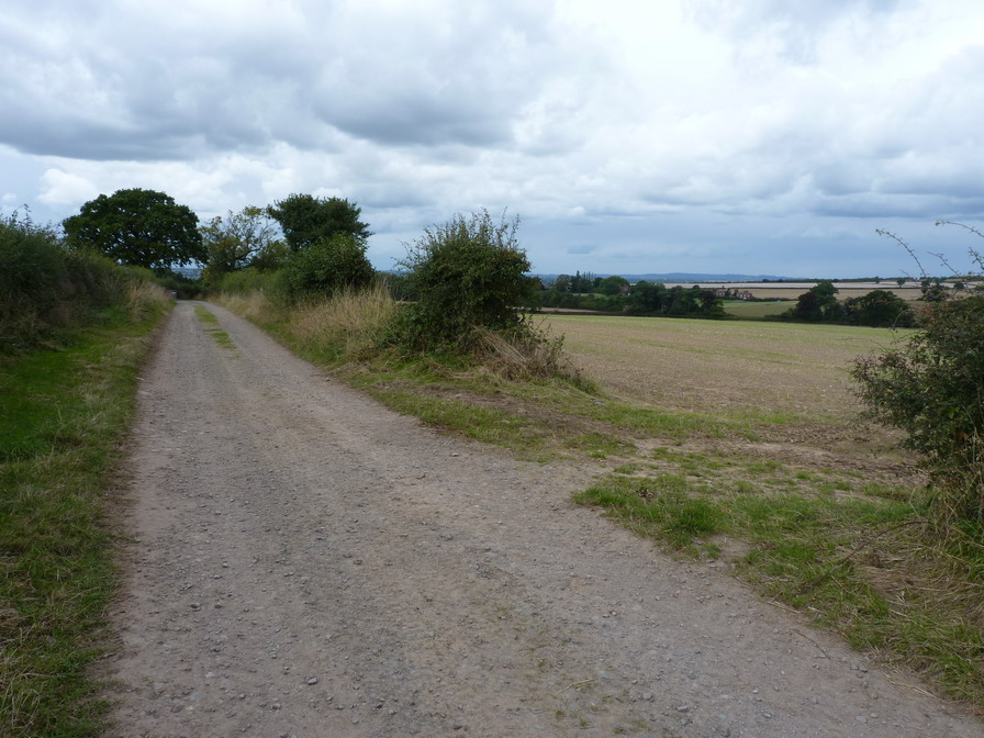
A track to nowhere much at all - geograph.org.uk - 6898343.jpg - GeographBot

A narrow country lane - geograph.org.uk - 6898952.jpg - GeographBot

Cast iron water pump at Haggs View (Halfway House) - geograph.org.uk - 6898956.jpg - GeographBot

Buildings at Haggs View - geograph.org.uk - 6898965.jpg - GeographBot

Brookside lane, looking towards Wroxeter - geograph.org.uk - 6898968.jpg - GeographBot

OS benchmark - Wroxeter, Halfway Meadows - geograph.org.uk - 6898975.jpg - GeographBot

Barn conversions at Halfway Meadows - geograph.org.uk - 6898981.jpg - GeographBot

Glebe Cottage, Wroxeter - geograph.org.uk - 6898992.jpg - GeographBot

OS benchmark - Wroxeter, church buttress - geograph.org.uk - 6899005.jpg - GeographBot

Wroxeter Grange - geograph.org.uk - 6899016.jpg - GeographBot

B4394, looking north - geograph.org.uk - 6900171.jpg - GeographBot

2 ^ 3 Norton Cross Roads - geograph.org.uk - 6900180.jpg - GeographBot

1 Norton Cross Roads - geograph.org.uk - 6900889.jpg - GeographBot

On the B4394 at Uckington Heath - geograph.org.uk - 6900892.jpg - GeographBot

Atcham Industrial Estate at Uckington Heath - geograph.org.uk - 6900900.jpg - GeographBot

Track to Uckington Farmhouse - geograph.org.uk - 6900902.jpg - GeographBot

Irrigation hose - geograph.org.uk - 6900904.jpg - GeographBot

A5 near Bluebell crossroads - geograph.org.uk - 6900907.jpg - GeographBot

Wildflower meadow bordering the River Severn - geograph.org.uk - 6909963.jpg - GeographBot

Derelict barn, Wroxeter - geograph.org.uk - 6962342.jpg - GeographBot

Wroxeter Roman city, general view - geograph.org.uk - 6962354.jpg - GeographBot

Watling Street, Wroxeter - geograph.org.uk - 6962374.jpg - GeographBot

Replica Roman villa, Wroxeter - geograph.org.uk - 6962376.jpg - GeographBot

Font, St Andrew's Church, Wroxeter - geograph.org.uk - 6962385.jpg - GeographBot

St Andrew's Church, Wroxeter - geograph.org.uk - 6962415.jpg - GeographBot

St Andrew's churchyard, Wroxeter - geograph.org.uk - 6962419.jpg - GeographBot

St Andrew's Church at Wroxeter - geograph.org.uk - 7014419.jpg - GeographBot

Lane towards Lower Dryton - geograph.org.uk - 7014432.jpg - GeographBot

Lane near Dryton - geograph.org.uk - 7016829.jpg - GeographBot

Wroxeter Roman Town in 1980 - geograph.org.uk - 7057057.jpg - GeographBot

The summit of the Wrekin - geograph.org.uk - 7081107.jpg - GeographBot

Tree on the Wrekin - geograph.org.uk - 7081112.jpg - GeographBot

Needle's Eye on the Wrekin - geograph.org.uk - 7081115.jpg - GeographBot

Needle's Eye rock outcrop on the Wrekin - geograph.org.uk - 7081194.jpg - GeographBot

Shropshire Way on the Wrekin - geograph.org.uk - 7081196.jpg - GeographBot

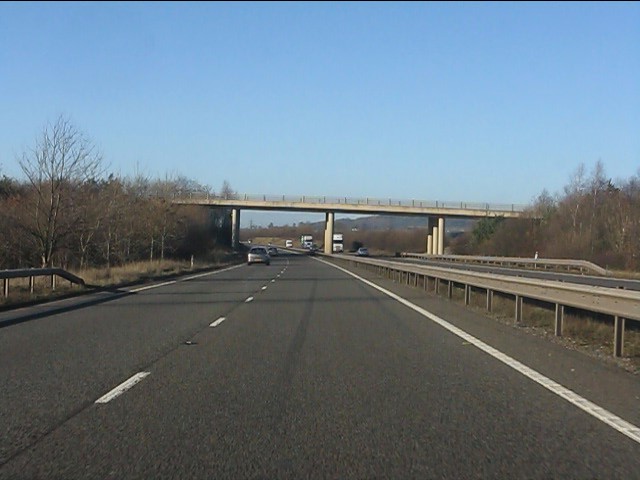
Along the A5 dual-carriageway - geograph.org.uk - 7158609.jpg - GeographBot

Field margin near the B4394 at Duncote - geograph.org.uk - 7158613.jpg - GeographBot

On the southern side of Ravenshaws Gorse - geograph.org.uk - 7158618.jpg - GeographBot

Looking along a hedgerow towards Wheathill Farm - geograph.org.uk - 7158621.jpg - GeographBot

Access to Duncote Farm and cottages - geograph.org.uk - 7170553.jpg - GeographBot

The Great Wall of the Basilica of the Bath House Complex - geograph.org.uk - 7208175.jpg - GeographBot

Remains of Viroconium - geograph.org.uk - 7208182.jpg - GeographBot

Fairview Farm - geograph.org.uk - 7228310.jpg - GeographBot

Road leaving Ruston - geograph.org.uk - 7228331.jpg - GeographBot

Lower Farm Ruston - geograph.org.uk - 7228363.jpg - GeographBot

The White House - geograph.org.uk - 7228478.jpg - GeographBot

Electricity pylon near Rushton - geograph.org.uk - 7228490.jpg - GeographBot

Road to Woodgreen - geograph.org.uk - 7230714.jpg - GeographBot

Uckington Garage Benchmark - geograph.org.uk - 7237524.jpg - GeographBot

OS benchmark - Uppington, The Smithy - geograph.org.uk - 7274155.jpg - GeographBot

OS benchmark and PA Bolt - Uppington church porch - geograph.org.uk - 7274275.jpg - GeographBot

Picnic Table by the Villa - geograph.org.uk - 7302772.jpg - GeographBot
Two Empty Houses - geograph.org.uk - 7302786.jpg - GeographBot

House near the Market - geograph.org.uk - 7302833.jpg - GeographBot

Barns in the Roman City - geograph.org.uk - 7302847.jpg - GeographBot

Wroxeter Cross Roads - geograph.org.uk - 7302858.jpg - GeographBot

Wroxeter villa urbana - geograph.org.uk - 7530625.jpg - GeographBot

Viroconium Forum Colonnade - geograph.org.uk - 7530632.jpg - GeographBot

Wrekin West Face Pivot Benchmark - geograph.org.uk - 7358471.jpg - GeographBot

River Tern downstream of Upton Forge bridge - geograph.org.uk - 7366047.jpg - GeographBot

Bank Farm - geograph.org.uk - 7366731.jpg - GeographBot

Barn at Little Hall Farm - geograph.org.uk - 7366732.jpg - GeographBot

Little Hall Farm - geograph.org.uk - 7366733.jpg - GeographBot

Neves Castle - geograph.org.uk - 7366734.jpg - GeographBot

A slow climb - geograph.org.uk - 7383454.jpg - GeographBot

The Shropshire Way in Littlehill Plantation - geograph.org.uk - 7383510.jpg - GeographBot

Stables behind The Horseshoe Inn - geograph.org.uk - 7385093.jpg - GeographBot

Uckington Pumping Station - geograph.org.uk - 7385095.jpg - GeographBot

Environmental Stewardship Field margin - geograph.org.uk - 7385096.jpg - GeographBot

The bridleway continues to Donnington - geograph.org.uk - 7385097.jpg - GeographBot

Beslow Cottage - geograph.org.uk - 7385098.jpg - GeographBot

Bridleway from Uckington to Donnington - geograph.org.uk - 7385101.jpg - GeographBot

Footbridge over the River Tern, Attingham Park - geograph.org.uk - 7395296.jpg - GeographBot

Wroxeter - geograph.org.uk - 7531345.jpg - GeographBot

The Old Work and heated rooms - geograph.org.uk - 7531371.jpg - GeographBot

Bath house remains, Wroxeter Roman City - geograph.org.uk - 7546927.jpg - GeographBot

Tern Lodge - geograph.org.uk - 7546936.jpg - GeographBot

Excavated remains, Wroxeter Roman City - geograph.org.uk - 7546952.jpg - GeographBot

Villa reconstruction, Wroxeter Roman City - geograph.org.uk - 7546959.jpg - GeographBot

Confluence of the River Tern and River Severn - geograph.org.uk - 7547406.jpg - GeographBot

The Cottage and The coach House, Wroxeter, from the River Severn - geograph.org.uk - 7547411.jpg - GeographBot

Island in the River Severn at Wroxeter - geograph.org.uk - 7547414.jpg - GeographBot

'The Boathouse' at Wroxter on the River Severn - geograph.org.uk - 7547420.jpg - GeographBot

Approaching Eyton on Severn - geograph.org.uk - 7547582.jpg - GeographBot

Exposed bedrock at Eytonrock - geograph.org.uk - 7547584.jpg - GeographBot

Exposed bedrock at Eytonrock - geograph.org.uk - 7547600.jpg - GeographBot

Eytonrock from The River Severn - geograph.org.uk - 7547601.jpg - GeographBot

The Riverside Inn, Cound from the river - geograph.org.uk - 7547608.jpg - GeographBot

Surface water abstraction from The River Severn - geograph.org.uk - 7547612.jpg - GeographBot

Atcham Business Park - geograph.org.uk - 7552986.jpg - GeographBot

Track on the south side of The Wrekin - geograph.org.uk - 7607001.jpg - GeographBot

The Roman Altar Stone at Uppington - geograph.org.uk - 7643328.jpg - GeographBot

Bell Brook, Wroxeter - geograph.org.uk - 7686165.jpg - GeographBot

Norton Farm, Upton Magna - geograph.org.uk - 7686168.jpg - GeographBot

Wroxeter Roman City - geograph.org.uk - 7686172.jpg - GeographBot

Wroxeter Roman City - geograph.org.uk - 7686173.jpg - GeographBot

Bell Brook, Shropshire - geograph.org.uk - 7686499.jpg - GeographBot

Former site of Viroconium Cornoviorum - geograph.org.uk - 7686503.jpg - GeographBot

Pond in New Plantation, Attingham Park - geograph.org.uk - 7699728.jpg - GeographBot

Fallen tree in the River Tern, Attingham Park - geograph.org.uk - 7701348.jpg - GeographBot

Avenue Farmhouse at Uppington - geograph.org.uk - 7719402.jpg - GeographBot

The Tudor House at no 1, Uppington - geograph.org.uk - 7728062.jpg - GeographBot

No 2 Uppington - geograph.org.uk - 7728065.jpg - GeographBot

Wroxeter and Uppington Cricket Club - geograph.org.uk - 7788648.jpg - GeographBot

The Poplars, Uppington - geograph.org.uk - 7788651.jpg - GeographBot

Grange Farm, Uppington - geograph.org.uk - 7788655.jpg - GeographBot

8 and 9, Uppington - geograph.org.uk - 7788659.jpg - GeographBot

Junction by 1 Wood Green, Uppington - geograph.org.uk - 7788662.jpg - GeographBot

Lower Farm, Rushton - geograph.org.uk - 7788663.jpg - GeographBot

Lane from Rushton to Donington - geograph.org.uk - 7788698.jpg - GeographBot

3 Charlton Hill, Wroxeter - geograph.org.uk - 7788703.jpg - GeographBot

Meadow Farm, Charlton Hill - geograph.org.uk - 7788705.jpg - GeographBot

View towards The Wrekin - geograph.org.uk - 7788708.jpg - GeographBot

Rear view of Charlton Hill Manor - geograph.org.uk - 7788712.jpg - GeographBot

Charlton Hill Farm - geograph.org.uk - 7788788.jpg - GeographBot

Granary Barn, Charlton Hill, Wroxeter - geograph.org.uk - 7788791.jpg - GeographBot

Lane near Donnington House - geograph.org.uk - 7788792.jpg - GeographBot

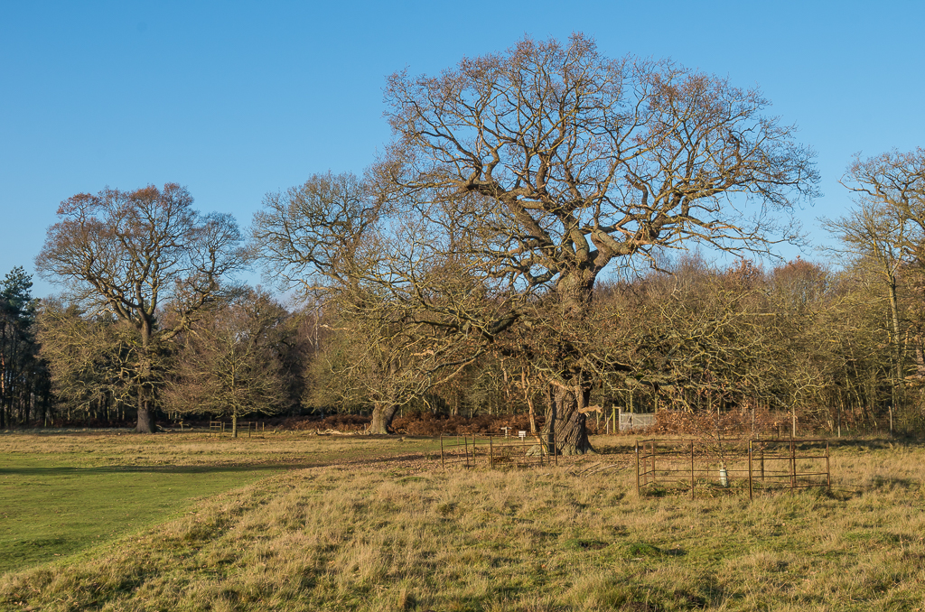
Field oak near Charlton Hill - geograph.org.uk - 7788793.jpg - GeographBot

Bridleway by School Lane cottages, Donnington - geograph.org.uk - 7788794.jpg - GeographBot

Bridleway through the field - geograph.org.uk - 7788796.jpg - GeographBot

Wetland area - geograph.org.uk - 7788798.jpg - GeographBot

Bridleway through the field - geograph.org.uk - 7788799.jpg - GeographBot

Where does the bridleway go^ - geograph.org.uk - 7788800.jpg - GeographBot

Using the tramlines as a makeshift path - geograph.org.uk - 7788801.jpg - GeographBot

Bridleway gap in the hedge - geograph.org.uk - 7788802.jpg - GeographBot

Locked bridleway gate - geograph.org.uk - 7788803.jpg - GeographBot

The Horseshoes Inn, Uckington - geograph.org.uk - 7788806.jpg - GeographBot

Track to Wheathill Farm, Uckington - geograph.org.uk - 7788807.jpg - GeographBot