Wikimedi'Òc
Modes d'emploi

Cet album fait partie des albums
Cet album photos contient les sous-albums suivants :


GPS Receivers.jpg - Lzur
GPS Receivers 2007.jpg - Geonarva

Station GPS receiver.jpg - VortBot

Construction laser.jpg - Jensens

CatCS56.jpg - Manuguf

FEMA - 40586 - Measuring the height of the Red River of the North in Fargo, ND.jpg - BotMultichillT

FEMA - 40588 - Fargo Engineer uses a GPS to measure the height of the river.jpg - BotMultichillT

Robotic-surveying-total-station-257041.jpg - Man of the war

US Navy 070801-F-8678B-039 Engineering Aide 2nd Class Randy Felipe attached to Naval Mobile Construction Battalion (NMCB) 4, trains on the new Trimble 5600DX Total Station series, survey equipment.jpg - BotMultichillT

US Navy 090320-N-8547M-015 Engineering Aide Constructionman Larry Winer, assigned to Naval Mobile Construction Battalion (NMCB)-5, surveys the elevation of dirt being added during a landing strip expansion.jpg - BotMultichillT

US Navy 090904-N-4440L-003 Engineering Aide 3rd Class William Anderson, assigned to Naval Mobile Construction Battalion (NMCB) 74, programs a Trimble S6 Total Station robotic surveying system.jpg - BotMultichillT

Trimble S-6.jpg - Sv1xv

Seabee with surveying prism.jpg - Sv1xv

NNSA-NSO-1443.jpg - Bomazi

Vermessung mit Trimble GPS System in Sofia 2012 PD 1.jpg - Bin im Garten

Vermessung mit Trimble GPS System in Sofia 2012 PD 2.jpg - Bin im Garten

Vermessung mit Trimble GPS System in Sofia 2012 PD 3.jpg - Bin im Garten

Vermessung mit Trimble GPS System in Sofia 2012 PD 4.jpg - Bin im Garten

Vermessung mit Trimble GPS System in Sofia 2012 PD 5.jpg - Bin im Garten

Knights Ferry Rd Flooding Lowndes County GPSing 1.JPG - Mjrmtg

Rocky Ford Rd Flooding Lowndes County GPSing 1.JPG - Mjrmtg

Rocky Ford Rd Flooding Lowndes County GPSing 2.JPG - Mjrmtg
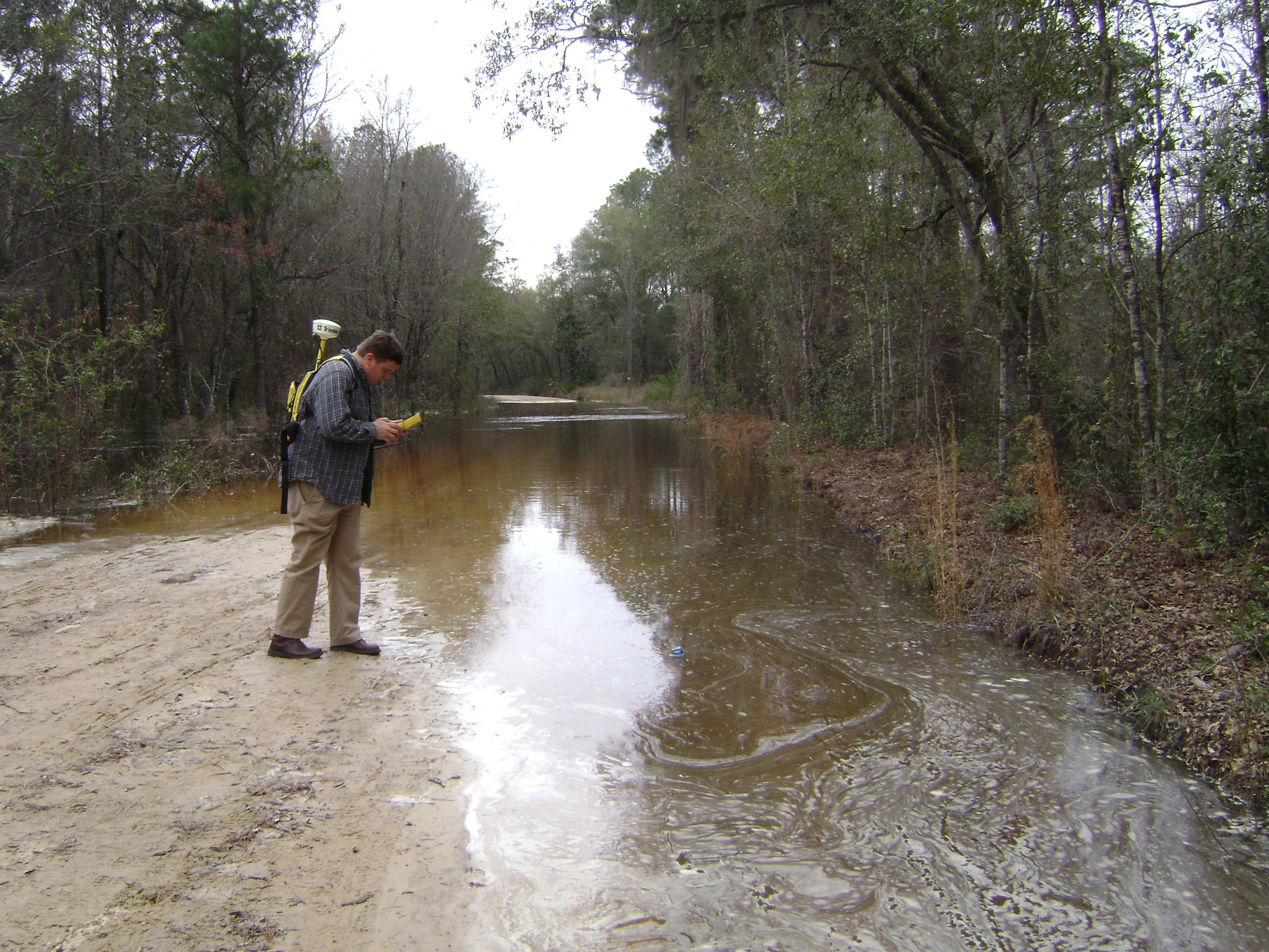
Knights Ferry Rd Flooding Lowndes County GPSing 2.JPG - Mjrmtg

Choke ring antenna Trimble 3305 Enhancer.jpg - Nevit

Laura Erickson with Trimble (6935101549).jpg - Daniel Mietchen

Detall equip de control - panoramio.jpg - Panoramio upload bot

Detall equip de control - panoramio - David Vallespí.jpg - Panoramio upload bot
InnoTrans 2016 (141) Travelarz.JPG - Travelarz
Tracking salmon spawning below Englebright Dam (6517185489).jpg - Vanished Account Byeznhpyxeuztibuo

Creator- H. Allison & Co. Photographers (6045209011).jpg - Fæ

Trimble R7 GNSS - panoramio.jpg - Panoramio upload bot

A bathymetric contour map of Castle Lake, Mount St. Helens.jpg - Simon04
Tekla-logo.svg - Manjiro5
Trimble (Unternehmen) logo.svg - Wdwdbot
Trimble Logo.svg - Wdwdbot

Trimble S6 -takymetri kolmijalan päällä.jpg - Agaboy6000

Trimble X9 3D-Laserscanning System.jpg - Best Tech Nick 25

Trimble X9 3D-Laserscanning System Tablet.jpg - Best Tech Nick 25

Trimble GNSS Messausrüstung R980 Empfänger.jpg - Best Tech Nick 25