Wikimedi'Òc
Modes d'emploi

Cet album fait partie des albums
Cet album photos contient les sous-albums suivants :


Spiral-ridge-trail-nc1.jpg - BrineStans

Balsam Mountain Trail - Flickr - pellaea.jpg - Josve05a
Clearing on the Mount Mitchell Trail 1.6 miles from the top - panoramio.jpg - Panoramio upload bot

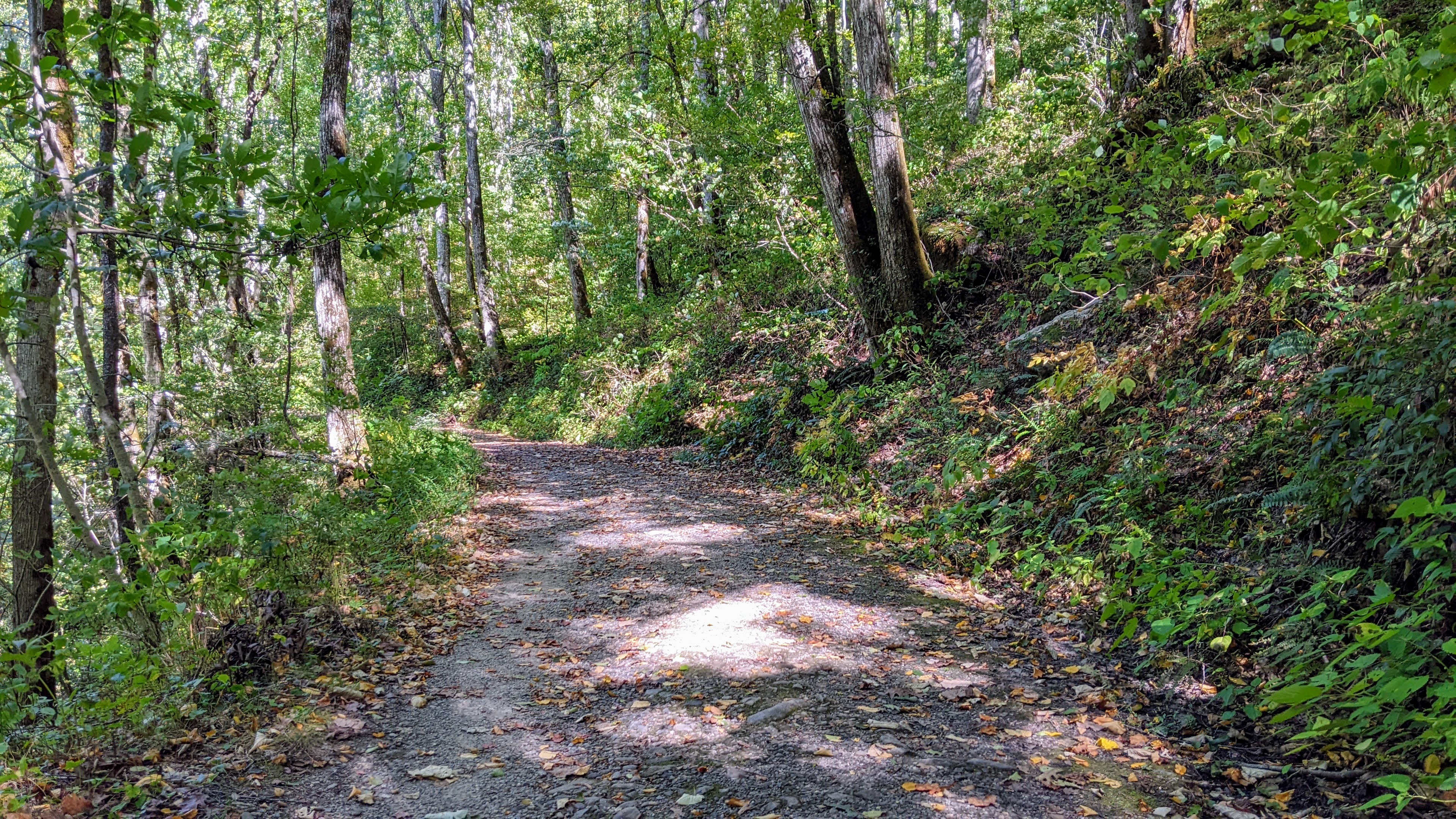
Mountains-to-Sea Trail - panoramio.jpg - Panoramio upload bot
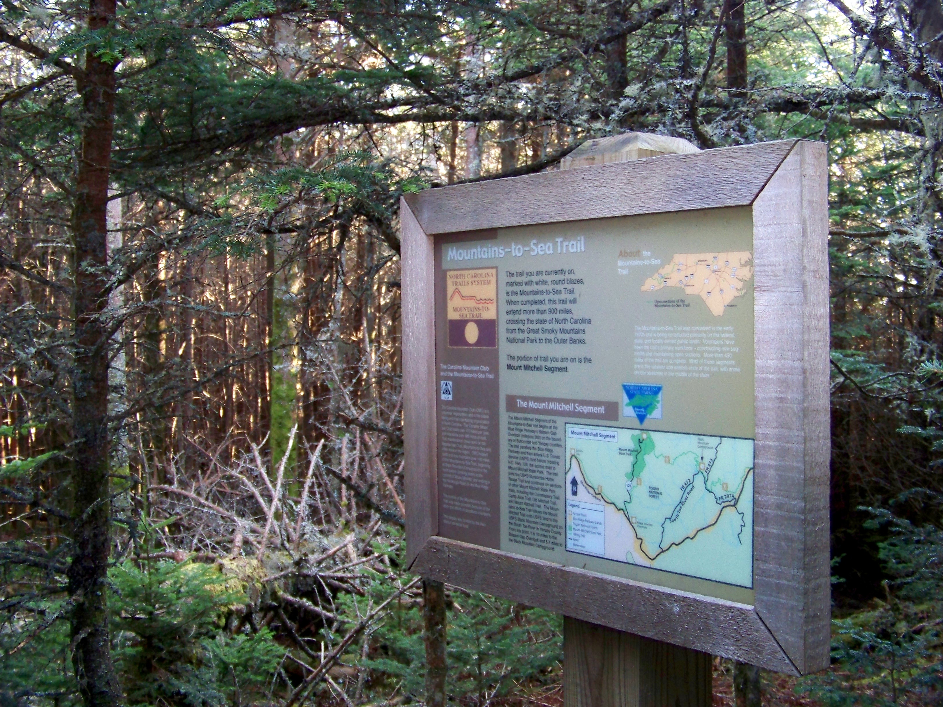
Mountains-to-Sea Trail sign - panoramio.jpg - Panoramio upload bot

Balsam Nature Trail - panoramio.jpg - Panoramio upload bot

Balsam Nature Trail - panoramio (1).jpg - Panoramio upload bot

ConDev StParks PicRev1942 P21 (16139273958).jpg - Fæ

Barnett Branch Trail Waterfall - panoramio.jpg - Panoramio upload bot
NPS overmountain-victory-trail-map.pdf - RKBot

Oconaluftee River Trail sign P9090768.jpg - Chris Light

Elkin Muster Grounds (847dd321-6ceb-44a1-92a9-7f05cbbe2482).jpg - BMacZeroBot

Black Bear Trail (f613c433-4608-481d-970c-0853381c3e2b).jpg - BMacZeroBot

Scene trail off Bunn Rd Buckhorn Reservoir ncwetlands KG (6).jpg - Ser Amantio di Nicolao

Carolina Beach State Park 1.jpg - Mx. Granger
Roanoke Mountain Campground, Milepost 120.4 (0f7efd37e4c64965a7c6e60c9788a88a).tif - BMacZeroBot

Walnut Hill Trail in Williamson Preserve 01.jpg - Fredlyfish4
Smart View Trails Cabin (31c5f45715d14d658654b52f4fdd6091).tif - BMacZeroBot
Environmental Message label sign (34b285ba7efd43bbb310df6d415f9fd8).tif - BMacZeroBot
Peaks of Otter, Milepost 85.9, Blue Ridge Parkway (4f60061eeb69443a9eb8b0bd9fa253e2).tif - BMacZeroBot
"Leg-stretcher Trail" at Boston Knob Overlook (9610777854314f6180dce6785d122a2b).tif - BMacZeroBot
Environmental Message label near bench (b45a2354ebdb457ca328d5033c90de81).tif - BMacZeroBot
Sharp Top Trail sign (d153c6e375cc43a5ac21c7e6abd549c9).tif - BMacZeroBot
"Leg-stretcher Trail" at Boston Knob Overlook (9610777854314f6180dce6785d122a2b) (cropped).tif - BMacZero
Trail at Beacon Heights (081ac4244ae54390aeacba697e43b358).tif - BMacZeroBot
Trail at Beacon Heights (3c50d0aa7bf44e05a143314451467a21).tif - BMacZeroBot
Visitors on Beacon Heights Trail (7a174e9d11d248f7866366233d129c03).tif - BMacZeroBot
Trail, environmental sign, and view at Beacon Heights (b32258105d8549c9a05e30370caef21e).tif - BMacZeroBot
Visitors on Beacon Heights Trail (fd41a02701f4419dbe1b886dcfc5438a).tif - BMacZeroBot
Visitors on Beacon Heights Trail (fdfb72040ac9422babe53b7d967dedfc).tif - BMacZeroBot

The Ramsgate Trail at Fort Fisher.jpg - DiscoA340

Deer at William B. Umstead State Park.jpg - DiscoA340

Trail Entrance at Occoneechee Mountain State Natural Area.jpg - DiscoA340

Trail in Occoneechee Mountain State Natural Area.jpg - DiscoA340

Medoc Mountain State Park Trail Entrance.jpg - DiscoA340

Elk River Trail October 2022 10.jpg - Michael Barera

Elk River Trail October 2022 01.jpg - Michael Barera

Bradley Fork Trail closeup (0cc79836-ec0e-4a65-af2a-a5cf1dbd6f7d).jpg - BMacZeroBot

The Purchase Knob Landscape (188194d4-2647-4f58-a4cb-1043317b4d51).JPG - BMacZeroBot

River views along the Little River Trail (40b0fb3a-ab98-4ec2-8d0b-feff3746f896).jpg - BMacZeroBot

A bench along the Little River Trail (52711a10-adda-4d1c-8e7b-73f9696afbd2).jpg - BMacZeroBot

Forest views on the Little River Trail (52a41d0e-3f7e-429c-a897-24cbd98cf94f).jpg - BMacZeroBot

A narrower section of the Little River Trail (5756861a-b468-44a5-8110-0af8a6a75a68).jpg - BMacZeroBot

Water scenery along the Bradley Fork Trail (57af438b-ef74-46ff-9f92-1aaa57d4b04c).jpg - BMacZeroBot
Typical view on the Bradley Fork Trail (5add60c2-2b30-44b7-9bb1-18333042316c).jpg - BMacZeroBot

View on the Bradley Fork Trail (5c0dec80-9dbe-4099-938e-cc37b7af30a3).jpg - BMacZeroBot

Large rock on the Bradley Fork Trail (87246b4d-7f55-4252-a62c-220698c1b260).jpg - BMacZeroBot

Rocks on the Bradley Fork Trail (9f017bd8-9bdf-44c1-a202-01412880e1af).jpg - BMacZeroBot

Rocky section of the Bradley Fork Trail (ab716000-515a-4cf7-a788-96db8a1ccf03).jpg - BMacZeroBot

Most of the Little River Trail is wide and flat. (c1eda4f1-a592-4e38-ab73-dc58d3c22cac).jpg - BMacZeroBot

The Little River Trail (ca9e34b7-20b9-419e-8724-61884de6df94).jpg - BMacZeroBot

A bridge on the Little River Trail (da834159-9dfc-4897-94e2-dde0b59eb17e).jpg - BMacZeroBot

Obstacles on the Bradley Fork Trail (edc51ca7-be6c-474a-85fc-1bc52807d40a).jpg - BMacZeroBot

Shallow potholes on the Bradley Fork Trail (d5e1759a-e483-451b-8bd2-71b6d6e2a42f).jpg - BMacZeroBot

Southport Waterfront Park (July 2023) 05.jpg - DiscoA340

Southport Ferry Terminal (July 2023) 05.jpg - DiscoA340

Bluffs Picnic Area - Doughton Park. Picnic trails that were built in 1939 contribute to the national significance of the parkway (22def776-98f1-820b-f1f8-f4569bfbbc1b).JPG - BMacZeroBot

The boardwalk part of the Hammock Hills Nature Trail on Ocracoke Island provides views out across the Pamlico Sound. (5d42bb4f-1dd8-b71c-07c2-029fd9bdfbdc).jpg - BMacZeroBot

Thomas Hariot Trail Forest (5db91cb6-1dd8-b71c-07d4-fdf9a1beca22).jpg - BMacZeroBot

Part of the Thomas Hariot Trail with a fresh layer of snow. (5dcb0fb5-1dd8-b71c-0718-f30e6c89d051).jpg - BMacZeroBot

A small waterfall on the Little River Trail (69f47b39-25a5-4ab0-8c79-d8ca8584fd19).jpg - BMacZeroBot

View along of the parkway between the James River Visitor Center and Humpback Rocks Visitor Center in Virginia. (27ef5db4-dcaa-451d-9617-7a686a4f6667).jpg - BMacZeroBot

View along of the parkway between the James River Visitor Center and Humpback Rocks Visitor Center in Virginia. (6797d83a-3666-4a82-bffd-4774bd6f04bb).jpg - BMacZeroBot

View along of the parkway between the James River Visitor Center and Humpback Rocks Visitor Center in Virginia. (77a405cd-35af-49ce-8394-7ee003b8360e).jpg - BMacZeroBot