Wikimedi'Òc
Modes d'emploi

Cet album fait partie des albums
Cet album photos contient les sous-albums suivants :


Ringstead Windmill.jpg - Angusmclellan

Hindringham Lower Green Windmill.jpg - Angusmclellan
Aslacton Mill.jpg - Mjroots

Aylsham Cawston Rd Mill.jpg - Mjroots

Great Ellingham Mill.jpg - Mjroots

Hempnall Mill.jpg - Mjroots

Ludham How Hill Mill.jpg - Mjroots

Shouldham, Fodderston Mill.jpg - Mjroots

Stratton St Michael, Leeder's Mill.jpg - Mjroots

Bixley Mill Letterhead.jpg - Mjroots

Upper Hellesdon sails painted.jpg - Mjroots
West Walton Ingleborough Towermill.jpg - Stavros1

Ingleborough tower mill, West Walton, Norfolk.jpg - Stavros1

West Walton Highway tower mill.JPG - Stavros1

High's Mill, Halvergate.jpg - Mjroots

Commission Mill, Stokesby.jpg - Mjroots

Stone's Mill, Halvergate.jpg - Mjroots

Black Mill, Belton.jpg - Mjroots

Fritton Marshes Mill.jpg - Mjroots

Bracey's Mill, Martham.jpg - Mjroots

Five Mile House Mill, Runham.jpg - Mjroots

South Mill, Runham Swim.jpg - Mjroots

North Mill, Runham Swim.jpg - Mjroots
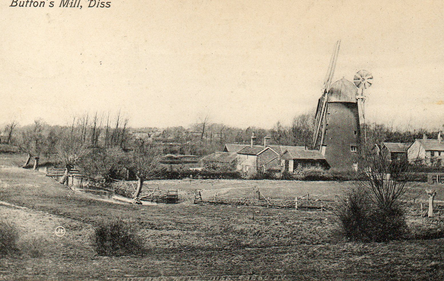
Button's Mill, Diss.jpg - Mjroots

Ingham - Mill Farm Mill.jpg - Aldux

A disused windmill near Neatishead - geograph.org.uk - 24696.jpg - GeographBot

Commuting! - geograph.org.uk - 547876.jpg - File Upload Bot (Magnus Manske)
Old Hall Drainage Mill - geograph.org.uk - 48112.jpg - GeographBot

Old mill, near Silfield - geograph.org.uk - 45316.jpg - GeographBot

West Winch Towermill - geograph.org.uk - 466840.jpg - File Upload Bot (Magnus Manske)

Ludham Bridge Drainage Mill - geograph.org.uk - 197285.jpg - GeographBot

Foulsham towermill Foulsham Norfolk circa 1911.jpg - MarmadukePercy

Yaxham Windmill - geograph.org.uk - 275729.jpg - GeographBot

Mill House and remains of the windmill at Ratten Row - geograph.org.uk - 283708.jpg - GeographBot

Dydall's Drainage Mill on the River Bure, west of Horning - geograph.org.uk - 379011.jpg - GeographBot

Converted Windmill - geograph.org.uk - 383715.jpg - GeographBot
Converted Windmill - geograph.org.uk - 383836.jpg - GeographBot

Halvergate Mill - geograph.org.uk - 473769.jpg - GeographBot

Here's how Mill Farm got its name - geograph.org.uk - 537999.jpg - GeographBot

Capless - geograph.org.uk - 547866.jpg - GeographBot

Old windmill - geograph.org.uk - 562004.jpg - GeographBot

Approach to Swim Coots Drainage Mill - geograph.org.uk - 577971.jpg - GeographBot
Swim Coots Drainage Mill - geograph.org.uk - 577959.jpg - GeographBot

Stone's Drainage Mill - geograph.org.uk - 622967.jpg - GeographBot

East Ruston towermill - geograph.org.uk - 785898.jpg - GeographBot

Ashtree farm drainage mill and pill box - geograph.org.uk - 1042856.jpg - GeographBot

Foulsham Windmill - geograph.org.uk - 1160506.jpg - GeographBot

Lambridge Mill - geograph.org.uk - 1222019.jpg - GeographBot

Foxley Mill - geograph.org.uk - 1310289.jpg - GeographBot

The White Mill in Sygate - geograph.org.uk - 1317037.jpg - GeographBot

The Wherryman's Way - approaching Hardley Mill - geograph.org.uk - 1419473.jpg - GeographBot

Fleggburgh St Margaret's Mill - geograph.org.uk - 1496115.jpg - GeographBot

Fleggburgh St Margaret's Mill - geograph.org.uk - 1496118.jpg - GeographBot

St Margaret's Retreat - geograph.org.uk - 1496110.jpg - GeographBot

Bracondale Mill.jpg - Mjroots

John Sell Cotman - St. Benet's Abbey - Google Art Project.jpg - DcoetzeeBot

Hindolveston tower mill (geograph 2263020).jpg - File Upload Bot (Magnus Manske)

East Harling tower windmill (geograph 2250026).jpg - File Upload Bot (Magnus Manske)

Wicklewood Windmill (geograph 3064973).jpg - File Upload Bot (Magnus Manske)
Hindringham tower mill (geograph 2031088).jpg - File Upload Bot (Magnus Manske)
Water mill and mill tower, Burnham Overy Town (geograph 3763752).jpg - File Upload Bot (Magnus Manske)

Little Melton Windmill-geograph.org.uk-3188763.jpg - Plucas58

Hermitage drainage pump, Acle-geograph.org.uk-3440011.jpg - Plucas58

Stokesby Mill-geograph.og.uk-2238058.jpg - Plucas58

Hingham Mill-geograph.org-2114333.jpg - Geograph Update Bot

Ringstead Mill-geograph.org-1912585.jpg - Geograph Update Bot
Lambridge Mill.jpg - Kelly

E.T. Daniell - Butter Hills.jpg - Amitchell125

E.T. Daniell - Landscape with Mill.jpg - Amitchell125

Thirtle - Rainbow Effect on the River, King Street, Norwich.jpg - Amitchell125

Windmill near Carbrooke (geograph 5393309).jpg - Mjroots

The old Windmill at Stoke Ferry (geograph 4521960).jpg - Mjroots

Upwell Mill (converted) (geograph 6145951).jpg - Mjroots

How Hill tower mill, Ludham - geograph.org.uk - 2811988.jpg - GeographBot