Wikimedi'Òc
Modes d'emploi

Cet album fait partie des albums
Cet album photos contient les sous-albums suivants :


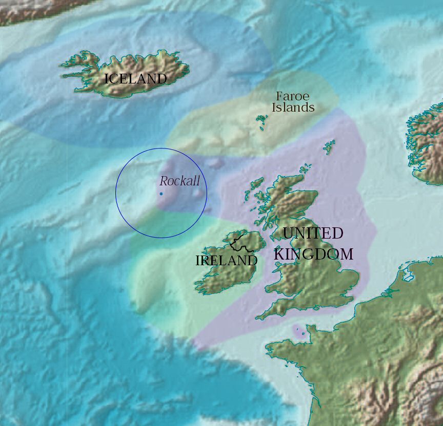
Rockall EEZ.jpg - Jooler~commonswiki
Uk topo de.jpg - Captain Blood~commonswiki

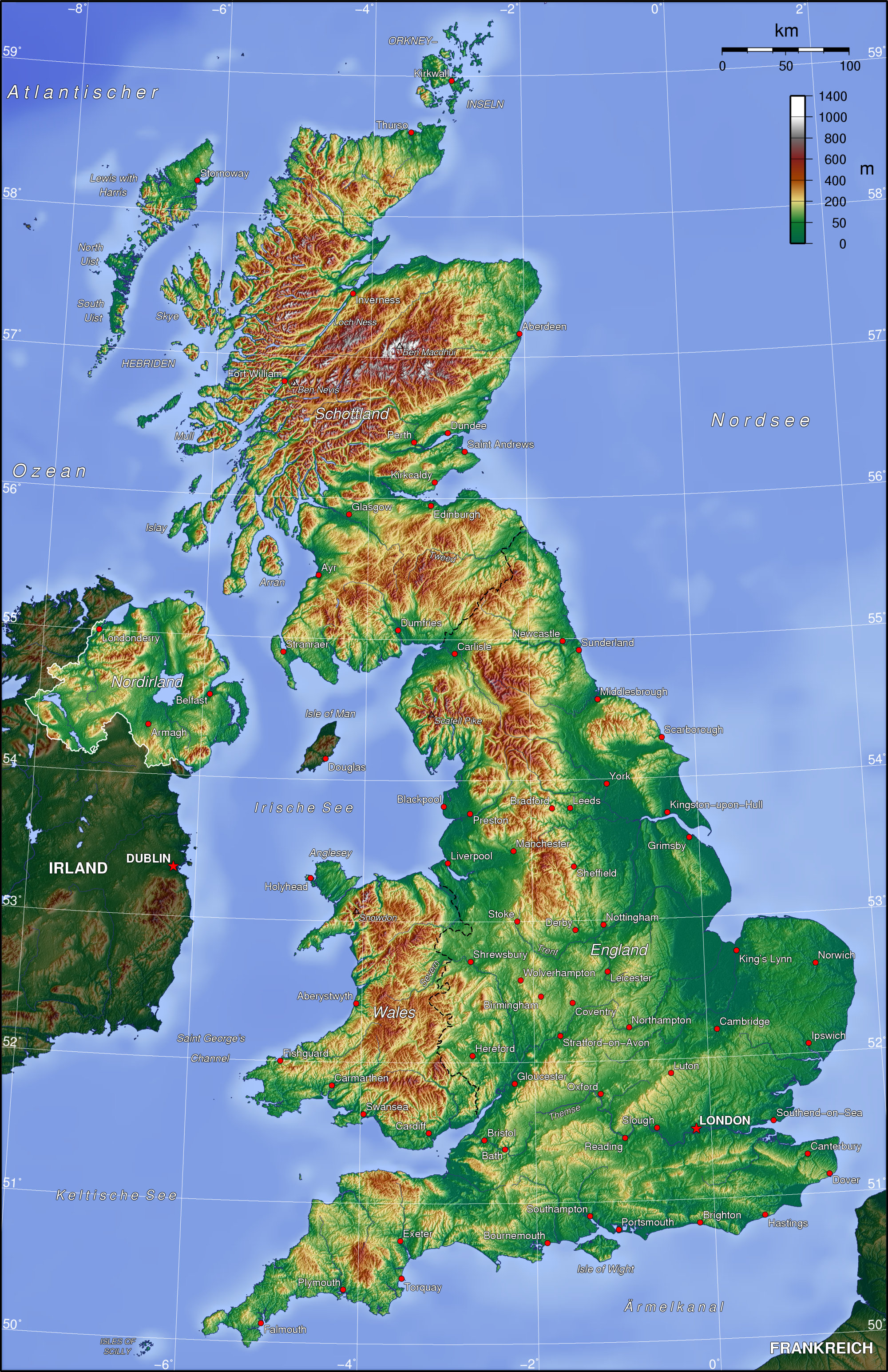
Uk topo en.jpg - Conscious

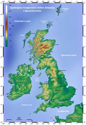
Grossbritannien Topographie Staedte.jpeg - Jlorenz1
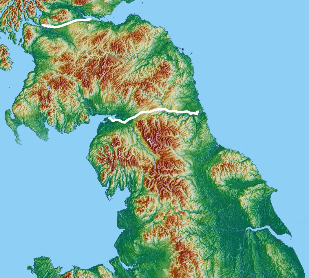
Roman.Britain.northern.topo.with.walls.jpg - Notuncurious
Topographic Map of the UK - Blank.png - Equestenebrarum

Topographic Map of the UK - Bulgarian.png - Equestenebrarum

Topographic Map of the UK - English.png - Equestenebrarum

Topographic Map of the UK - Lithuanian.png - Equestenebrarum

Crsel.png - Kicior99

Highlands location.png - Hogweard
Topographic Map of the UK - hr.pdf - MaGa

Pennines location map.png - Hellerick

IrishSeaReliefmap.png - Ulamm
Irish Sea – relief, ports, limits.tif - Ulamm

A short history of England and the British Empire (1915) (14580507139).jpg - SteinsplitterBot

The international geography (1916) (14593098617).jpg - Fæ

163 of 'The International Geography. ... Edited by H. R. Mill' (11288092744).jpg - Kilom691

8 of 'The Earth and its Inhabitants. The European section of the Universal Geography by E. Reclus. Edited by E. G. Ravenstein. Illustrated by ... engravings and maps' (11126296943).jpg - FlickreviewR 2

9 of 'The Earth and its Inhabitants. The European section of the Universal Geography by E. Reclus. Edited by E. G. Ravenstein. Illustrated by ... engravings and maps' (11123415066).jpg - FlickreviewR 2
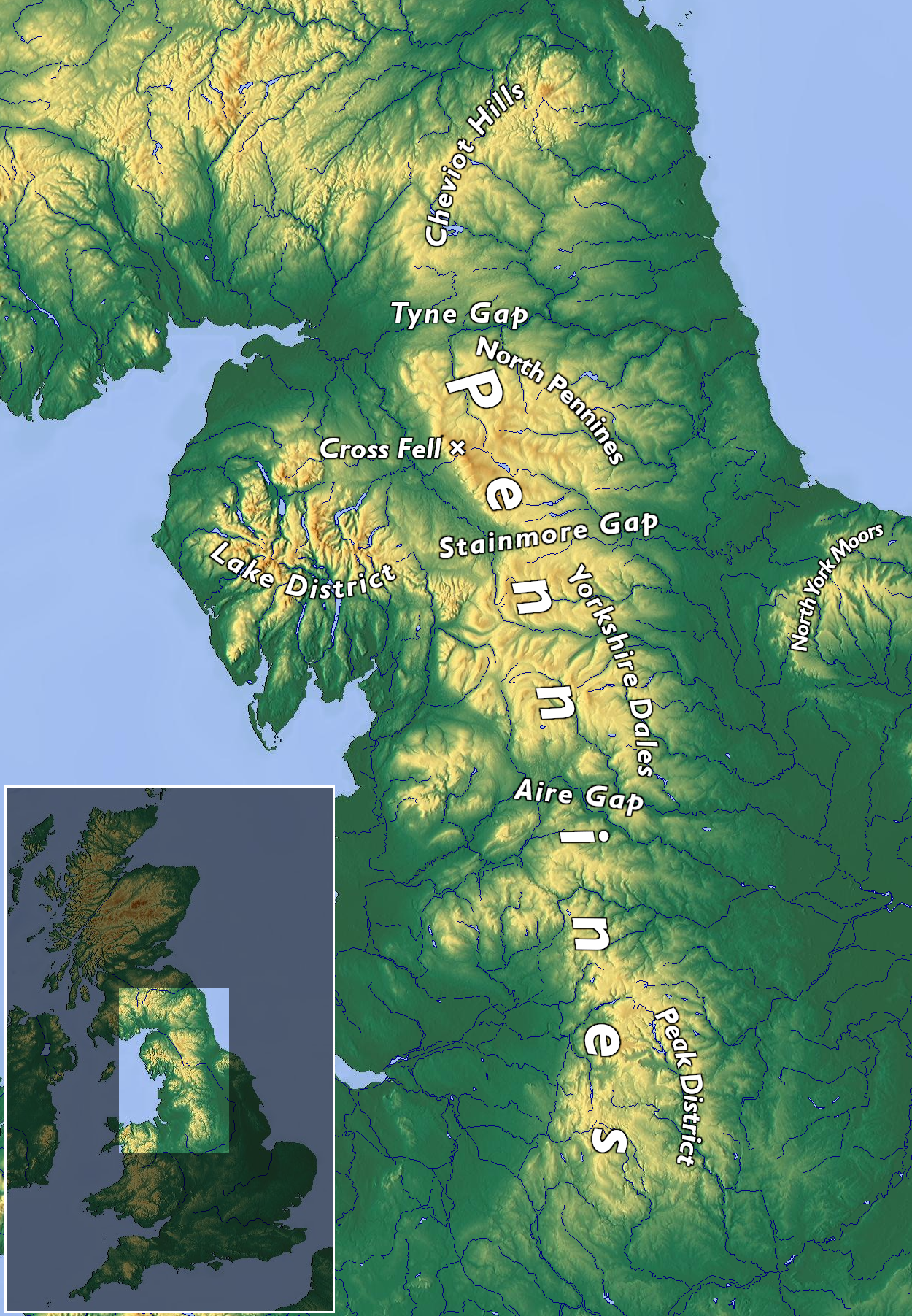
Topo Map Pennines.png - Kreuzschnabel
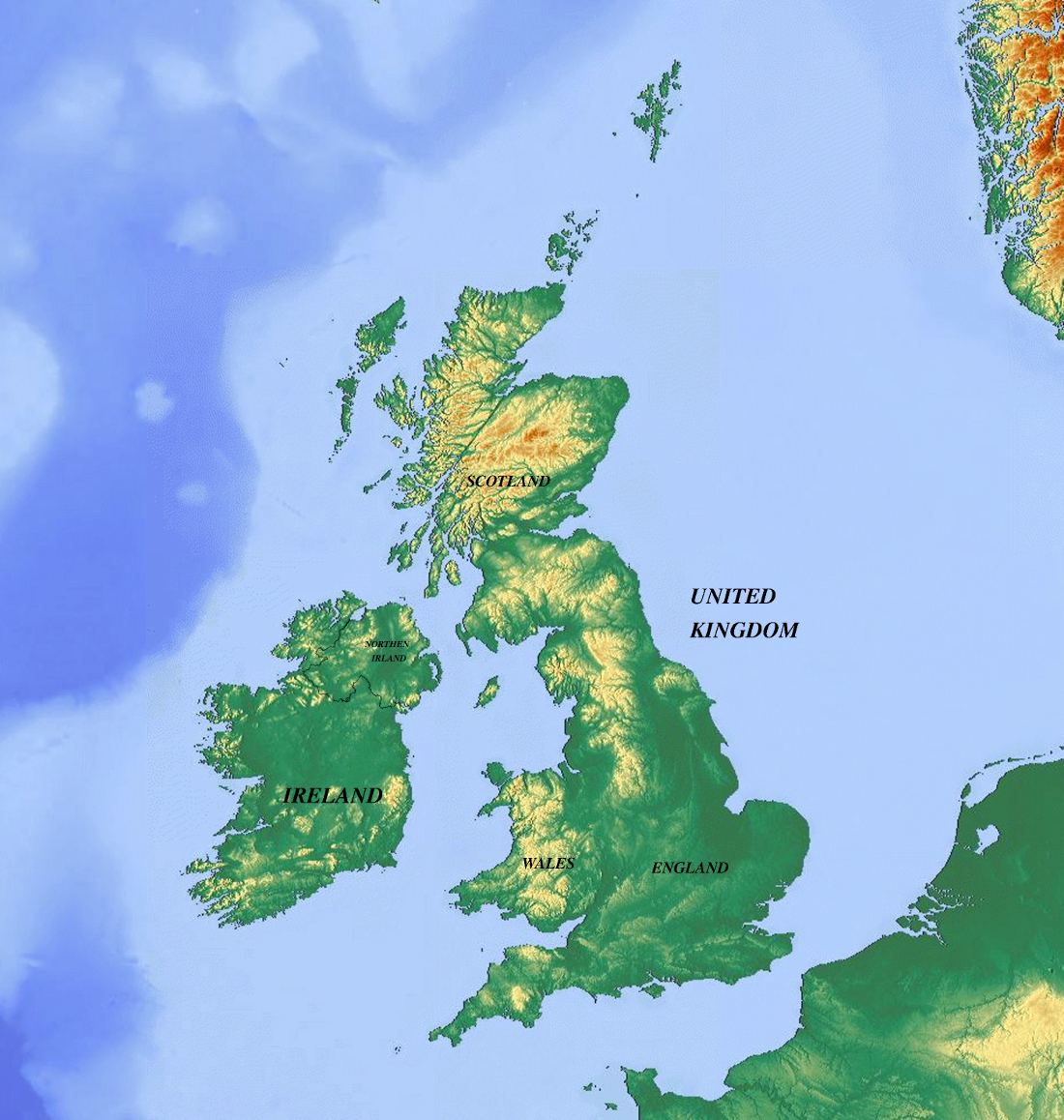
Great Britain-United Kingdom Topographic Map.jpg - Maps world