Wikimedi'Òc
Modes d'emploi

Cet album fait partie des albums
Cet album photos contient les sous-albums suivants :


Brimscombe bridge.jpg - DisillusionedBitterAndKnackered
South Cerney canal.jpg - Blisco

WoodenStile.JPG - Hohum
Chalford Bottom - geograph.org.uk - 144340.jpg - GeographBot

Small bridge near Latton on A419 - geograph.org.uk - 115967.jpg - GeographBot

Thames and Severn Canal near South Cerney - geograph.org.uk - 250147.jpg - GeographBot

Line of old Canal near South Cerney - geograph.org.uk - 288055.jpg - GeographBot

Thames and Severn Canal - geograph.org.uk - 337169.jpg - GeographBot

Course of old canal near Dudgrove Farm - geograph.org.uk - 347979.jpg - GeographBot

Thames and Severn Canal - geograph.org.uk - 350333.jpg - GeographBot

Thames and Severn Canal 2 - geograph.org.uk - 350334.jpg - GeographBot

Thames and Severn canal looking south - geograph.org.uk - 465999.jpg - GeographBot

Coot and chicks, Thames and Severn canal, near South Cerney (1) - geograph.org.uk - 484265.jpg - GeographBot

Coot and chicks, Thames and Severn canal, near South Cerney (2) - geograph.org.uk - 484266.jpg - GeographBot

Coot in the Thames and Severn canal, near South Cerney - geograph.org.uk - 484267.jpg - GeographBot

Raindrops and lily pads in the Thames and Severn canal - geograph.org.uk - 484330.jpg - GeographBot

Thames and Severn canal, near South Cerney (1) - geograph.org.uk - 484268.jpg - GeographBot

Thames and Severn canal, near South Cerney - geograph.org.uk - 484329.jpg - GeographBot

Thames and Severn Canal Towpath - Swindon Gloucester Railway Overbridge - geograph.org.uk - 615822.jpg - GeographBot

Rucks Bridge, Thames and Severn Canal - geograph.org.uk - 671801.jpg - GeographBot

Thames and Severn Canal near Daneway - geograph.org.uk - 735880.jpg - GeographBot

Round house by the Thames and Severn Canal - geograph.org.uk - 898516.jpg - GeographBot

Thames and Severn Canal - geograph.org.uk - 898550.jpg - GeographBot

Thames and Severn Canal - geograph.org.uk - 898557.jpg - GeographBot

Thames and Severn Canal - geograph.org.uk - 898623.jpg - GeographBot

Three footpaths in one - geograph.org.uk - 898544.jpg - GeographBot

Thames and Severn Canal, Inglesham - geograph.org.uk - 914099.jpg - GeographBot

Confluence of River Thames and River Coln - geograph.org.uk - 977276.jpg - GeographBot

Approaching site of aqueduct over the River Churn - geograph.org.uk - 1049525.jpg - GeographBot

Cirencester Arm, Thames and Severn Canal - geograph.org.uk - 1049536.jpg - GeographBot

Cowground bridge - geograph.org.uk - 1049528.jpg - GeographBot
Gate in the canal bed - geograph.org.uk - 1049526.jpg - GeographBot

Lane to Plummer's Farm - geograph.org.uk - 1049529.jpg - GeographBot
Latton Junction - geograph.org.uk - 1048462.jpg - GeographBot

Missing bridge - geograph.org.uk - 1048464.jpg - GeographBot

Missing bridge at Northmoor Lane - geograph.org.uk - 1049520.jpg - GeographBot

North Wilts - Latton Basin - geograph.org.uk - 1048461.jpg - GeographBot

Remains of MandSWJ bridge over the Thames and Severn Canal - geograph.org.uk - 1049531.jpg - GeographBot

Siddington Junction - geograph.org.uk - 1049535.jpg - GeographBot

Site of aqueduct over the River Churn - geograph.org.uk - 1049524.jpg - GeographBot

Spine Road bridge - geograph.org.uk - 1049508.jpg - GeographBot

Thames and Severn Canal - geograph.org.uk - 1048467.jpg - GeographBot

Thames and Severn Canal - geograph.org.uk - 1048468.jpg - GeographBot

Thames and Severn Canal near Cerney Wick - geograph.org.uk - 1048463.jpg - GeographBot

Below St Mary's Lock - geograph.org.uk - 1054667.jpg - GeographBot

Blockage of the Thames and Severn Canal at Stroud bypass - geograph.org.uk - 1052895.jpg - GeographBot

Bowbridge bridge - geograph.org.uk - 1054685.jpg - GeographBot

Chalford Arches - geograph.org.uk - 1054676.jpg - GeographBot

Ham Mill Bridge - geograph.org.uk - 1054689.jpg - GeographBot

Jubilee Bridge - geograph.org.uk - 1054688.jpg - GeographBot

New Thames and Severn Canal bridge under Dr Newton's Way - geograph.org.uk - 1052896.jpg - GeographBot

Route of Thames and Severn Canal through Chalford - geograph.org.uk - 1054673.jpg - GeographBot

Stanton's Bridge - geograph.org.uk - 1054687.jpg - GeographBot

Thames and Severn Canal culvert under the A46 - geograph.org.uk - 1052892.jpg - GeographBot

Wallbridge Upper Lock - geograph.org.uk - 1052894.jpg - GeographBot

Footpath from Gateway Centre to the Thames and Severn Canal - geograph.org.uk - 1082560.jpg - GeographBot

Information Board on Thames and Severn Canal by Spine Road Bridge - geograph.org.uk - 1082594.jpg - GeographBot

Thames and Severn Canal milepost near Spine Road Bridge - geograph.org.uk - 1082683.jpg - GeographBot

Thames and Severn Canal near Spine Road Bridge - geograph.org.uk - 1082607.jpg - GeographBot

Thames and Severn Canal near Wildmoorway Lower Lock and Bridge - geograph.org.uk - 1082664.jpg - GeographBot

Cyclists, Thames and Severn canal, near Frampton Mansell - geograph.org.uk - 1133836.jpg - GeographBot

Bed of Thames and Severn Canal at Eysey - geograph.org.uk - 1177712.jpg - GeographBot

Thames and Severn Canal at Marston Meysey - geograph.org.uk - 1177716.jpg - GeographBot

Cirencester branch bridge - geograph.org.uk - 1208801.jpg - GeographBot

Coates Roundhouse - geograph.org.uk - 1208043.jpg - GeographBot

Coates Roundhouse - geograph.org.uk - 1208045.jpg - GeographBot

Course of Thames and Severn Canal at Thames Head - geograph.org.uk - 1208796.jpg - GeographBot

Course of Thames and Severn Canal between Bluehouse and Fuzen Leaze - geograph.org.uk - 1208809.jpg - GeographBot

Course of the Thames and Severn Canal - geograph.org.uk - 1206815.jpg - GeographBot

Ex-GWR skew bridge - geograph.org.uk - 1208047.jpg - GeographBot

House at Ewen Wharf - geograph.org.uk - 1208799.jpg - GeographBot

King's Reach - geograph.org.uk - 1208042.jpg - GeographBot

Remains of Thames and Severn Canal Smerrill embankment - geograph.org.uk - 1208798.jpg - GeographBot

Remains of railway bridge over the Thames and Severn Canal - geograph.org.uk - 1208802.jpg - GeographBot

Remains of the Cirencester branch of the Thames and Severn Canal - geograph.org.uk - 1206829.jpg - GeographBot

Site of Smerrill Aqueduct - geograph.org.uk - 1206821.jpg - GeographBot

Site of Smerrill Aqueduct - geograph.org.uk - 1206822.jpg - GeographBot

Skew bridge over the Thames and Severn Canal - geograph.org.uk - 1206826.jpg - GeographBot

Thames and Severn Canal - Cirencester Branch - geograph.org.uk - 1208035.jpg - GeographBot

Thames and Severn Canal - Cirencester Branch - geograph.org.uk - 1208037.jpg - GeographBot

Thames and Severn Canal - geograph.org.uk - 1206818.jpg - GeographBot

Thames and Severn Canal at Ewen Wharf - geograph.org.uk - 1208800.jpg - GeographBot

Thames and Severn Canal at Park Leaze bridge - geograph.org.uk - 1208804.jpg - GeographBot

Thames and Severn Canal at Smerrill Farm - geograph.org.uk - 1208797.jpg - GeographBot

Thames and Severn Canal at the site of Level Bridge - geograph.org.uk - 1208806.jpg - GeographBot

Thames and Severn Canal near Ewen - geograph.org.uk - 1208805.jpg - GeographBot

Thames and Severn Canal near Park Leaze bridge - geograph.org.uk - 1208803.jpg - GeographBot

Trewsbury Bridge - geograph.org.uk - 1208048.jpg - GeographBot

King's Reach, Thames and Severn Canal, Tarlton - geograph.org.uk - 1517700.jpg - GeographBot

Thames and Severn Canal, near Tarlton - geograph.org.uk - 1517588.jpg - GeographBot

Thames and Severn Canal, north-east of Tarlton - geograph.org.uk - 1517660.jpg - GeographBot

Thames and Severn Canal and a passing place, near Tarlton - geograph.org.uk - 1517625.jpg - GeographBot

Thames and Severn Canal looking towards Spine Road Bridge - geograph.org.uk - 1514051.jpg - GeographBot

Thames and Severn Canal near Spine Road Bridge - geograph.org.uk - 1513944.jpg - GeographBot

Thames and Severn Canal passing place, near Tarlton - geograph.org.uk - 1519962.jpg - GeographBot

Bridge over Disused Canal - geograph.org.uk - 1539280.jpg - GeographBot

Bridge over disused Canal - geograph.org.uk - 1539283.jpg - GeographBot

Ham Mill Lane canal Bridge and Level Crossing - geograph.org.uk - 1539292.jpg - GeographBot

Footpath beside the Thames and Severn Canal - geograph.org.uk - 1776206.jpg - GeographBot

Old lock-keepers cottage - geograph.org.uk - 1776209.jpg - GeographBot

Halfway Bridge on the former Thames and Severn Canal at Ewen - panoramio.jpg - Panoramio upload bot

Kaart met drie afbeeldingen van plaatsen langs de Theems, RP-F-2001-7-1144-4.jpg - Mr.Nostalgic

Round Tower, Thames and Severn Canal (geograph 4812126).jpg - Rodw

Waters meet (geograph 6124851).jpg - Rodw

Lock on the Thames and Severn canal, west of Siddington - geograph.org.uk - 1880730.jpg - GeographBot

Part of the Thames and Severn canal, Upper Siddington - geograph.org.uk - 1880732.jpg - GeographBot

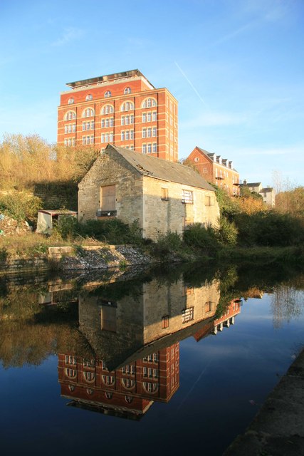
Disused Thames and Severn Canal at Brimscombe.jpg - Rodw

Disused Thames and Severn Canal at Brimscombe 2.jpg - Rodw

Marston Meysey roundhouse (geograph 3336995).jpg - Bjh21

Canal wall reflection at the Brewery Bridge - geograph.org.uk - 2637853.jpg - GeographBot

Thames & Severn Canal information board by footbridge, near Inglesham - geograph.org.uk - 2914457.jpg - GeographBot

Confluence of the Rivers Thames & Coln and the Thames & Severn Canal, near Inglesham - geograph.org.uk - 2914538.jpg - GeographBot

Stroud railway viaduct graffiti Thames & Severn Canal towpath Gloucestershire 01.jpg - Acabashi

Stroud railway viaduct graffiti Thames & Severn Canal towpath Gloucestershire 02.jpg - Acabashi

Whitehall Bridge, Thames Severn canal - geograph.org.uk - 2975093.jpg - GeographBot

Thames Severn canal old towpath - geograph.org.uk - 2975299.jpg - GeographBot

Footbridge over the Thames Severn canal - geograph.org.uk - 2975311.jpg - GeographBot

Thames Severn canal old towpath - geograph.org.uk - 2975325.jpg - GeographBot

Bowbridge Lock - geograph.org.uk - 3029388.jpg - GeographBot

Coates Roundhouse 2021.jpg - MIDI

Remains of Humpback Bridge, Thames & Severn Canal - geograph.org.uk - 3230527.jpg - GeographBot

Siddington Locks.jpg - MIDI

Course of Thames & Severn Canal east of Kempsford - geograph.org.uk - 3264268.jpg - GeographBot

Green Lane Bridge over Thames & Severn Canal - geograph.org.uk - 3264288.jpg - GeographBot

Site of Kempsford Bridge over Thames & Severn Canal - geograph.org.uk - 3264314.jpg - GeographBot

Thames and Severn disused Canal - geograph.org.uk - 3281734.jpg - GeographBot

Thames & Severn Canal - Cowground Bridge undergoing repair in 1998, near Siddington - geograph.org.uk - 3313776.jpg - GeographBot

Thames & Severn Canal - Looking northwest to Cowground Bridge in 1998, near Siddington - geograph.org.uk - 3313781.jpg - GeographBot

Thames & Severn Canal - Looking southeast to Cowground Bridge in 1998, near Siddington - geograph.org.uk - 3313788.jpg - GeographBot

Lock-keeper's cottage, Thames & Severn Canal, near Eysey - geograph.org.uk - 3321380.jpg - GeographBot

Towpath on the disused Thames & Severn Canal near Cricklade - geograph.org.uk - 3321970.jpg - GeographBot

Rucks Bridge, Thames ^ Severn Canal, near Eysey - geograph.org.uk - 3322180.jpg - GeographBot

Rucks Bridge, Thames ^ Severn Canal, near Eysey - geograph.org.uk - 3322203.jpg - GeographBot

Rucks Bridge, Thames & Severn Canal, near Eysey - geograph.org.uk - 3322206.jpg - GeographBot

Bridge and roundhouse on the disused Thames & Severn Canal near Marston Meysey - geograph.org.uk - 3337011.jpg - GeographBot

Tarlton Bridge - Thames & Severn Canal - geograph.org.uk - 3339876.jpg - GeographBot

Former canal roundhouse on the disused Thames & Severn Canal near Marston Meysey - geograph.org.uk - 3350879.jpg - GeographBot
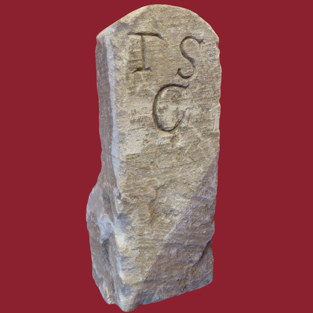
Boundary Stone, Thames & Severn Canal (geograph 6991995).jpg - Sic19

Thames & Severn Path near South Cerney (geograph 6539254).jpg - Sic19

Wallbridge canal bridge, Stroud - geograph.org.uk - 3550104.jpg - GeographBot

Wallbridge canal lock, Stroud - geograph.org.uk - 3550128.jpg - GeographBot

Bourne Mill and Thames & Severn Canal - geograph.org.uk - 3718138.jpg - GeographBot

Thames & Severn Canal - Capel Mill diversion - geograph.org.uk - 3755978.jpg - GeographBot
Thames & Severn Canal, Stroud - geograph.org.uk - 3757092.jpg - GeographBot

Wallbridge over the canal below - geograph.org.uk - 3757216.jpg - GeographBot

Closed to traffic - geograph.org.uk - 3759529.jpg - GeographBot

Fit only for ducks - geograph.org.uk - 3759542.jpg - GeographBot

Need a handle - geograph.org.uk - 3759556.jpg - GeographBot

Visitor Centre & Canal Shop, Stroud - geograph.org.uk - 3841446.jpg - GeographBot

Wallbridge Lock, Stroud - geograph.org.uk - 3841456.jpg - GeographBot

New line of the Thames and Severn Canal - geograph.org.uk - 3949772.jpg - GeographBot

Thames and Severn Canal - geograph.org.uk - 3949823.jpg - GeographBot

The Thames and Severn Canal - geograph.org.uk - 3949840.jpg - GeographBot

The Thames and Severn Canal - geograph.org.uk - 3949989.jpg - GeographBot

Thames and Severn Canal reflections - geograph.org.uk - 3950014.jpg - GeographBot

Thames and Severn Canal - geograph.org.uk - 3950077.jpg - GeographBot

Thames and Severn Canal - geograph.org.uk - 3950096.jpg - GeographBot

Thames and Severn Canal - Dr Newton's Way bridge - geograph.org.uk - 3950113.jpg - GeographBot

Thames and Severn Canal, Stroud - geograph.org.uk - 4441506.jpg - GeographBot

Capel Mill diversion on the Thames and Severn Canal - geograph.org.uk - 4441528.jpg - GeographBot

Wallbridge Upper Lock on the Thames and Severn Canal - geograph.org.uk - 4441533.jpg - GeographBot

Reflections in the Thames and Severn Canal, Stroud - geograph.org.uk - 4441549.jpg - GeographBot

Thames and Severn Canal between Siddington and Cerney Wick 02.jpg - Rodw

Thames and Severn Canal between Siddington and Cerney Wick 01.jpg - Rodw

Thames and Severn Canal between Siddington and Cerney Wick 05.jpg - Rodw

Thames and Severn Canal between Siddington and Cerney Wick 04.jpg - Rodw

Thames and Severn Canal between Siddington and Cerney Wick 07.jpg - Rodw

Thames and Severn Canal between Siddington and Cerney Wick 06.jpg - Rodw

Thames and Severn Canal between Siddington and Cerney Wick 08.jpg - Rodw

Thames and Severn Canal between Siddington and Cerney Wick 09.jpg - Rodw

Thames and Severn Canal between Siddington and Cerney Wick 03.jpg - Rodw

Thames and Severn Canal between Siddington and Cerney Wick 11.jpg - Rodw

Thames and Severn Canal between Siddington and Cerney Wick 12.jpg - Rodw

Thames and Severn Canal between Siddington and Cerney Wick 10.jpg - Rodw

Course of the Thames and Severn Canal 03.jpg - Rodw

Course of the Thames and Severn Canal 01.jpg - Rodw

Course of the Thames and Severn Canal 04.jpg - Rodw

Course of the Thames and Severn Canal 06.jpg - Rodw

Course of the Thames and Severn Canal 07.jpg - Rodw

Course of the Thames and Severn Canal 02.jpg - Rodw

Course of the Thames and Severn Canal 08.jpg - Rodw

Course of the Thames and Severn Canal 10.jpg - Rodw

Course of the Thames and Severn Canal 12.jpg - Rodw

Course of the Thames and Severn Canal 13.jpg - Rodw

Course of the Thames and Severn Canal 15.jpg - Rodw

Course of the Thames and Severn Canal 16.jpg - Rodw

Course of the Thames and Severn Canal 14.jpg - Rodw

Course of the Thames and Severn Canal 17.jpg - Rodw

Course of the Thames and Severn Canal 18.jpg - Rodw

Course of the Thames and Severn Canal 11.jpg - Rodw

Graffiti on a canal bridge wall, Stroud - geograph.org.uk - 4649713.jpg - GeographBot

Canal path, Stroud - geograph.org.uk - 4649831.jpg - GeographBot

Capel's Mill Restoration information board near a railway viaduct, Stroud - geograph.org.uk - 4649958.jpg - GeographBot

Wallbridge Upper Lock, Stroud - geograph.org.uk - 4709833.jpg - GeographBot

Remains of the M&SWJR Bridge across the Thames & Severn Canal at Siddington - geograph.org.uk - 4778099.jpg - GeographBot

Upper Siddington Bridge, Thames ^ Severn Canal - geograph.org.uk - 4778783.jpg - GeographBot

Stanton's Bridge - geograph.org.uk - 4815726.jpg - GeographBot

Disused Thames and Severn Canal - geograph.org.uk - 4816059.jpg - GeographBot

Canal above Arundel Aqueduct - geograph.org.uk - 4817484.jpg - GeographBot

Thames and Severn Canal and GWR railway viaduct - geograph.org.uk - 4817519.jpg - GeographBot

Lorry crossing a canal bridge - geograph.org.uk - 4817549.jpg - GeographBot

Ground paddle above Wallbridge upper lock - geograph.org.uk - 4891411.jpg - GeographBot

Tracks along the bed of the Thames & Severn Canal - geograph.org.uk - 4891735.jpg - GeographBot

The Thames & Severn Canal above Bowbridge Lock - geograph.org.uk - 4891986.jpg - GeographBot

Thames ^ Severn Canal north of Ham Mill Lane - geograph.org.uk - 4892345.jpg - GeographBot

Thames & Severn Canal, east end of Brimcombe Port - geograph.org.uk - 4893506.jpg - GeographBot

Bridge over the Thames & Severn Canal at Bourne Mill - geograph.org.uk - 4893518.jpg - GeographBot

Thames ^ Severn Canal culverted (1) - geograph.org.uk - 4893531.jpg - GeographBot

The Thames & Severn Canal, looking eastwards - geograph.org.uk - 4893565.jpg - GeographBot

Thames & Severn Canal culverted (2) - geograph.org.uk - 4893575.jpg - GeographBot

The Thames & Severn Canal, east of the A419, Chalford - geograph.org.uk - 4893614.jpg - GeographBot

The Thames & Severn Canal, west of the A419, Chalford - geograph.org.uk - 4893944.jpg - GeographBot

Culverted Thames ^ Severn Canal, Chalford - geograph.org.uk - 4893956.jpg - GeographBot

The Thames & Severn canal, near Belvedere Mill - geograph.org.uk - 4893981.jpg - GeographBot

The Thames ^ Severn Canal, looking westwards - geograph.org.uk - 4894156.jpg - GeographBot

The Thames ^ Severn Canal, culverted - geograph.org.uk - 4894168.jpg - GeographBot

Thames & Severn Canal, below Iles Lock - geograph.org.uk - 4894649.jpg - GeographBot

Thames & Severn Canal, below St Mary's Lock - geograph.org.uk - 4894667.jpg - GeographBot

The route of the Thames ^ Severn Canal (now a road) - geograph.org.uk - 4894826.jpg - GeographBot

The Thames & Severn Canal, looking south-east - geograph.org.uk - 4894830.jpg - GeographBot

Floating dredger on the Thames ^ Severn Canal - geograph.org.uk - 4894843.jpg - GeographBot

Wheatfield overlooking the Thames ^ Severn Canal - geograph.org.uk - 5014403.jpg - GeographBot

Site of Hamfield Bridge, Thames & Severn Canal - geograph.org.uk - 5023639.jpg - GeographBot

Parapet, Hamfield Bridge, Thames ^ Severn Canal - geograph.org.uk - 5023644.jpg - GeographBot

Parapet, Hamfield Bridge, Thames ^ Severn Canal - geograph.org.uk - 5023649.jpg - GeographBot

Stonework, disused Thames ^ Severn Canal - geograph.org.uk - 5023681.jpg - GeographBot

Stonework, disused Thames & Severn Canal - geograph.org.uk - 5023685.jpg - GeographBot

Disused Thames & Severn Canal, Kempsford Manor - geograph.org.uk - 5120371.jpg - GeographBot

The Thames and Severn Canal - geograph.org.uk - 5337571.jpg - GeographBot

Wallbridge Canal Lock - geograph.org.uk - 5337668.jpg - GeographBot

Walking beside the Thames & Severn Canal - geograph.org.uk - 5361559.jpg - GeographBot

Across the (disused) Thames & Severn Canal - geograph.org.uk - 5361573.jpg - GeographBot

CGL Stroud - geograph.org.uk - 5391605.jpg - GeographBot

Capel's Mill, Stroud.jpg - OrangeStarling1997