Wikimedi'Òc
Modes d'emploi

Cet album fait partie des albums
Cet album photos contient les sous-albums suivants :


Waterfall between Talybont-on-Usk and Merthyr Tydfil - geograph.org.uk - 25886.jpg - GeographBot

Former railway line - geograph.org.uk - 284562.jpg - GeographBot
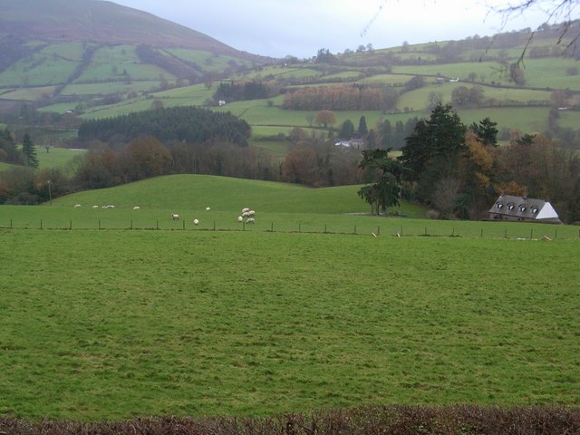
The Elms - geograph.org.uk - 284565.jpg - GeographBot

Cairn on south tip of Cwar y Gigfran - geograph.org.uk - 401230.jpg - GeographBot

Cwar y Gigfran - geograph.org.uk - 402185.jpg - GeographBot

Lift Bridge on the Monmouthshire and Brecon Canal between Cross Oak and Pencelli - geograph.org.uk - 406081.jpg - GeographBot

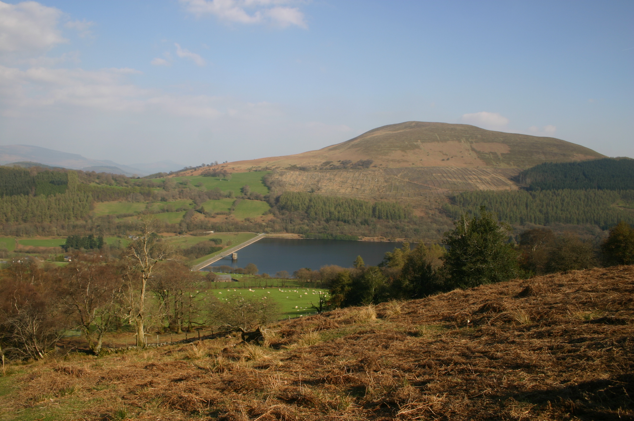
View towards Talybont Reservoir from the Taff Trail - geograph.org.uk - 476996.jpg - GeographBot

Interlocking Spurs - geograph.org.uk - 485713.jpg - GeographBot

Car Park on the Nant Bwrefwr - geograph.org.uk - 571307.jpg - GeographBot

Mountain View - geograph.org.uk - 584647.jpg - GeographBot

Waterfall - geograph.org.uk - 584660.jpg - GeographBot
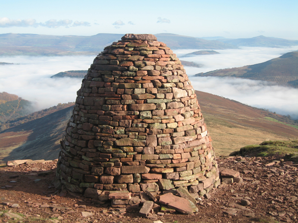
Carn Pica - geograph.org.uk - 665499.jpg - GeographBot

A rocky stream - geograph.org.uk - 694915.jpg - GeographBot

Farmland edge - geograph.org.uk - 694937.jpg - GeographBot

Gorse and fir trees - geograph.org.uk - 694868.jpg - GeographBot

Old walls - geograph.org.uk - 693624.jpg - GeographBot

Maesmawr from the A40 layby - geograph.org.uk - 792069.jpg - GeographBot

Pant-y-rhiw adventure centre - geograph.org.uk - 838115.jpg - GeographBot

Defaid ar fryn calchfaen - geograph.org.uk - 890306.jpg - GeographBot

Hollows abound - geograph.org.uk - 890312.jpg - GeographBot

Pond on Bwlch Gwyn - geograph.org.uk - 890376.jpg - GeographBot

The long fence - geograph.org.uk - 890382.jpg - GeographBot

Improved pasture between wood and moor. - geograph.org.uk - 925511.jpg - GeographBot

Moorland edge in Cwm Tarthwynni - geograph.org.uk - 925501.jpg - GeographBot

Overlooking Talybont Reservoir - geograph.org.uk - 925508.jpg - GeographBot

Peek-a-baa^ - geograph.org.uk - 925516.jpg - GeographBot

Settlement in Cwm Tarthwynni - geograph.org.uk - 925505.jpg - GeographBot

Blaen y Glyn Waterfall - geograph.org.uk - 939206.jpg - GeographBot

The End of the Line, Brecon Mountain Railway - geograph.org.uk - 931246.jpg - GeographBot

Tor y Foel, showing the track to the summit - geograph.org.uk - 932301.jpg - GeographBot
Tor y Foel, the northern flank - geograph.org.uk - 932289.jpg - GeographBot

Tor y Foel, the start of the track on the southern flank - geograph.org.uk - 932282.jpg - GeographBot

Tor y Foel, the western flank, looking towards the southern end of the Talybont Reservoir - geograph.org.uk - 932295.jpg - GeographBot

Woodland Waterfall - geograph.org.uk - 939214.jpg - GeographBot

Ystradgynwyn - geograph.org.uk - 939222.jpg - GeographBot

Flooding near Talybont - geograph.org.uk - 951154.jpg - GeographBot

Gullied ground below Gorlan Tyn-y-waun - geograph.org.uk - 955710.jpg - GeographBot

Into Cwm Callan - geograph.org.uk - 994732.jpg - GeographBot

Blaencallan - geograph.org.uk - 1000352.jpg - GeographBot

Breach in the road - geograph.org.uk - 1000350.jpg - GeographBot

Damage to the byway - geograph.org.uk - 1000264.jpg - GeographBot

More timber - geograph.org.uk - 1000364.jpg - GeographBot

Pasture near Dolygaer - geograph.org.uk - 1000252.jpg - GeographBot

Pentwyn Reservoir - geograph.org.uk - 1000317.jpg - GeographBot

Pentwyn Reservoir 2 - geograph.org.uk - 1000339.jpg - GeographBot

Pine trees and stream - geograph.org.uk - 1000267.jpg - GeographBot

Pontsticill Reservoir - geograph.org.uk - 1000373.jpg - GeographBot

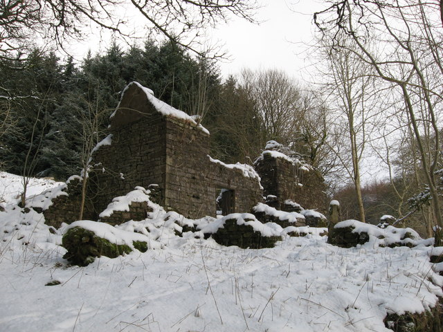
Ruined farmhouse - geograph.org.uk - 1000280.jpg - GeographBot

Stack of timber - end view - geograph.org.uk - 1000296.jpg - GeographBot

Stacked timber - geograph.org.uk - 1000283.jpg - GeographBot

Timber above Cwm Callan - geograph.org.uk - 1000360.jpg - GeographBot

Waiting in the rain - geograph.org.uk - 1000311.jpg - GeographBot

Which way now chaps^ - geograph.org.uk - 1000370.jpg - GeographBot

Yes, it was raining - geograph.org.uk - 1000300.jpg - GeographBot

View over Talybont-ar-Wysg from A40 - geograph.org.uk - 1083773.jpg - GeographBot

Approaching Twyn Du - geograph.org.uk - 1106128.jpg - GeographBot

Ascending Twyn Du - geograph.org.uk - 1108625.jpg - GeographBot

Boundary of Access Land - geograph.org.uk - 1106775.jpg - GeographBot

Cairn approaching Twyn Du - geograph.org.uk - 1106101.jpg - GeographBot

Car park by Talybont reservoir - geograph.org.uk - 1105994.jpg - GeographBot

Climbing to the moorland - geograph.org.uk - 1106051.jpg - GeographBot

Defences by Nant Tarthwynni - geograph.org.uk - 1106005.jpg - GeographBot

Eastern slopes of Twyn Du 10 - geograph.org.uk - 1108460.jpg - GeographBot

Eastern slopes of Twyn Du 11 - geograph.org.uk - 1108478.jpg - GeographBot

Eastern slopes of Twyn Du 12 - geograph.org.uk - 1108528.jpg - GeographBot

Eastern slopes of Twyn Du 13 - geograph.org.uk - 1108538.jpg - GeographBot

Eastern slopes of Twyn Du 14 - geograph.org.uk - 1108553.jpg - GeographBot

Eastern slopes of Twyn Du 1 - geograph.org.uk - 1106801.jpg - GeographBot

Eastern slopes of Twyn Du 2 - geograph.org.uk - 1106818.jpg - GeographBot

Eastern slopes of Twyn Du 4 - geograph.org.uk - 1106873.jpg - GeographBot

Eastern slopes of Twyn Du 5 - geograph.org.uk - 1106890.jpg - GeographBot

Eastern slopes of Twyn Du 6 - geograph.org.uk - 1106905.jpg - GeographBot

Eastern slopes of Twyn Du 7 - geograph.org.uk - 1106917.jpg - GeographBot

Eastern slopes of Twyn Du 8 - geograph.org.uk - 1106927.jpg - GeographBot

Eastern slopes of Twyn Du 9 - geograph.org.uk - 1108435.jpg - GeographBot

Emerging from the mist - geograph.org.uk - 1100213.jpg - GeographBot

Emerging from the mist - geograph.org.uk - 1106076.jpg - GeographBot

Footpath on Twyn Du - geograph.org.uk - 1109310.jpg - GeographBot

Footpath to Carn Pica - geograph.org.uk - 1109339.jpg - GeographBot

Hoar frost on the track - geograph.org.uk - 1106057.jpg - GeographBot

Nant Tarthwynni - geograph.org.uk - 1106012.jpg - GeographBot

Pillbox above Talybont Reservoir - geograph.org.uk - 1106949.jpg - GeographBot

Pillbox above Talybont Reservoir - geograph.org.uk - 1106960.jpg - GeographBot

Steep path up Craig y Fan 1 - geograph.org.uk - 1109373.jpg - GeographBot

Steep path up Craig y Fan 2 - geograph.org.uk - 1109384.jpg - GeographBot

Talybont Forest in cloud - geograph.org.uk - 1100222.jpg - GeographBot

Three Geographers on Twyn Du - geograph.org.uk - 1100261.jpg - GeographBot

Tor y Foel from Twyn Du - geograph.org.uk - 1101785.jpg - GeographBot

Tor y Foel from below Twyn Du - geograph.org.uk - 1106093.jpg - GeographBot

Two geographers by Carn Pica - geograph.org.uk - 1109410.jpg - GeographBot

View east from Twyn Du - geograph.org.uk - 1108615.jpg - GeographBot

View from Twyn Du - geograph.org.uk - 1106139.jpg - GeographBot

Winter food - geograph.org.uk - 1106645.jpg - GeographBot

Woodland by Talybont Reservoir - geograph.org.uk - 1104201.jpg - GeographBot

Woodland by the reservoir - geograph.org.uk - 1104169.jpg - GeographBot

Track above Aber - geograph.org.uk - 1116362.jpg - GeographBot

Monmouthshire and Brecon Canal - geograph.org.uk - 1149799.jpg - GeographBot

Blaen y Glyn - geograph.org.uk - 1163082.jpg - GeographBot

Blaen y Glyn - geograph.org.uk - 1163087.jpg - GeographBot

Blaen y Glyn - geograph.org.uk - 1163088.jpg - GeographBot

Blaen y Glyn - geograph.org.uk - 1163092.jpg - GeographBot

Blaen y Glyn - geograph.org.uk - 1163096.jpg - GeographBot

Blaen y Glyn - geograph.org.uk - 1163099.jpg - GeographBot

Mossy landscape, Blaen y Glyn - geograph.org.uk - 1163078.jpg - GeographBot

Waterfalls on the Caerfanell, Blaen y Glyn - geograph.org.uk - 1162681.jpg - GeographBot

Craig y Fan Ddu - geograph.org.uk - 1208837.jpg - GeographBot

Farmland near Abercynafon - geograph.org.uk - 1207161.jpg - GeographBot

Farmland near Abercynafon - geograph.org.uk - 1207171.jpg - GeographBot

Farmland near Talybont Reservoir - geograph.org.uk - 1206858.jpg - GeographBot

Mountain Road - geograph.org.uk - 1208850.jpg - GeographBot

Path through the forest - geograph.org.uk - 1208878.jpg - GeographBot

River Caerfanell at Abercynafon - geograph.org.uk - 1207131.jpg - GeographBot

The lower slopes of Allt Forgan - geograph.org.uk - 1207182.jpg - GeographBot

The road to Talybont on Usk - geograph.org.uk - 1207145.jpg - GeographBot

The shore at Talybont Reservoir - geograph.org.uk - 1206857.jpg - GeographBot

Entrance to the Car Park - geograph.org.uk - 1213528.jpg - GeographBot

Moss on a Stone Wall - geograph.org.uk - 1213562.jpg - GeographBot

The new car park - geograph.org.uk - 1213526.jpg - GeographBot

The old car park - geograph.org.uk - 1213525.jpg - GeographBot

Craig Y Fan Ddu - geograph.org.uk - 1247566.jpg - GeographBot

Hillside footpath near Talybont Reservoir - geograph.org.uk - 1248577.jpg - GeographBot

Slopes of Tor y Foel - geograph.org.uk - 1248612.jpg - GeographBot

Talybont Forest - geograph.org.uk - 1248630.jpg - GeographBot

Barn in the Caerfanell valley - geograph.org.uk - 1378230.jpg - GeographBot

Barn in the Caerfanell valley - geograph.org.uk - 1378232.jpg - GeographBot

Cow parsley on the towpath - geograph.org.uk - 1376748.jpg - GeographBot

Craig Danywenallt - geograph.org.uk - 1379890.jpg - GeographBot

Haymaking in the Usk Valley - geograph.org.uk - 1376769.jpg - GeographBot

The Usk Valley Walk - geograph.org.uk - 1376763.jpg - GeographBot

Valley at Aber village - geograph.org.uk - 1378225.jpg - GeographBot

View to Buckland Hill - geograph.org.uk - 1377810.jpg - GeographBot

Bridge over the Usk - geograph.org.uk - 1385634.jpg - GeographBot

Hay making near Pencelli - geograph.org.uk - 1381200.jpg - GeographBot

Rusting boats - geograph.org.uk - 1382400.jpg - GeographBot

The Usk looking downstream - geograph.org.uk - 1385638.jpg - GeographBot

Cwar y Gigfran - geograph.org.uk - 1405075.jpg - GeographBot

Mudflow beneath Craig Pwllfa (2) - geograph.org.uk - 1405857.jpg - GeographBot

Mudflow beneath Craig Pwllfa - geograph.org.uk - 1405853.jpg - GeographBot

Path towards Craig y Fan Ddu - geograph.org.uk - 1405035.jpg - GeographBot

The Caerfanell, flowing away from Blean-y-glyn waterfall - geograph.org.uk - 1405087.jpg - GeographBot

View, from Buckland Hill - geograph.org.uk - 1416280.jpg - GeographBot

Footpath beside Pontsticill Reservoir - geograph.org.uk - 1451338.jpg - GeographBot

Forest path - geograph.org.uk - 1451339.jpg - GeographBot

Path beside Brecon Mountain Railway - geograph.org.uk - 1451342.jpg - GeographBot

Path beside Brecon Mountain Railway - geograph.org.uk - 1451343.jpg - GeographBot

Remains of building in open moorland - geograph.org.uk - 1451316.jpg - GeographBot

Wall, fence and open moorland - geograph.org.uk - 1451317.jpg - GeographBot

Paddling Madeleine home - geograph.org.uk - 1499053.jpg - GeographBot

Waterfall on the Afon Caerfanell - geograph.org.uk - 1613786.jpg - GeographBot
Blaencallan - abandoned farmhouse - geograph.org.uk - 1651287.jpg - GeographBot

Forest path and Brecon Mountain Railway - geograph.org.uk - 1652536.jpg - GeographBot

Gateway to open moorland - geograph.org.uk - 1651290.jpg - GeographBot

Looking toward Tal-y-bont reservoir - geograph.org.uk - 1651377.jpg - GeographBot

On Bryniau Gleision - geograph.org.uk - 1651298.jpg - GeographBot

On the way to the summit - geograph.org.uk - 1651311.jpg - GeographBot

On top of Bryniau Gleision - geograph.org.uk - 1651321.jpg - GeographBot

Path along Pontsticill Reservoir - geograph.org.uk - 1652551.jpg - GeographBot

Path beside the Brecon Mountain Railway - geograph.org.uk - 1652544.jpg - GeographBot

Path descending to Ponsticill Reservoir - geograph.org.uk - 1652513.jpg - GeographBot

Pontstcill Reservoir - geograph.org.uk - 1652566.jpg - GeographBot

Pontstcill Reservoir at Sunset - geograph.org.uk - 1652554.jpg - GeographBot

Queuing to cross the stream - geograph.org.uk - 1652498.jpg - GeographBot

Rocks near the summit - geograph.org.uk - 1651318.jpg - GeographBot

Snowy wilderness - geograph.org.uk - 1651338.jpg - GeographBot
Path coming down from Twyn-Du - geograph.org.uk - 1717641.jpg - GeographBot

Footpath above Talybont Reservoir - geograph.org.uk - 1741844.jpg - GeographBot

New cairn on Craig y Fan - geograph.org.uk - 1741781.jpg - GeographBot

Tyle-Clydach Farm - geograph.org.uk - 1741857.jpg - GeographBot

View down Nant Tarthwynni - geograph.org.uk - 1741801.jpg - GeographBot

Waterfalls - July 2012 - panoramio.jpg - Panoramio upload bot

Cool shower - July 2012 - panoramio.jpg - Panoramio upload bot

View across the forest - July 2012 - panoramio.jpg - Panoramio upload bot

Forest and water - July 2012 - panoramio.jpg - Panoramio upload bot

Tree growing in the air with waterfall behind - July 2012 - panoramio.jpg - Panoramio upload bot

Powys Wales communities - Talybont-on-Usk locator.png - Sionk

Signpost at the summit of the hill overlooking Talybont Reservoir - geograph.org.uk - 1823684.jpg - GeographBot

The beautiful Usk valley - geograph.org.uk - 1878175.jpg - GeographBot

Lane west of Bwlch - geograph.org.uk - 1977828.jpg - GeographBot
Taff Trail (NCN route 8) near Talybont reservoir - geograph.org.uk - 1996946.jpg - GeographBot

Talybont Reservoir buildings - geograph.org.uk - 1996961.jpg - GeographBot

Bridge below Taff Trail, above Talybont Reservoir - geograph.org.uk - 1996978.jpg - GeographBot

Taff Trail (NCN route 8) at Pant-y-rhiw, above Talybont reservoir - geograph.org.uk - 1996986.jpg - GeographBot

Taff Trail towards Pant-y-rhiw, above Talybont reservoir - geograph.org.uk - 1997018.jpg - GeographBot

Taff Trail above Talybont Reservoir - geograph.org.uk - 1997031.jpg - GeographBot

Taff Trail above Caerfanell valley - geograph.org.uk - 1997054.jpg - GeographBot

Taff Trail above Caerfanell valley - geograph.org.uk - 1997060.jpg - GeographBot
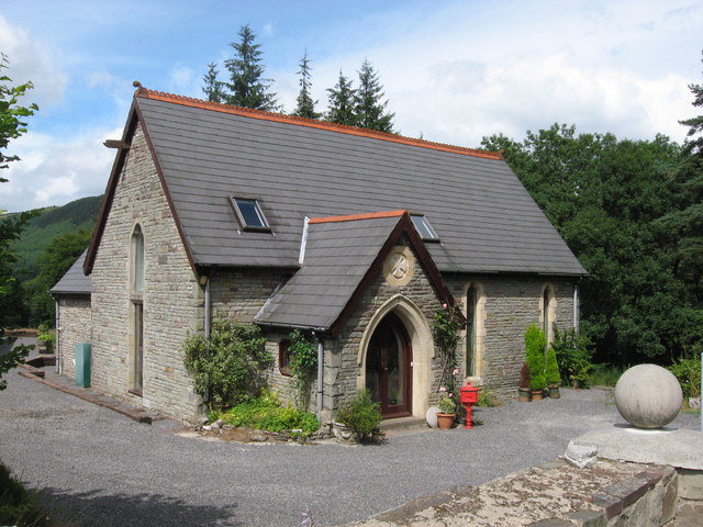
Converted chapel near Dol-y-gaer - geograph.org.uk - 1997088.jpg - GeographBot

Cwar y Gigfran mountainside - geograph.org.uk - 2014065.jpg - GeographBot

Blaen y Glyn valley - geograph.org.uk - 2014069.jpg - GeographBot

Caerfanell valley - geograph.org.uk - 2014080.jpg - GeographBot

Nant Tarthwynni seen from Tor y Foel - geograph.org.uk - 2153776.jpg - GeographBot

Craig Danywenallt seen from Tor y Foel - geograph.org.uk - 2174504.jpg - GeographBot

Bwlch-y-waun and Tor-y-foel seen from Carn Caws - geograph.org.uk - 2174593.jpg - GeographBot

Talybont Reservoir from Tor y Foel.jpg - Bibeyjj

Blaen-y-glyn Waterfalls - geograph.org.uk - 2401420.jpg - GeographBot

Waterworks at Talybont Reservoir - geograph.org.uk - 2402543.jpg - GeographBot

Footpath gate near Allt yr Esgair - geograph.org.uk - 2414386.jpg - GeographBot
Dozing pig at Tal-y-bryn Farm - geograph.org.uk - 2414395.jpg - GeographBot

Lane and footpath junction near Tal-y-bryn Farm - geograph.org.uk - 2414406.jpg - GeographBot

Hill view from a bend in the A40 west of Bwlch - geograph.org.uk - 2514983.jpg - GeographBot

Entrance drive to Llanfellte near Bwlch - geograph.org.uk - 2514990.jpg - GeographBot

Caravans in a layby on the A40 west of Bwlch - geograph.org.uk - 2515001.jpg - GeographBot
Rain clouds over Tor y Foel, Brecon Beacons - geograph.org.uk - 2515007.jpg - GeographBot

Facilities and speed cameras ahead, A40 west of Bwlch - geograph.org.uk - 2515035.jpg - GeographBot

Long layby on the A40 west of Bwlch - geograph.org.uk - 2515045.jpg - GeographBot

Postbox in a small parking area on the A40 near to Talybryn Lodge - geograph.org.uk - 2515053.jpg - GeographBot

Entrance drive to Talybryn Lodge and Talybryn House near Bwlch - geograph.org.uk - 2515058.jpg - GeographBot

Sign for Buckland Hall, A40 - geograph.org.uk - 2515071.jpg - GeographBot

The Elms farmhouse viewed from the A40 - geograph.org.uk - 2515095.jpg - GeographBot

Pentremelin near Bwlch - geograph.org.uk - 2526941.jpg - GeographBot

Pontsticill Reservoir from the Brecon Mountain Railway - geograph.org.uk - 2542702.jpg - GeographBot

Brecon Mountain Railway near Dolygaer - geograph.org.uk - 2542705.jpg - GeographBot
The Beacons Way on Craig y Fan Ddu - geograph.org.uk - 2579397.jpg - GeographBot
Part of the Beacons Way at Blaen Caerfanell - geograph.org.uk - 2582984.jpg - GeographBot

View south from Graig Fan Las towards Craig y Fan Ddu - geograph.org.uk - 2582996.jpg - GeographBot

Grassland near Blaen y Glyn - geograph.org.uk - 2583011.jpg - GeographBot

Part of the Taff Trail in Taf Fechan Forest - geograph.org.uk - 2583338.jpg - GeographBot

Part of the Taff Trail below Craig y Fan Ddu - geograph.org.uk - 2583364.jpg - GeographBot

Tree-lined picnic area, Talybryn - geograph.org.uk - 2590485.jpg - GeographBot

Pools on Ffordd Las - geograph.org.uk - 2632376.jpg - GeographBot

Footpath on Ffordd Las - geograph.org.uk - 2632389.jpg - GeographBot

Northern slopes of Bryn - geograph.org.uk - 2632418.jpg - GeographBot

Footpath on Gist Wen - geograph.org.uk - 2676679.jpg - GeographBot

Roman Road - geograph.org.uk - 2742729.jpg - GeographBot

Brecon Mountain Railway - temporary terminus at Dolygaer - geograph.org.uk - 2743146.jpg - GeographBot

Wellington Bomber Crash Site from Cwar y Gigfran - geograph.org.uk - 2745325.jpg - GeographBot

On Graig Fan Las - geograph.org.uk - 2877272.jpg - GeographBot

Carn Pica - geograph.org.uk - 2877359.jpg - GeographBot

Carn Pica - geograph.org.uk - 2877369.jpg - GeographBot

View to Allt Lwyd from Craig y Fan - geograph.org.uk - 2877381.jpg - GeographBot

Gwalciau'r Cwm - geograph.org.uk - 2877393.jpg - GeographBot

Cairn on Gwalciau'r Cwm - geograph.org.uk - 2877417.jpg - GeographBot

Cairn and rock outcrop on Gwalciau'r Cwm - geograph.org.uk - 2877423.jpg - GeographBot

The Usk valley at Ashford - geograph.org.uk - 2950671.jpg - GeographBot

Path at the edge of forestry - geograph.org.uk - 2952862.jpg - GeographBot

On Bryn Melyn looking to Tor y Foel - geograph.org.uk - 2952943.jpg - GeographBot

Saddle between Tor y Foel and Bryn Melyn - geograph.org.uk - 2952950.jpg - GeographBot

Looking to the summit of Tor y Foel - geograph.org.uk - 2952972.jpg - GeographBot

Ruined barn - geograph.org.uk - 2953643.jpg - GeographBot

On top of Allt yr Esgair - geograph.org.uk - 2986741.jpg - GeographBot

Six miles to Brecon from Llansantffraed - geograph.org.uk - 3112081.jpg - GeographBot

Roadside access to the riverside, Llansantffraed - geograph.org.uk - 3112174.jpg - GeographBot

Combined steps and stile, Llansantffraed - geograph.org.uk - 3112326.jpg - GeographBot

Canal bridge 150 near Pencelli - geograph.org.uk - 3115389.jpg - GeographBot

Passing place on the B4558 NW of Pencelli - geograph.org.uk - 3122310.jpg - GeographBot

Groove of Blaen Caerfanell - geograph.org.uk - 3282104.jpg - GeographBot

Off-roading at Pen Bwlch Glasgwm - geograph.org.uk - 3282120.jpg - GeographBot

Looking NE along Bwlch Main - geograph.org.uk - 3286309.jpg - GeographBot

Gathering on Bwlch Main - geograph.org.uk - 3286312.jpg - GeographBot

Descent towards Clawdd Coch - geograph.org.uk - 3286341.jpg - GeographBot

Descent from Clawdd Coch - geograph.org.uk - 3286373.jpg - GeographBot

Waun Rydd - geograph.org.uk - 3364053.jpg - GeographBot

Side view of the Field Studies Centre, Talybont-on-Usk - geograph.org.uk - 3366819.jpg - GeographBot

Path along Graig Fan Las above the Caerfanell valley - geograph.org.uk - 3390196.jpg - GeographBot

The Caerfanell valley from Graig Fan Las - geograph.org.uk - 3390203.jpg - GeographBot

The Blaen Caerfanell - geograph.org.uk - 3390207.jpg - GeographBot

From the path on Craig y Fan Ddu - geograph.org.uk - 3390213.jpg - GeographBot

View SE from Craig y Fan Ddu - geograph.org.uk - 3390218.jpg - GeographBot

Busy car park at Blaen y Glyn - geograph.org.uk - 3390231.jpg - GeographBot

Field in the Taf Fechan valley - geograph.org.uk - 3390250.jpg - GeographBot

Brecon Mountain Railway near Pontsticill - geograph.org.uk - 3390264.jpg - GeographBot

Entrance road to Talybont Water Treatment Works - geograph.org.uk - 3393073.jpg - GeographBot

Layby and picnic area next to the A40 - geograph.org.uk - 3435502.jpg - GeographBot

Sunken path on Allt-yr-Esgair in summer - geograph.org.uk - 3503763.jpg - GeographBot

On Allt-yr-Esgair in June - geograph.org.uk - 3503804.jpg - GeographBot

Bluebells on Allt-yr-Esgair in June - geograph.org.uk - 3503895.jpg - GeographBot

On Allt-yr-Esgair in June - geograph.org.uk - 3503917.jpg - GeographBot

Steam Locomotive, Brecon Mountain Railway - geograph.org.uk - 3661410.jpg - GeographBot

Steam Locomotive, Brecon Mountain Railway - geograph.org.uk - 3661417.jpg - GeographBot

Brecon Mountain Railway - geograph.org.uk - 3661429.jpg - GeographBot

Pontsticill Reservoir from the Brecon Mountain Railway - geograph.org.uk - 3661431.jpg - GeographBot
Parking Area near Blaen-y-Glyn, Brecon Beacons, Wales - geograph.org.uk - 3662868.jpg - GeographBot
Brecon Beacons, Wales - geograph.org.uk - 3662894.jpg - GeographBot

Entrance to Llwynbedw Farm near Talybont Reservoir - geograph.org.uk - 3761619.jpg - GeographBot

Sheep grazing near Talybont Reservoir - geograph.org.uk - 3761822.jpg - GeographBot
Brecon Beacons - geograph.org.uk - 3825212.jpg - GeographBot

Looking west along the A40 near Bwlch - geograph.org.uk - 3904303.jpg - GeographBot

Penparc from lay-by opposite on the A40 - geograph.org.uk - 3904310.jpg - GeographBot

The A40 looking west at Tal-y-bryn - geograph.org.uk - 3904315.jpg - GeographBot

Brecon Mountain Railway - geograph.org.uk - 3928855.jpg - GeographBot

Brecon Mountain Railway - geograph.org.uk - 3928860.jpg - GeographBot

Brecon Mountain Railway - geograph.org.uk - 3928872.jpg - GeographBot

Forestry track above the Pentwyn Reservoir - geograph.org.uk - 3929031.jpg - GeographBot

Forestry track in the Taf Fechan Forest - geograph.org.uk - 3929037.jpg - GeographBot

Brecon Mountain Railway - geograph.org.uk - 3929044.jpg - GeographBot

Brecon Mountain Railway - geograph.org.uk - 3929061.jpg - GeographBot

Cascades on the uppermost Caerfanell - geograph.org.uk - 3971927.jpg - GeographBot

Wales Powys Community Talybont-on-Usk map.svg - DankJae