Wikimedi'Òc
Modes d'emploi

Cet album fait partie des albums
Cet album photos contient les sous-albums suivants :


Death Rock, mouth of Echo Canyon. Summit County, Utah - NARA - 517324.tif - US National Archives bot

View in the Uinta Mountains, Summit County, Utah - NARA - 516919.jpg - US National Archives bot

View in the Uinta Mountains, Summit County, Utah - NARA - 516922.jpg - US National Archives bot

Utah Welcome Sign.jpg - SreeBot

Utah wildfires 130815-Z-KC166-189.jpg - Fæ
Utah wildfires 130815-Z-KC166-253.jpg - Fæ
Utah wildfires 130815-Z-KC166-367.jpg - Fæ

Utah wildfires 130815-Z-KC166-186.jpg - Fæ

Utah wildfires 130815-Z-KC166-368.jpg - Fæ

Utah wildfires 130815-Z-KC166-188.jpg - Fæ

Utah wildfires 130815-Z-KC166-248.jpg - Fæ

Utah wildfires 130815-Z-KC166-320.jpg - Fæ

40. The Devils War Club, Witch Rocks, W.P.R.R.jpg - Jason.nlw

Rest Stop - panoramio - Wendell Smith.jpg - Panoramio upload bot

Walking in a Utah winter (Unsplash).jpg - Fæ

High Uintas, Utah - 2015.07.11 12.19.58 DSCN2639 - Flickr - andrey zharkikh.jpg - Josve05a

Road in snowy forest (Unsplash).jpg - Fæ

Alone in the snow (Unsplash).jpg - Fæ

Sarah Crowley TT Utah.jpg - Reddogstan

Summit County, Utah sign on SR-32, Apr 16.jpg - An Errant Knight

I-80 northbound exit on US-40 US-189, Apr 16.jpg - An Errant Knight
Summit County, Utah - Oakley, Kamas, and Francis.jpg - Firstcultural

Uinta Mountains, head of Blacks Fork. Summit County, Utah. 1870.jpg - Ooligan
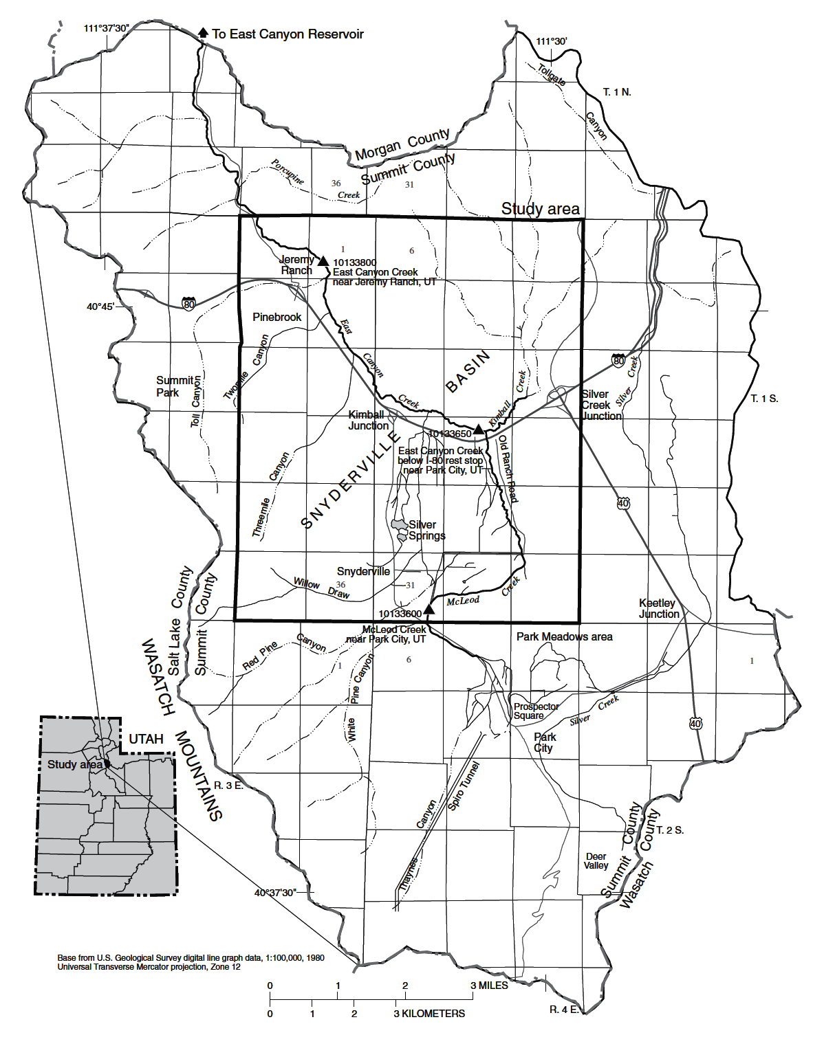
USGS Map of Kimball Creek and McLeod Creek confluence, the sources of East Canyon Creek.png - Schmiebel

McLeod Creek Looking South over Swaner Preserve from Highland Drive 2023-10-15.jpg - Schmiebel
High Valley Transit Gillig Low-floor Electric 40'.png - Maylingoed

IMG High Valley Van near Skullcandy.jpg - Maylingoed
Bus 667 (Park City Transit).jpg - Maylingoed
Park City Transit Bus.jpg - Maylingoed

HVT bus with ski baket.jpg - Maylingoed

Millennium Trail near trailhead.jpg - Maylingoed
High Valley Transit near Kimball Junction.jpg - Eyezak mad