Wikimedi'Òc
Modes d'emploi

Cet album fait partie des albums
Cet album photos contient les sous-albums suivants :


The Gasometer, Weymouth. - geograph.org.uk - 45339.jpg - GeographBot
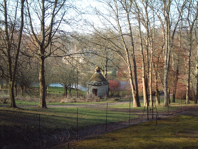
Dewlish House - geograph.org.uk - 113387.jpg - GeographBot
2010-10-02 Nodding Donkey Kimmeridge Bay.jpg - Huligan0

Oil Well, Kimmeridge - geograph.org.uk - 414831.jpg - GeographBot

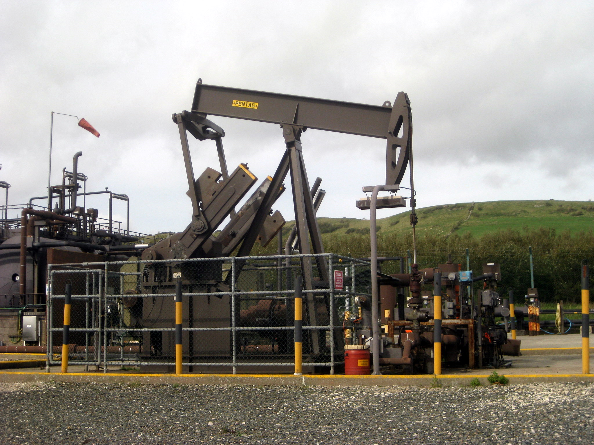
Wytch Farm Oil Wells - geograph.org.uk - 493803.jpg - GeographBot

Coastal path above West Bottom - geograph.org.uk - 645002.jpg - GeographBot

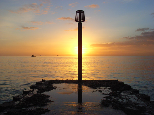
Outflow marker, Weymouth Bay - geograph.org.uk - 653108.jpg - GeographBot
Outflow marker, Weymouth Bay - geograph.org.uk - 653232.jpg - GeographBot

Weymouth Bay - geograph.org.uk - 653860.jpg - GeographBot

Weymouth Bay - geograph.org.uk - 654077.jpg - GeographBot

Bournemouth, a patchwork paste-up - geograph.org.uk - 729335.jpg - GeographBot
Beacon on hill top - geograph.org.uk - 763444.jpg - GeographBot

Nautical mile indicator posts - geograph.org.uk - 766220.jpg - GeographBot

Obelisk on the hill - geograph.org.uk - 765965.jpg - GeographBot

Wooden Groyne, Swanage - geograph.org.uk - 766297.jpg - GeographBot

A small concrete jetty - geograph.org.uk - 782204.jpg - GeographBot

Weymouth Bay Hazard Marker - geograph.org.uk - 818498.jpg - GeographBot

Weymouth Bay hazard marker - geograph.org.uk - 819252.jpg - GeographBot

Kimmeridge, boathouses - geograph.org.uk - 836097.jpg - GeographBot

Weymouth Bay Hazard Marker - geograph.org.uk - 857500.jpg - GeographBot

Wytch Farm oilfield (1980) - geograph.org.uk - 860599.jpg - Blythwood

A view along the Esplanade at Weymouth - geograph.org.uk - 885663.jpg - GeographBot

Old fuel pump, Sydling St Nicholas - geograph.org.uk - 907720.jpg - GeographBot

Lyme Regis seafront during the storm of Oct 2004 - geograph.org.uk - 956493.jpg - GeographBot
Power Transformer, Chickerell - geograph.org.uk - 966242.jpg - GeographBot

Wareham Channel marker - geograph.org.uk - 972666.jpg - GeographBot

Storage tanks on Corton Down - geograph.org.uk - 1034613.jpg - GeographBot

A happy Christmas^ - geograph.org.uk - 1091471.jpg - GeographBot

Weymouth Gasometer - geograph.org.uk - 1145509.jpg - GeographBot

Osprey Nest at Eye Mead - geograph.org.uk - 1189391.jpg - GeographBot

Middlebere, water equipment - geograph.org.uk - 1201499.jpg - GeographBot

Swanage, Stone Quay - geograph.org.uk - 1206773.jpg - GeographBot

Flag Pole and WWII defences at Worbarrow Bay - geograph.org.uk - 1215646.jpg - GeographBot

Studland Heath, benchmark - geograph.org.uk - 1255856.jpg - GeographBot

Dorchester Skate Park - geograph.org.uk - 1269345.jpg - GeographBot

Froom's Lane, brick kiln - geograph.org.uk - 1268768.jpg - GeographBot

Dorchester Skate Park Flying High - geograph.org.uk - 1270750.jpg - GeographBot

Worth Matravers, 'Duckingham Palace' - geograph.org.uk - 1366522.jpg - GeographBot
View west, from Thorncombe Beacon - geograph.org.uk - 1454313.jpg - GeographBot

Lyme Regis, steps to the seafront - geograph.org.uk - 1485347.jpg - GeographBot

Abbotsbury, brick structure - geograph.org.uk - 1529100.jpg - GeographBot
Navigation beacon and South West Coast Path - geograph.org.uk - 1529616.jpg - GeographBot

Obelisk and Seat, Bindon Hill - geograph.org.uk - 1521183.jpg - GeographBot
Old Navigation Beacon Chaldon Down - geograph.org.uk - 1529123.jpg - GeographBot

Verwood, star-shaped bench at Stephen's Castle - geograph.org.uk - 1575251.jpg - GeographBot

Verwood, what's under your feet? - geograph.org.uk - 1575254.jpg - GeographBot

Wareham - Worgret Heath - geograph.org.uk - 1574831.jpg - GeographBot

Bournemouth, the eternal flame - or rather, bulb - geograph.org.uk - 1628723.jpg - GeographBot

Unidentified structures at St Aldhelm's Head - geograph.org.uk - 1626225.jpg - GeographBot

'Nodding donkey' at Kimmeridge wellsite - geograph.org.uk - 1632405.jpg - GeographBot

Kimmeridge Wellsite - geograph.org.uk - 1632395.jpg - GeographBot

White Nothe to Lulworth Cove - geograph.org.uk - 1708377.jpg - GeographBot

Woodsford, bus shelter and postbox - geograph.org.uk - 1707673.jpg - GeographBot

Alderney, parallel poles - geograph.org.uk - 1712100.jpg - GeographBot

Studland , Middle Beach Car Park - geograph.org.uk - 1712571.jpg - GeographBot