Wikimedi'Òc
Modes d'emploi

Cet album fait partie des albums


Soil map of Clark and a portion of Floyd Counties. - DPLA - 98dc339e943a5bd7b0e4b00c7774c6a8.jpg - DPLA bot

Soil map of Daviess County. - DPLA - 29e4fb58a3066fd24126737bb45cb5aa.jpg - DPLA bot
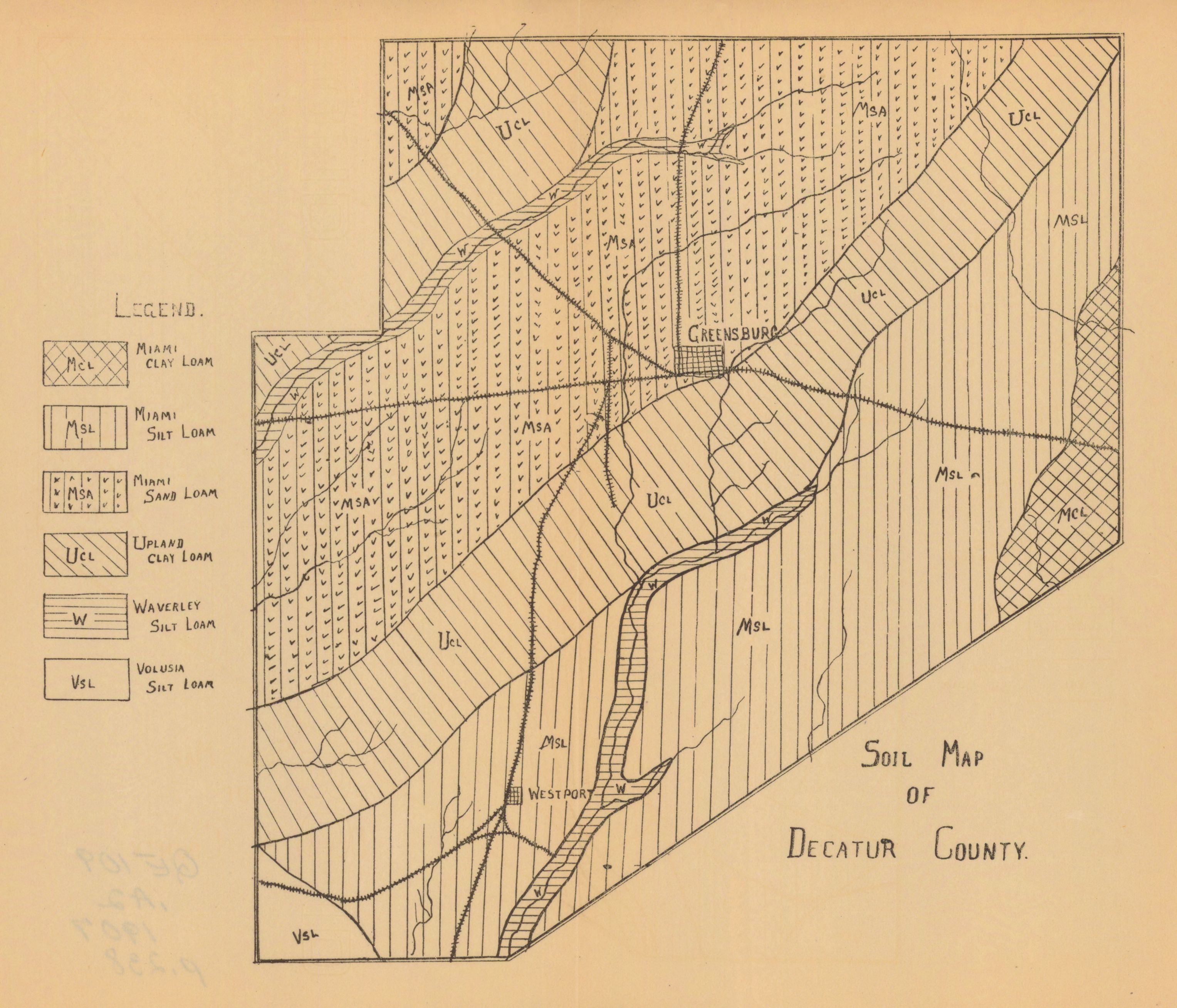
Soil map of Decatur County. - DPLA - 9b6f4d3a7c1a8df8f54e91fcd7f3d3fa.jpg - DPLA bot

Soil map of Floyd and Harrison Counties. - DPLA - 8711339ad0c961fe669fa0b99565ebb6.jpg - DPLA bot

Soil map of Henry County. - DPLA - fda98ba9be689f6cbccfd53fd1bb8af1.jpg - DPLA bot

Soil map of Jefferson County. - DPLA - 52a6a67d9dc780a1d4a20d28e8c515b6.jpg - DPLA bot

Soil map of Johnson County. - DPLA - a1cc6de5e2b8d4e045739c0a5858bdf3.jpg - DPLA bot

Soil map of Randolph County. - DPLA - 83f15fe11edb7f2660fae8c115b14611.jpg - DPLA bot

Soil map of Shelby County. - DPLA - cc1f5c28923f363d631fa8542ff6c5f6.jpg - DPLA bot

Soil map of Switzerland County. - DPLA - d649a3d2bfce1c894ae00ad6272dcbe5.jpg - DPLA bot

Soil map of Wayne County. - DPLA - ff9078fe4f006dd846087cd0f5f19701.jpg - DPLA bot

Soil map of Hancock County. - DPLA - 887f8cd88af3509db20f804a9c66521b.jpg - DPLA bot