Wikimedi'Òc
Modes d'emploi

Cet album fait partie des albums
Cet album photos contient les sous-albums suivants :


Entrance to Rutland Water Nature Reserve - geograph.org.uk - 161760.jpg - GeographBot

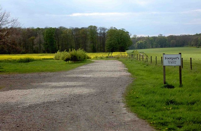
Footpath sign - geograph.org.uk - 166132.jpg - GeographBot

Keep out of TF0512 - geograph.org.uk - 115128.jpg - GeographBot

Little Casterton near Stamford - geograph.org.uk - 214693.jpg - GeographBot

Sign at Lavington Lake - geograph.org.uk - 329791.jpg - GeographBot

Village pond at Glaston - geograph.org.uk - 364733.jpg - GeographBot
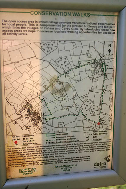
Information sign for the Conservation Walk near Irnham - geograph.org.uk - 386138.jpg - GeographBot

Empingham church - geograph.org.uk - 488191.jpg - GeographBot

Rutland - geograph.org.uk - 487767.jpg - GeographBot

Sign affixed to the viaduct - geograph.org.uk - 484700.jpg - GeographBot

Wills Farm - geograph.org.uk - 599111.jpg - GeographBot

Approaching Braunston-in-Rutland - geograph.org.uk - 600089.jpg - GeographBot

Leicestershire-Rutland border - geograph.org.uk - 600128.jpg - GeographBot

Rutland-Leicestershire border - geograph.org.uk - 600122.jpg - GeographBot

The A47 Uppingham Road enters Rutland - geograph.org.uk - 603433.jpg - GeographBot

Building site notice - geograph.org.uk - 690331.jpg - GeographBot

Cold Overton Road enters Rutland - geograph.org.uk - 761518.jpg - GeographBot

Fosse Lane enters Rutland - geograph.org.uk - 804395.jpg - GeographBot
The junction with the Viking Way footpath - geograph.org.uk - 1276673.jpg - GeographBot

Clipsham Yew Tree Avenue - geograph.org.uk - 1533172.jpg - GeographBot

Boundary marker, Duddington (geograph 2124182).jpg - Robert EA Harvey
Rutland Radio Logo.jpg - Astevens93

Notice of pending work at Ashwell level crossing - geograph.org.uk - 4942310.jpg - GeographBot