Wikimedi'Òc
Modes d'emploi

Cet album fait partie des albums
Cet album photos contient les sous-albums suivants :


Shyok2.svg - Kmhkmh
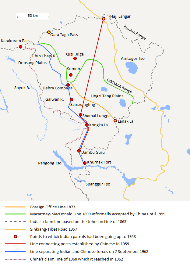
Aksai Chin Sino-Indian border map.png - The Discoverer

Provincial Geographies of India Volume 1 0387.jpg - Moondyne

Txu-oclc-6654394-ni-44-3rd-ed.jpg - User-duck

"PANGONG TSO" map by the Army Map Service, Corps of Engineers, 1950, printed 1953, from- Txu-oclc-6654394-ni-44-3rd-ed (cropped).jpg - Tibet Nation

Shyok.png - Ccmpg

Aksai Chin Sino-Indian border map.svg - Hogweard

Aksai Chin Sino-Indian border map-ar.svg - Sgh45