Wikimedi'Òc
Modes d'emploi

Cet album fait partie des albums
Cet album photos contient les sous-albums suivants :


Footpath - geograph.org.uk - 23466.jpg - GeographBot

Horsted Lane - geograph.org.uk - 21186.jpg - GeographBot
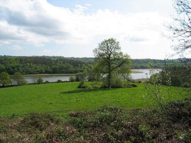
Weir Wood Reservoir - geograph.org.uk - 6827.jpg - GeographBot

Sharpethorne Garage - geograph.org.uk - 21185.jpg - GeographBot

Stone Farm rocks - geograph.org.uk - 23464.jpg - GeographBot

Weir Wood Reservoir - geograph.org.uk - 148526.jpg - GeographBot

Sharpthorne village residential area - geograph.org.uk - 165589.jpg - GeographBot

Entrance to Blacklands Farm - geograph.org.uk - 182730.jpg - GeographBot

Field and Wood - geograph.org.uk - 182726.jpg - GeographBot

Mill Place - geograph.org.uk - 182721.jpg - GeographBot

Muddy path through the woods, Blackland Farm. - geograph.org.uk - 182734.jpg - GeographBot

Sharpethorne Garage - closed^^ - geograph.org.uk - 182693.jpg - GeographBot

Steam train passing over a bridge - geograph.org.uk - 182720.jpg - GeographBot

Sussex Border Path - geograph.org.uk - 182732.jpg - GeographBot

Tents, Blacklands Farm - geograph.org.uk - 182736.jpg - GeographBot

Traffic calming measures, entering Sharpthorne. - geograph.org.uk - 182691.jpg - GeographBot

Trees and fields - geograph.org.uk - 182727.jpg - GeographBot

Woodland Stream, Ashdown Forest - geograph.org.uk - 182733.jpg - GeographBot

The Mill Place complex - geograph.org.uk - 390323.jpg - GeographBot

Admiral's Bridge Lane - geograph.org.uk - 624992.jpg - GeographBot

Admiral's Bridge Lane - geograph.org.uk - 624998.jpg - GeographBot

Chaffinch 5 - geograph.org.uk - 625046.jpg - GeographBot

Coombe Brook - geograph.org.uk - 625079.jpg - GeographBot

Derelict Outbuildings, Neylands Farm - geograph.org.uk - 625030.jpg - GeographBot

Leggat's Lakes - geograph.org.uk - 624905.jpg - GeographBot

Neylands Farm Cottages, Grinstead Lane - geograph.org.uk - 625038.jpg - GeographBot

Old Coombe - geograph.org.uk - 625089.jpg - GeographBot

Pond near Whillet's Bridge - geograph.org.uk - 625019.jpg - GeographBot

Railway Bridge - geograph.org.uk - 625083.jpg - GeographBot

River Medway - geograph.org.uk - 624894.jpg - GeographBot

River Medway - geograph.org.uk - 625015.jpg - GeographBot

Sandstone Outcrops - geograph.org.uk - 624970.jpg - GeographBot

Standen Rocks - geograph.org.uk - 624986.jpg - GeographBot

Sussex Border Path - geograph.org.uk - 625072.jpg - GeographBot

Tits Wood, Blacklands Farm Guide Camp - geograph.org.uk - 625126.jpg - GeographBot

Vinols Cross - geograph.org.uk - 625122.jpg - GeographBot

Admirals Bridge - geograph.org.uk - 1093050.jpg - GeographBot

Brick building in middle of field next to Tanyard - geograph.org.uk - 1434536.jpg - GeographBot

Buildings at Tanyard off Horsted Lane - geograph.org.uk - 1434522.jpg - GeographBot

Derelict building near Northwood - geograph.org.uk - 1435365.jpg - GeographBot

Drive wheel and shaft above well - geograph.org.uk - 1435371.jpg - GeographBot

Footpath descending across hillside towards Moon's Wood - geograph.org.uk - 1435406.jpg - GeographBot

Garden gate at Violet Cottage - geograph.org.uk - 1434543.jpg - GeographBot

Grass in seed south of Sloe Garden Wood - geograph.org.uk - 1435462.jpg - GeographBot

Play area in Sharpthorne - geograph.org.uk - 2459607.jpg - GeographBot

The Mid Sussex Link south of Sharpthorne - geograph.org.uk - 2459616.jpg - GeographBot

Kissing gate on the Mid Sussex Link south of Sharpthorne - geograph.org.uk - 2459625.jpg - GeographBot

Chilling Street near Sharpthorne - geograph.org.uk - 2964585.jpg - GeographBot