Wikimedi'Òc
Modes d'emploi

Cet album fait partie des albums
Cet album photos contient les sous-albums suivants :


Svc3.jpg - Delta 51
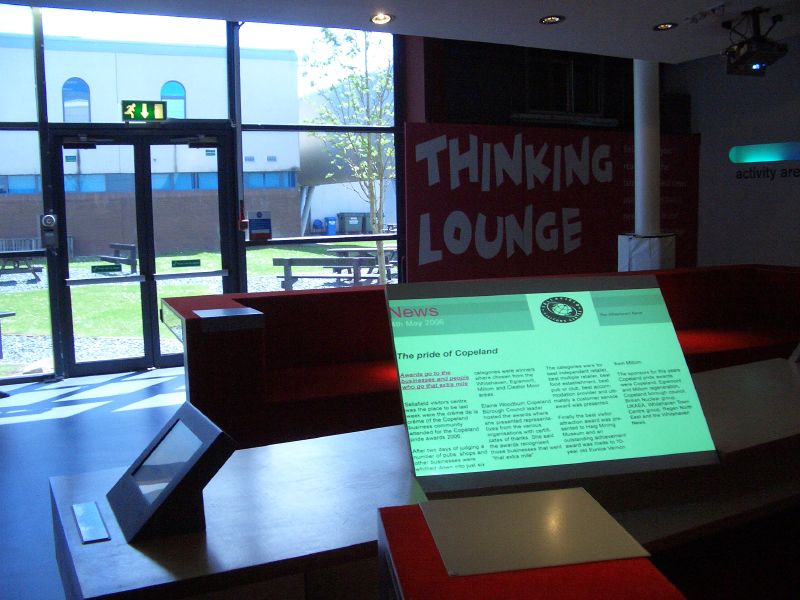
Sellafield Visitors' Centre.jpg - Robert Weemeyer

Sellafield from the golf course - geograph.org.uk - 1053108.jpg - File Upload Bot (Magnus Manske)

Looking across Sellafield Golf Course - geograph.org.uk - 1348610.jpg - File Upload Bot (Magnus Manske)

Railway Locomotive in the sidings at Sellafield - geograph.org.uk - 1348574.jpg - File Upload Bot (Magnus Manske)

Railway sidings behind the boundary fence at Sellafield Works - geograph.org.uk - 1348581.jpg - File Upload Bot (Magnus Manske)

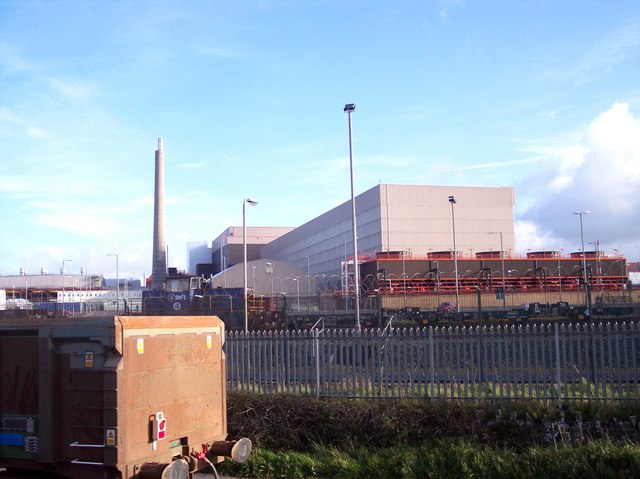
New construction going on at Sellafield - geograph.org.uk - 1348585.jpg - File Upload Bot (Magnus Manske)

Towards the pipebridge from BNG. - geograph.org.uk - 97387.jpg - File Upload Bot (Magnus Manske)

Construction on the outfall pipe, Sellafield - geograph.org.uk - 1343583.jpg - File Upload Bot (Magnus Manske)

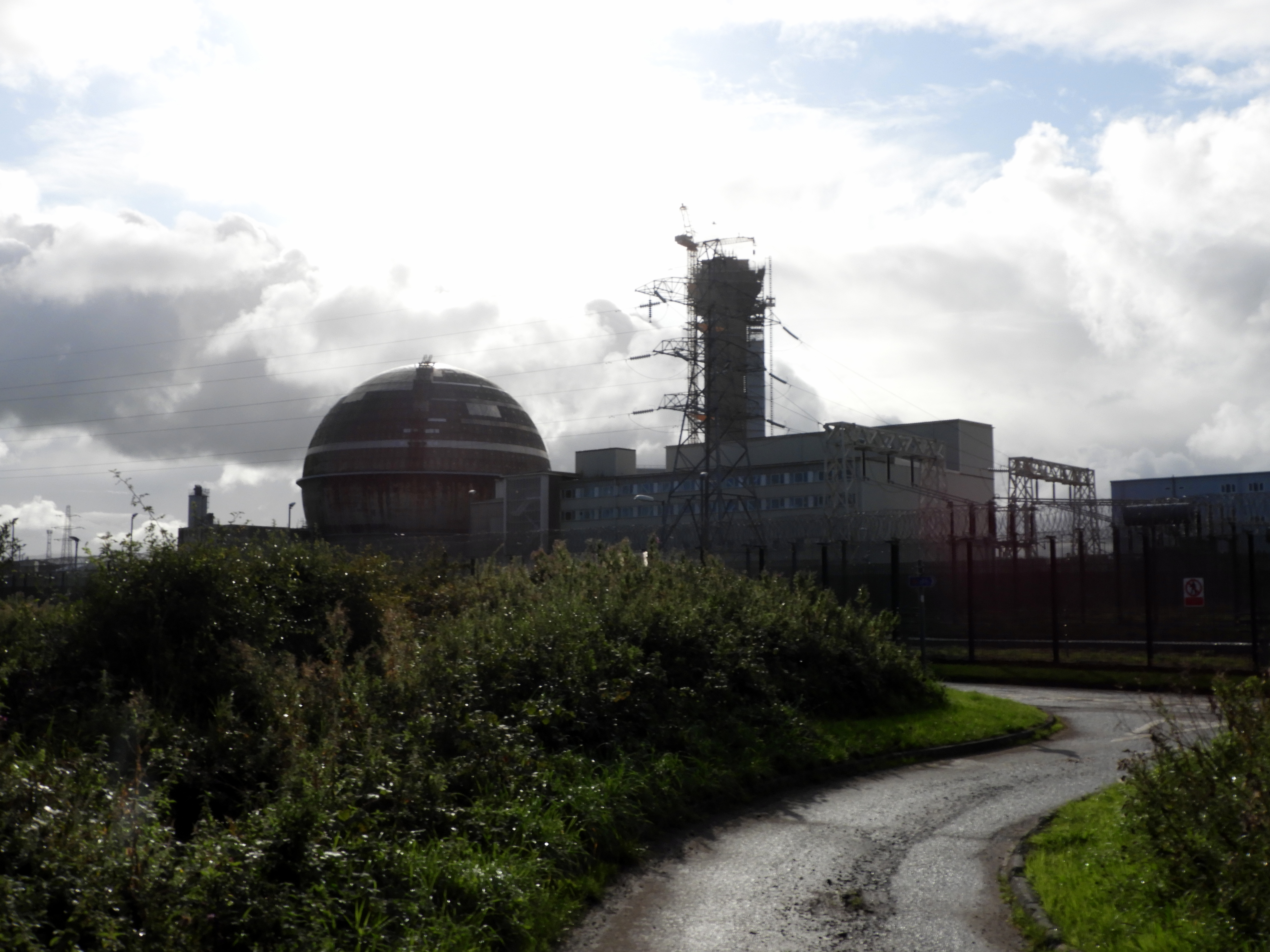
Aerial view Sellafield, Cumbria - geograph.org.uk - 50827.jpg - File Upload Bot (Magnus Manske)

Welcome flower bed. - geograph.org.uk - 97561.jpg - File Upload Bot (Magnus Manske)

Sellafield from Hard Rigg. - geograph.org.uk - 246518.jpg - File Upload Bot (Magnus Manske)

Cloud over Sellafield (non radioactive) - geograph.org.uk - 335287.jpg - File Upload Bot (Magnus Manske)
Sellafield power station viewed from railway line - geograph.org.uk - 1002965.jpg - File Upload Bot (Magnus Manske)
Nuclear Flasks in the sidings at Sellafield - geograph.org.uk - 1348546.jpg - File Upload Bot (Magnus Manske)

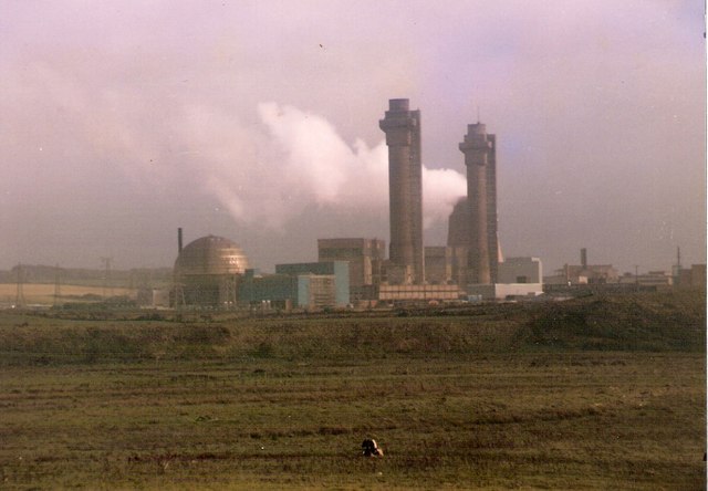
A view of Calder Hall (Sellafield) - geograph.org.uk - 616224.jpg - File Upload Bot (Magnus Manske)

The river Calder with Calder Hall cooling towers. - geograph.org.uk - 97834.jpg - File Upload Bot (Magnus Manske)

From the Mid Tarn Farm Turnoff. - geograph.org.uk - 98363.jpg - File Upload Bot (Magnus Manske)

Sellafield Visitors Centre - geograph.org.uk - 306969.jpg - File Upload Bot (Magnus Manske)

Sellafield view from Visitors Centre - geograph.org.uk - 306975.jpg - File Upload Bot (Magnus Manske)
Storm Clouds over Sellafield - geograph.org.uk - 330062.jpg - File Upload Bot (Magnus Manske)

Looking westwards towards Sellafield from Irton Fell - geograph.org.uk - 10817.jpg - GeographBot

Seascale - geograph.org.uk - 19296.jpg - GeographBot

Sellafield Visitors Centre - geograph.org.uk - 46454.jpg - GeographBot

Mouth of the river Calder. - geograph.org.uk - 98376.jpg - GeographBot

Mouth of the rivers Calder and Ehen. - geograph.org.uk - 98378.jpg - GeographBot

Footpath to Black How. - geograph.org.uk - 156218.jpg - GeographBot

Lime Brown Field. - geograph.org.uk - 156203.jpg - GeographBot

Sellafield from Tongue How - geograph.org.uk - 198751.jpg - GeographBot

Seascale Jetty - geograph.org.uk - 286187.jpg - GeographBot

Sellafield sculpture - geograph.org.uk - 306972.jpg - GeographBot

Small Overhang Above The Screes. - geograph.org.uk - 536985.jpg - GeographBot

Cycle track on dismantled railway, High Sellafield - geograph.org.uk - 1265319.jpg - GeographBot

Stile on dismantled railway, High Sellafield - geograph.org.uk - 1265330.jpg - GeographBot

Construction site, Sellafield - geograph.org.uk - 1343573.jpg - GeographBot

Pond by the railway line - geograph.org.uk - 1343495.jpg - GeographBot

Pond near Sellafield - geograph.org.uk - 1343499.jpg - GeographBot

The boundary between Sellafield Works and Sellafield Golf Course - geograph.org.uk - 1348597.jpg - GeographBot

On Cold Fell - geograph.org.uk - 1621364.jpg - GeographBot

Sellafield geograph-3503246-by-Ben-Brooksbank.jpg - Chevin

Sellafield geograph-3503250-by-Ben-Brooksbank.jpg - Chevin

Trig Point of Harnsey Moss, Cumbria.jpg - Geograph Update Bot

Ordnance Survey One-Inch Sheet 88 Barrow-in-Furness, Published 1965.jpg - Kognos

Ordnance Survey One-Inch Sheet 88 Barrow in Furness, Published 1947.jpg - Kognos

Sellafield Visitors Centre, frontage.jpg - Rwendland

THORP, first fuel.jpg - Rwendland

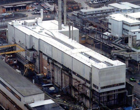
Sellafield Vitrification Plant, interior.jpg - Rwendland
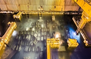
FGMSP Skips.jpg - Victuallers
Sellafield.jpg - Beevor54
261102792.jpg.gallery.jpg - North747

BDK Duisburg Grüne 1989 31 Kamran Salimi.jpg - Kasa Fue
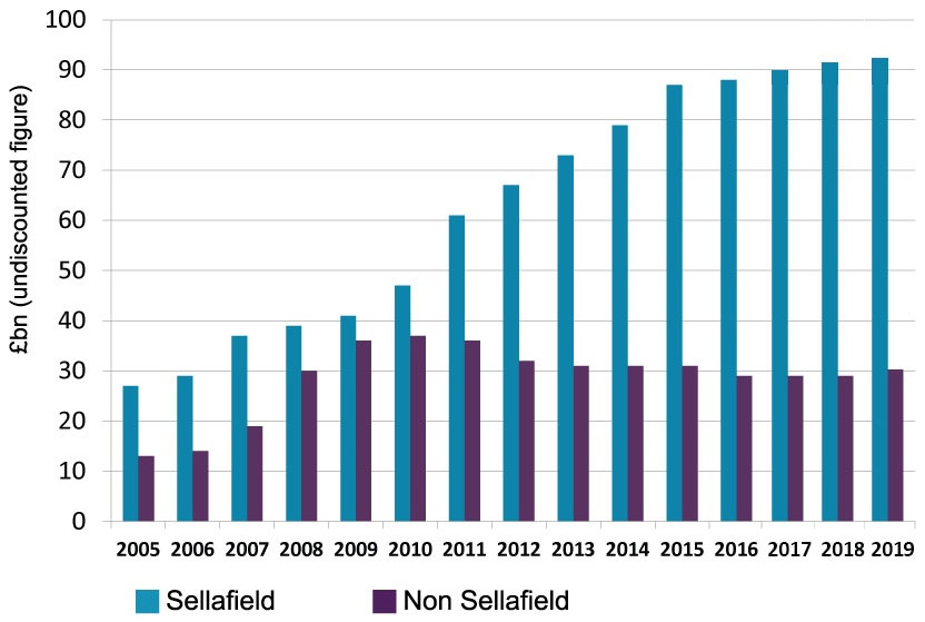
Chart forecast costs clean up Sellafield vs non-Sellafield from 2005.jpg - Wickey

Sellafield aerial.jpg - Lieven Smits

Sellafield aerial detail.jpg - Lieven Smits

View to Sellafield - geograph.org.uk - 4652112.jpg - GeographBot
Simulated intermediate level nuclear waste - Science Museum, London.jpg - The wub