Wikimedi'Òc
Modes d'emploi

Cet album fait partie des albums
Cet album photos contient les sous-albums suivants :


Himalaya composite.jpg - Wdshu

Himalaya 85.30820E 32.11063N.jpg - Rex

Hymalayas 86.15103E 31.99726N.jpg - Rex

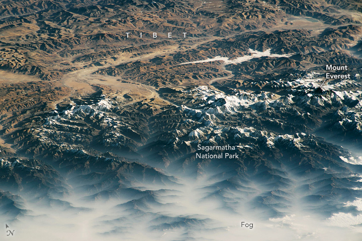
NASA-Himalaya-Tibet.jpg - Roland Schmid

Hindu Kush satellite image.jpg - Avenue

TibetplateauA2002144.0440.500m.jpg - Shack
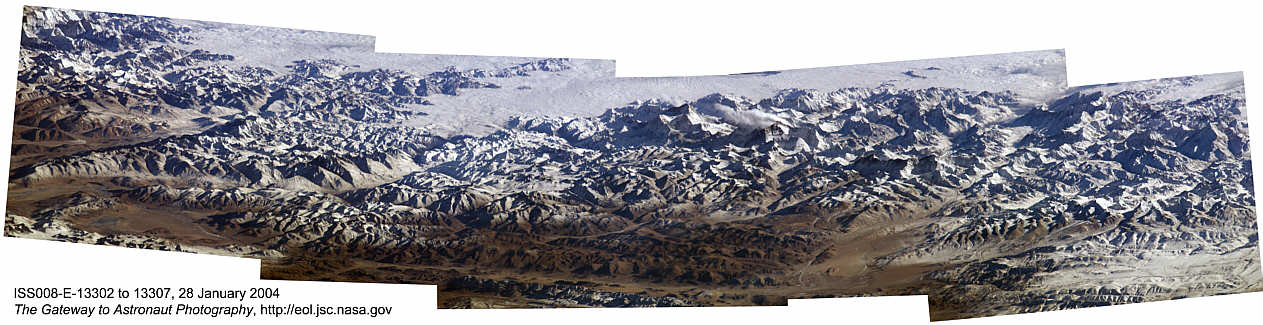
Himalaya Mosaik.jpg - Gildemax

Mount-Imeon.PNG - Apcbg
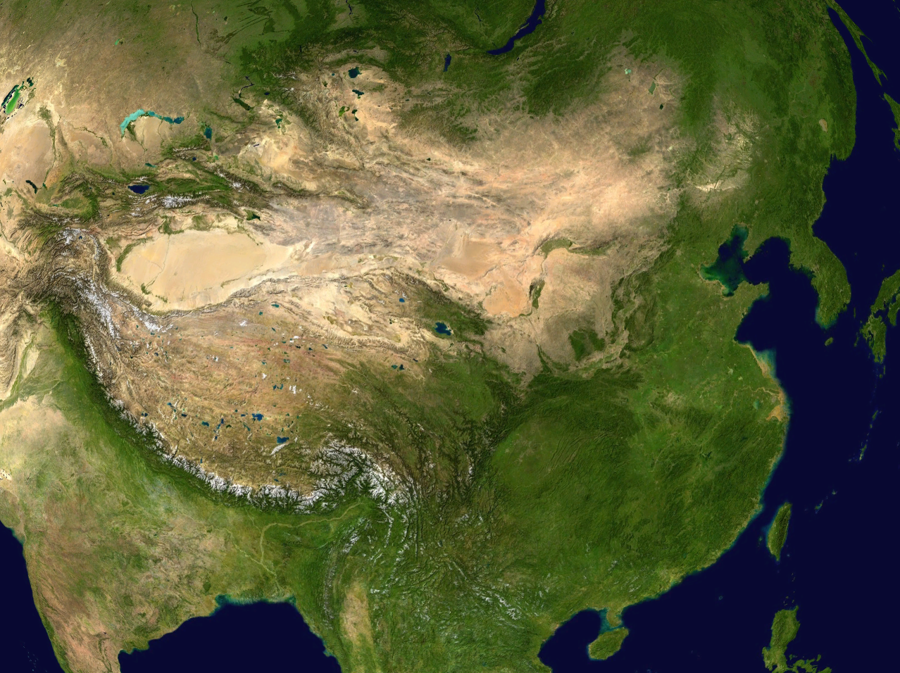
China satellite.png - Joowwww

EverestMosaic.jpg - GeorgHH

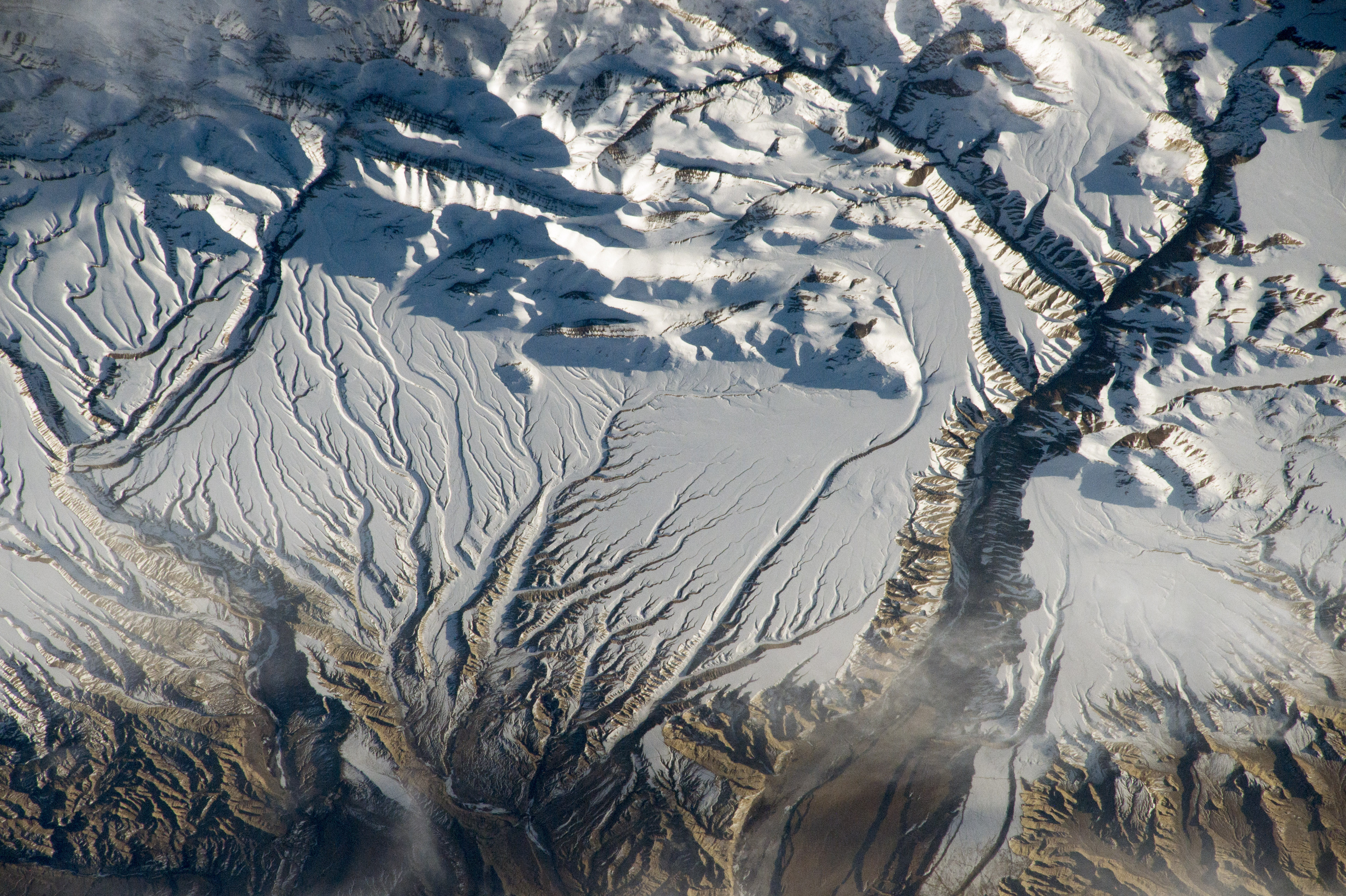
Himalayan Glacier, Southern China 2009-12-25.jpg - Captain-tucker

Himalayan Glacier, Southern China 2009-12-25. lrg.jpg - Captain-tucker

ASTER Views the Himalaya.jpg - Originalwana

STS-135 final flyaround of ISS 4.jpg - Leebrandoncremer

Haze along the Himalaya - NASA Earth Observatory.jpg - Dzlinker
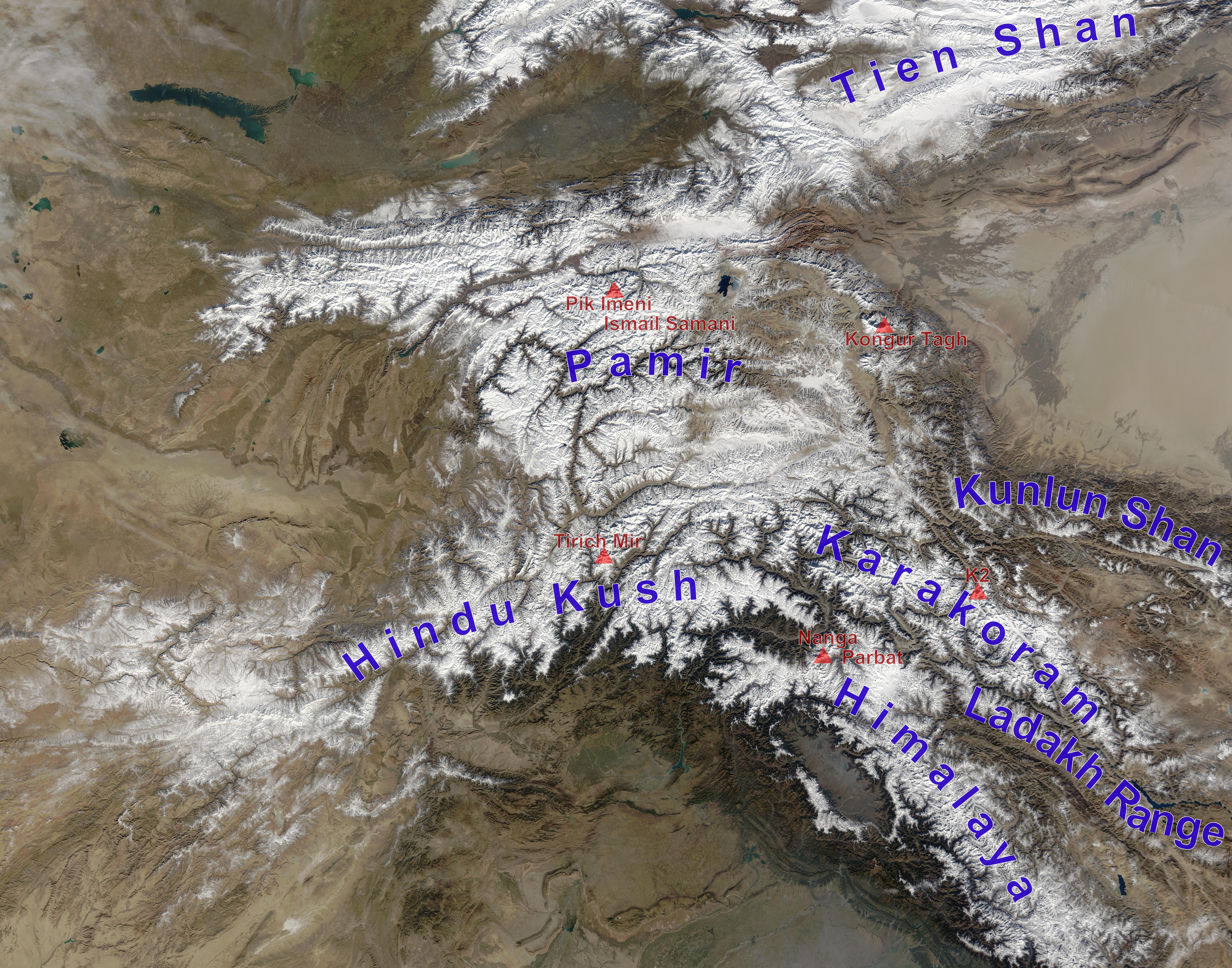
High Asia Mountain Ranges.jpg - Rupert Pupkin

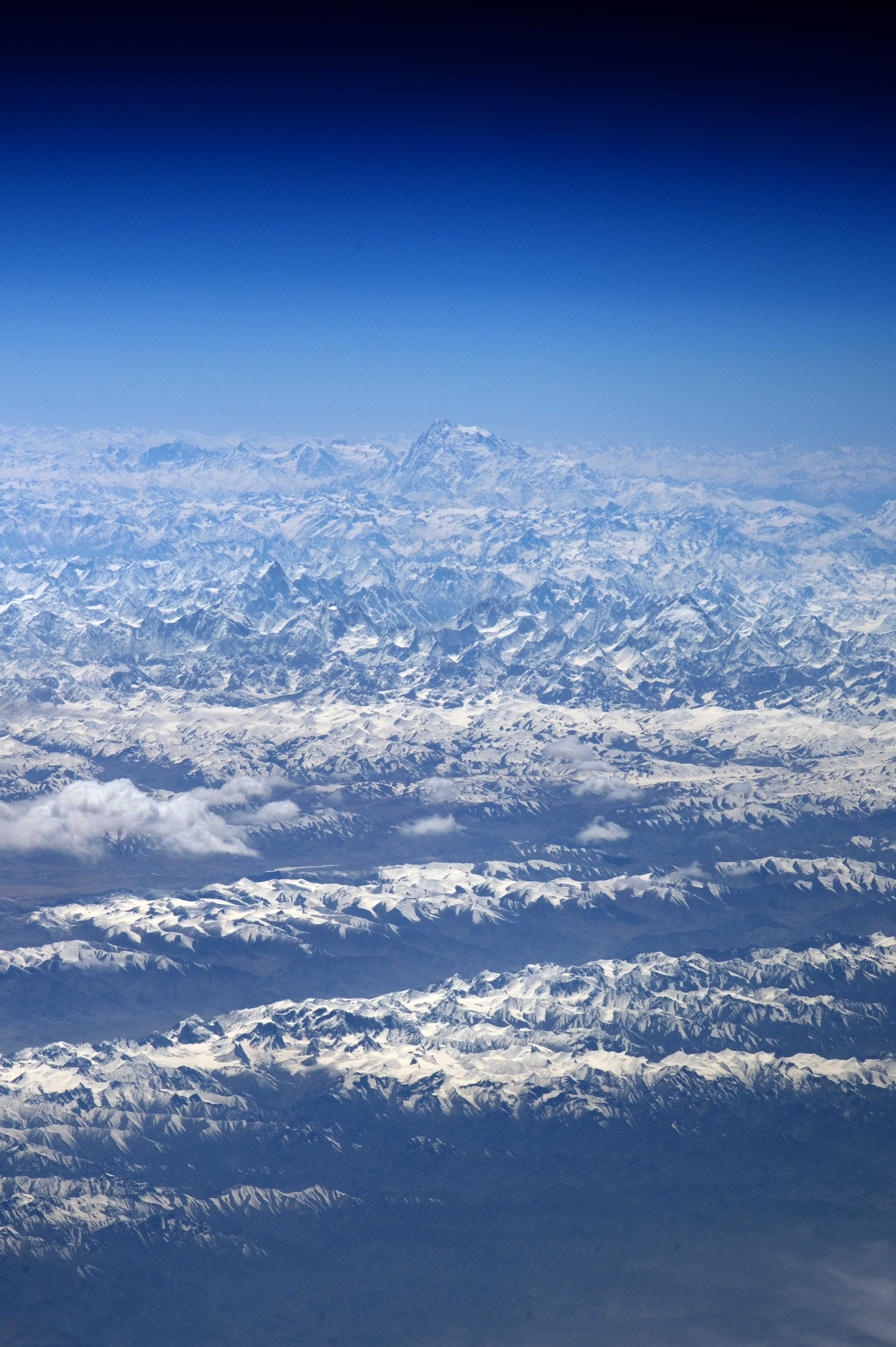
Himalayas from ISS.jpg - MGA73bot2

AS07-07-1748.jpg - Askeuhd

Himalayas with territorial boundaries.png - OgreBot

North Col of Mount Everest.jpg - NahidSultan

Hindu Kush and Karakoram peaks annotated (NASA satellite Terra MODIS).png - OgreBot

Himalayan foreland basin.png - Mikenorton
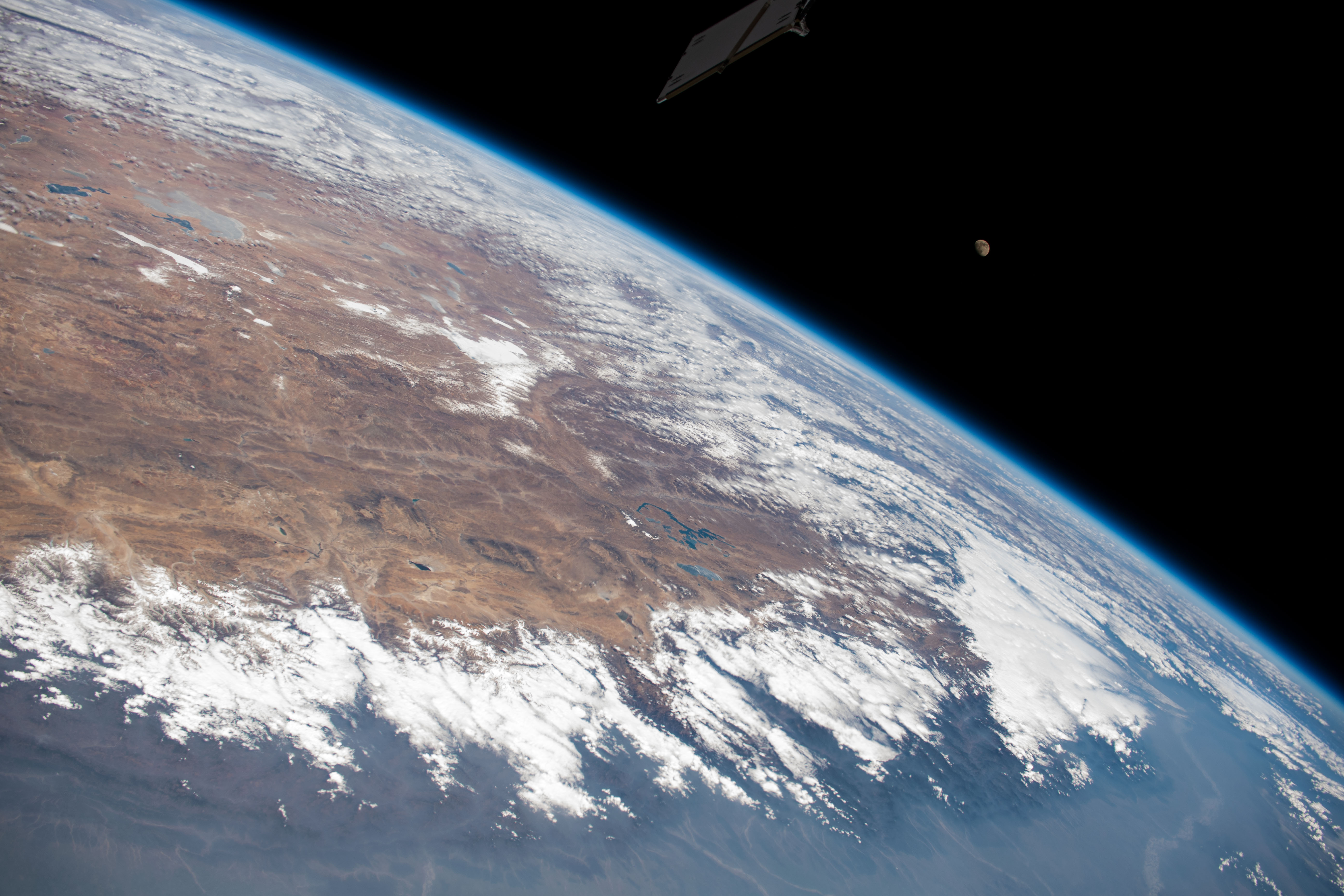
ISS-44 Himalayas.jpg - Ras67
ISS-43 Himalaya range near the China–India border.jpg - Ras67
ISS-47 Himalaya Mountains.jpg - Ras67

AS09-20-3173 (21750445008).jpg - Tm

Himalayas landsat 7.png - FastilyClone

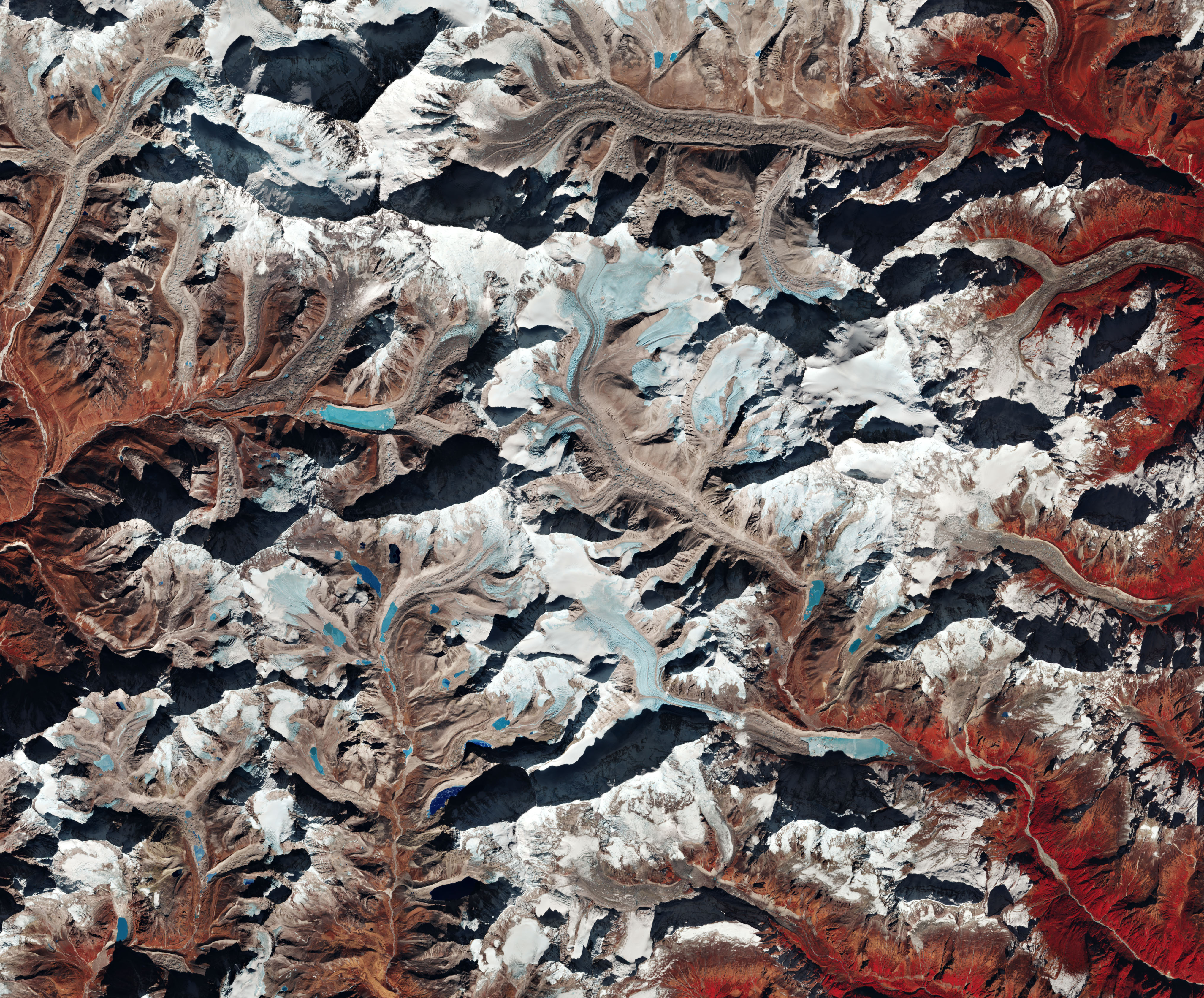
Himalayan Mountains - Envisat.jpg - Revent

Kathmandu, Nepal ESA367157.jpg - Yann

Tibet-PHOTO-Satellite--NASA-Moderate Resolution Imaging Spectroradiometer(MODIS) show the high, arid, Tibetan Plateau in Asia. Tibet lies north of the Himalaya Mountains in Nepal---Tibet.A2002343.0445.1km.jpg - A ri gi bod
Himalayan Mountains ESA231048.tiff - Fæ
Envisat's MERIS image over the Himalayas ESA226457.tiff - Fæ

Envisat's MERIS image over the Himalayas ESA226457.jpg - Fæ

Himalayas 2017 01 11 (32249124115).jpg - A1Cafel

ISS-53 Himalayan mountain range.jpg - Ras67

Himalayas (4404818798).jpg - OceanAtoll
Mount Makalu, Himalayas ESA395402.tiff - Fæ
Mount Makalu, Himalayas ESA395402.jpg - Fæ

ISS-57 Himalayan mountain range.jpg - Ras67

AS07-07-1748 - Apollo 7 - Apollo 7 Mission, India, Nepal, China - NARA - 16666155.jpg - US National Archives bot

Highestmtns.jpg - Afasmit

2020-10-14-00 00 2020-10-14-23 59 Sentinel-2 L2A 1 TRUE COLOR.jpg - Kroger4

S01-12-356 - STS-001 - Earth observations taken during STS-1 mission - DPLA - b2070721848c636aff76a4dc73e5e864.jpg - DPLA bot
ISS-64 India, the Himalayas and China.jpg - Ras67

ISS053-E-317703 - View of Nepal.jpg - StellarHalo

ISS031-E-67020 Himalayas.jpeg - StellarHalo

Himalayas Mountain Range & Mahalangur Himal, Nepal - Tibet (China) (34954655592).jpg - Sentinel user

ISS025-E-11518 - View of China.jpg - Askeuhd

L9 himalaya hyperwall rgb nolabels.jpg - Don-vip

Himalayas and allied ranges NASA Landsat showing the eight thousanders, annotated with major rivers.jpg - Fowler&fowler

ISS012-E-21748 - View of India.jpg - AskeBot

Iss068e044967.jpeg - OptimusPrimeBot

Iss068e047345.jpeg - OptimusPrimeBot

Iss068e047346.jpeg - OptimusPrimeBot
Iss068e051118.jpg - Lupe

Snow Across the Himalayas and Kunlun Mountains (MODIS).jpg - OptimusPrimeBot

Iss070e091714.jpg - OptimusPrimeBot

Iss070e097638.jpg - OptimusPrimeBot

Earth from Space- A veil of haze and smoke ESA25954650.jpg - OptimusPrimeBot
Earth from Space- A veil of haze and smoke ESA25954650.tiff - OptimusPrimeBot

Haze along the Himalayas (MODIS 2024-04-26).jpg - OptimusPrimeBot

Illustrating Climate Divisions- The Himalayas (NESDIS 2013-11-15).png - OptimusPrimeBot

NOAA-20 Shows Snowpack Within The Himalayas (NESDIS 2020-04-02).jpg - OptimusPrimeBot

The Himalayas separate China from a cloudy India (iss072e397138).jpg - OptimusPrimeBot

ISS030-E-27965 - View of China - Umbak Himal with Ama Drime and Nyonno Ri summits - Tibet (cropped).jpg - LudwigSebastianMicheler

ISS030-E-27843 - View of Earth - Tibet - Shigatse - Yarlung Zangbo - Umbak Himal - Kangchenjunga range - Sikkim - Chomolhari Range Himalayas - Bhutan valleys and mountains (cropped).jpg - LudwigSebastianMicheler

ISS066-E-86260 - View of China - Tibet - Rongbuk-Rongpu-Zhagga-Qu Valley - Gyaqung Qu valley - Gyachung Kang - zha ga qu (river) - Rongbuk Co (lake) - Hongxing Ri (cropped).jpg - LudwigSebastianMicheler

ISS061-E-148216 - View of Earth - Kharta Chu valley in Tibet - Tolakangboqie - Chomo Lonzo - Kangchungtse - Makalu - Peak 4 (Himalayas) - Chamlang - Sherson-Yaupa-Saldim and some mountains of Nepal in a sea of clouds (cropped).jpg - LudwigSebastianMicheler

ISS066-E-86246 - View of China - Mountain Tolakangboqie - Kharta Chu valley in Tibet - Tangse Co and Gongli Co glacier lakes in Mahalangur Himal (cropped).jpg - LudwigSebastianMicheler

ISS061-E-148212 - View of China - Tibet - Umbak Himal - Tingri County - river Bum Chu - Zhagga Chu - Rongbuk - Lake Tingmo Tso - Kharta Chu - Tolakangboqie - Nyonno Ri - Dinggyê - Yairu Zangbo River - Lhagoi Kangri (cropped).jpg - LudwigSebastianMicheler

ISS008-E-6149 - View of Earth - Peak 4, Mahalangur Himal, Chomo Lonzo, the 2 Pethangtse peaks, Lhote, Kharta Chu Valley and a view to mountain Tolakangboqie from above of Makalu (cropped).jpg - LudwigSebastianMicheler

ISS008-E-6146 - View of China - Chomo Lonzo - Makalu massif - shadows of mountains in a sea of clouds - Sherson - Peak 4 (Mahalangur Himal) from above (cropped).jpg - LudwigSebastianMicheler

ISS066-E-86246 - View of Earth - Himalayas - Saldim - Yaupa - Sherson from above - Labeilang Glacier - Makalu Massif (cropped).jpg - LudwigSebastianMicheler

ISS008-E-6146 - View of China - Summits of mountains Tolakangboqie, Lasaqie and Chomo Lonzo above of a sea of clouds - Karma Chu Valley - Kharta Chu valley in Tibet (cropped).jpg - LudwigSebastianMicheler

ISS064-E-12596 - View of China - Gurla Mandhata - lake Lhamoradi Co - Nalakankar - Namoradi Glacier - Namona'nyi Glacier - Gurla Chu - Gonalha - 6 glacier finger mountain - Ronggo Chu - Nankasya summits (cropped).jpg - LudwigSebastianMicheler

ISS061-E-145762 - View of Himalayas - Manaslu (Nepal) - Peri Himal - Annapurna Himal - Damodar Himal - Kali Gandaki Valley - Dhaulagiri Himal - Mustang Himal - Tibet (cropped).jpg - LudwigSebastianMicheler