Wikimedi'Òc
Modes d'emploi

Cet album fait partie des albums
Cet album photos contient les sous-albums suivants :


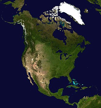


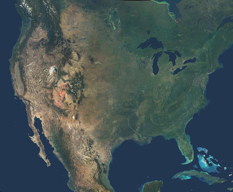
PIA04361; Natural Color Mosaic of North America PIA04361.jpg - Ficaia

North America (CIRA 2023-09-10 - june00).png - OptimusPrimeBot

North America (CIRA 2023-09-10 - september00).png - OptimusPrimeBot

North America (CIRA 2023-09-10).gif - OptimusPrimeBot
North America (CIRA 2023-09-10).webm - OptimusPrimeBot

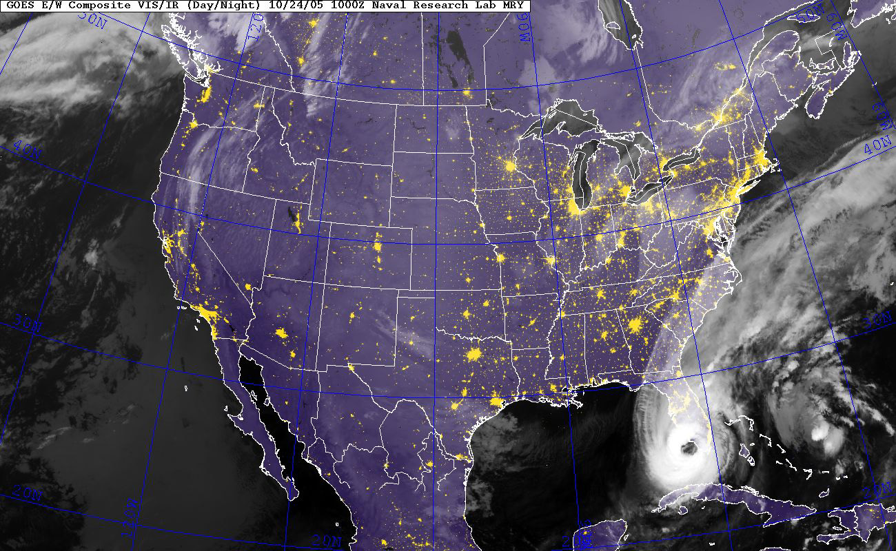
Atlantic Sept 24 2010 1445Z.jpg - Nino Marakot

North America Oct 27 2010 1745Z.jpg - Nino Marakot

North America 2011-02-04 GOES-13.jpg - Nino Marakot
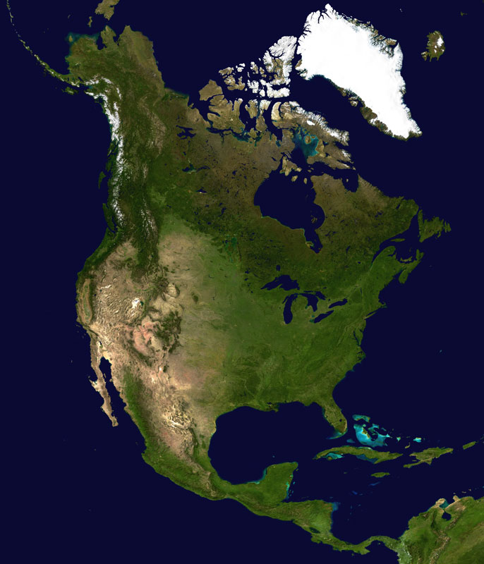
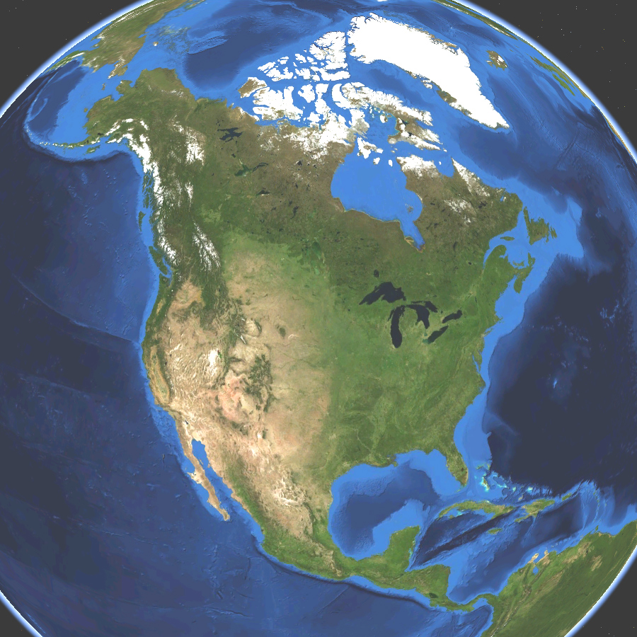
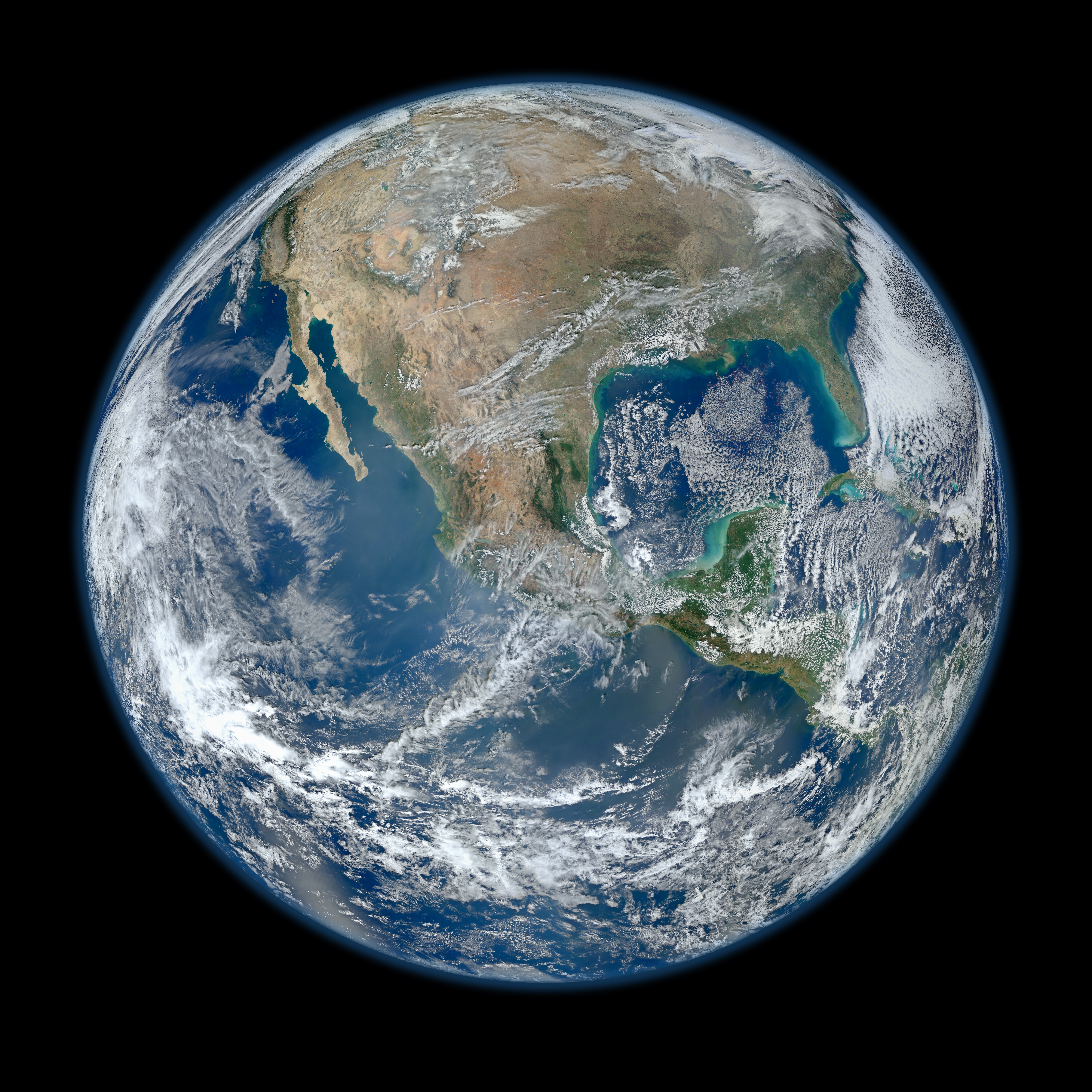
North America satellite globe.jpg - Kaldari

North America satellite orthographic.jpg - Ghalas

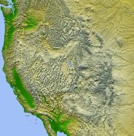
The Rocky Mountains.jpg - Rex
Northa America satellite globe 2.jpg - TOR

West Coast of North America satellite orthographic.jpg - NorCalHistory
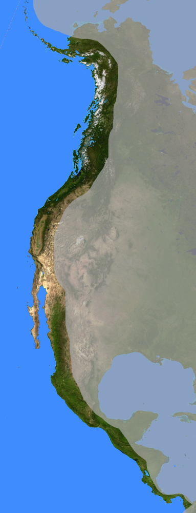
West Coast of North America satellite orthographic.png - NorCalHistory

1024px-Antichthon.jpg - Leonel Sohns
Amerikanisches Mittelmeer NASA World Wind Globe.jpg - ILA-boy

USA-satellite.jpg - Kaldari
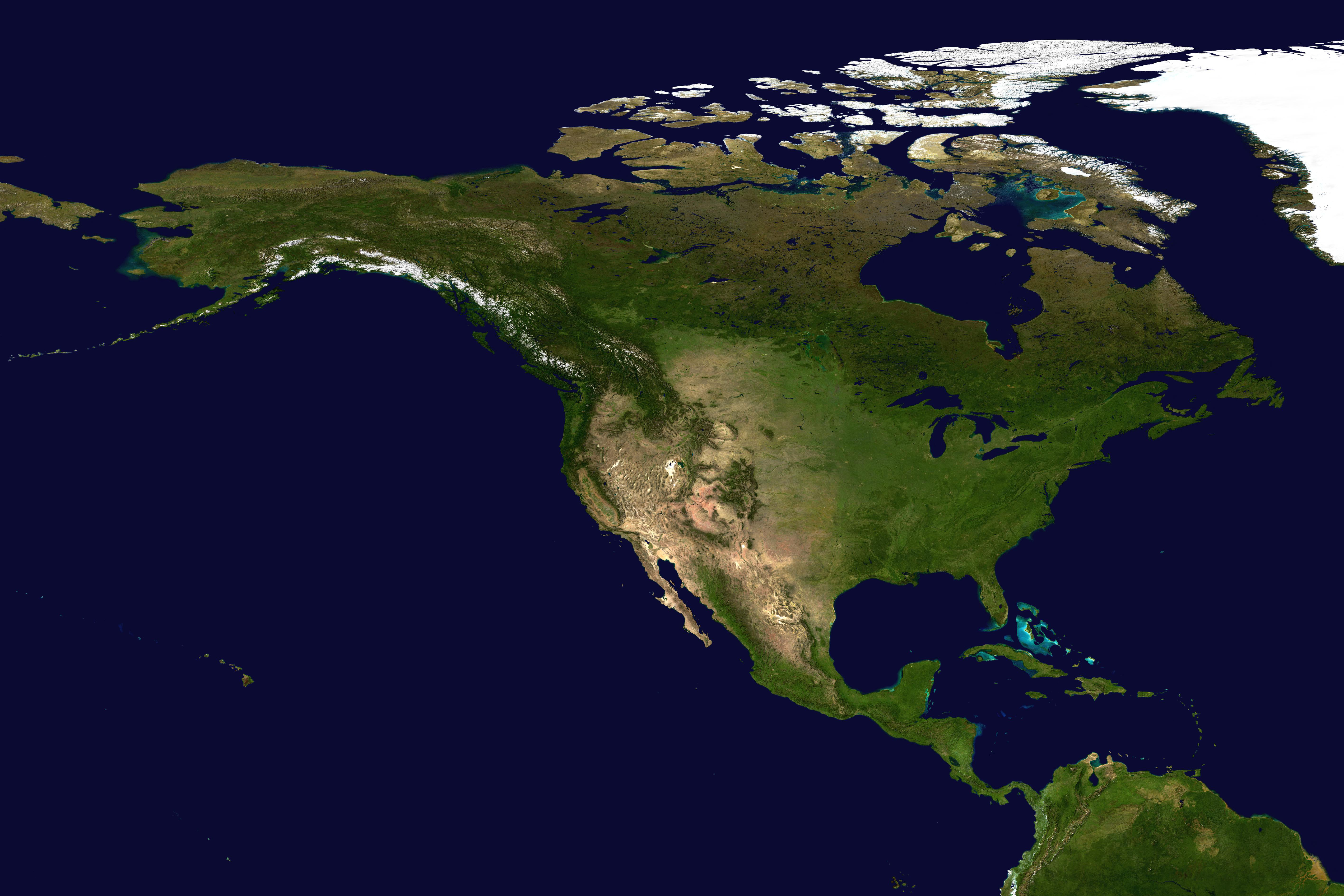
North America satellite.jpg - Koyos
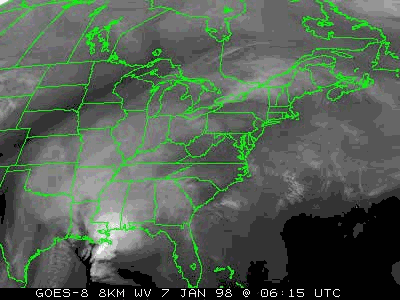
Boucle GOES8-1998-01 07-09.gif - Pierre cb

Ice storm Wv loop.gif - Pierre cb

Beardmore Relics (map).jpg - Brianann MacAmhlaidh

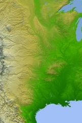
Noord-Amerika reliëf.jpg - Ghouston

US Navy 050922-N-0000X-001 GOES-12 Satellite infrared image provided by the U.S. Naval Research Laboratory, Monterey, Calif., showing the status of Hurricane Rita at 3-30 am EST.jpg - BotMultichillT

US Navy 050923-N-0000X-003 GOES-12 Satellite composite image provided by the U.S. Naval Research Laboratory, Monterey, Calif., showing the status of Hurricane Rita at 1-00 am EST.jpg - BotMultichillT
US Navy 051024-N-0000X-001 OES E-W Satellite composite image provided by the U.S. Naval Research Laboratory, Monterey, Calif., showing the status of Hurricane Wilma at 4-00 am EST.jpg - BotMultichillT
2009 Christmas Storm 12-24.jpg - HikingHurricane
Incendi.jpg - FaleBot

Earthobservatory Mexico.JPG - Penarc

Satellite Super Outbreak 1974-04-03 21 GMT.gif - Pierre cb

Hurricane Agatha GOES-17 30 May 2022.png - Mdnavman

Spac0585 - Flickr - NOAA Photo Library.jpg - Kobac

Spac0571 - Flickr - NOAA Photo Library.jpg - Kobac

Spac0575 - Flickr - NOAA Photo Library.jpg - Kobac
North America from low orbiting satellite Suomi NPP.jpg - Hellbus

Debby 12-06-24 overview.jpg - Marcusmax

Satellite Sees An Atlantic Triple Tropical Threat - Flickr - NASA Goddard Photo and Video.jpg - Werieth

Mundo Maya, Meso-America.png - Pgbk1987

N. Am. frm space.PNG - Chuck Marean
North America topic image Satellite image.jpg - Pbsouthwood

New England at night.jpg - Ktr101

NASA.EOS.79810.Suomi NPP night bakken.vir 2012317.jpg - A5b

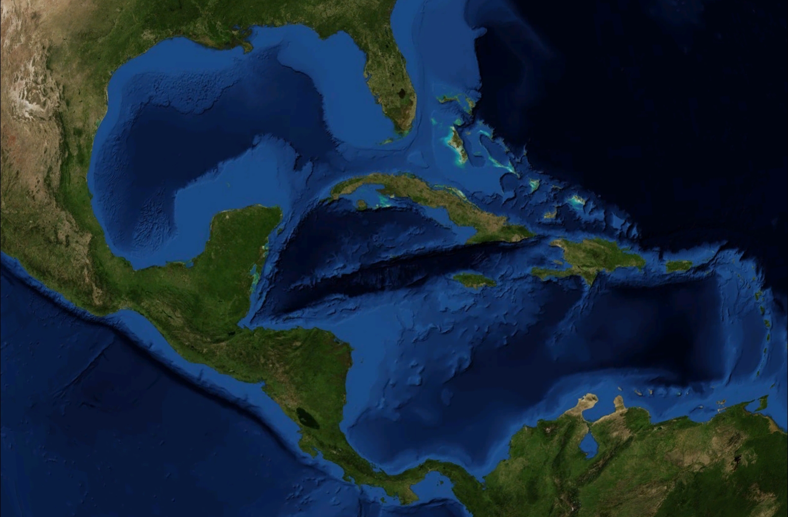
Caribbean satellite view.png - Globe Master - SideEffect

Caribbean satellite view 2.png - Globe Master - SideEffect

Hudson Bay from space.png - Globe Master - SideEffect

North America satellite globe Pacific Coast Ranges.jpg - Gemini1980

Mesoamerica satellite image.jpg - Merikanto
MAP.USA Relief middle.jpg - Andrew Dalby
MAP.USA Relief east.jpg - Andrew Dalby
MAP.USA Relief west.jpg - Andrew Dalby

A Satellite View of a Back-door Cold Front (14295309881).jpg - Vanished Account Byeznhpyxeuztibuo

Satellite View of Eastern US on Feb. 2, 2014 (12270676485).jpg - Vanished Account Byeznhpyxeuztibuo
NASA Satellite Gives a Clear View for NASA's LADEE Launch (9685915701).jpg - Vanished Account Byeznhpyxeuztibuo

Snow in the Rockies (6460593469).jpg - Vanished Account Byeznhpyxeuztibuo

Earthatnight.jpg - Zppix

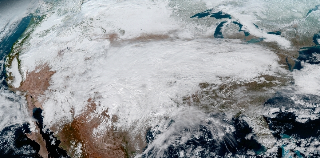
North American ice storm 2017-01-15.jpg - Huntster
North American ice storm 2017-01-15 (cropped).jpg - Master of Time

GOES 16 Full Western Hemisphere 20170115 1807.jpg - Recent contributor
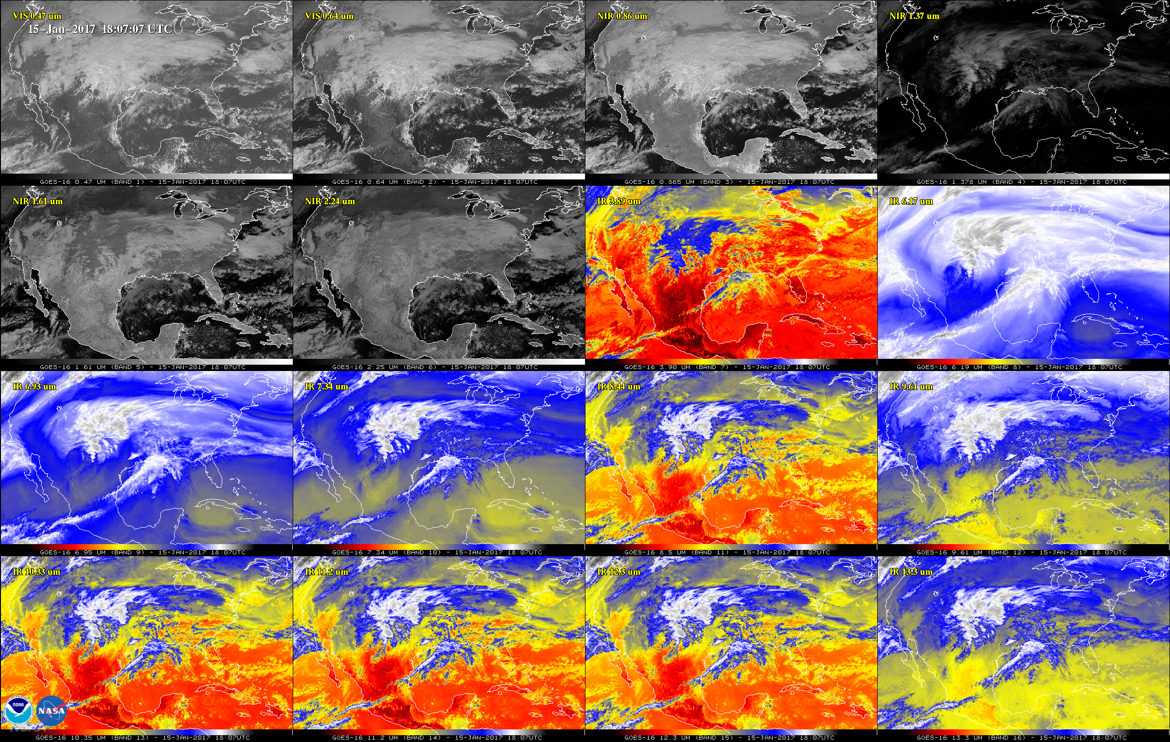
GOES 16 Advanced Baseline Imager multi-channel of North America 20170115 1807.png - Huntster

Great Lakes ESA357715.jpg - Fæ

Strong Extratropical Cyclone Over the US Midwest (5124467559).jpg - A1Cafel

Satellite Image of January 27th Snowstorm (5395334509).jpg - A1Cafel

Monster snowstorm hits Chicago (5410244219).jpg - A1Cafel

GOES-11 Sees Approaching Rainmaker to Add to Snowmelt on Columbia River (5754836133).jpg - A1Cafel

Mexicali 2017 03 12 (33296255591).jpg - A1Cafel

GOES East Coast View March 6, 2010 (4410346285).jpg - A1Cafel

GOES US East Coast View March 9, 2010 (4420032720).jpg - A1Cafel

North hemisphere on June 15, 2017.png - A1Cafel

GOES-17 Imagery from all 16 of the Advanced Baseline Imager's Channels (43904871081).gif - MarginalCost

GOES East Captures View of Vernal Equinox (47418902822).jpg - MarginalCost

Great Lakes Region Slammed By Severe Winter Storm (49305407947).jpg - MarginalCost

Two Large Winter Storms to Wallop Parts of the U.S.jpg - Wikicanada1127

Lake St Clair ESA21485544.jpeg - OptimusPrimeBot
Lake St Clair ESA21485544.tiff - OptimusPrimeBot

NASA's Wallops Flight Facility is located on Wallops Island. Satellite imagery from NOAA's GOES-East satellite shows that high pressure remains in control over the Mid-Atlantic region, providing an almost cloud-free sky.jpg - Eyes Roger

ISS047-E-96688 - View of Earth.jpg - Askeuhd

2021 JTWC 01E IR satellite imagery.jpg - Cewbot

GOES 16 1750z 2021-06-15.jpg - TheWxResearcher

Pointrobertswide oli 2020210.jpg - Matthiasb

Pointrobertszm oli 2020210.jpg - Matthiasb

Pointrobertswide oli 2020210 lrg.jpg - Matthiasb

GOES 16 2021-08-25 2010Z.jpg - TheWxResearcher

GOES 16 2021-10-18 1630Z.jpg - TheWxResearcher

GOES 16 2021-11-01 1440Z.jpg - TheWxResearcher

GOES Satellites 2021-11-06 1540Z.jpg - TheWxResearcher

DSCOVR 2021-09-26.png - TheWxResearcher

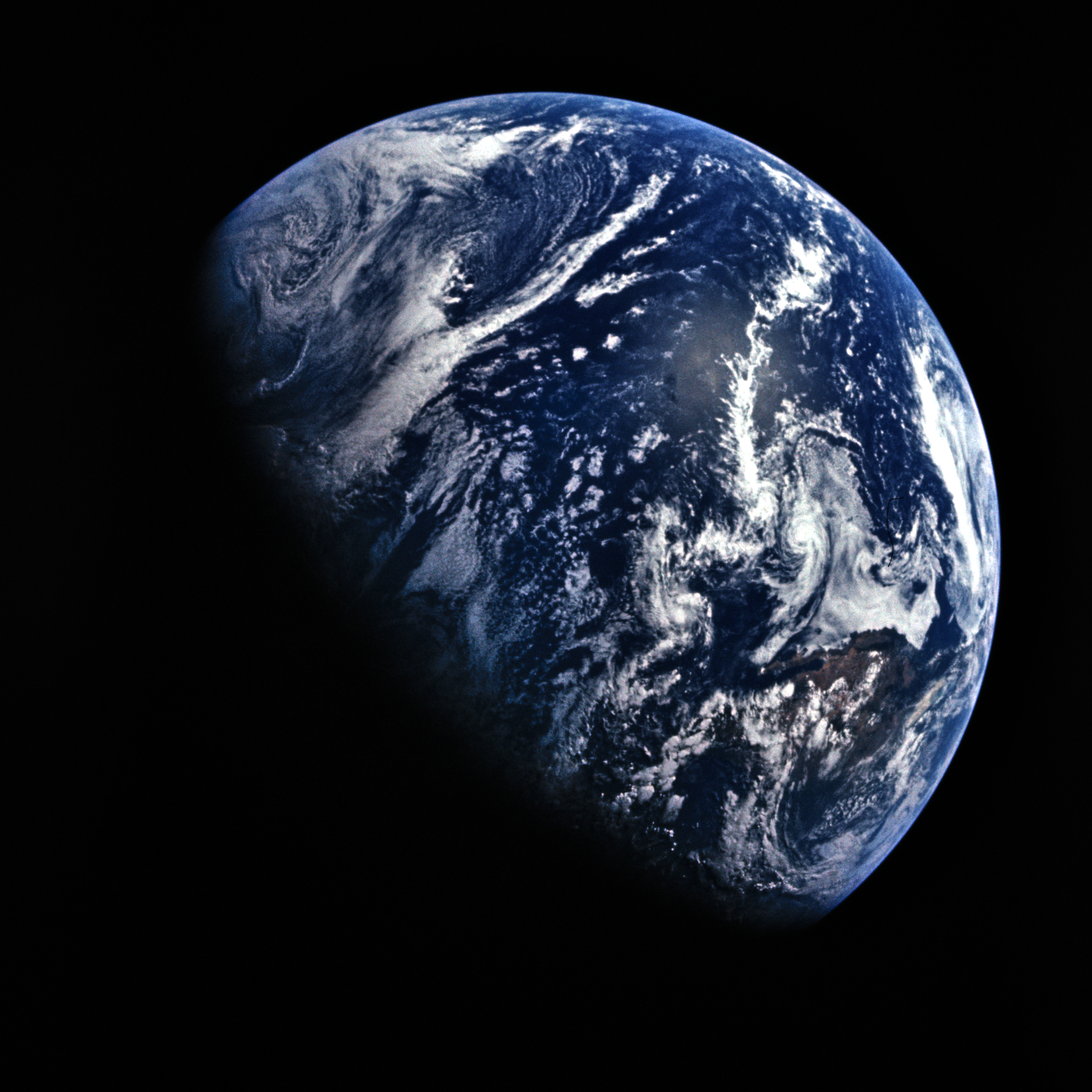
North America on April 16, 1972, cropped from AS16-118-18879.png - Ahecht

Lake Michigan and Jupiter on November 14, 1969, cropped from AS12-50-7325.png - Epiphyllumlover

North America on April 16, 1972, cropped from AS16-118-18878.png - Epiphyllumlover

North America on April 16, 1972, cropped from AS16-118-18880.png - Huntster
North America on July 26, 1971, cropped from AS15-91-12344.png - Epiphyllumlover

Canada–US heatwave (51283106611).jpg - Astromessier

Earth June Solstice 2022.jpg - TheWxResearcher

Earth on August 7, 2022.png - TheWxResearcher

Fiona, Gaston, Hermine and 09L on September 23, 2022.png - TheWxResearcher

GOES 16 2022-12-01 1600Z.jpg - TheWxResearcher

GOES 16 on August 21 2017.jpg - TheWxResearcher

Earth viewed by GOES-16 2023-03-11 1700Z.jpg - TheWxResearcher

Earth on April 21 2023.png - TheWxResearcher

Comparison of Earth and Moon size experiments 2.jpg - Artistosteles

Carbon monoxide from fires in Canada ESA24926246.jpg - OptimusPrimeBot

Unprecedented smoke cloud over the US West Coast and Pacific Ocean.jpg - OptimusPrimeBot

Intense snowfall gripped North America.jpg - OptimusPrimeBot

Idalia and Franklin 2023-08-29 1630Z.jpg - TheWxResearcher
Goes-16-ir-with--source-s-logo.png - Edits4019

Worldview Tour- Atmospheric Rivers (SVS5180 - Worldview AtmosphericRivers).png - OptimusPrimeBot
Image of San Francisco, CA from Umbra space radar.tif - MorphBoldo

Powerful Winter Storm Takes Aim at the Plains and Upper Midwest (NESDIS 2018-11-30).jpg - OptimusPrimeBot

Black Body Friday (NESDIS 2017-11-24).jpg - OptimusPrimeBot

Frontal system clouds extending through 30 degrees of longitude from southwest Texas through Florida to southeast of Cape Hatteras (2282-105).jpg - OptimusPrimeBot

GOES imagery (2282-104).jpg - OptimusPrimeBot

GOES image of North America with storm system over southern states and frontal system off the East Coast (2282-83).jpg - OptimusPrimeBot

GOES image of North America (2282-88).jpg - OptimusPrimeBot

GOES view of North America (2282-94).jpg - OptimusPrimeBot

GOES view of North America (2282-95).jpg - OptimusPrimeBot