Wikimedi'Òc
Modes d'emploi

Cet album fait partie des albums
Cet album photos contient les sous-albums suivants :


Santa Fe Trail marker in Coolidge, KS IMG 5820.JPG - Billy Hathorn

Santa Fe wagon trail ruts, Ford County, Kansas.png - Magicpiano
Santa Fe Trail, Kansas City, Mo LCCN2007662431.tif - Fæ

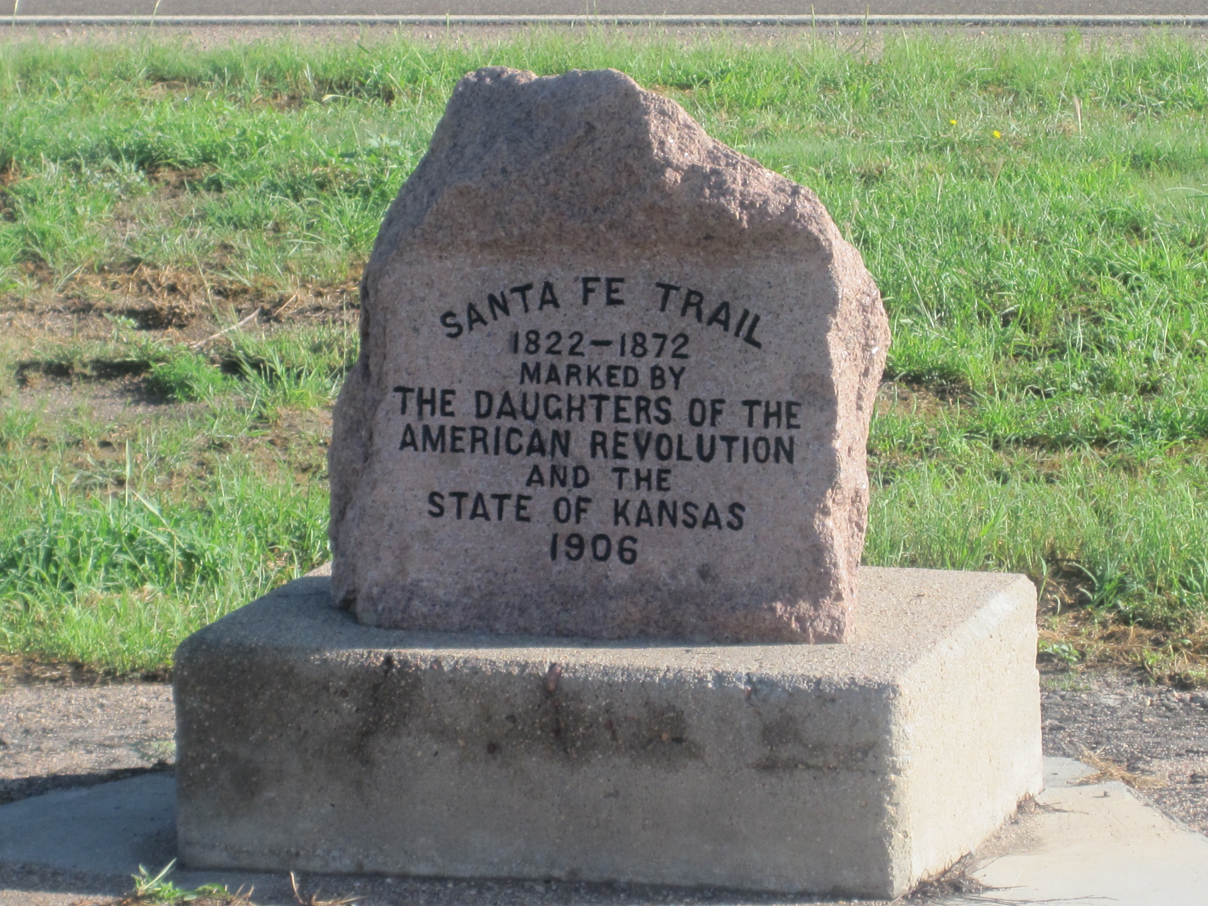
Ellinwood Santa Fe Trail Marker (DAR) P5310459.JPG - Chris Light

Ellinwood Santa Fe Trail Marker (DAR) P5310460.JPG - Chris Light

Ellinwood P5310458.JPG - Chris Light

Ellinwood Santa Fe Trail Marker (DAR) P5310461.JPG - Chris Light

Santa Fe Train passing through Ellsworth, Kansas, 1867. (Boston Public Library) (cropped).jpg - Monopoly31121993

Moving the Mail On the Santa Fe Trail (7222841226).jpg - Ser Amantio di Nicolao

Moving the Mail On the Santa Fe Trail (7222841158).jpg - Ser Amantio di Nicolao

Flying the Flag (7222841452).jpg - Ser Amantio di Nicolao

Info Kiosk P5310584 Gt Wagon Road.jpg - Chris Light

Info Kiosk P5310588 See and Do.jpg - Chris Light

Auto Tour Route Sign P5310425.jpg - Chris Light

Auto Tour Route Sign P5310426.jpg - Chris Light

18. Parting of the Trails - Gardner Jct. (U.S. 56 and 183rd Street, Gardner, KS) on the California, Oregon, and Santa Fe National Historic Trails (2004) (03830995-ac3f-46cc-b16a-13482d5971f0).jpg - BMacZeroBot

17. Lone Elm Campground (167th and Lone Elm, Olathe, KS) on the California, Oregon, and Santa Fe National Historic Trails (2003) (10f3d5cd-e263-4628-b8ab-b4cc72a148c6).jpg - BMacZeroBot

A Trail Trace and wheat fields in the distance at Fry's Ruts near Windom, KS (04287c9af445448eb2dc5b5f94e18ff9).JPG - BMacZeroBot

A birds eye view of an actual crossing at Rock Creek Crossing in Council Grove, KS (0fa36bc9f079474b9093539808106d06).JPG - BMacZeroBot

"People and the Land" wayside at Point of Rocks in Elkhart, Kansas (11ccaf3f5cb549eb91d363a0a02102f4).JPG - BMacZeroBot

"Santa Fe Trail Sites to the West" wayside in McPherson, Kansas (252590acef7b41ab8c392918402e4c9b).JPG - BMacZeroBot

A spring time view at rock Creek Crossing in Council Grove, KS (276f51d3ed604fd3bf509ae1fe4ee10c).JPG - BMacZeroBot

A boyscout marker at Swanson Swales in Rice County, KS (28f4be7ba8b54446903dcc2d2ba4a01f).JPG - BMacZeroBot

Hays House Restaurant sidewalk view in Council Grove, KS (2bacf37d3e934d0f9b21406b62ca0ff3).JPG - BMacZeroBot

A view from the creek bank at Rock Creek Crossing in Council Grove, KS (2edd7fd80c4a43a6a30a64b034e91057).JPG - BMacZeroBot

A woman takes a photo of a tree at Rock Creek Crossing in Council Grove, KS - 2 (2f3a674dbb6e4cef91e32377cfe1ebdc).JPG - BMacZeroBot

Scenic overlook at Point of Rocks in Elkhart, Kansas (3013f0bb889e42e2aa6a65ef64e3453a).JPG - BMacZeroBot

An overlook with views at Point of Rocks in Elkhart, Kansas (301625aa821c43ccb93316bbb04ab3d4).JPG - BMacZeroBot

Cottonwoods and yucca plants at Middle Spring Site near Elkhart, KS - 2 (30fb6fc8dc244648bc85d145da8d26f6).JPG - BMacZeroBot

Windmill and barbed wire displays development impact sin Elkhart, KS. (32a5e5756b8d48649176ed8efb7a6811).JPG - BMacZeroBot

A woman takes a photo of a tree at Rock Creek Crossing in Council Grove, KS - 3 (37105dd334f94908ab0631eb87691d1b).JPG - BMacZeroBot

A marker in a field at Fry's Ruts near Windom, KS - 2 (3751d95d9a974fc988ce2b9470413543).JPG - BMacZeroBot

A wayside and marker outside Seth Hays Home at Council Grove, KS 2 (37df44f6abf64fdbac3334a6f7984af7).JPG - BMacZeroBot

"Mountain Branch Trail Ruts" NTIR Sign near Fort Union National Monument (380d1aa59ba1476bb8e237948a83d1dc).JPG - BMacZeroBot

"Santa Fe Trail Sites to the East" wayside in McPherson, Kansas (4f7f7a9fb6b54dc3bb565e61ff5460db).JPG - BMacZeroBot

"Middle Spring" wayside beside trees at Cimarron National Grassland (509da04d2eab418b8305bf19c145122d).JPG - BMacZeroBot

"Indian Country" wayside at Point of Rocks in Elkhart, Kansas (619e823dc2504aa49d7f9181341e7d35).JPG - BMacZeroBot

A Trail Trace and wheat fields in the distance at Fry's Ruts near Windom, KS - 2 (6f7f618ab49547a6913fe28b81f52669).JPG - BMacZeroBot

A scraggly tree at Rock Creek Crossing in Council Grove, KS -2 (81f6b68b44874342a79f4c5ef5d59987).JPG - BMacZeroBot

A wayside and marker outside Seth Hays Home at Council Grove, KS (8b061cfc535e433e972bfcba1b7c3483).JPG - BMacZeroBot

A scraggly tree at Rock Creek Crossing in Council Grove, KS (8c9da8c4707140fea89ad4923d6b1756).JPG - BMacZeroBot

"Along the Santa Fe Trail" wayside in Morton County, Kansas (8f4d60a091a54c8f8ea65a1da84ac499).JPG - BMacZeroBot

"Along the Santa Fe Trail" wayside with views of the prairie in Morton County, Kansas (933185635f8a4c3da1627ffe9713f899).JPG - BMacZeroBot

Late spring, green grass at Lost Spring Site (9a8de3b3e36d407986e5ae323a121153).JPG - BMacZeroBot

Monument and Non-NTIR Sign at Six Mile Stage Station at Lost Springs, KS (a87860049b664174a2f93a4c6edbdd64).JPG - BMacZeroBot

A marker alonside ruts and swales at Swanson Swales in Rice County, KS (b2b0546dd5174d56949171e117022ada).JPG - BMacZeroBot

A Trail Trace at Fry's Ruts near Windom, KS (be03213c62c849afa2820b85ae3f742b).JPG - BMacZeroBot

Views of the prairie at Lost Spring Station in Kansas (c0e7e088e2854573878cd97ac4523a66).JPG - BMacZeroBot

"Murphy Wagons" wayside at Cimarron National Grassland (c489fc28b72147c0a8df81808b1bb32d).JPG - BMacZeroBot

"Conestoga Wagons" wayside at Cimarron National Grassland (c5ef346bdc944cd699b338063bb4b874).JPG - BMacZeroBot

A marker in a field at Fry's Ruts near Windom, KS (e1838a91d32f4d828e297585e6880f9f).JPG - BMacZeroBot

"Middle Spring" wayside at Middle Spring Site - 2 (e756d07a3c0d4a25a245c6de81b5ce3e).JPG - BMacZeroBot

"Middle Spring" wayside at Middle Spring Site - 2 (e78ac56153e74484a0a7efeecc3841db).JPG - BMacZeroBot

Deep ruts and swales in a green grass pasture at Swanson Swales in Rice County, KS (f172ef326c4247b78adbbc59acf171b6).JPG - BMacZeroBot

Very wide ruts and swales covered in green grass at Swanson Swales in Rice County, KS (f618016d1cdb434980841d5cfcbdc93b).JPG - BMacZeroBot

Ruts and swales at French Franks Trail Segment (f89c5072c3654b0aa8b41ce8cc0f6504).JPG - BMacZeroBot

Marker and NTIR Staff standing beside vehicle at Six Mile Stage Station at Lost Springs, KS (fa42e76df794475c8ded69de8687be5a).JPG - BMacZeroBot

Marker and NTIR Staff at Six Mile Stage Station at Lost Springs, KS (ff2101b52da84d04ac1163a9284c122a).JPG - BMacZeroBot

Green prairie grass at French Franks Trail Segment (ff901936a16b40acbe697e2d43c9ddf1).JPG - BMacZeroBot

A scraggly tree at Rock Creek Crossing in Council Grove, KS - 3 (ebb98228ac76420da7501baa077174f8).JPG - BMacZeroBot

Brooklyn Townsite.jpg - Bhall87

Santa Fe Trail park marker 1.jpg - Jcushman1998

Santa Fe trail marker 2.jpg - Jcushman1998

Fort Laramie Treaty, 1851. Indian territories, Like A Fishhook Village, Oregon Trail and Santa Fe Trail.png - Indianertosset

Santa Fe Trail marker.jpg - Helper20203456

Santa fe trail marker 2.jpg - Helper20203456

Map of Santa Fe Trail (Cimarron Route) and the home country of the Kiowa.png - Indianertosset

Cottonwoood Crossing, Marion County, Kansas (f4b705f9-155d-451f-6776-88201eaaf760).JPG - BMacZeroBot

Gardner Junction Park, near Kansas City, Kansas (f4ca547f-155d-451f-67fa-5e7a2f6ac26f).JPG - BMacZeroBot
Dodge City Ruts near Dodge City, Kansas (f5b00ee1-155d-451f-6787-8e62dd059859).jpg - BMacZeroBot