Wikimedi'Òc
Modes d'emploi

Cet album fait partie des albums
Cet album photos contient les sous-albums suivants :


Moving Sheep from Field to Field - geograph.org.uk - 7423084.jpg - GeographBot

Hadrian's Wall Footpath Rerouted - geograph.org.uk - 7424188.jpg - GeographBot

Hadrian's Wall Footpath through part of Stanley Wood - geograph.org.uk - 7424190.jpg - GeographBot

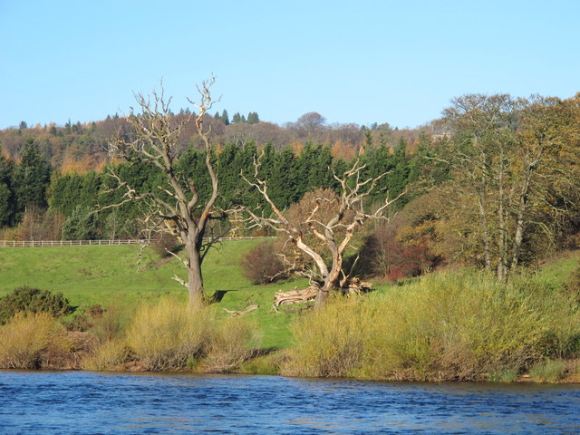
Storm Arwen Tree Damage - geograph.org.uk - 7424191.jpg - GeographBot

OS bench mark on a stone in Sandhoe - geograph.org.uk - 1297225.jpg - File Upload Bot (Magnus Manske)

Beaufront Castle, near Sandhoe - geograph.org.uk - 82736.jpg - GeographBot

Field, A69 and Red House Plantation, Corbridge - geograph.org.uk - 83154.jpg - GeographBot

Cross roads near Fern Hill Farm - geograph.org.uk - 229779.jpg - GeographBot

Beaufront County First School - geograph.org.uk - 243330.jpg - GeographBot

River Tyne west of Corbridge - geograph.org.uk - 248420.jpg - GeographBot

Cottages in Sandhoe - geograph.org.uk - 253521.jpg - GeographBot

Stagshaw High House - geograph.org.uk - 253291.jpg - GeographBot

Stanley Cottages - geograph.org.uk - 253843.jpg - GeographBot

River Tyne East of Hexham - geograph.org.uk - 264039.jpg - GeographBot

River Tyne at Widehaugh. - geograph.org.uk - 264048.jpg - GeographBot

Widehaugh Nursery - geograph.org.uk - 264057.jpg - GeographBot

Acomb Fell Farm - geograph.org.uk - 273436.jpg - GeographBot

Acomb Fell Farm - geograph.org.uk - 273438.jpg - GeographBot

Acomb Fell Farm - sign at entrance to farm track - geograph.org.uk - 274219.jpg - GeographBot

Fern Hill Farm - geograph.org.uk - 274205.jpg - GeographBot

Fern Hill Farm - geograph.org.uk - 274207.jpg - GeographBot

Byway near Keepwick Farm - geograph.org.uk - 417744.jpg - GeographBot

Byway near Keepwick Farm - geograph.org.uk - 417757.jpg - GeographBot

Old quarry near Keepwick Fell - geograph.org.uk - 417792.jpg - GeographBot

Old quarry next to Keepwick Fell - geograph.org.uk - 417785.jpg - GeographBot

Trees near Keepwick Farm - geograph.org.uk - 417773.jpg - GeographBot

Victorian postbox near Sandhoe Hall - geograph.org.uk - 494562.jpg - GeographBot

Gated road near Written Crag - geograph.org.uk - 528694.jpg - GeographBot

Minor road and woodland near Hill head - geograph.org.uk - 528699.jpg - GeographBot

Pastures near Fallowfield, and Square Wood - geograph.org.uk - 528688.jpg - GeographBot

Disused quarry near Keepwith Fell - geograph.org.uk - 541583.jpg - GeographBot

Rough pastures east of Keepwith Fell - geograph.org.uk - 541580.jpg - GeographBot

Rough pastures east of Keepwith Fell - geograph.org.uk - 541586.jpg - GeographBot

Rough pastures near Keepwith Fell - geograph.org.uk - 540937.jpg - GeographBot

The Errington Arms, Stagshaw - geograph.org.uk - 578926.jpg - GeographBot

Leaning trees - geograph.org.uk - 612825.jpg - GeographBot

Pasture below the ruin - geograph.org.uk - 613026.jpg - GeographBot

Pastures above Errington (3) - geograph.org.uk - 613022.jpg - GeographBot

Pastures above Errington (4) - geograph.org.uk - 613034.jpg - GeographBot

Pastures above Errington - geograph.org.uk - 613017.jpg - GeographBot

Pastures near Errington Hill Head (2) - geograph.org.uk - 613032.jpg - GeographBot

Pastures near Errington Hill Head - geograph.org.uk - 613029.jpg - GeographBot

Ruin - geograph.org.uk - 613030.jpg - GeographBot

Farmland near Errington - geograph.org.uk - 627382.jpg - GeographBot

Country road from Sandhoe to Fawcett - geograph.org.uk - 935605.jpg - GeographBot

Crossroads at Fawcett Hill - geograph.org.uk - 935597.jpg - GeographBot

Ploughed field below Beaufront Castle - geograph.org.uk - 935590.jpg - GeographBot

The path from Beaufront Castle to Anick - geograph.org.uk - 935591.jpg - GeographBot

Wall and house at Sandhoe - geograph.org.uk - 935593.jpg - GeographBot

Woodyard at Beaufront - geograph.org.uk - 935594.jpg - GeographBot

Devastated crop near Stagshaw - geograph.org.uk - 955323.jpg - GeographBot

Field above Stagshaw - geograph.org.uk - 955329.jpg - GeographBot

Mount Pleasant, Sandhoe - geograph.org.uk - 955315.jpg - GeographBot

Farmland and woodland north of Black Hill (2) - geograph.org.uk - 1289524.jpg - GeographBot

Farmland and woodland north of Black Hill - geograph.org.uk - 1289522.jpg - GeographBot

Farmland east of Fern Hill Farm (2) - geograph.org.uk - 1289516.jpg - GeographBot

Pastures and woodland near Fawcet Hill - geograph.org.uk - 1289485.jpg - GeographBot

Pastures east of Fern Hill Farm (3) - geograph.org.uk - 1289495.jpg - GeographBot

Pastures east of Fern Hill Farm (4) - geograph.org.uk - 1289508.jpg - GeographBot

A door in a wall - geograph.org.uk - 1297229.jpg - GeographBot

Another door in a wall - geograph.org.uk - 1297269.jpg - GeographBot

Cultivation terraces southwest of Holly Hall (2) - geograph.org.uk - 1297353.jpg - GeographBot

Cultivation terraces southwest of Holly Hall - geograph.org.uk - 1297302.jpg - GeographBot

Farmland and woodland east of Sandoe - geograph.org.uk - 1297327.jpg - GeographBot

Farmland and woodland near Beaufront Hill Head (2) - geograph.org.uk - 1297198.jpg - GeographBot

Farmland and woodland near Beaufront Hill Head - geograph.org.uk - 1297190.jpg - GeographBot

Farmland and woods west of Black Hill - geograph.org.uk - 1297106.jpg - GeographBot

House in Sandoe - geograph.org.uk - 1297214.jpg - GeographBot

Minor road in Sandoe - geograph.org.uk - 1297236.jpg - GeographBot

Minor road in Sandoe - geograph.org.uk - 1297250.jpg - GeographBot

Minor road north of Sandoe Hall - geograph.org.uk - 1297208.jpg - GeographBot

Mount Pleasant, near Sandoe - geograph.org.uk - 1297287.jpg - GeographBot

Old building in Sandoe - geograph.org.uk - 1297277.jpg - GeographBot

The entrance to Sandoe Hall - geograph.org.uk - 1297306.jpg - GeographBot

(Slightly blocked) track south of the minor road west of Portgate Farm - geograph.org.uk - 1308680.jpg - GeographBot

Fawcett Hill Cottage - geograph.org.uk - 1308710.jpg - GeographBot

Marshy land (and pheasant) west of Stagshaw High House - geograph.org.uk - 1308705.jpg - GeographBot

Marshy pastures west of Stagshaw High House - geograph.org.uk - 1308692.jpg - GeographBot

Minor road east of Fawcett Hill Cottage (2) - geograph.org.uk - 1308708.jpg - GeographBot

Minor road east of Fawcett Hill Cottage - geograph.org.uk - 1308699.jpg - GeographBot

Minor road southwest of Fawcett Hill Cottage - geograph.org.uk - 1308718.jpg - GeographBot

Pastures and woodland near Fawcett Hill - geograph.org.uk - 1308687.jpg - GeographBot

Track north of the minor road west of Portgate Farm - geograph.org.uk - 1308676.jpg - GeographBot

Derelict farm buildings near Wall Fell Farm (2) - geograph.org.uk - 1387461.jpg - GeographBot

Pastures south of the Stanley Plantation (2) - geograph.org.uk - 1387437.jpg - GeographBot

Pastures south of the Stanley Plantation (3) - geograph.org.uk - 1387439.jpg - GeographBot

Pastures south of the Stanley Plantation (4) - geograph.org.uk - 1387442.jpg - GeographBot

Pastures south of the Stanley Plantation - geograph.org.uk - 1387434.jpg - GeographBot

Pastures west of the Stanley Plantation - geograph.org.uk - 1387408.jpg - GeographBot

Track and pastures south of the Stanley Plantation - geograph.org.uk - 1387444.jpg - GeographBot

Track and pastures west of the Stanley Plantation - geograph.org.uk - 1387387.jpg - GeographBot

Track west of the Stanley Plantation - geograph.org.uk - 1387451.jpg - GeographBot

Byway near Stanley Plantation - geograph.org.uk - 1557314.jpg - GeographBot

Tyne valley - geograph.org.uk - 1737172.jpg - GeographBot

Farmland east of Anick - geograph.org.uk - 2144325.jpg - GeographBot

Beaufront Castle - geograph.org.uk - 2144341.jpg - GeographBot

Farmland east of Anick Grange - geograph.org.uk - 2155281.jpg - GeographBot

Farmland east of Anick Grange (2) - geograph.org.uk - 2155286.jpg - GeographBot

Farmland east of Anick Grange (3) - geograph.org.uk - 2155289.jpg - GeographBot

Farmland east of Anick Grange (4) - geograph.org.uk - 2155297.jpg - GeographBot

Farmland east of Anick Grange (5) - geograph.org.uk - 2155300.jpg - GeographBot

Farmland east of Anick Grange (6) - geograph.org.uk - 2155306.jpg - GeographBot

Farmland below Beaufront Castle - geograph.org.uk - 2155309.jpg - GeographBot

Farmland below Beaufront Castle (2) - geograph.org.uk - 2155315.jpg - GeographBot

Lane near Beaufront Castle - geograph.org.uk - 2155318.jpg - GeographBot

Farmland (and pheasants) west of Beaufront Castle - geograph.org.uk - 2155325.jpg - GeographBot

Farmland west of Beaufront Castle - geograph.org.uk - 2155330.jpg - GeographBot

The Tyne Valley below Beaufront Castle - geograph.org.uk - 2155337.jpg - GeographBot

The River Tyne west of Wide Haugh - geograph.org.uk - 2161438.jpg - GeographBot

Lodge and gates near Sandhoe - geograph.org.uk - 2202084.jpg - GeographBot

Beaufront Castle - geograph.org.uk - 2205459.jpg - GeographBot

The River Tyne west of Wide Haugh (2) - geograph.org.uk - 2205464.jpg - GeographBot

Beaufront Castle - geograph.org.uk - 2205548.jpg - GeographBot

The River Tyne southeast of Anick Grange - geograph.org.uk - 2205555.jpg - GeographBot

The River Tyne southeast of Anick Grange (2) - geograph.org.uk - 2205574.jpg - GeographBot

Bend in the River Tyne below Beaufront Castle (2) - geograph.org.uk - 2205643.jpg - GeographBot

Land between the River Tyne and the flood barrier on the north of Wide Haugh - geograph.org.uk - 2205680.jpg - GeographBot

Rapids on the River Tyne west of Prior Thorns - geograph.org.uk - 2205694.jpg - GeographBot

The River Tyne west of Prior Thorns - geograph.org.uk - 2205727.jpg - GeographBot

The River Tyne at Prior Thorns - geograph.org.uk - 2206319.jpg - GeographBot

The River Tyne west of Prior Thorns (2) - geograph.org.uk - 2206558.jpg - GeographBot
Dead trees on the north bank of the River Tyne - geograph.org.uk - 2206567.jpg - GeographBot

The River Tyne at Prior Thorns (3) - geograph.org.uk - 2206586.jpg - GeographBot

The River Tyne below Beaufront Castle - geograph.org.uk - 2206648.jpg - GeographBot

The River Tyne below Sandoe Hall - geograph.org.uk - 2206654.jpg - GeographBot

The River Tyne below Beaufront Castle - geograph.org.uk - 2206677.jpg - GeographBot

The River Tyne west of Wide Haugh - geograph.org.uk - 2206688.jpg - GeographBot

Gateway, Sandhoe - geograph.org.uk - 2208516.jpg - GeographBot

Farmland near Sandhoe (1) - geograph.org.uk - 2208519.jpg - GeographBot

Farmland near Sandhoe (2) - geograph.org.uk - 2208522.jpg - GeographBot

Silhouettes in the evening sun - geograph.org.uk - 2218886.jpg - GeographBot

New growth - geograph.org.uk - 2218893.jpg - GeographBot

Skies over Northumberland on a cold winter's day - geograph.org.uk - 2218903.jpg - GeographBot

Country road in winter - geograph.org.uk - 2219252.jpg - GeographBot

Winter sunshine at Fawcett Hill - geograph.org.uk - 2219253.jpg - GeographBot

Pylon at Fawcett Hill - geograph.org.uk - 2219254.jpg - GeographBot

Fields near Fawcett Hill - geograph.org.uk - 2219255.jpg - GeographBot

Gated road near Portgate - geograph.org.uk - 2219256.jpg - GeographBot

Former lodge near Sandhoe - geograph.org.uk - 2379229.jpg - GeographBot

Common, Stagshaw - geograph.org.uk - 2633807.jpg - GeographBot

Sawdust hill at Egger's Factory, Hexham - geograph.org.uk - 2658336.jpg - GeographBot

Bank Foot - geograph.org.uk - 2659533.jpg - GeographBot

A69 approaching the Hexham roundabout - geograph.org.uk - 2659547.jpg - GeographBot

Track to Anick Farm and footpath to Hexham - geograph.org.uk - 2659599.jpg - GeographBot

Oakwood - geograph.org.uk - 2659716.jpg - GeographBot

Bank Cottage near East Park - geograph.org.uk - 2660674.jpg - GeographBot

Central reservation on A69 east of Hexham roundabout - geograph.org.uk - 2660684.jpg - GeographBot

Harling's Garden Centre, Bridge End - geograph.org.uk - 2660693.jpg - GeographBot

Beaufront Business Park, Ferry Road, Bridge End - geograph.org.uk - 2660704.jpg - GeographBot

Cottage on the A68 at Stagshaw - geograph.org.uk - 2710292.jpg - GeographBot

A68 main road at Stagshaw Bank - geograph.org.uk - 2710363.jpg - GeographBot

Stagshaw Bank - geograph.org.uk - 2710414.jpg - GeographBot

Stagshaw High House from Stagshaw Bank - geograph.org.uk - 2710445.jpg - GeographBot

Stagshaw Bank south of Portgate - geograph.org.uk - 2710463.jpg - GeographBot

Electricity pylons near Stagshawbank Burn - geograph.org.uk - 2710475.jpg - GeographBot

Pond on Stagshawbank Burn south of Portgate - geograph.org.uk - 2710485.jpg - GeographBot

Holly Hall - geograph.org.uk - 2741436.jpg - GeographBot

Sandhoe - geograph.org.uk - 2741987.jpg - GeographBot

Highwood Hotts - geograph.org.uk - 2741988.jpg - GeographBot

Black Hill - geograph.org.uk - 2741994.jpg - GeographBot

Beaufront Hill Head - geograph.org.uk - 2742043.jpg - GeographBot

Heading towards Turret 23B - geograph.org.uk - 2891988.jpg - GeographBot

Walking towards Stanley Plantation - geograph.org.uk - 2891994.jpg - GeographBot

Entering Stanley Plantation - geograph.org.uk - 2891999.jpg - GeographBot

Stanley Plantation near Turret 23B - geograph.org.uk - 2892005.jpg - GeographBot

Heading towards the A68 - geograph.org.uk - 2892014.jpg - GeographBot

Walking east at Stanley Plantation - geograph.org.uk - 2892016.jpg - GeographBot

The path at Stanley Plantation - geograph.org.uk - 2892019.jpg - GeographBot

Walking east in Stanley Plantation - geograph.org.uk - 2892022.jpg - GeographBot

Oakwood Bank - geograph.org.uk - 3154336.jpg - GeographBot

Hexham - Bridge view of Weir - geograph.org.uk - 3182690.jpg - GeographBot

View downriver from Hexham Bridge - geograph.org.uk - 3189754.jpg - GeographBot

A69 Between Hexham and Corbridge - geograph.org.uk - 3191258.jpg - GeographBot

Layby on the A69 - geograph.org.uk - 3191263.jpg - GeographBot

Oakwood - geograph.org.uk - 3191501.jpg - GeographBot

Tynedale - geograph.org.uk - 3191510.jpg - GeographBot

Road Through Bridge End Industrial Estate - geograph.org.uk - 3194904.jpg - GeographBot

A69 and Chipboard Factory, Bridge End, Hexham - geograph.org.uk - 3194933.jpg - GeographBot

A69 Towards Corbridge - geograph.org.uk - 3194937.jpg - GeographBot

A69 Towards Hexham - geograph.org.uk - 3194940.jpg - GeographBot

Oakwood Bank - geograph.org.uk - 3194946.jpg - GeographBot

Redhouse Burn - geograph.org.uk - 3247012.jpg - GeographBot

View below Beaufront Castle - geograph.org.uk - 3247017.jpg - GeographBot

The Tyne Valley and chipboard factory near sunset - geograph.org.uk - 3247039.jpg - GeographBot

Border Craft - geograph.org.uk - 3247047.jpg - GeographBot

Entrance to Eggers chipboard factory - geograph.org.uk - 3247052.jpg - GeographBot

Steps down to the A69 - geograph.org.uk - 3253937.jpg - GeographBot

Avenue to Beaufront Castle - geograph.org.uk - 3253941.jpg - GeographBot

Rough grazing near Stanley Plantation - geograph.org.uk - 3431218.jpg - GeographBot

Farm track heading south - geograph.org.uk - 3431220.jpg - GeographBot

The Vallum near Milecastle 24 - geograph.org.uk - 3499044.jpg - GeographBot

Is this where the cloud comes from^ - geograph.org.uk - 3830784.jpg - GeographBot

Hadrian's Wall Path - geograph.org.uk - 4114364.jpg - GeographBot

Road bridge over Birkey Burn - geograph.org.uk - 4323613.jpg - GeographBot

Wooden fence alongside minor road - geograph.org.uk - 4432489.jpg - GeographBot

Private access road near Hexham - geograph.org.uk - 4525320.jpg - GeographBot

Cottages on Dere Street - geograph.org.uk - 4605042.jpg - GeographBot

Ordnance Survey Cut Mark - geograph.org.uk - 4696412.jpg - GeographBot

Hadrian's Wall Long Distance Path wending its way through Stanley Plantation - geograph.org.uk - 4753734.jpg - GeographBot

The Tyne in spate - geograph.org.uk - 4758558.jpg - GeographBot

Best view of the Egger works - geograph.org.uk - 4782104.jpg - GeographBot
Field below Oakwood - geograph.org.uk - 4865552.jpg - GeographBot

Corchester Lane - geograph.org.uk - 4865569.jpg - GeographBot

Harwood Meadows - geograph.org.uk - 4865582.jpg - GeographBot

Benches on Anick village green - geograph.org.uk - 4865587.jpg - GeographBot

Field below Anick - geograph.org.uk - 4865593.jpg - GeographBot

Wintry trees above Anick - geograph.org.uk - 4865711.jpg - GeographBot

Country road from Oakwood to Beaufront - geograph.org.uk - 4865719.jpg - GeographBot

Manure heap near Beaufront School - geograph.org.uk - 4865723.jpg - GeographBot

Field boundary near Beaufront Wood Head Farm - geograph.org.uk - 4865727.jpg - GeographBot

Field near Beaufront Wood Head Farm - geograph.org.uk - 4865730.jpg - GeographBot

Minor road from Sandhoe to Fawcet Hill - geograph.org.uk - 4866047.jpg - GeographBot

Switchback road from Sandhoe to Fawcet Hill - geograph.org.uk - 4866050.jpg - GeographBot

Driveway to Black Hill - geograph.org.uk - 4866061.jpg - GeographBot

Field, moor, plantations and pylons at Fawcet Hill - geograph.org.uk - 4866070.jpg - GeographBot

Estate road into the Beaufront Castle Estate - geograph.org.uk - 4866074.jpg - GeographBot

The road from Corbridge to Sandhoe - geograph.org.uk - 4866082.jpg - GeographBot

Alas, poor Moley^ - geograph.org.uk - 4866080.jpg - GeographBot

Bridge over Birkey Burn - geograph.org.uk - 5234510.jpg - GeographBot

Remains of a sluice gate on the Birkey Burn - geograph.org.uk - 5234512.jpg - GeographBot

Egger's seen from Yarridge Road - geograph.org.uk - 5289631.jpg - GeographBot

Junction of roads in Sandhoe - geograph.org.uk - 5330217.jpg - GeographBot

Road Junction at The North Lodge of Beaufront Castle - geograph.org.uk - 5330219.jpg - GeographBot

Road to Sandhoe - geograph.org.uk - 5330222.jpg - GeographBot

Hadrian's Wall Path - geograph.org.uk - 5385554.jpg - GeographBot

Ordnance Survey Flush Bracket G2334 - geograph.org.uk - 5425187.jpg - GeographBot

Ordnance Survey Cut Mark - geograph.org.uk - 5425197.jpg - GeographBot

Ordnance Survey Flush Bracket 2361 - geograph.org.uk - 5425211.jpg - GeographBot

Beaufront Wood Head Farm - geograph.org.uk - 5426840.jpg - GeographBot

Clarty Lane - geograph.org.uk - 5426843.jpg - GeographBot

Clarty Lane - geograph.org.uk - 5426850.jpg - GeographBot

Birkey Burn - geograph.org.uk - 5426855.jpg - GeographBot

Clarty Lane - geograph.org.uk - 5426864.jpg - GeographBot

Bridleway from Anick - geograph.org.uk - 5426870.jpg - GeographBot

Footpath Between Anick and Beaufront - geograph.org.uk - 5428051.jpg - GeographBot

Road Junction and North Lodge, Beaufront Castle - geograph.org.uk - 5428064.jpg - GeographBot

Farmland at Black Hill - geograph.org.uk - 5428069.jpg - GeographBot

Landscape North of Beaufront Hillhead - geograph.org.uk - 5428076.jpg - GeographBot

Road North of Beaufront Hill Head - geograph.org.uk - 5428090.jpg - GeographBot

Footpath heading towards Portgate - geograph.org.uk - 5666485.jpg - GeographBot

Byway beside Stanley Plantation - geograph.org.uk - 5666711.jpg - GeographBot
Electricity transmission lines crossing moorland - geograph.org.uk - 5666748.jpg - GeographBot

Large bird feeder and box - geograph.org.uk - 5673144.jpg - GeographBot

Benches on the village green at Anick - geograph.org.uk - 5673150.jpg - GeographBot

Path into the wood - geograph.org.uk - 5673155.jpg - GeographBot

The road to Salmonswell Farm - geograph.org.uk - 5673157.jpg - GeographBot

The River Tyne by Broomhaugh Island - geograph.org.uk - 5793317.jpg - GeographBot

A68 north of Chantry Farm - geograph.org.uk - 5846612.jpg - GeographBot

Stagshaw House - geograph.org.uk - 6227420.jpg - GeographBot

Stagshaw House from the Gardens - geograph.org.uk - 6227422.jpg - GeographBot

Stagshaw House Entrance - geograph.org.uk - 6227423.jpg - GeographBot

South Lodge to Beaufront Castle - geograph.org.uk - 6331979.jpg - GeographBot

EGGER Group factory in Hexham - geograph.org.uk - 6332787.jpg - GeographBot

Flood plain of River Tyne - geograph.org.uk - 6332806.jpg - GeographBot

A69 approaches Hexham - geograph.org.uk - 6333603.jpg - GeographBot

A69 Heading towards Newcastle - geograph.org.uk - 6333613.jpg - GeographBot

Bank Foot - geograph.org.uk - 6333633.jpg - GeographBot

Campact plant at Egger, Hexham - geograph.org.uk - 6421436.jpg - GeographBot
A clear view of Eggers - geograph.org.uk - 6531846.jpg - GeographBot

House in Oakwood - geograph.org.uk - 6531861.jpg - GeographBot

Pebbledash houses on East Oakwood - geograph.org.uk - 6531863.jpg - GeographBot

A small Buddha - geograph.org.uk - 6531865.jpg - GeographBot

Social distancing at the Rat - geograph.org.uk - 6531867.jpg - GeographBot

Birkey Burn - geograph.org.uk - 6531868.jpg - GeographBot

View from Anick - geograph.org.uk - 6569198.jpg - GeographBot

View from Anick - geograph.org.uk - 6569203.jpg - GeographBot

Hadrian's Wall Path near Errington Hill Head - geograph.org.uk - 6658322.jpg - GeographBot

Wax Cap near Stanley Plantation - geograph.org.uk - 6658326.jpg - GeographBot

Hadrian's Wall Path in Stanley Plantation - geograph.org.uk - 6658549.jpg - GeographBot

Entrance to Sandhoe Hall - geograph.org.uk - 6676980.jpg - GeographBot

The Church or Chapel of St. Aidan's at Stagshaw - geograph.org.uk - 6676982.jpg - GeographBot

Egger's - geograph.org.uk - 6716815.jpg - GeographBot

Flood defence on north side of River Tyne - geograph.org.uk - 6722271.jpg - GeographBot

Rough grazing on south side of A69 - geograph.org.uk - 6722339.jpg - GeographBot

Overbridge at Anick - geograph.org.uk - 6848667.jpg - GeographBot

Egger's Chipboard Factory - Hexham - geograph.org.uk - 6848671.jpg - GeographBot

Sheep, lambs and feeders - geograph.org.uk - 6852005.jpg - GeographBot

Birch trees on the edge of Stanley Plantation - geograph.org.uk - 6852008.jpg - GeographBot

Field with sheep - geograph.org.uk - 6852009.jpg - GeographBot

An effective barrier - geograph.org.uk - 6852017.jpg - GeographBot

Hadrian's Wall National Trail in Stanley Plantation - geograph.org.uk - 6852026.jpg - GeographBot

Horse rider on byway - geograph.org.uk - 6852038.jpg - GeographBot

Roofless farmhouse and barn - geograph.org.uk - 7012445.jpg - GeographBot

Stanley Plantation - geograph.org.uk - 7012450.jpg - GeographBot

Gateway opposite Stanley Plantation - geograph.org.uk - 7012453.jpg - GeographBot

Old gateposts on the edge of Stanley Plantation - geograph.org.uk - 7012456.jpg - GeographBot

Stanley Plantation - geograph.org.uk - 7012457.jpg - GeographBot

The Vallum in Stanley Plantation - geograph.org.uk - 7012460.jpg - GeographBot

Fawcet Hill - geograph.org.uk - 7012470.jpg - GeographBot

"The Rat" at Anick - geograph.org.uk - 7025666.jpg - GeographBot

Lopped trees at Anick - geograph.org.uk - 7025669.jpg - GeographBot

Eggers works - geograph.org.uk - 7085876.jpg - GeographBot

The road to Portgate Farm - geograph.org.uk - 7085878.jpg - GeographBot

Hexham's signature plume of steam - geograph.org.uk - 7374163.jpg - GeographBot

The lane to Fawcett Hill - geograph.org.uk - 7374192.jpg - GeographBot

Field of bales - geograph.org.uk - 7374210.jpg - GeographBot

Confluence on the Birkey Burn - geograph.org.uk - 7374217.jpg - GeographBot

Gnarly trees beside the lane to Fawcett Hill - geograph.org.uk - 7374221.jpg - GeographBot

Broadleaf plantation - geograph.org.uk - 7374225.jpg - GeographBot

Gateway beside the lane to Fawcett Hill - geograph.org.uk - 7374231.jpg - GeographBot

Field of bales - geograph.org.uk - 7374232.jpg - GeographBot

The lane from Fawcett Hill to Oakwood - geograph.org.uk - 7374235.jpg - GeographBot

Field with bales beside the lane to Fawcett Hill - geograph.org.uk - 7374239.jpg - GeographBot

Farmland near Stagshaw House - geograph.org.uk - 7548711.jpg - GeographBot

Lodge to the north gate of Beaufront Castle - geograph.org.uk - 7549814.jpg - GeographBot

High House West, Sandhoe - geograph.org.uk - 7549823.jpg - GeographBot

Dead tree trunk - geograph.org.uk - 7549826.jpg - GeographBot

Footpath to Anick - geograph.org.uk - 7550885.jpg - GeographBot

Beaufront Wood Head Farm - geograph.org.uk - 7550895.jpg - GeographBot

Footpath to Sandhoe - geograph.org.uk - 7554758.jpg - GeographBot

Lane at Sandhoe - geograph.org.uk - 7559685.jpg - GeographBot

Public Footpath at Sandhoe - geograph.org.uk - 7559709.jpg - GeographBot

Footpath to Mount Pleasant at Sandhoe - geograph.org.uk - 7559713.jpg - GeographBot

Towards Dere Street - geograph.org.uk - 7561337.jpg - GeographBot

Towards Sandhoe - geograph.org.uk - 7561341.jpg - GeographBot

Bridge End House - geograph.org.uk - 7645146.jpg - GeographBot

Hardrian's Wall Path - geograph.org.uk - 7768218.jpg - GeographBot

Just Another Boring Photo of Tarmac - geograph.org.uk - 7768546.jpg - GeographBot