Wikimedi'Òc
Modes d'emploi

Cet album fait partie des albums
Cet album photos contient les sous-albums suivants :


Devolution in the United Kingdom map.svg - DankJae

2005UKElectionMap.svg - Eopsid

RhanbarthauRygbiCymru.svg - AlexJ

Uk-map.svg - Haziq Faruqi

United Kingdom CIA map PL.svg - MesserWoland

Usafeuk-2006.svg - Stannered

England.svg - Jlorenz1

NormantonPontefractCastlefordConstituency.svg - Sebastian Wallroth

Uk-map he.svg - חי

British Islands.svg - TheBritinator

United Kingdom in the British Isles.svg - Cnbrb

British Isles Rockall.svg - Cnbrb

Uk-map-sr.svg - Obradovic Goran~commonswiki

Shokunin United Kingdom map.svg - RaviC

Uk-map MK.svg - Bjankuloski06en

Location UK EU Europe 001.svg - De728631

Manchester in the UK.svg - AndrewRT

Swine flu outbreak in UK 28-02-2009.svg - Spaully

H1N1 United Kingdom Map - Region.svg - AxG

H1N1 United Kingdom Map - Region 2.svg - AxG

UK amateur radio regional locators.svg - ChrisRuvolo

England Regions within UK.svg - Ch1902

H1N1 United Kingdom Map - Region (Deaths).svg - AxG

H1N1 United Kingdom Map - Region 3.svg - AxG

UK digital switchover.svg - AxG

UK-map-sv.svg - DJ Tricky

Map great britain kipling PL.svg - File Upload Bot (Magnus Manske)

England Regions within UK - fr.svg - Otourly

Gb4dot rivers.svg - Cavila

United Kingdom civil parishes, communities and council areas.svg - Nilfanion

British National Grid.svg - Nandhp

Map of GDP per capita in the UK in 2007 (NUTS 3).svg - Jolly Janner

Newark and Sherwood Parish map.svg - Mirrorme22

North East Derbyshire District, Derbyshire.svg - Mirrorme22

Newark and Sherwood Wards.svg - Mirrorme22

Great Britain Hausdorff.svg - Jeanacoa

Great Britain Box.svg - Prokofiev

Great Britain coverings.svg - Prokofiev

UK election, Oct 1974.svg - Renamed user OCfxJKu7j2

North south UK.svg - Derfel73

Territorial waters - United Kingdom.svg - Ratherous

CrownEstate.svg - Geord0

DuchofCornwall.svg - Geord0

DuchyofLancaster.svg - Geord0

British Isles mk.svg - Bjankuloski06en

NUTS 1 statistical regions of the United Kingdom map.svg - Dr Greg

2012 Summer Olympics torch relay map.svg - Cmglee

UK-map-ja.svg - Doraemonplus

NUTS 3 regions of Northern Ireland map.svg - Dr Greg

NUTS 2 statistical regions of the United Kingdom map.svg - Dr Greg

Map of Scotland within the United Kingdom.svg - Peeperman

Map of England within the United Kingdom.svg - Peeperman

Map of Wales within the United Kingdom.svg - Peeperman

Map of Northern Ireland within the United Kingdom.svg - Peeperman

UK Falklands comparison.svg - Martinvl

European Parliament (United Kingdom) election 2009.svg - Barryob

Uk-map IT.svg - Bukkia

Coatbridge Airdrie 1950–1955, Lanarkshire (UK Parliament constituency).svg - Barryob

Lanark 1950–1955, Lanarkshire (UK Parliament constituency).svg - Barryob

London Underground with Greater London map.svg - HarJIT

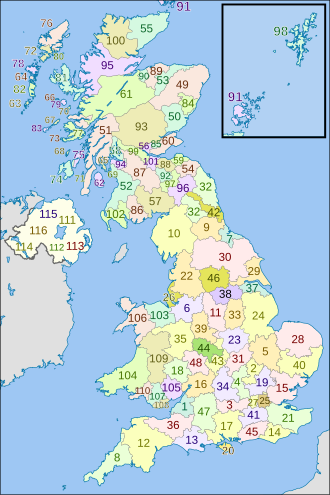
British former postal counties (numbered).svg - Dr Greg

UK Happisburgh c. 800000 BP EN.svg - Philg88

United Kingdom (orthographic projection).svg - Magog the Ogre

Map of Police forces in the United Kingdom.svg - Rob984

Map of Scotland Police area in the United Kingdom.svg - Rob984

Map of Northern Ireland Police area in the United Kingdom.svg - Rob984

Map of English and Welsh Police areas in the United Kingdom.svg - Rob984

Map of the National Crime Agency's jurisdiction.svg - Rob984

Green county & district councillors 2014.svg - BennH

English Police areas in the United Kingdom.svg - Rob984

Реки во Британија.svg - Bjankuloski06

British Isles map.svg - Djethro

British Isles map showing UK, Republic of Ireland, and historic counties.svg - Visitor from Wikishire

UK election, 1979.svg - MrPenguin20

UK election, Feb 1974.svg - MrPenguin20

Pan Celtic Festival winners map.svg - Alex Great

Locator map of the United Kingdom.svg - Nordwestern

NUTS 2 statistical regions of the United Kingdom 2015 map.svg - Dr Greg

Urban rail in the UK.svg - Stannered

UK General Election, 1970.svg - Mirrorme22

UK General Election, 1966.svg - Mirrorme22

UK General Election, 1964.svg - Mirrorme22

UK General Election, 1959.svg - YttriumShrewmedia

UK General Election, 1955.svg - Mirrorme22

European Parliament election, 2004 (United Kingdom).svg - RaviC

European Parliament election, 2009 (United Kingdom).svg - RaviC

European Parliament election, 1999 (United Kingdom).svg - MrPenguin20

European Parliament election, 2014 (United Kingdom).svg - RaviC

United Kingdom local elections, 1989.svg - MrPenguin20

UK City Regions.svg - Renamed user OCfxJKu7j2
Inner Hebrides blank.svg - Hogweard

UK terkep ures.svg - Regasterios

UK motorways map 2016.svg - Dr Greg

UK motorways map (thick lines).svg - Dr Greg

M4 motorway (Great Britain) map.svg - Dr Greg

Motorway number zones in England and Wales map.svg - Dr Greg

Pan Celtic Festival winners map 2.svg - Alex Great

UK General Election, February 1974.svg - Mirrorme22

UK General Election, October 1974.svg - Mirrorme22

UK General Election, 1979.svg - Mirrorme22

British Isles interactive.svg - Shyamal

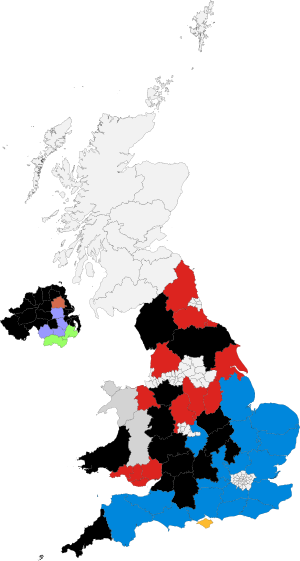
United Kingdom EU referendum 2016 area results YLB.svg - Renamed user OCfxJKu7j2

UK Köppen.svg - Redtitan

European Parliament election, 1979-1999 (Northern Ireland, UK).svg - RaviC

European Parliament election, 2004-2014 (Northern Ireland, UK).svg - RaviC

United Kingdom General Election 2017 Results Map (East Midlands).svg - DrRandomFactor

United Kingdom General Election 2017 Results Map (East of England).svg - DrRandomFactor

United Kingdom General Election 2017 Results Map (Yorkshire and the Humber).svg - DrRandomFactor

United Kingdom General Election 2017 Results Map (North West England).svg - DrRandomFactor

United Kingdom General Election 2017 Results Map (West Midlands).svg - DrRandomFactor

United Kingdom General Election 2017 Results Map (South East England).svg - DrRandomFactor

United Kingdom General Election 2017 Results Map (North East England).svg - DrRandomFactor

United Kingdom General Election 2017 Results Map (South West England).svg - DrRandomFactor

United Kingdom General Election 2017 Results Map (London).svg - DrRandomFactor

Europe gb.svg - Hacim bengali

UK General Election, 1951.svg - Offa29

UK General Election, 1950.svg - Offa29

King John's campaign 1215-6-es.svg - Rowanwindwhistler

ITV Border 2015 locator map.svg - Dr Greg

ITV Central 2015 locator map.svg - Dr Greg

ITV Anglia 2015 locator map.svg - Dr Greg

ITV Cymru Wales 2015 locator map.svg - Dr Greg

ITV London 2015 locator map.svg - Dr Greg

ITV Granada 2015 locator map.svg - Dr Greg

ITV Meridian 2015 locator map.svg - Dr Greg

ITV Tyne Tees 2015 locator map.svg - Dr Greg

ITV West Country 2015 locator map.svg - Dr Greg

STV Central 2015 locator map.svg - Dr Greg

STV North 2015 locator map.svg - Dr Greg

ITV Yorkshire 2015 locator map.svg - Dr Greg

UTV 2015 locator map.svg - Dr Greg

ATV 1974-1981 locator map.svg - Dr Greg

Carlton & LWT 1999-2002 locator map.svg - Dr Greg

ITV Thames Valley 2006-2009 locator map.svg - Dr Greg

ITV Tyne Tees and Border 2009-2013 locator map.svg - Dr Greg

ITV Wales and West 2009-2013 locator map.svg - Dr Greg

ITV Westcountry 2009-2013 locator map.svg - Dr Greg

Southern Television 1974-1981 locator map.svg - Dr Greg

Thames Television & LWT 1982-1992 locator map.svg - Dr Greg

TSW 1982-1992 locator map.svg - Dr Greg

Westward TV 1974-1981 locator map.svg - Dr Greg

TVS 1982-1992 locator map.svg - Dr Greg

Granada Television until 1968 coverage map.svg - Dr Greg

ABC Weekend TV until 1968 coverage map.svg - Dr Greg

ATV until 1968 coverage map.svg - Dr Greg

Wales West and North Television until 1964 coverage map.svg - Dr Greg

Rediffusion London until 1968 coverage map.svg - Dr Greg

TWW until 1968 coverage map.svg - Dr Greg

ITV (TV network) channels 2015 map.svg - Dr Greg

STV (TV channel) 2015 locator map.svg - Dr Greg

ITV (TV channel) 2015 locator map.svg - Dr Greg

ITV microregions map 2015.svg - Cillbill

Regions of the United Kingdom by HDI (2017).svg - Allice Hunter

East of England districts 2014 map (EP results).svg - T85753

ITV-branded franchises map 2015.svg - Dr Greg

European Parliament election, 2019 (United Kingdom) area results.svg - RaviC

European Parliament election, 2019 (United Kingdom) area results cy.svg - Llywelyn2000

East of England districts 2019 map (EP results).svg - T85753

London boroughs 2014 map (EP results).svg - RaviC

European Parliament election results, 2014 (North East England by council areas).svg - RaviC

European Parliament election results, 2014 (South West England by council areas).svg - RaviC

European Parliament election results, 2014 (North West England by council areas).svg - RaviC

European Parliament election results, 2014 (South East England by council areas).svg - RaviC

European Parliament election results, 2014 (West Midlands by council areas).svg - RaviC

European Parliament election results, 2014 (Yorkshire and the Humber by council areas).svg - RaviC

European Parliament election results, 2014 (East Midlands by council areas).svg - RaviC

2019 European Parliament election in the United Kingdom estimated results by Westminster constituency.svg - RaviC

British National Grid 500 km.svg - Thincat

European Parliament election results, 2009 (South West England by council areas).svg - RaviC

Northgate ward in Canterbury 2003.svg - The-

British and Irish Isles.svg - DrSmuggles

COVID-19 Outbreak Cases in UK lieutenancy areas.svg - Smurrayinchester

Political map of England 1140.svg - Rowanwindwhistler

Political map of England 1153.svg - Rowanwindwhistler

North East Combined Authorty 2014.svg - DrFrench

North East Combined Authority 2018.svg - DrFrench

North of Tyne Combined Authority 2018.svg - DrFrench

Tees Valley Combined Authority.svg - DrFrench

COVID-19 outbreak UK per capita cases map 2.svg - John Jones

Great Britain Political Terms.svg - EniPort
Bedfordshire & Hertfordshire UK parish map (blank).svg - Alex.brad

Wales-England Border Lettered.svg - DankJae

Freeports UK Map.svg - Tsange

ITV-branded franchises map 2020.svg - Cillbill

ITV-branded news regions map 2002-2006.svg - Dr Greg

ITV-branded news regions map 2006-2009.svg - Dr Greg

ITV-branded news regions map 2009-2013.svg - Dr Greg

ITV-branded franchises map 2002-2013.svg - Dr Greg

Uk-metro-areas.svg - ExplicitImplicity

Northern Ireland Map.svg - Tcr25

UK without Northern Ireland.svg - Nichard23

ITV Channel TV 2015 locator map.svg - Dr Greg

Rhu Peninsula map 1.svg - Goran tek-en

Rhu Peninsula map 1 location legend.svg - Goran tek-en

Map of the countries of the United Kingdom.svg - DankJae

United Kingdom 1 disputed w1 countrymap.svg - Onemilenorth

United Kingdom 2 disputed w1 countrymap.svg - Onemilenorth

Map of COVID-19 cumulative case rates per 100,000 by UK country and English region.svg - FotoFree

Map of COVID-19 cumulative death rates per 100,000 by UK country and English region.svg - FotoFree

Alternative UK constituencies map by country.svg - DankJae

Map of the UK with SARS-CoV-2 Virion.svg - Cakelot1

UK motorways map 2022.svg - Dr Greg

Map of Admiralty facilities on Portland, Dorset.svg - Goran tek-en

Downland in southern England.svg - Goran tek-en

UK + dependencies + Commonwealth realms.svg - Sbb1413

UK House of Commons constituencies 2023.svg - 沁水湾

UK House of Commons constituencies 2023, labeled.svg - 沁水湾

SurreyParliamentaryConstituencies1950.svg - Trimfrim20
UK Constituencies 2024 (blank).svg - DankJae

European Parliament election, 2009 (West Midlands).svg - Alextheconservative

European Parliament election, 2009 (East Midlands).svg - Alextheconservative

European Parliament election, 2009 (East of England).svg - Alextheconservative

European Parliament election, 2009 (London).svg - Alextheconservative

European Parliament election, 2009 (North East England).svg - Alextheconservative

European Parliament election, 2009 (North West England).svg - Alextheconservative

European Parliament election, 2009 (South East England).svg - Alextheconservative

European Parliament election, 2009 (Yorkshire and the Humber).svg - Alextheconservative

European Parliament election, 2009 (Wales).svg - Alextheconservative

European Parliament election, 2004 (East Midlands).svg - Alextheconservative

European Parliament election, 2004 (East of England).svg - Alextheconservative

European Parliament election, 2004 (London).svg - Alextheconservative

European Parliament election, 2004 (North East England).svg - Alextheconservative

European Parliament election, 2004 (North West England).svg - Alextheconservative

European Parliament election, 2004 (South East England).svg - Alextheconservative

European Parliament election, 2004 (South West England).svg - Alextheconservative

European Parliament election, 2004 (West Midlands).svg - Alextheconservative

European Parliament election, 2004 (Yorkshire and the Humber).svg - Alextheconservative

European Parliament election, 2004 (Wales).svg - Alextheconservative

European Parliament election, 1999 (East of England).svg - Alextheconservative

European Parliament election, 1999 (London).svg - Alextheconservative

European Parliament election, 1999 (East Midlands).svg - Alextheconservative

European Parliament election, 1999 (South East England).svg - Alextheconservative

European Parliament election, 1999 (North West England).svg - Alextheconservative

European Parliament election, 1999 (North East England).svg - Alextheconservative

European Parliament election, 1999 (West Midlands).svg - Alextheconservative

European Parliament election, 1999 (South West England).svg - Alextheconservative

European Parliament election, 1999 (Wales).svg - Alextheconservative

European Parliament election, 1999 (Yorkshire and the Humber).svg - Alextheconservative