Wikimedi'Òc
Modes d'emploi

Cet album fait partie des albums
Cet album photos contient les sous-albums suivants :


Big Hole National Battlefield Site. The natural systems and resources of the area are critical for understanding the (212bc5f0-eb8e-1eef-80a6-ba869c290871).jpg - BMacZeroBot

MT Mountain River.jpg - LeaMaimone

MT Forest Fire Rapids.jpg - LeaMaimone
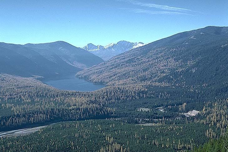
Big Salmon Lake.jpg - Hike395
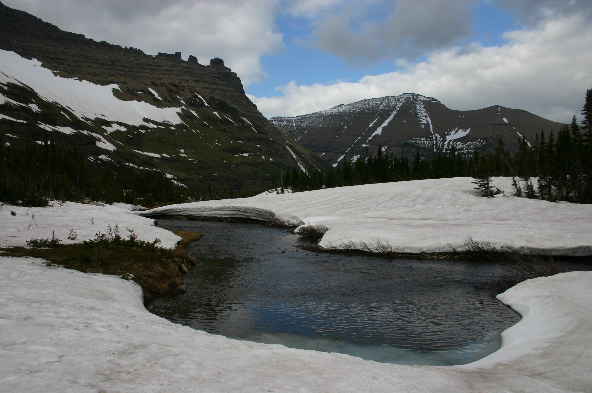
Snow Melts into River near Iceberg Lake in Glacier National Park.jpg - Wingchi

MontanaRivr.jpg - Bobjgalindo

MontanaScene.jpg - Bobjgalindo
Montana landscape. 2.jpg - Catfisheye

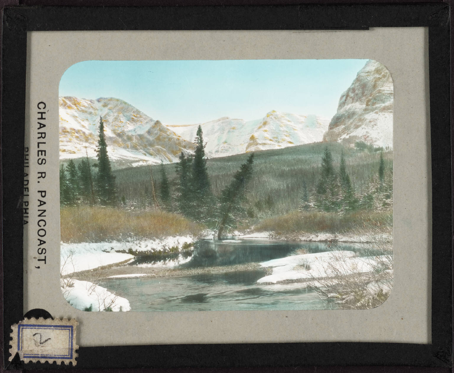
Headwaters of the Columbia River. 14.jpg - Catfisheye
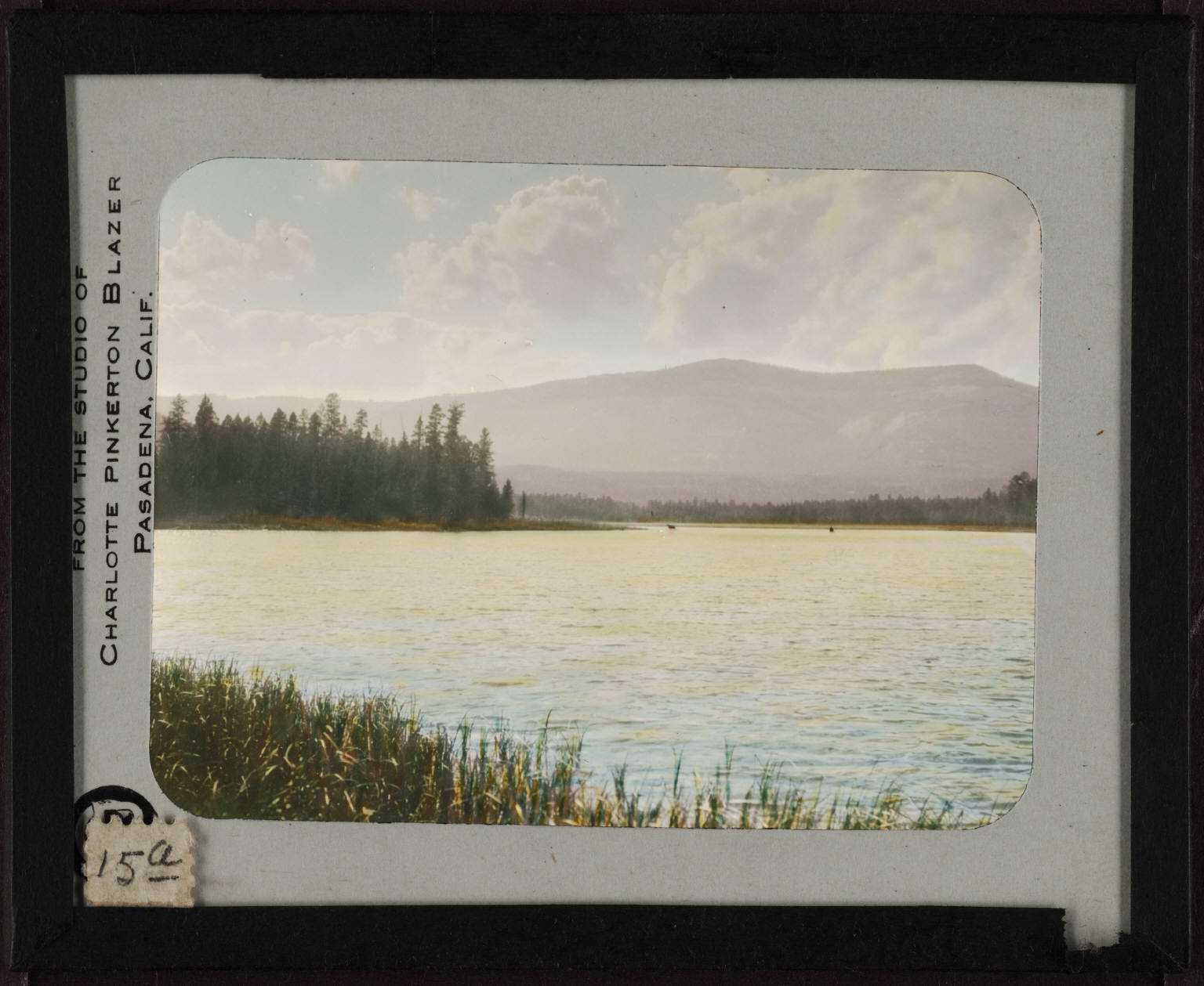
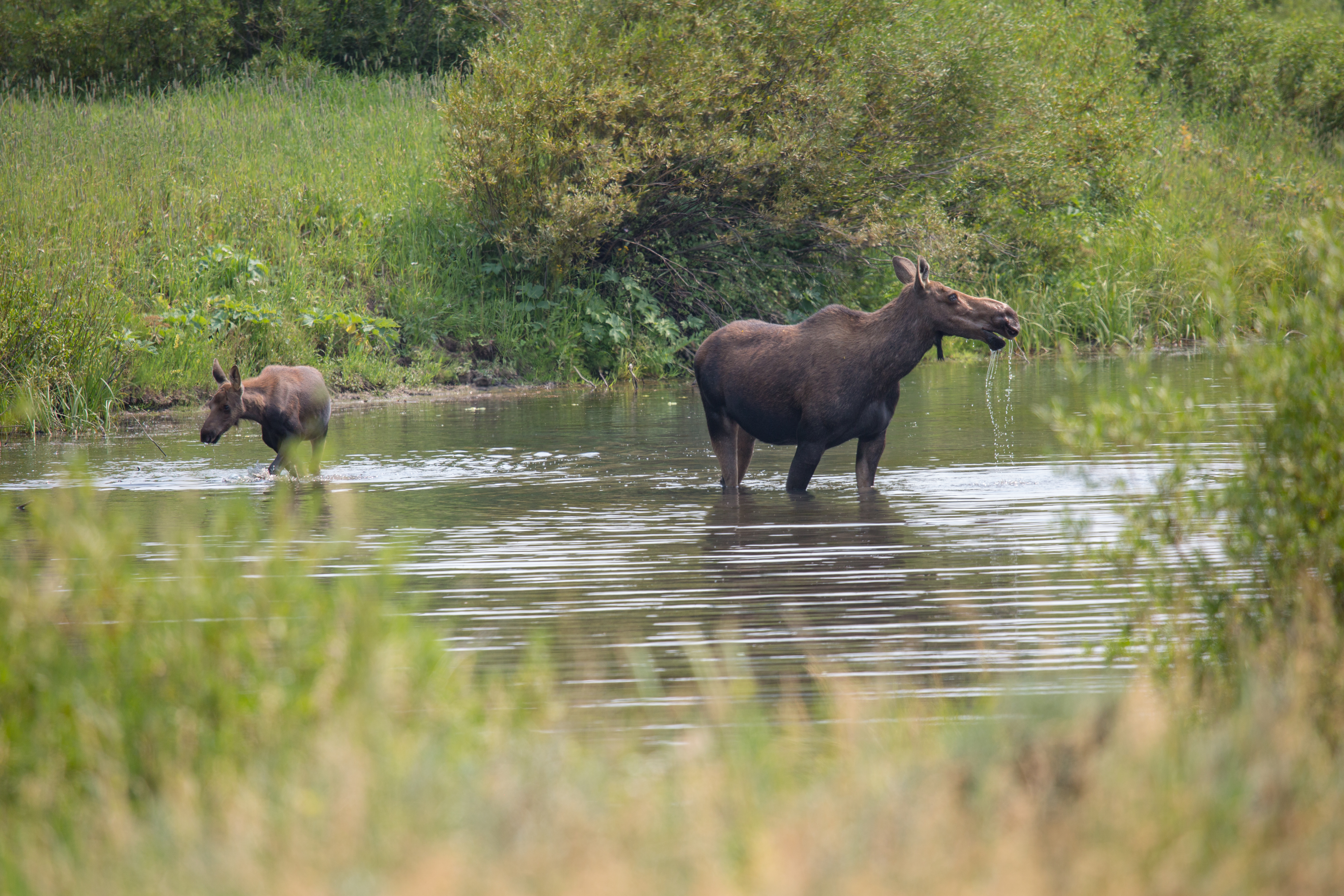
Marshy point with two moose in the distance. 15a.jpg - Catfisheye

Blackfeet country. 32.jpg - Catfisheye

Evening sky and river near Blackfeet camp. 40a.jpg - Catfisheye
Scobeymontanariver.jpg - Flickr upload bot

Roscoe, Montana.jpg - BarkingMoon

CLOSE-UP OF STREAM BED ILLUSTRATES THE DRY CLIMATE OF THE PROPOSED STRIP-MINING AREA OF SARPY BASIN. MINING OPERATION... - NARA - 549201.jpg - US National Archives bot

CD3418-0006 - Flickr - USDAgov.jpg - BotMultichillT

BlodgettCanyonMT.jpg - Bulwersator

At N Yellowstone Trail Rd - Yellowstone River - Montana - 2013-07-07.jpg - Tim1965

U.S. Route 93 in Montana near Lower Stillwater Lake 01 - white balanced (10322243725).jpg - File Upload Bot (Magnus Manske)

U.S. Route 93 in Montana near Lower Stillwater Lake 01 (10323372474).jpg - File Upload Bot (Magnus Manske)

U.S. Route 93 in Montana near Lower Stillwater Lake 02 - white balanced (10322367463).jpg - File Upload Bot (Magnus Manske)

U.S. Route 93 in Montana near Lower Stillwater Lake 02 (10323530903).jpg - File Upload Bot (Magnus Manske)
View from south creek bank looking west - Divide Creek Bridge, Spanning Divide Creek at Going-to-the-Sun Road, West Glacier, Flathead County, MT HAER MONT,15-WEGLA,15-1.tif - Fæ

Madison River near Ennis January 2015 03.JPG - Mike Cline

Tree and river near Ninemile Remount Depot.jpg - Djembayz

Annual report of the American Bison Society (1907) (18435603001).jpg - SteinsplitterBot

Annals of the Carnegie Museum (1908-1909) (18414943931).jpg - SteinsplitterBot

Centennial Mountains WSA (9441023835).jpg - Wilfredor

Bulletin (Page 342) BHL3976025.jpg - SteinsplitterBot

Bulletin (Page 211) BHL3976298.jpg - Fæ

Helena National Forest 99-7435 (5881429412).jpg - Holly Cheng

Kootenayrivermapnew.png - Shannon1

West Lake St. Mary - panoramio.jpg - Panoramio upload bot

Kalispell, MT, MT, USA - panoramio.jpg - Panoramio upload bot

Spotted Bear River (9394850821).jpg - Artix Kreiger

Water28 (25209106408).jpg - MechQuester

Water24 (25209095148).jpg - MechQuester

Whitefish River January 2, 2019.jpg - Schmiebel

River in the vicinity of the Jay Gould Mine, Montana, circa 1894 (AL+CA 3148).jpg - BMacZeroBot
Horses and Cattle Beside a River in Big Dry, Northern Montana (113bccc95bfa4edba5b0d7c334918b64).tif - BMacZeroBot
StRegisRiverMT.jpg - Ken Gallager

20190329-FS-FlatheadNF-YFYF-040 (32581940247).jpg - Ser Amantio di Nicolao

20190329-FS-FlatheadNF-YFYF-064 (47472037462).jpg - Ser Amantio di Nicolao
20190329-FS-FlatheadNF-YFYF-111 (47471879152).jpg - Ser Amantio di Nicolao

Squaw Creek (Gallatin Range, Montana, USA) (19660474359).jpg - Ser Amantio di Nicolao
StormCastleLookingSouth.jpg - Pahcal123

Photography by Victor Albert Grigas (1919-2017) MONTANA 1-40 XDo 1 00282 (50728311202).jpg - Victorgrigas

Alpine cedar tree overlooking the Glacier Park valley and river below, near Kalispell, Montana, between 1921 and 1931 (AL+CA 4372).jpg - BMacZeroBot

Cow moose, Gallatin River (6e1701a4-2be1-469c-8564-a8c4cd37c71b).jpg - BMacZeroBot
Cow & calf moose, Gallatin River (83a41395-0cb6-4654-843b-c318612ebdf8).jpg - BMacZeroBot

Cow moose, Gallatin River (c1953045-0207-450c-a326-43c995f3021d).jpg - BMacZeroBot

Clark Fork River in MT - Flickr - landscapesinthewest.jpg - Red panda bot

Glacier National Park - Mountain Stream - GTTS Road LSPE-1 - Flickr - Kevin Crosby.jpg - Red panda bot