Wikimedi'Òc
Modes d'emploi

Cet album fait partie des albums
Cet album photos contient les sous-albums suivants :


Trees in the Trent - geograph.org.uk - 1156095.jpg - GeographBot

Sky and River - geograph.org.uk - 923496.jpg - GeographBot

Sign along the River Trent - geograph.org.uk - 4585704.jpg - GeographBot

Swan on the Trent - geograph.org.uk - 897886.jpg - GeographBot

Sunset over The Trent - geograph.org.uk - 5128808.jpg - GeographBot

Swan on the Trent - geograph.org.uk - 897885.jpg - GeographBot

The River Trent near Sawley - geograph.org.uk - 662643.jpg - GeographBot

Sawley Weir - geograph.org.uk - 1105740.jpg - GeographBot

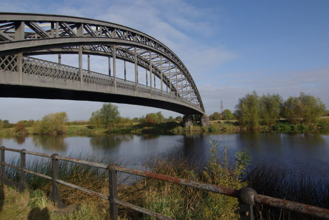
View from Bridge over the Trent at Sawley - geograph.org.uk - 1158463.jpg - GeographBot

River Trent near Trent Lock - geograph.org.uk - 685849.jpg - GeographBot

Wreck on The Trent seen from Harrington Bridge - geograph.org.uk - 7449460.jpg - GeographBot

Cyclists on the north bank of the River Trent - geograph.org.uk - 6191012.jpg - GeographBot

Drain outfall, north bank of the River Trent - geograph.org.uk - 6191107.jpg - GeographBot

Eastbound signage on River Trent as you approach Trentlock - geograph.org.uk - 7099242.jpg - GeographBot

From under the M1 - geograph.org.uk - 744617.jpg - GeographBot

Footpath by the River Trent west of Trentlock - geograph.org.uk - 3671104.jpg - GeographBot

Footpath along the River Trent - geograph.org.uk - 4585590.jpg - GeographBot

Lock keepers house from across the trent at Sawley - geograph.org.uk - 1109141.jpg - GeographBot

North bank of the River Trent near Trentlock - geograph.org.uk - 6000651.jpg - GeographBot

Lock keepers house from across the trent at Sawley - geograph.org.uk - 1109145.jpg - GeographBot

Narrow boat on The River Trent - geograph.org.uk - 7448479.jpg - GeographBot

Path by the Trent - geograph.org.uk - 1102847.jpg - GeographBot

North bank of the River Trent near Trentlock, Derbyshire - geograph.org.uk - 6000971.jpg - GeographBot

Northern Reflections - geograph.org.uk - 923487.jpg - GeographBot

On the River Trent - geograph.org.uk - 7306047.jpg - GeographBot

Path by the Trent - geograph.org.uk - 1102962.jpg - GeographBot

Path by the Trent - geograph.org.uk - 1109170.jpg - GeographBot

Path by the Trent lock Golf Course - geograph.org.uk - 1103007.jpg - GeographBot

Path by the Trent near Sawley - geograph.org.uk - 1103041.jpg - GeographBot

Path by the Trent near Sawley - geograph.org.uk - 1105974.jpg - GeographBot

Path by the Trent near Sawley - geograph.org.uk - 1108640.jpg - GeographBot

Path by the Trent near Sawley - geograph.org.uk - 1108655.jpg - GeographBot

Path by the Trent near Sawley - geograph.org.uk - 1108666.jpg - GeographBot

Path by the Trent near Sawley - geograph.org.uk - 1108708.jpg - GeographBot

Path by the Trent near Sawley - geograph.org.uk - 1108678.jpg - GeographBot

Path by the Trent near Sawley - geograph.org.uk - 1108717.jpg - GeographBot

Path by the Trent near Sawley - geograph.org.uk - 1108787.jpg - GeographBot

Path by the Trent near Sawley - geograph.org.uk - 1108732.jpg - GeographBot
Pipe bridge above Sawley - geograph.org.uk - 1541607.jpg - GeographBot

Pipe bridge above Sawley - geograph.org.uk - 1541600.jpg - GeographBot

Riverside path E of Sawley Railway Viaduct - geograph.org.uk - 7099229.jpg - GeographBot

Steam Power - orders of magnitude apart - geograph.org.uk - 3544602.jpg - GeographBot

Sawley Lock, seen across the Trent - geograph.org.uk - 5836713.jpg - GeographBot

Riverside path ^ River Trent between Sawley Railway Viaduct ^ Trentlock - geograph.org.uk - 7099241.jpg - GeographBot

Stop lock on the River Trent Navigation, Sawley 01.jpg - Simon Burchell

Stop lock on the River Trent Navigation, Sawley 02.jpg - Simon Burchell

Stop lock on the River Trent Navigation, Sawley 03.jpg - Simon Burchell

Sailing past Trent Valley Sailing Club - geograph.org.uk - 7222844.jpg - GeographBot

Sunrise over River Trent from Sawley Bridge - geograph.org.uk - 2313300.jpg - GeographBot

Trent Sailing Club - geograph.org.uk - 687376.jpg - GeographBot

Cows on the banks of the Trent - geograph.org.uk - 1437461.jpg - GeographBot

The River Trent - geograph.org.uk - 6870934.jpg - GeographBot

By The Trent - looking east to Barton-in-Fabis - geograph.org.uk - 7448273.jpg - GeographBot

River Trent - geograph.org.uk - 7481.jpg - GeographBot

River Trent - geograph.org.uk - 33712.jpg - GeographBot

The Trent at Twyford - geograph.org.uk - 59273.jpg - GeographBot
River Trent From Willington Bridge - geograph.org.uk - 134668.jpg - GeographBot

River Trent, Ingleby - geograph.org.uk - 238701.jpg - GeographBot

Mouth of the Dove (1) - geograph.org.uk - 287073.jpg - GeographBot

Cranfleet Lock, River Trent Navigation - geograph.org.uk - 374864.jpg - GeographBot

Path along the bank of the Trent - geograph.org.uk - 375405.jpg - GeographBot

Poplars beside the Trent in winter - geograph.org.uk - 375220.jpg - GeographBot

Island on the Trent - geograph.org.uk - 387685.jpg - GeographBot

River Trent near Willington - geograph.org.uk - 380263.jpg - GeographBot

The Trent in Flood at Swarkestone - geograph.org.uk - 478950.jpg - GeographBot

Trent Junction - geograph.org.uk - 614460.jpg - GeographBot

The River Trent - In flood - geograph.org.uk - 662492.jpg - GeographBot

The River Trent - In flood - geograph.org.uk - 662495.jpg - GeographBot

The River Trent - In flood - geograph.org.uk - 662648.jpg - GeographBot

The River Trent - In flood - geograph.org.uk - 662650.jpg - GeographBot

Riverside houses, Barrow upon Trent - geograph.org.uk - 679474.jpg - GeographBot

Chain ferry post at Twyford - geograph.org.uk - 680633.jpg - GeographBot

Cooling Towers - geograph.org.uk - 680645.jpg - GeographBot

Pasture beside the Trent - geograph.org.uk - 680960.jpg - GeographBot

Power Lines crossing the Trent - geograph.org.uk - 685343.jpg - GeographBot

River Trent at Twyford - geograph.org.uk - 680617.jpg - GeographBot

Riverside dwelling at Twyford - geograph.org.uk - 680627.jpg - GeographBot

Trent floodplain east of Willington Bridge - geograph.org.uk - 680744.jpg - GeographBot

Complex Junction Ahead - geograph.org.uk - 919737.jpg - GeographBot

High water - geograph.org.uk - 955036.jpg - GeographBot

Boats and riverside houses - geograph.org.uk - 1091203.jpg - GeographBot

Failed Barge - geograph.org.uk - 1091207.jpg - GeographBot

Natural and industrial reflections - geograph.org.uk - 1090665.jpg - GeographBot

River Trent - geograph.org.uk - 1090583.jpg - GeographBot

Houses on the Trent at Sawley - geograph.org.uk - 1105961.jpg - GeographBot

Not Three bird then^ - geograph.org.uk - 1109177.jpg - GeographBot

Outlet to the Trent from the golf course - geograph.org.uk - 1109160.jpg - GeographBot

Path by the Trent near Sawley - geograph.org.uk - 1108584.jpg - GeographBot

Path by the Trent near Sawley - geograph.org.uk - 1108811.jpg - GeographBot

River Trent at Sawley - geograph.org.uk - 1103061.jpg - GeographBot

River Trent at Sawley - geograph.org.uk - 1105998.jpg - GeographBot

River Trent at Sawley - geograph.org.uk - 1106007.jpg - GeographBot

River Trent at Sawley - geograph.org.uk - 1108563.jpg - GeographBot

River Trent at Sawley - geograph.org.uk - 1109130.jpg - GeographBot

River Trent at Sawley looking back at the M1 - geograph.org.uk - 1108688.jpg - GeographBot

River Trent at Sawley with the Marina in the background - geograph.org.uk - 1109134.jpg - GeographBot

River Trent path - geograph.org.uk - 1102807.jpg - GeographBot

Riverside living at Sawley by the Trent - geograph.org.uk - 1105647.jpg - GeographBot

Small Island in the Trent at Sawley - geograph.org.uk - 1108574.jpg - GeographBot

The Trent at Sawley - geograph.org.uk - 1108629.jpg - GeographBot

Tree beside the Trent at Sawley - geograph.org.uk - 1108597.jpg - GeographBot

River Trent near Sawley - geograph.org.uk - 1156083.jpg - GeographBot

River Trent near Sawley - geograph.org.uk - 1156088.jpg - GeographBot

Washed away trees in the Trent - geograph.org.uk - 1156087.jpg - GeographBot

River Trent to the east of Ingleby - geograph.org.uk - 1251657.jpg - GeographBot
Barge transport, Attenborough Quarry - geograph.org.uk - 1357270.jpg - GeographBot

Navigation sign - geograph.org.uk - 1357363.jpg - GeographBot

Quarry loading point - geograph.org.uk - 1357392.jpg - GeographBot

Some bailing-out is required - geograph.org.uk - 1494176.jpg - GeographBot

River Trent, Sawley - geograph.org.uk - 1541132.jpg - GeographBot

Entrance to Erewash Canal at Trent Lock (2).JPG - HJ Mitchell

River Trent from Willington Bridge.jpg - Nick Moyes

The Ferry King's Mill Castle Donington.jpg - Jokulhlaup

The Severn Trent Water building - geograph.org.uk - 2655390.jpg - GeographBot

The River Trent near Trent Lock - geograph.org.uk - 2666994.jpg - GeographBot

River Trent at Trent Lock - geograph.org.uk - 2832912.jpg - GeographBot

The River Trent from above Newton Solney - geograph.org.uk - 3177206.jpg - GeographBot

Willington and the power station - geograph.org.uk - 3177216.jpg - GeographBot

The River Trent near Ingleby - geograph.org.uk - 3200044.jpg - GeographBot

The River Trent and Ratcliffe-on-Soar Power Station - geograph.org.uk - 3400422.jpg - GeographBot

Barge on the River Trent - geograph.org.uk - 3400669.jpg - GeographBot

The River Trent - geograph.org.uk - 3400688.jpg - GeographBot

Repton and the River Trent - geograph.org.uk - 3558522.jpg - GeographBot

River Trent - geograph.org.uk - 3678989.jpg - GeographBot

Priest House Hotel and River Trent - geograph.org.uk - 3859159.jpg - GeographBot

The River Trent near Ingleby - geograph.org.uk - 3877468.jpg - GeographBot

The M1 crosses the River Trent - geograph.org.uk - 4488876.jpg - GeographBot

River Trent near Trentlock - geograph.org.uk - 4585690.jpg - GeographBot

The River Trent at Trentlock - geograph.org.uk - 4585751.jpg - GeographBot

River Trent - geograph.org.uk - 4755260.jpg - GeographBot

River Trent - geograph.org.uk - 4755261.jpg - GeographBot

River Trent from the railway - geograph.org.uk - 4775328.jpg - GeographBot

River Trent at Trent Lock - geograph.org.uk - 5280239.jpg - GeographBot

River Trent at Harrington Bridge - geograph.org.uk - 5648736.jpg - GeographBot

River Trent and Ratcliffe power station - geograph.org.uk - 5836702.jpg - GeographBot

The River Trent south-east of Long Eaton, Derbyshire - geograph.org.uk - 5999585.jpg - GeographBot

River Trent south-east of Long Eaton, Derbyshire - geograph.org.uk - 5999773.jpg - GeographBot

River Trent south-east of Long Eaton, Derbyshire - geograph.org.uk - 5999778.jpg - GeographBot

River Trent south-east of Long Eaton, Derbyshire - geograph.org.uk - 5999787.jpg - GeographBot

River Trent south-east of Long Eaton in Derbyshire - geograph.org.uk - 5999795.jpg - GeographBot

River Trent south-east of Long Eaton, Derbyshire - geograph.org.uk - 5999800.jpg - GeographBot

The River Trent at Trentlock, Derbyshire - geograph.org.uk - 6000520.jpg - GeographBot

River Trent Moorings near Trentlock, Derbyshire - geograph.org.uk - 6000534.jpg - GeographBot

River Trent Moorings near Trentlock, Derbyshire - geograph.org.uk - 6000535.jpg - GeographBot

River Trent west of Trentlock in Derbyshire - geograph.org.uk - 6000543.jpg - GeographBot

River Trent moorings west of Trentlock in Derbyshire - geograph.org.uk - 6000549.jpg - GeographBot

River Trent approaching Trentlock in Derbyshire - geograph.org.uk - 6000653.jpg - GeographBot

River Trent near Sawley in Derbyshire - geograph.org.uk - 6001053.jpg - GeographBot

River Trent near Sawley in Derbyshire - geograph.org.uk - 6001056.jpg - GeographBot

River Trent near Sawley in Derbyshire - geograph.org.uk - 6001071.jpg - GeographBot

The River Trent and the entrance to the Erewash Canal - geograph.org.uk - 6180941.jpg - GeographBot

The unnavigable River Trent, near Sawley - geograph.org.uk - 6190977.jpg - GeographBot