Wikimedi'Òc
Modes d'emploi

Cet album fait partie des albums
Cet album photos contient les sous-albums suivants :


The River Ouse seen from The Ouse Embankment, Barlby - geograph.org.uk - 7680153.jpg - GeographBot

The River Ouse seen from The Ouse Embankment, Barlby - geograph.org.uk - 7680181.jpg - GeographBot

Saltmarshe.jpg - Angusmclellan

River Ouse at Aldwark.jpg - Angusmclellan

Newton on Ouse from the River Ouse.jpg - Angusmclellan

Riverbank at Saltmarshe.jpg - Keith D

River Ouse at Swinefleet.jpg - Keith D

Asselby Island and confluence of Rivers Aire and Ouse - geograph.org.uk - 79165.jpg - GeographBot

Autumn cruise on the River Ouse - geograph.org.uk - 70599.jpg - GeographBot

Blacktoft Channel - geograph.org.uk - 115277.jpg - GeographBot

River Ouse near Thorpe Underwood - geograph.org.uk - 139522.jpg - GeographBot

Victoria Lock - geograph.org.uk - 138936.jpg - GeographBot

River Ouse near to Nun Monkton - geograph.org.uk - 140568.jpg - GeographBot

Alder Tree Reach - geograph.org.uk - 184554.jpg - GeographBot

Banks of the Ouse - geograph.org.uk - 184571.jpg - GeographBot

Banks of the Ouse near Scarborough Bridge - geograph.org.uk - 184586.jpg - GeographBot

A Glimpse of the River Ouse - geograph.org.uk - 200406.jpg - GeographBot

Monkton Reach - geograph.org.uk - 184546.jpg - GeographBot

Overton across the Ouse - geograph.org.uk - 184572.jpg - GeographBot

River Ouse - Overton Ings - geograph.org.uk - 184560.jpg - GeographBot

River Ouse - geograph.org.uk - 194877.jpg - GeographBot

River Ouse near Cawood Parish Church - geograph.org.uk - 195016.jpg - GeographBot

The Ouse and Overton Wood - geograph.org.uk - 184565.jpg - GeographBot

The Land Beyond the Ouse - geograph.org.uk - 194883.jpg - GeographBot
Trans Pennine Trail at Skelton, East Riding of Yorkshire,.jpg - GeographBot

River Ouse, Acaster Selby - geograph.org.uk - 200093.jpg - GeographBot

River Ouse - geograph.org.uk - 207955.jpg - GeographBot

The Ouse - geograph.org.uk - 202853.jpg - GeographBot

The River Ouse and Eggborough - geograph.org.uk - 200387.jpg - GeographBot
The River Ouse from the Trans-Pennine Trail - geograph.org.uk - 200321.jpg - GeographBot
The Trans-Pennine Trail and Drax - geograph.org.uk - 200384.jpg - GeographBot

Ouse sunset.jpg - Keith D

Sunset over the River Ouse..jpg - Keith D

A Tiger's Stripes - geograph.org.uk - 250640.jpg - GeographBot

A view up the River Ouse - geograph.org.uk - 256831.jpg - GeographBot

Almost Lighting-up Time - geograph.org.uk - 256851.jpg - GeographBot

Evening Light - geograph.org.uk - 256823.jpg - GeographBot

Fishing on the River near Birkin - geograph.org.uk - 250922.jpg - GeographBot

Local Radio - geograph.org.uk - 250705.jpg - GeographBot

The Northern Bank - geograph.org.uk - 250637.jpg - GeographBot
The Trans-Pennine Trail - geograph.org.uk - 250633.jpg - GeographBot
The Trans-Pennine Trail - geograph.org.uk - 250704.jpg - GeographBot
The Trans-Pennine Trail - geograph.org.uk - 256848.jpg - GeographBot

River Ouse at Cawood with Cawood Church - geograph.org.uk - 292314.jpg - GeographBot

View of Riccall from Wheel Hall Bridge - geograph.org.uk - 343438.jpg - GeographBot

Muddy Waters - geograph.org.uk - 351192.jpg - GeographBot

Swinefleet Road - geograph.org.uk - 365010.jpg - GeographBot

The River Ouse - geograph.org.uk - 370422.jpg - GeographBot

Alkborough from Faxfleet - geograph.org.uk - 381319.jpg - GeographBot

Swinefleet Reach - geograph.org.uk - 397919.jpg - GeographBot

Long barn on north bank of the Ouse - geograph.org.uk - 420832.jpg - GeographBot

Looking along the Ouse flood bank - geograph.org.uk - 420411.jpg - GeographBot

The Ouse flood bank - geograph.org.uk - 420828.jpg - GeographBot

By the River Ouse - geograph.org.uk - 435580.jpg - GeographBot

River Ouse - geograph.org.uk - 495460.jpg - GeographBot

River Ouse from Reedness - geograph.org.uk - 507485.jpg - GeographBot

River Ouse from Reedness - geograph.org.uk - 509210.jpg - GeographBot

On the banks of the Ouse - geograph.org.uk - 531508.jpg - GeographBot

View down to the river - geograph.org.uk - 543622.jpg - GeographBot

River Ouse between Beninborough Park and Newton on Ouse - geograph.org.uk - 565815.jpg - GeographBot

The River Ouse, Hemingbrough - geograph.org.uk - 577476.jpg - GeographBot

The River Ouse - geograph.org.uk - 610549.jpg - GeographBot
The Trans Pennine Trail - geograph.org.uk - 610546.jpg - GeographBot

River Ouse - geograph.org.uk - 701077.jpg - GeographBot

Riccall Ings - geograph.org.uk - 730757.jpg - GeographBot

Bank of the River Ouse - geograph.org.uk - 835826.jpg - GeographBot

Bank of the River Ouse - geograph.org.uk - 835827.jpg - GeographBot

Where the River Wharfe meets the River Ouse - geograph.org.uk - 835822.jpg - GeographBot

Hall Staith - geograph.org.uk - 859243.jpg - GeographBot

Confluence of the rivers Aire and Ouse - geograph.org.uk - 1214878.jpg - GeographBot

The River Ouse and Asselby island - geograph.org.uk - 1214881.jpg - GeographBot

River Ouse towards Cotness Clough - geograph.org.uk - 1257316.jpg - GeographBot

River Ouse towards Waterside House - geograph.org.uk - 1257314.jpg - GeographBot

Flood Bank, Saltmarshe - geograph.org.uk - 1326227.jpg - GeographBot

Navigation mark by the Ouse - geograph.org.uk - 1326257.jpg - GeographBot

Riverbank east of Saltmarshe - geograph.org.uk - 1326286.jpg - GeographBot

The Ouse at Saltmarshe - geograph.org.uk - 1326251.jpg - GeographBot

The Ouse at Saltmarshe - geograph.org.uk - 1326266.jpg - GeographBot

The Ouse River Bank - geograph.org.uk - 1507710.jpg - GeographBot

The River Ouse - geograph.org.uk - 1508422.jpg - GeographBot

Elegant waterfront dwelling - geograph.org.uk - 1512270.jpg - GeographBot

Pylons by River Ouse - geograph.org.uk - 1512579.jpg - GeographBot

River Ouse by Clifton Ings - geograph.org.uk - 1512526.jpg - GeographBot

Bend in the Ouse - geograph.org.uk - 1522051.jpg - GeographBot

Ouse ewe - geograph.org.uk - 1523172.jpg - GeographBot

Ouse mud - geograph.org.uk - 1523169.jpg - GeographBot

Ouse near Saltmarshe Hall - geograph.org.uk - 1525118.jpg - GeographBot

The Ouse at Sandhall Estate, Skelton, East Riding of Yorkshire.jpg - GeographBot

River Ouse - geograph.org.uk - 1594937.jpg - GeographBot

River Ouse - geograph.org.uk - 1595054.jpg - GeographBot

River Ouse - geograph.org.uk - 1595068.jpg - GeographBot

River Ouse - geograph.org.uk - 1611000.jpg - GeographBot

View of the River Ouse - geograph.org.uk - 1691674.jpg - GeographBot

StateLibQld 1 126051 Aire II (ship).jpg - SLQbot

View across Faxfleet Ness - geograph.org.uk - 1729611.jpg - GeographBot

StateLibQld 1 132997 Active (ship).jpg - SLQbot

StateLibQld 1 133145 Altona (ship).jpg - SLQbot

River Ouse (27883541743).jpg - INeverCry

River Ouse at Selby (6959784577).jpg - INeverCry

Reedness from across the Ouse - panoramio.jpg - Panoramio upload bot

Reedness from across the Ouse - panoramio (1).jpg - Panoramio upload bot

Saltmarshe - panoramio.jpg - Panoramio upload bot

Saltmarshe - panoramio (1).jpg - Panoramio upload bot

Swinefleet - panoramio.jpg - Panoramio upload bot

River Ouse Heron, Bedford (9055737252).jpg - Спасимир

River Ouse above Offord Lock - April 2016 - panoramio.jpg - Panoramio upload bot
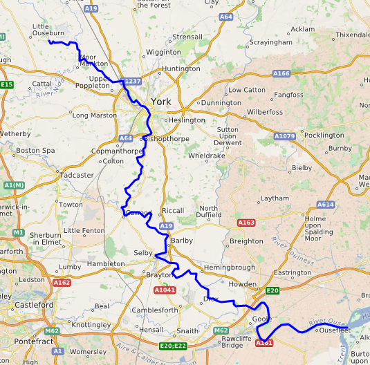
Ouse (Yorkshire).png - Ccmpg

Thomas Lound (1802-1861) - A Swing Bridge on the River Ouse - 515539 - National Trust.jpg - BotMultichill

William Marlow R. Ouse.jpg - Ttocserp