Wikimedi'Òc
Modes d'emploi

Cet album fait partie des albums


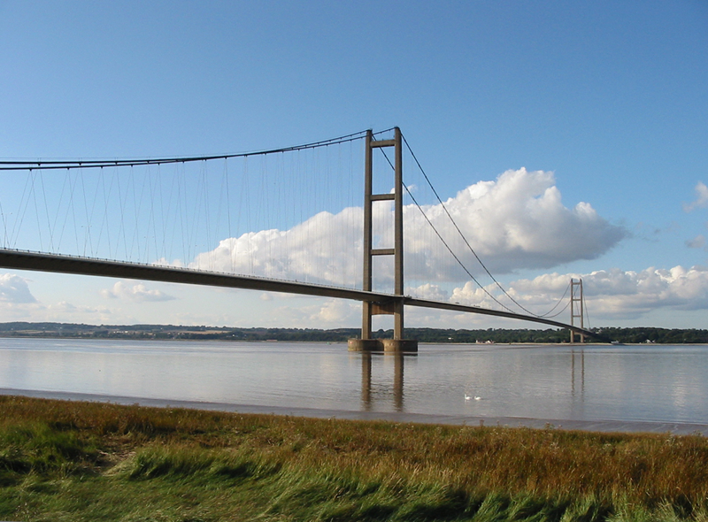
Humber Bridge.png - Ranveig

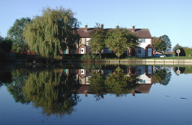
Village pond at Wetwang.jpg - Angusmclellan

Beverley.JPG - Joyradost
Jubilee Pond Gilberdyke.jpg - Keith D

Goole Docks, Dredger - geograph.org.uk - 197322.jpg - GeographBot

Swanland, Christchurch and Village Pond - geograph.org.uk - 236168.jpg - GeographBot

South Holderness Technology College.jpg - Keith D
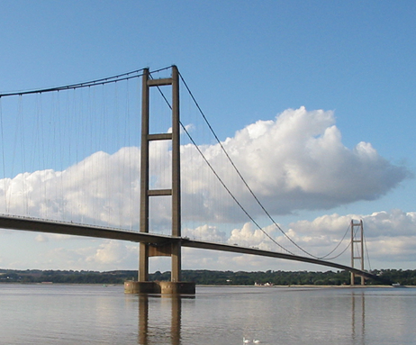
Humber Bridge2.png - Glabb

Ottringham Ings - geograph.org.uk - 263421.jpg - GeographBot

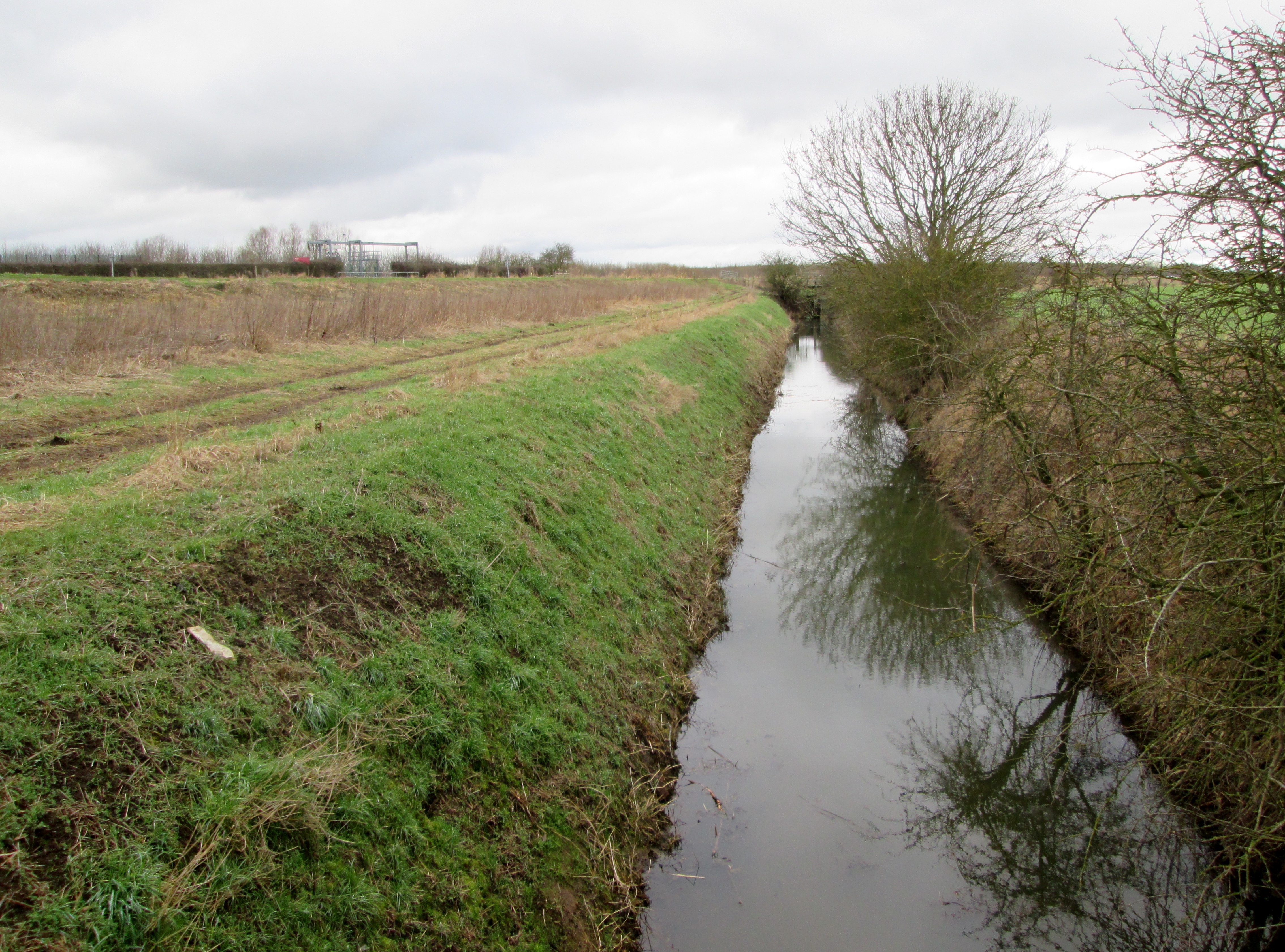
Ottringham Drain - geograph.org.uk - 297415.jpg - GeographBot

The Outstray, Cherry Cobb Sands - geograph.org.uk - 295742.jpg - GeographBot

The Outstray, Cherry Cobb Sands - geograph.org.uk - 296018.jpg - GeographBot

Pond decoy duck at Rimswell, East Riding of Yorkshire - geograph.org.uk - 300404.jpg - GeographBot

Parent and Guardian - geograph.org.uk - 456273.jpg - GeographBot

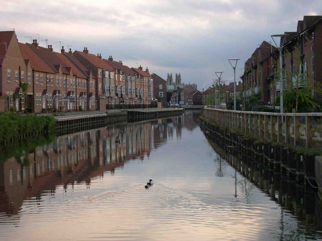
Beverley Beck - geograph.org.uk - 470547.jpg - GeographBot

Reflections on Humber Bridge and Moon - geograph.org.uk - 511033.jpg - GeographBot

Reflections at Howden Marsh - geograph.org.uk - 555423.jpg - Rotatebot

Eastrington Ponds Nature Reserve - geograph.org.uk - 592962.jpg - GeographBot

Motorway Pond, Newport - geograph.org.uk - 596092.jpg - GeographBot
Wauldby Dam - geograph.org.uk - 624324.jpg - GeographBot

Forge Cottage, Bishop Burton - geograph.org.uk - 683798.jpg - GeographBot

Paull's River Lagoon Car Park Pond - geograph.org.uk - 686975.jpg - GeographBot

Nafferton Mere - geograph.org.uk - 697122.jpg - GeographBot

Beverley and Barmston Drain - geograph.org.uk - 730439.jpg - GeographBot

Hedon Haven - geograph.org.uk - 757599.jpg - GeographBot

The Three Stooges, North Ferriby Reed Pond - geograph.org.uk - 775392.jpg - GeographBot

Wauldby Dam (pond) in the Springtime - geograph.org.uk - 788684.jpg - GeographBot

Woodland reflection - geograph.org.uk - 793595.jpg - GeographBot

Warter Pond - geograph.org.uk - 900031.jpg - GeographBot

Reflected Bridge - geograph.org.uk - 1072604.jpg - GeographBot

Reflecting on Hedon Church - geograph.org.uk - 1079598.jpg - GeographBot

Preening on the pond - geograph.org.uk - 1118421.jpg - GeographBot

Old Hall Farm Pond - geograph.org.uk - 1277601.jpg - GeographBot

Reflection of the Early Morning Sun - geograph.org.uk - 1360890.jpg - GeographBot

Reflections on the Humber - geograph.org.uk - 1361444.jpg - GeographBot

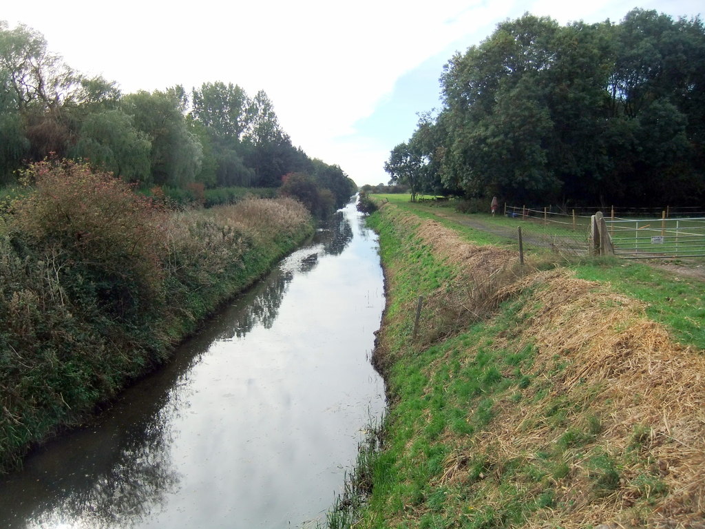
Canal Head - geograph.org.uk - 1415493.jpg - GeographBot

The River Hull, Tophill Low - geograph.org.uk - 1454049.jpg - GeographBot

Pond Reflections - geograph.org.uk - 1511836.jpg - GeographBot

Warter pond - geograph.org.uk - 1541680.jpg - GeographBot

Cool Reflection - geograph.org.uk - 1605672.jpg - GeographBot

Mirrored in the Mud - geograph.org.uk - 1602104.jpg - GeographBot
The Beck, Beverley - geograph.org.uk - 647536.jpg - GeographBot

Wauldby Chapel.jpg - Geograph Update Bot

Jack Russell Terrier - Eddi - panoramio.jpg - Panoramio upload bot

Sutton Bridge Geograph 3774489.jpg - Keith D

Pond Reflection at Wold Newton (geograph 3352300).jpg - Keith D

Beach Reflection (geograph 5230616).jpg - Keith D

Withernsea Seafront Houses Sand Reflection (geograph 5230620).jpg - Keith D

Bovine reflection, near Wilberfoss (geograph 5744799).jpg - Keith D

House by the pond in Wetwang (geograph 3066279).jpg - Keith D

Wetwang Pond (geograph 4329525).jpg - Keith D

Looking into it (geograph 5849127).jpg - Keith D
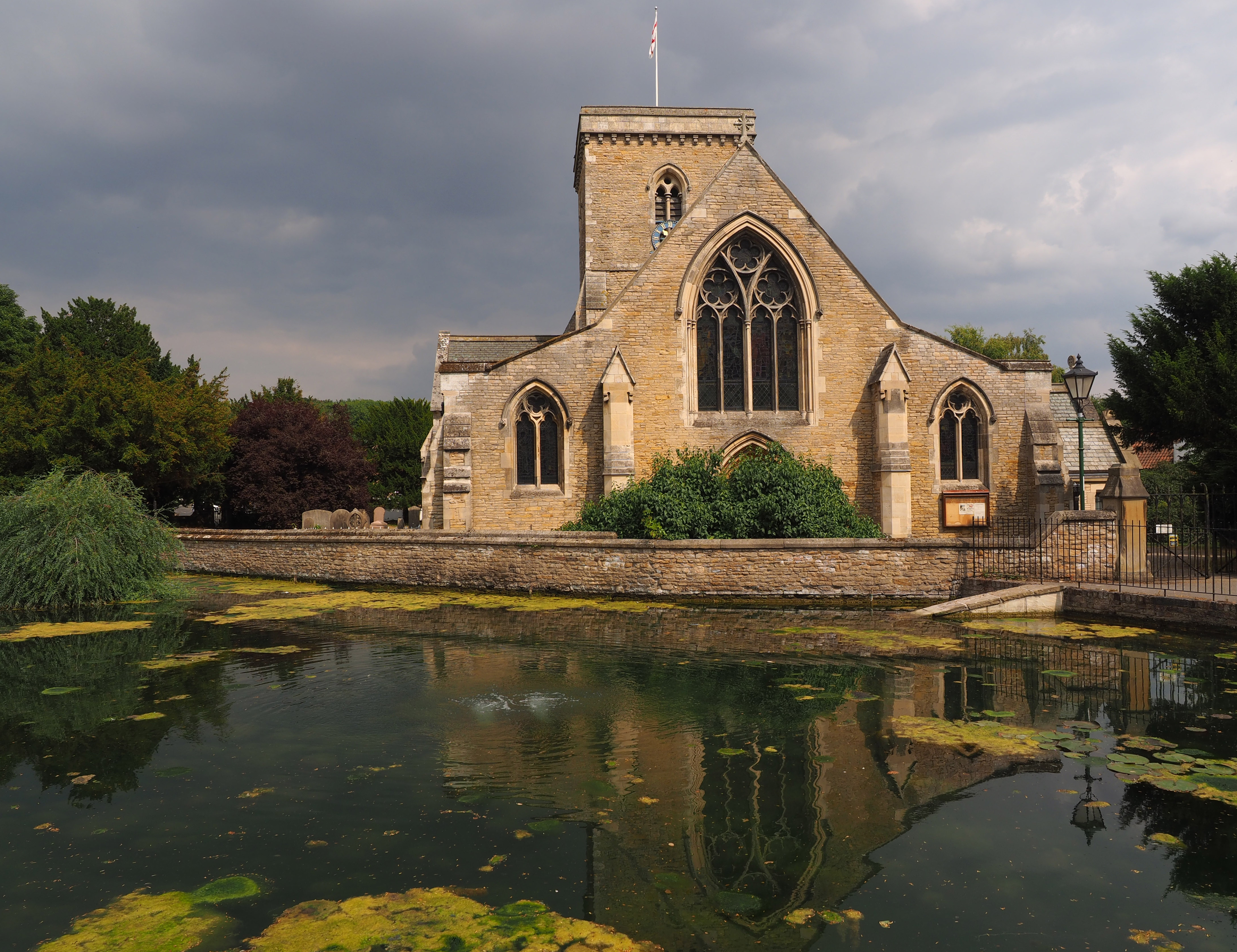
Welton Church and Pond (geograph 5849133).jpg - Keith D

St Helen's Church, Welton (I) (geograph 6279847).jpg - Keith D

St Helen's Church, Welton (II) (geograph 6279851).jpg - Keith D

St Helen's Church, Welton (III) (geograph 6279857).jpg - Keith D

Beck in Welton (geograph 6298798).jpg - Keith D

Welton Ings Small Pond (geograph 3316515).jpg - Keith D

The small pond at Melton Ings (geograph 3316518).jpg - Keith D

Wauldby Dam (geograph 3816480).jpg - Keith D

Wauldby Dam (geograph 4188371).jpg - Keith D

Wauldby Chapel (geograph 4380777).jpg - Keith D

Wauldby Dam is a very photogenic pond, with pin-sharp reflections (geograph 4407021).jpg - Keith D

Wauldby Dam and its upside-down trees (geograph 4407023).jpg - Keith D

Holderness Drain, Kingston upon Hull (geograph 5634180).jpg - Keith D

Holderness Drain, Kingston upon Hull (geograph 5634184).jpg - Keith D

Dyke side bush reflected in water (geograph 5276784).jpg - Keith D

Walking east on Scurf Dyke with reflection (geograph 5276772).jpg - Keith D

River Hull at Bethell's Bridge (geograph 6516358).jpg - Keith D

Afternoon shadow on the River Hull (geograph 5268580).jpg - Keith D

Overcast sky but a little sun to cast a shadow on the River Hull (geograph 5268588).jpg - Keith D

Hempholme Lock and River Hull (geograph 5778901).jpg - Keith D
Looking north on Roam Drain (geograph 5268484).jpg - Keith D

Beverley and Barmston Drain Top Hill Low (geograph 5268602).jpg - Keith D

Baswick Landing (geograph 5090000).jpg - Keith D

Fence in the river, near Baswick Steer (geograph 5090004).jpg - Keith D

Beverley and Barmston Drain from Top Hill Low bridge (geograph 5268609).jpg - Keith D
Barmston Drain at Tophill Low Bridge (geograph 5933168).jpg - Keith D

Path alongside the Beverley and Barmston Drain (geograph 6147307).jpg - Keith D

The Beverley and Barmston Drain (geograph 6148315).jpg - Keith D

Pond at Warter (geograph 5608915).jpg - Keith D

Village pond at Warter (geograph 6009933).jpg - Keith D