Wikimedi'Òc
Modes d'emploi

Cet album fait partie des albums


WestervilleLS-exposure-RockIslandTrail-IrwinRd-20230422 193039 lmc 8.4.jpg - Bhugh

WintersetLS-cliff-RockIslandTrail-Frost-LMC 20231106 163355 LMC8.3R8 Moto G Stylus 2022 first-CROP-CROP.jpg - Bhugh

WestervilleLS-crinoid-RockIslandTrail-75thSt-IMG 20230419 174042699.jpg - Bhugh

WestervilleLS-Crinoids-RockIslandTrail-75thSt-IMG 20230419 174648604.jpg - Bhugh

WestervilleLS-fossils-RockIslandTrail-75thSt-IMG 20230419 174712352.jpg - Bhugh

BlockLS-RockIslandTrail-75thSt-20230422 200158 lmc 8.4.jpg - Bhugh

WintersetLS-detail-RockIslandTrail-Noland-IMG 20231106 164111419.jpg - Bhugh

WintersetLS-cliff-RockIslandTrail-Frost-20230422 200738 lmc 8.4.jpg - Bhugh

WintersetLS-RockIslTrail-Noland-LMC 20241008 184525 LMC8.3R8 Moto G Stylus 2022 first.jpg - Bhugh

Cave Spring, Santa Fe Trail Campground.jpg - Bhugh

Wea Shale, Cherryvale Formation, Lower Linn Subgroup, Kansas City Group.jpg - Bhugh

LMC 20250412 175105 2024-10-03 LMC8.4r8.jpg - Bhugh

Raytown Limestone Formation and underlying Muncie Creek Shale, Kansas City Group.jpg - Bhugh

Detail of Cement City Limestone, Kansas City Group.jpg - Bhugh

Block Limestone Exposed by a Creek.jpg - Bhugh

Wea Shale Excavated by a Burrowing Rodent.jpg - Bhugh
MOMap-doton-Raytown.png - SieBot

Jackson County Missouri Incorporated and Unincorporated areas Raytown Highlighted.svg - ArkyBot~commonswiki
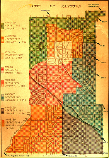
RaytownStreetMap.jpg - Btvarner

Raytown South High School - Raytown Missouri 08-31-2013.jpg - Ichabod

Aerial view of Raytown, Missouri 8-31-2013.JPG - Ichabod
Rice-Tremonti Home Raytown Missouri Photo by Lila Haris.jpg - Smuckola

5. Rice-Tremonti Home (8801 E 66th Street, Raytown, MO) on the California and Oregon National Historic Trails (2003) (dbc9c787-8c06-40eb-99bb-4da6f5690370).JPG - BMacZeroBot