Wikimedi'Òc
Modes d'emploi

Cet album fait partie des albums
Cet album photos contient les sous-albums suivants :


Path on Hay Bluff - geograph.org.uk - 2574528.jpg - GeographBot

Welsh Bridleway North Powys.JPG - MylesC~commonswiki

Steep path down Craig y Ddinas - geograph.org.uk - 14636.jpg - GeographBot

Offa's Dyke Path near Hengwm Hill - geograph.org.uk - 38336.jpg - GeographBot

Trackway, Glanmerin - geograph.org.uk - 34397.jpg - GeographBot

Footpath into Cwm Llwch - geograph.org.uk - 83880.jpg - GeographBot

The Hermits Coach Road - geograph.org.uk - 86885.jpg - GeographBot

Path on the slopes of Pen Milan - geograph.org.uk - 190710.jpg - GeographBot

The path to Corn Du - geograph.org.uk - 190460.jpg - GeographBot

Offa's Dyke path - geograph.org.uk - 200308.jpg - GeographBot
Bracken, Beacon Hill - geograph.org.uk - 226176.jpg - GeographBot

Track up southern slopes of Mynydd Llangorse - geograph.org.uk - 248474.jpg - GeographBot

Footpath from Pont Pentre Llech - geograph.org.uk - 284540.jpg - GeographBot

Footpath to Pen yr Allt fâch - geograph.org.uk - 296818.jpg - GeographBot

Footpath at Pen y bryn - geograph.org.uk - 318157.jpg - GeographBot

Footpath to the Digedi Brook - geograph.org.uk - 318071.jpg - GeographBot
Grassy track up Twyn-y-Gaer - geograph.org.uk - 311567.jpg - GeographBot

Forest Footpath - geograph.org.uk - 376977.jpg - GeographBot

Green lane above Twyn, Crickhowell - geograph.org.uk - 369395.jpg - GeographBot

Path up west side of Fan y Big - geograph.org.uk - 402483.jpg - GeographBot

Offa's Dyke near Discoed - geograph.org.uk - 438553.jpg - GeographBot
Approaching Hay Bluff - geograph.org.uk - 442247.jpg - GeographBot

Footpath from Treheslog Farm - geograph.org.uk - 461509.jpg - GeographBot

Llangynog with Y Gribin - geograph.org.uk - 477517.jpg - GeographBot

Jack Mytton Way - geograph.org.uk - 497636.jpg - GeographBot
Offa's Dyke Footpath on Blodwel Rock - geograph.org.uk - 526835.jpg - GeographBot

Pont ar Ddyfi - geograph.org.uk - 521842.jpg - GeographBot

Footpath blocked - geograph.org.uk - 536565.jpg - GeographBot

Footpath over to Tredustan - geograph.org.uk - 539078.jpg - GeographBot

Grassy track leading down from the Severn Way to the river - geograph.org.uk - 532333.jpg - GeographBot

Path above Pen Rhos Dirion - geograph.org.uk - 540054.jpg - GeographBot

The Severn Way above Aberhafesp - geograph.org.uk - 540834.jpg - GeographBot

Path through bracken on side of Pen Coed Hill - geograph.org.uk - 568497.jpg - GeographBot

Pererindod Melangell, Dyfnant Forest - geograph.org.uk - 560344.jpg - GeographBot

Feel the silt beneath your feet - geograph.org.uk - 579375.jpg - GeographBot

Montgomery Canal near Abermule - geograph.org.uk - 588601.jpg - GeographBot

Montgomery Canal south of Pool Quay - geograph.org.uk - 588637.jpg - GeographBot

Route of the dismantled tramway on Ogof Ffynnon Ddu - geograph.org.uk - 589716.jpg - GeographBot

Trees and big hedges - geograph.org.uk - 580974.jpg - GeographBot

Footpath By River Teme, Knighton - geograph.org.uk - 591472.jpg - GeographBot

Footpath To Offa's Dyke - geograph.org.uk - 591470.jpg - GeographBot

Marker post for the Pererindod Melangell - geograph.org.uk - 600290.jpg - GeographBot

Pererindod Melangell trail - geograph.org.uk - 600268.jpg - GeographBot

Montgomery canal near Belan - geograph.org.uk - 617416.jpg - GeographBot

Decorative paving, Severn Porte, Llanidloes - geograph.org.uk - 622382.jpg - GeographBot

Footpath to Dol-y-felin - geograph.org.uk - 629462.jpg - GeographBot

Footpath near Tiruched Farm - geograph.org.uk - 636907.jpg - GeographBot

Llwybyr Glyndwr - Glyndwr's Way - geograph.org.uk - 642749.jpg - GeographBot

Parting of the ways - geograph.org.uk - 669067.jpg - GeographBot

Restricted byway - geograph.org.uk - 669966.jpg - GeographBot

Track to the saddle - geograph.org.uk - 666881.jpg - GeographBot

Green lane - geograph.org.uk - 670822.jpg - GeographBot

In Stile - geograph.org.uk - 687821.jpg - GeographBot

Stile with a View - geograph.org.uk - 687542.jpg - GeographBot

Adjacent Footpath - geograph.org.uk - 692549.jpg - GeographBot

Parting of the ways^ - geograph.org.uk - 693972.jpg - GeographBot
Approaching Beacon Ring - geograph.org.uk - 709586.jpg - GeographBot

Footpath across the field - geograph.org.uk - 732273.jpg - GeographBot

Paved Path to Corn Du and Pen-Y-Fan - geograph.org.uk - 734165.jpg - GeographBot

Alison's Seat - geograph.org.uk - 742007.jpg - GeographBot

Eroded footpath - geograph.org.uk - 755512.jpg - GeographBot

Descending Corn Du - geograph.org.uk - 764913.jpg - GeographBot

Steep path to the woods - geograph.org.uk - 774647.jpg - Geograph Update Bot

Country footpath - geograph.org.uk - 815704.jpg - GeographBot

Route up to Corn Du - geograph.org.uk - 817419.jpg - GeographBot

Choice of routes - geograph.org.uk - 839513.jpg - GeographBot

Footpath to Tynrhos - geograph.org.uk - 839799.jpg - GeographBot

Steep climb to the top of Pistyll Rhaeadr - geograph.org.uk - 978918.jpg - GeographBot

Footpath near Llanfihangel Nant Bran - geograph.org.uk - 1013458.jpg - GeographBot

Footpath near Llanfihangel Nant Bran - geograph.org.uk - 1013472.jpg - GeographBot

Footpath near Llanfihangel Nant Bran - geograph.org.uk - 1013475.jpg - GeographBot

Above the waterfall - geograph.org.uk - 1059648.jpg - GeographBot

New Gate - geograph.org.uk - 1060814.jpg - GeographBot

Bridge to the old pump house - geograph.org.uk - 1072993.jpg - GeographBot
Riverside walk - geograph.org.uk - 1090988.jpg - GeographBot

A lone walker on Offa's Dyke Path - geograph.org.uk - 1108585.jpg - GeographBot

Descent from Corn Du - geograph.org.uk - 1108598.jpg - GeographBot

Path to Corn Du - geograph.org.uk - 1108603.jpg - GeographBot

Path to Corn Du - geograph.org.uk - 1108612.jpg - GeographBot

Path to Corn Du - geograph.org.uk - 1108635.jpg - GeographBot
Bwlch ar y Fan, Brecon Beacons - geograph.org.uk - 1111149.jpg - GeographBot

Path at Ffridd Faldwyn - geograph.org.uk - 1115127.jpg - GeographBot

Stile, Ffridd Faldwyn - geograph.org.uk - 1115129.jpg - GeographBot
Forestry debris and clear-fell beside the Severn - geograph.org.uk - 1122469.jpg - GeographBot

Near the end of the Severn Way boardwalk - geograph.org.uk - 1122454.jpg - GeographBot

Fan Fawr in the early sunshine. - geograph.org.uk - 1235117.jpg - GeographBot

Footpath close to Llanllwchaiarn church - geograph.org.uk - 1275044.jpg - GeographBot

The path down to Storey Arms - geograph.org.uk - 1279674.jpg - GeographBot

Mynydd Pen-y-fâl - geograph.org.uk - 1299281.jpg - GeographBot

Footpath from Cambrian Way to Dolafon - geograph.org.uk - 1301189.jpg - GeographBot

Bridge 94, Monmouthshire and Brecon Canal - geograph.org.uk - 1317646.jpg - GeographBot

Looking down Broad Street, Montgomery - geograph.org.uk - 1314224.jpg - GeographBot

A pleasant spot for lunch - geograph.org.uk - 1320366.jpg - GeographBot

Bridge 118, Monmouthshire and Brecon Canal - geograph.org.uk - 1322342.jpg - GeographBot

Bridge 128, Monmouthshire and Brecon Canal - geograph.org.uk - 1325163.jpg - GeographBot

Bridge 130, Monmouthshire and Brecon Canal - geograph.org.uk - 1325695.jpg - GeographBot

House at Llangattock Wharf - geograph.org.uk - 1322199.jpg - GeographBot

Marina at Pen-pedair-heol - geograph.org.uk - 1320239.jpg - GeographBot

Usk Valley Walk at Aber - geograph.org.uk - 1378223.jpg - GeographBot

Aqueduct on the Brecon and Monmouthshire Canal - geograph.org.uk - 1382382.jpg - GeographBot

Path up Corn Du - geograph.org.uk - 1383440.jpg - GeographBot

Footpath below Creigiau Pennant - geograph.org.uk - 1425713.jpg - GeographBot

Approaching Talyrnau - geograph.org.uk - 1434188.jpg - GeographBot

Looking down the footpath - geograph.org.uk - 1447164.jpg - GeographBot

Bit muddy but well worth it - geograph.org.uk - 1496425.jpg - GeographBot

A very faint, old footpath - geograph.org.uk - 1508291.jpg - GeographBot
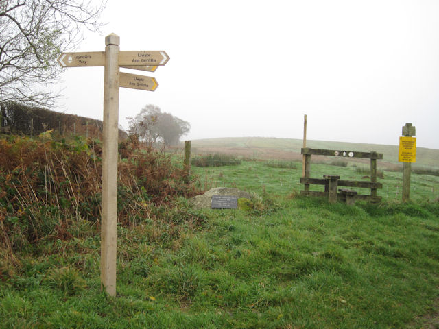
Ann Griffiths walk opposite Dolwar Fach entrance - geograph.org.uk - 1574233.jpg - GeographBot

Footpath and cycleway alongside Caban Coch reservoir - geograph.org.uk - 1596362.jpg - GeographBot

Footpath near Dolygaer - geograph.org.uk - 1651282.jpg - GeographBot

Footpath by Chwar Mawr - geograph.org.uk - 1765287.jpg - GeographBot

Bridleway beside Afon Bidno - geograph.org.uk - 2300550.jpg - GeographBot

Gate in woodland near Llansantffraed - geograph.org.uk - 2414055.jpg - GeographBot

The Gap Road below Bwlch ar y Fan - geograph.org.uk - 2583290.jpg - GeographBot

Canalside path, Brecon - geograph.org.uk - 2608649.jpg - GeographBot

Railway path above Pen-y-garreg Reservoir - geograph.org.uk - 2608850.jpg - GeographBot

Path at Blaen Taf Fawr - geograph.org.uk - 2631550.jpg - GeographBot

Public right of way at Pen-y-crug.jpg - BigDom