×

Direction Sign - Signpost on Cheese Lane near Coryates - geograph.org.uk - 7406088.jpg - GeographBot

Hellstone portesham.jpg - JimChampion

The Hell Stone Dolmen - geograph.org.uk - 994.jpg - GeographBot

Portesham down and strip lynchets with the Isle of Portland in the distance - geograph.org.uk - 25049.jpg - GeographBot

Green phone box at Portesham. - geograph.org.uk - 45359.jpg - GeographBot

Portesham hill looking south towards the coast - geograph.org.uk - 40270.jpg - GeographBot

Woodland - geograph.org.uk - 48056.jpg - GeographBot

Clayhanger Farm - geograph.org.uk - 123883.jpg - GeographBot

Disused railway near Portesham - geograph.org.uk - 123895.jpg - GeographBot

East Elworth Farm - geograph.org.uk - 123890.jpg - GeographBot

Green Lane, West Elworth - geograph.org.uk - 123887.jpg - GeographBot

The Fleet at Langton Hive Point - geograph.org.uk - 126433.jpg - GeographBot

Coast Path and Hodder's Coppice - geograph.org.uk - 161492.jpg - GeographBot

Coast Path and farmland, Merry Hill - geograph.org.uk - 161486.jpg - GeographBot

Bull on Portesham Hill - geograph.org.uk - 242800.jpg - GeographBot

Cattle on Portesham Hill - geograph.org.uk - 242795.jpg - GeographBot

Field and gate west of Hampton Barn - geograph.org.uk - 242743.jpg - GeographBot

Hampton Barn - geograph.org.uk - 242746.jpg - GeographBot
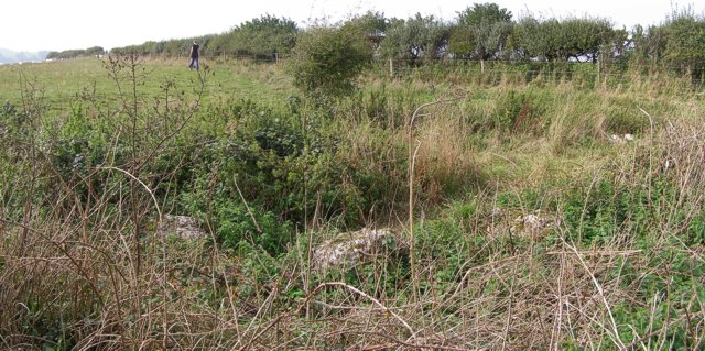
Hampton Down stone circle - geograph.org.uk - 242207.jpg - GeographBot

Inland coastal footpath on Hampton Down - geograph.org.uk - 242738.jpg - GeographBot

Sheep grazing near the Hellstone - geograph.org.uk - 242199.jpg - GeographBot

Sheep on Hampton Down - geograph.org.uk - 242193.jpg - GeographBot

Stone wall in disrepair, north of the Hellstone - geograph.org.uk - 242749.jpg - GeographBot

The Portesham-Winterbourne Abbas road - geograph.org.uk - 242747.jpg - GeographBot

View towards Portesham Hill from Hampton Barn - geograph.org.uk - 242752.jpg - GeographBot

End of overground power line, Hell Bottom - geograph.org.uk - 298203.jpg - GeographBot
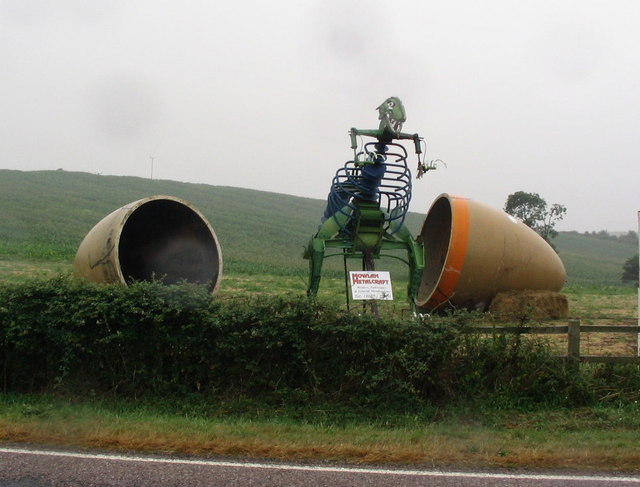
Jurassic Coast Dinosaur^ - geograph.org.uk - 341329.jpg - GeographBot

18th Century Barn at Friar Waddon Farm - geograph.org.uk - 402325.jpg - GeographBot

Friar Waddon (2) - geograph.org.uk - 402319.jpg - GeographBot

Friar Waddon - geograph.org.uk - 402316.jpg - GeographBot

Dismantled Railway Track - geograph.org.uk - 411546.jpg - GeographBot

Crooked tree on the B3157 near Portesham - geograph.org.uk - 430103.jpg - GeographBot

Fabulous views east - geograph.org.uk - 456567.jpg - GeographBot

Looking towards Portland from above Abbotsbsury - geograph.org.uk - 521891.jpg - GeographBot

Farm track junction and hedgerow - geograph.org.uk - 619456.jpg - GeographBot

Farm track and pylons at Corton Down - geograph.org.uk - 620125.jpg - GeographBot

Portesham Farm - geograph.org.uk - 620135.jpg - GeographBot

Downland, Corton - geograph.org.uk - 654840.jpg - GeographBot

Countryside near Coryates - geograph.org.uk - 897843.jpg - GeographBot

Farm track near Friar Waddon - geograph.org.uk - 897803.jpg - GeographBot

Friar Waddon - geograph.org.uk - 897804.jpg - GeographBot

Friar Waddon Hill - geograph.org.uk - 897805.jpg - GeographBot

Power lines near Corton Farm - geograph.org.uk - 897807.jpg - GeographBot

Power lines near Corton Farm - geograph.org.uk - 897808.jpg - GeographBot

Wheatfield near Coryates - geograph.org.uk - 897844.jpg - GeographBot

Black Down Barn - geograph.org.uk - 913852.jpg - GeographBot

Hampton Stone Circle - geograph.org.uk - 913824.jpg - GeographBot

The Kings Arms Hotel Portesham - geograph.org.uk - 916369.jpg - GeographBot

Track beside Benecke Wood - geograph.org.uk - 913828.jpg - GeographBot

House and Farm track at Tatton - geograph.org.uk - 966239.jpg - GeographBot

Maize Field near Tatton - geograph.org.uk - 966240.jpg - GeographBot

Corton Down - geograph.org.uk - 1022755.jpg - GeographBot
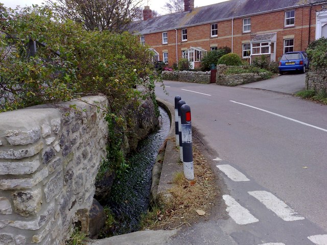
Culvert in Portesham - geograph.org.uk - 1022388.jpg - GeographBot

High stone wall, Portesham - geograph.org.uk - 1022430.jpg - GeographBot

Portesham Dorset - geograph.org.uk - 1021340.jpg - GeographBot

Portesham Dorset - geograph.org.uk - 1021341.jpg - GeographBot

School Building, Portesham - geograph.org.uk - 1022453.jpg - GeographBot

The King's Arms, Portesham - geograph.org.uk - 1022443.jpg - GeographBot

Dry stone wall, Bronkham Hill - geograph.org.uk - 1034614.jpg - GeographBot

Field warning sign at Portesham, Dorset - geograph.org.uk - 1034148.jpg - GeographBot

Barrows on Ridge Hill - geograph.org.uk - 1092251.jpg - GeographBot

Coryates, Dorset - geograph.org.uk - 1092397.jpg - GeographBot

Countryside near Portesham - geograph.org.uk - 1092401.jpg - GeographBot

SW Coast Path - geograph.org.uk - 1092249.jpg - GeographBot

Shilvinghampton, Dorset - geograph.org.uk - 1092394.jpg - GeographBot

Winters Lane, Waddon, Dorset - geograph.org.uk - 1092402.jpg - GeographBot

British Telecom building near Portesham - geograph.org.uk - 1218644.jpg - GeographBot

Countryside near Portesham - geograph.org.uk - 1218645.jpg - GeographBot

SW Coast Path Near Portesham - geograph.org.uk - 1216576.jpg - GeographBot

White Hill - geograph.org.uk - 1216578.jpg - GeographBot

Abbotsbury, arable land - geograph.org.uk - 1528841.jpg - GeographBot

Abbotsbury, reedbed - geograph.org.uk - 1528856.jpg - GeographBot

Portesham, drain - geograph.org.uk - 1528877.jpg - GeographBot

Portesham, farm entrance - geograph.org.uk - 1524979.jpg - GeographBot

Portesham, fingerpost - geograph.org.uk - 1529631.jpg - GeographBot

Portesham, phone box - geograph.org.uk - 1529609.jpg - GeographBot

Portesham, post office - geograph.org.uk - 1529636.jpg - GeographBot

Portesham, stream - geograph.org.uk - 1529625.jpg - GeographBot

Portesham, trackbed - geograph.org.uk - 1528781.jpg - GeographBot

Portesham Hill - geograph.org.uk - 1529649.jpg - GeographBot

White Hill, downland - geograph.org.uk - 1529577.jpg - GeographBot

Portesham, Dorset ... when post offices die! (4354633440).jpg - File Upload Bot (Magnus Manske)

The Valley of the Stones, near Little Bredy, Dorset.jpg - Ydigresse

Portesham mirror.JPG - Pasicles

White Hill, Road near the hill - geograph.org.uk - 1820727.jpg - GeographBot

Friar Waddon, postbox № DT3 71 - geograph.org.uk - 1886758.jpg - GeographBot

Waddon, heading for Portesham - geograph.org.uk - 1886763.jpg - GeographBot

Waddon, view towards misty Portland - geograph.org.uk - 1886770.jpg - GeographBot

Portesham, almost hidden signpost - geograph.org.uk - 1886774.jpg - GeographBot

Portesham, finger-post detail - geograph.org.uk - 1886777.jpg - GeographBot

Portesham, postbox № DT3 80 - geograph.org.uk - 1886782.jpg - GeographBot

Portesham, the village green - geograph.org.uk - 1887262.jpg - GeographBot

Portesham, the green phone box - geograph.org.uk - 1887266.jpg - GeographBot

Portesham, the village green from the north - geograph.org.uk - 1887269.jpg - GeographBot

Portesham, a glimpse of the King’s Arms - geograph.org.uk - 1887272.jpg - GeographBot

Portesham, postbox № DT3 45 - geograph.org.uk - 1887274.jpg - GeographBot

Path near Hardy Monument - geograph.org.uk - 1945503.jpg - GeographBot

Bronkham Hill - geograph.org.uk - 1945504.jpg - GeographBot

Barrow on Bronkham Hill - geograph.org.uk - 1945505.jpg - GeographBot

Path to tumulus on Bronkham Hill - geograph.org.uk - 1945507.jpg - GeographBot

The way to Hell - geograph.org.uk - 1946160.jpg - GeographBot

Signpost on Bronkham Hill - geograph.org.uk - 1946169.jpg - GeographBot
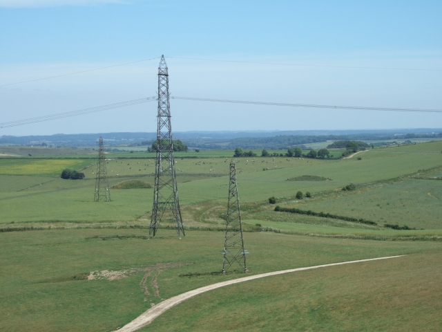
Pylons seen from Bronkham Hill - geograph.org.uk - 1946186.jpg - GeographBot

Storage tanks on Bronkham Hill-Corton Down - geograph.org.uk - 1946202.jpg - GeographBot

Badger sett on the SW Coast Path - geograph.org.uk - 1946215.jpg - GeographBot

Storage tanks on Bronkham Hill-Corton Down - geograph.org.uk - 1946218.jpg - GeographBot

Ruined building on south slope of Bronkham Hill - geograph.org.uk - 1946223.jpg - GeographBot

One of two ruined farmhouses at Bench in Hell Bottom - geograph.org.uk - 1946239.jpg - GeographBot

The Jubilee Way passing Bench - geograph.org.uk - 1946243.jpg - GeographBot

Jubilee Trail below Bronkham Hill - geograph.org.uk - 1946252.jpg - GeographBot

Corton, Junction to Corton Farm - geograph.org.uk - 2038961.jpg - GeographBot

Looking towards Portesham from path to the Hardy Monument - geograph.org.uk - 2108011.jpg - GeographBot

The Dorset Ridgway path, looking towards Bronkham Hill - geograph.org.uk - 2108033.jpg - GeographBot

Track and farmland, Shilvinghampton, Portesham - geograph.org.uk - 2230205.jpg - GeographBot

Pasture, Portesham - geograph.org.uk - 2230213.jpg - GeographBot

Pasture, Portesham - geograph.org.uk - 2230222.jpg - GeographBot

Farmland, Portesham - geograph.org.uk - 2230233.jpg - GeographBot

Pasture, track and woodland, Portesham - geograph.org.uk - 2230239.jpg - GeographBot

Pasture, Shilvinghampton, Portesham - geograph.org.uk - 2230245.jpg - GeographBot

Pasture, Shilvinghampton, Portesham - geograph.org.uk - 2230248.jpg - GeographBot

Pasture, Portesham - geograph.org.uk - 2230257.jpg - GeographBot

Track and farmland, Corton, Portesham - geograph.org.uk - 2230268.jpg - GeographBot

Track and farmland, Buckland Ripers, Chickerell - geograph.org.uk - 2230272.jpg - GeographBot

Farmland and track, Friar Waddon, Portesham - geograph.org.uk - 2230274.jpg - GeographBot

Portesham - 1982 - geograph.org.uk - 2247716.jpg - GeographBot

Sheep on Corton Hill - geograph.org.uk - 2314025.jpg - GeographBot

Anyone seen Hardy Monument^ - geograph.org.uk - 2314966.jpg - GeographBot

Hardy Monument and Signpost - geograph.org.uk - 2314984.jpg - GeographBot

Pylons (and Portland), Corton Down - geograph.org.uk - 2315023.jpg - GeographBot

View across to Portland - geograph.org.uk - 2315258.jpg - GeographBot

Black Down Barn - geograph.org.uk - 2316045.jpg - GeographBot

Cows at Portesham Farm - geograph.org.uk - 2319933.jpg - GeographBot

Dismantled Railway - geograph.org.uk - 2320000.jpg - GeographBot

Farm Track and Young Trees, Portesham - geograph.org.uk - 2333097.jpg - GeographBot

Looking past the Portesham Withy Beds - geograph.org.uk - 2333109.jpg - GeographBot

Portesham Withy Beds and Chesil Beach - geograph.org.uk - 2333132.jpg - GeographBot

Trackbed and Derelict Railway Building - geograph.org.uk - 2333201.jpg - GeographBot

The King's Arms - geograph.org.uk - 2542962.jpg - GeographBot

Junction of Brandon Lane and Front Street - geograph.org.uk - 2542966.jpg - GeographBot

Portesham - 1982 - geograph.org.uk - 2772553.jpg - GeographBot

Portesham - 1982 - geograph.org.uk - 2772556.jpg - GeographBot

The Hardy Monument from the east - geograph.org.uk - 2875139.jpg - GeographBot

Pylons on Corton Down - geograph.org.uk - 2892353.jpg - GeographBot

Bridleway on Bronkham Hill - geograph.org.uk - 2892370.jpg - GeographBot

Tumuli on Bronkham Hill - geograph.org.uk - 2892386.jpg - GeographBot

Track on White Hill - geograph.org.uk - 2917391.jpg - GeographBot

Portesham down - geograph.org.uk - 2917409.jpg - GeographBot

Strip lynchets, Portesham Down - geograph.org.uk - 2917411.jpg - GeographBot

Portesham Down - geograph.org.uk - 2917416.jpg - GeographBot

The South Dorset Ridgeway - geograph.org.uk - 2917420.jpg - GeographBot

Footpath through Benecke Wood - geograph.org.uk - 2918126.jpg - GeographBot

Black Down - geograph.org.uk - 2918134.jpg - GeographBot

View to the east from Black Down - geograph.org.uk - 2918145.jpg - GeographBot

Goldcombe Farm - geograph.org.uk - 2918151.jpg - GeographBot

Pylons on Corton Hill - geograph.org.uk - 2918178.jpg - GeographBot

Stones for wall building - geograph.org.uk - 2918188.jpg - GeographBot

Meeting of footpaths - geograph.org.uk - 2918208.jpg - GeographBot

Coryates, farm road - geograph.org.uk - 3308096.jpg - GeographBot

Coryates, fingerpost - geograph.org.uk - 3308110.jpg - GeographBot

Portesham, Church Lane - geograph.org.uk - 3308311.jpg - GeographBot

Portesham Temperance Hall - geograph.org.uk - 3308316.jpg - GeographBot

Portesham Methodist Church - geograph.org.uk - 3308327.jpg - GeographBot

Portesham, Kings Arms - geograph.org.uk - 3308329.jpg - GeographBot

View eastwards from the Hardy Monument - geograph.org.uk - 3314693.jpg - GeographBot

Portesham, sheep grazing - geograph.org.uk - 3383689.jpg - GeographBot

Corton, Blackacre Farm - geograph.org.uk - 3383806.jpg - GeographBot

Weymouth Bay from the Hardy Monument - geograph.org.uk - 3511504.jpg - GeographBot

New bus shelter with plaque - geograph.org.uk - 3813496.jpg - GeographBot

Bus shelter plaque - geograph.org.uk - 3813499.jpg - GeographBot

Portesham House - geograph.org.uk - 3813518.jpg - GeographBot

Olds Garage closed - geograph.org.uk - 3813529.jpg - GeographBot

Olds Garage closed - geograph.org.uk - 3813537.jpg - GeographBot

Old railway embankment - geograph.org.uk - 3813552.jpg - GeographBot

Portesham - geograph.org.uk - 3813558.jpg - GeographBot

Sleepers Cottage - geograph.org.uk - 3813566.jpg - GeographBot

Portesham from Bramdon Lane - geograph.org.uk - 3813571.jpg - GeographBot

Portesham New Road and Front Street - geograph.org.uk - 3813584.jpg - GeographBot

Church Lane - geograph.org.uk - 3813596.jpg - GeographBot

Front Street, Portesham - geograph.org.uk - 3813620.jpg - GeographBot

Front Street and stream - geograph.org.uk - 3813630.jpg - GeographBot

The King's Arms - geograph.org.uk - 3813646.jpg - GeographBot

Ordnance Survey Flush Bracket G5012 - geograph.org.uk - 3930609.jpg - GeographBot

Ordnance Survey Flush Bracket G5011 - geograph.org.uk - 3930631.jpg - GeographBot

Signpost in Portesham - geograph.org.uk - 3941471.jpg - GeographBot

War Memorial and Portesham church - geograph.org.uk - 3941477.jpg - GeographBot

Cherry blossom in Portesham - geograph.org.uk - 3941489.jpg - GeographBot

View from the Hardy Monument - geograph.org.uk - 3941514.jpg - GeographBot

Abandoned farmstead, Hell Bottom - geograph.org.uk - 4039322.jpg - GeographBot

Portesham House, former home of the other Thomas Hardy (1) - geograph.org.uk - 4246296.jpg - GeographBot

Portesham House, former home of the other Thomas Hardy (2) - geograph.org.uk - 4246305.jpg - GeographBot

Dry Stone Walling - geograph.org.uk - 4270452.jpg - GeographBot

Strip Lynchets near Portesham - geograph.org.uk - 4308358.jpg - GeographBot

Hampton Down Stone Circle, South Dorset Ridgeway - geograph.org.uk - 4308363.jpg - GeographBot

Portesham Village, Dorset - geograph.org.uk - 4308365.jpg - GeographBot

Manor House, Portesham - geograph.org.uk - 4308368.jpg - GeographBot

Hell stone, near Portesham, Dorset - geograph.org.uk - 4308379.jpg - GeographBot

South East from the Monument - geograph.org.uk - 4322843.jpg - GeographBot

Hampton Stone Circle, Dorset - geograph.org.uk - 4413887.jpg - GeographBot

Friar Waddon Hill - geograph.org.uk - 4414307.jpg - GeographBot

Entrance to Corton Farm - geograph.org.uk - 4414315.jpg - GeographBot

Footpath - geograph.org.uk - 4417563.jpg - GeographBot

Benchmark on property, Corton Hill - geograph.org.uk - 4574623.jpg - GeographBot

Scaffolding on property, Corton Hill - geograph.org.uk - 4574627.jpg - GeographBot

Rocket Quarry, near Portesham Farm - geograph.org.uk - 4574681.jpg - GeographBot
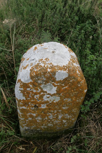
Boundary stone, Ridgeway Hill - geograph.org.uk - 4618683.jpg - GeographBot

View towards coast from Friar Waddon - geograph.org.uk - 4816032.jpg - GeographBot

Strip lynchets on the South Dorset ridgeway near Portesham - geograph.org.uk - 4834206.jpg - GeographBot

Friar Waddon Farm - geograph.org.uk - 4837546.jpg - GeographBot

Corton Dairy House ruin - geograph.org.uk - 4919540.jpg - GeographBot

Pylons on Hewish Hill - geograph.org.uk - 4919622.jpg - GeographBot

Ordnance Survey Cut Mark - geograph.org.uk - 4935633.jpg - GeographBot

An old building belonging to Waddon House near Portesham, Dorset - geograph.org.uk - 4952671.jpg - GeographBot

Portesham, view towards Portland from the Hardy Monument - geograph.org.uk - 4954705.jpg - GeographBot

Portesham, refreshment caravan at the Hardy Monument - geograph.org.uk - 4954708.jpg - GeographBot

Portesham, staircase in the Hardy Monument - geograph.org.uk - 4954714.jpg - GeographBot

Portesham, path through bluebells at Hardy Monument - geograph.org.uk - 4954717.jpg - GeographBot

Portesham, bluebells and a Portland view - geograph.org.uk - 4954719.jpg - GeographBot

Portesham, bluebells and the Hardy Monument - geograph.org.uk - 4954723.jpg - GeographBot

View to the east from The Hardy Monument - geograph.org.uk - 4955227.jpg - GeographBot

View to the Hardy Monument - geograph.org.uk - 4955233.jpg - GeographBot

Gorse blossom and the Hardy Monument - geograph.org.uk - 4955234.jpg - GeographBot

Footpath near the Hardy Monument - geograph.org.uk - 4955236.jpg - GeographBot

Heathland around the Hardy Monument - geograph.org.uk - 4955238.jpg - GeographBot

Bridleway on Bronkham Hill - geograph.org.uk - 4955344.jpg - GeographBot

Bridleway on Bronkham Hill - geograph.org.uk - 4955349.jpg - GeographBot

Footpath to Hell Bottom - geograph.org.uk - 4955353.jpg - GeographBot

Track on Corton Down - geograph.org.uk - 4955358.jpg - GeographBot

Tumuli on Corton Down - geograph.org.uk - 4955737.jpg - GeographBot
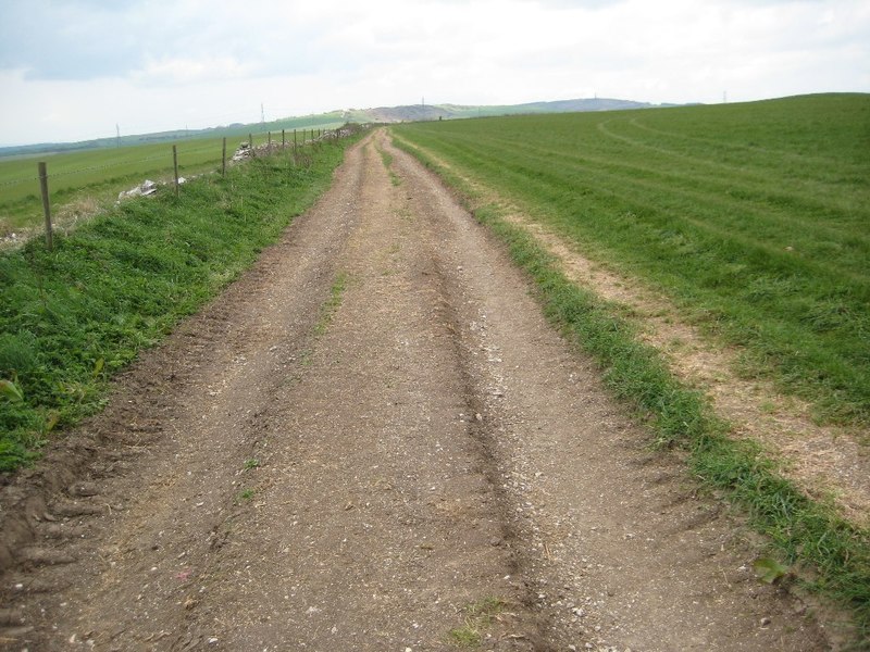
The South Dorset Ridgeway on Ridge Hill - geograph.org.uk - 4955907.jpg - GeographBot

Former Texaco Garage - geograph.org.uk - 4987727.jpg - GeographBot

Kings Arms, Portesham - geograph.org.uk - 4987736.jpg - GeographBot

Frys Close off Goose Hill, Portesham - geograph.org.uk - 4987739.jpg - GeographBot

Village Hall on Goose Hill, Portesham - geograph.org.uk - 4987741.jpg - GeographBot

Harebells, Hardy Monument - geograph.org.uk - 5059271.jpg - GeographBot

Barley, White Hill above Abbotsbury - geograph.org.uk - 5059314.jpg - GeographBot

White Hill on the South Dorset Ridgeway - geograph.org.uk - 5119736.jpg - GeographBot

Duck's Cafe, Portesham - geograph.org.uk - 5261216.jpg - GeographBot

Kings Arms and car park, Portesham - geograph.org.uk - 5261367.jpg - GeographBot

Frys Close, Portesham in the rain - geograph.org.uk - 5665610.jpg - GeographBot

Bramdon Close, Portesham - geograph.org.uk - 5665619.jpg - GeographBot

Where the paths divide - geograph.org.uk - 5750584.jpg - GeographBot

Portesham - geograph.org.uk - 5819868.jpg - GeographBot

View from Hardy's monument - geograph.org.uk - 5906776.jpg - GeographBot

Bronkham Hill view - geograph.org.uk - 5906777.jpg - GeographBot

View from the SWCP - geograph.org.uk - 5906783.jpg - GeographBot

Layby on B3157 - geograph.org.uk - 5965696.jpg - GeographBot

B3157 enters Portesham - geograph.org.uk - 5965925.jpg - GeographBot

B3157 at Elworth Corner - geograph.org.uk - 5965943.jpg - GeographBot

View SE from Bishop's Road - geograph.org.uk - 5966018.jpg - GeographBot

Bishop's Road - geograph.org.uk - 5966026.jpg - GeographBot

At Portesham Hill Cross - geograph.org.uk - 5966287.jpg - GeographBot

Ancient Tumuli - geograph.org.uk - 6022591.jpg - GeographBot

Old Direction Sign - Signpost by Front Street, Portesham Parish - geograph.org.uk - 6043445.jpg - GeographBot

Old Direction Sign - Signpost by Front Street, Portesham - geograph.org.uk - 6045197.jpg - GeographBot

Disused rail line and associated building, Portesham - geograph.org.uk - 6082453.jpg - GeographBot

Direction Sign - Signpost by Coryates, Portesham parish - geograph.org.uk - 6099271.jpg - GeographBot

St Peter's Church, Portesham - geograph.org.uk - 6203480.jpg - GeographBot

Lots of cars waiting to be scrapped - geograph.org.uk - 6219318.jpg - GeographBot

2008 Volkswagen Passat Highline TDI - geograph.org.uk - 6219322.jpg - GeographBot

2008 Honda CR-V ES I-CTDI - geograph.org.uk - 6219323.jpg - GeographBot

Bramdon Lane - geograph.org.uk - 6219326.jpg - GeographBot

Front Street - geograph.org.uk - 6219327.jpg - GeographBot

Portesham Hill - geograph.org.uk - 6219329.jpg - GeographBot

Hardy Monument, Black Down - geograph.org.uk - 6457347.jpg - GeographBot

Hell Stone Burial Chamber above Portesham - geograph.org.uk - 6481565.jpg - GeographBot

Wall on Ridge Hill - geograph.org.uk - 6498036.jpg - GeographBot

Misty, South Dorset Ridgeway - geograph.org.uk - 6498039.jpg - GeographBot

Tumulus in the mist - geograph.org.uk - 6498045.jpg - GeographBot

South Dorset Ridgeway - geograph.org.uk - 6498047.jpg - GeographBot

South Dorset Ridgeway - geograph.org.uk - 6498049.jpg - GeographBot

South Dorset Ridgeway - geograph.org.uk - 6498054.jpg - GeographBot

Tumulus, Ridge Hill - geograph.org.uk - 6498058.jpg - GeographBot

Tumulus, Ridge Hill - geograph.org.uk - 6498062.jpg - GeographBot

Footpath off Ridgeway Path - geograph.org.uk - 6498066.jpg - GeographBot

Ruined wall - geograph.org.uk - 6498070.jpg - GeographBot

South Dorset Ridgeway - geograph.org.uk - 6498076.jpg - GeographBot

South Dorset Ridgeway - geograph.org.uk - 6498081.jpg - GeographBot

Tumulus - geograph.org.uk - 6498084.jpg - GeographBot

South Dorset Ridgeway - geograph.org.uk - 6498087.jpg - GeographBot

Tumulus - geograph.org.uk - 6498089.jpg - GeographBot

Two tumuli - geograph.org.uk - 6502607.jpg - GeographBot

Tumulus, Corton Down - geograph.org.uk - 6502610.jpg - GeographBot

Pylon, Corton Down - geograph.org.uk - 6502619.jpg - GeographBot

View from Car Park for Bishop's Limekiln - geograph.org.uk - 6517800.jpg - GeographBot

Hardy Monument - geograph.org.uk - 6517827.jpg - GeographBot

Bishops Road looking towards the Hardy Monument - geograph.org.uk - 6517830.jpg - GeographBot

B3157 - geograph.org.uk - 6555132.jpg - GeographBot

B3157 - geograph.org.uk - 6555148.jpg - GeographBot

Three hedges - geograph.org.uk - 6555169.jpg - GeographBot

B3157 - geograph.org.uk - 6555173.jpg - GeographBot

Brandon lane - geograph.org.uk - 6555177.jpg - GeographBot

Brandon Lane - geograph.org.uk - 6555179.jpg - GeographBot

Entering Portesham - geograph.org.uk - 6555181.jpg - GeographBot

New Rd and Front Rd - geograph.org.uk - 6555183.jpg - GeographBot

Goose Hill - geograph.org.uk - 6555184.jpg - GeographBot

B3157 - geograph.org.uk - 6555187.jpg - GeographBot

B3157 - geograph.org.uk - 6555188.jpg - GeographBot

B3157 - geograph.org.uk - 6555190.jpg - GeographBot

B3157 - geograph.org.uk - 6555193.jpg - GeographBot

Sewage Works - geograph.org.uk - 6555204.jpg - GeographBot

Crops - geograph.org.uk - 6563350.jpg - GeographBot

B3157 - geograph.org.uk - 6563366.jpg - GeographBot

B3157 - geograph.org.uk - 6563384.jpg - GeographBot

Clover Farm - geograph.org.uk - 6563388.jpg - GeographBot

Mast by Bramdon Lane - geograph.org.uk - 6568909.jpg - GeographBot

Entering Portesham - geograph.org.uk - 6568911.jpg - GeographBot

Entering Portesham again^ - geograph.org.uk - 6568912.jpg - GeographBot

Ducks Cafe - geograph.org.uk - 6568913.jpg - GeographBot

Kings Arms - geograph.org.uk - 6568914.jpg - GeographBot

Fry's Close - geograph.org.uk - 6568918.jpg - GeographBot

Portesham Village Hall - geograph.org.uk - 6568919.jpg - GeographBot

Dorset pasture, Goose Hill - geograph.org.uk - 6568941.jpg - GeographBot

West Elworth turning - geograph.org.uk - 6568942.jpg - GeographBot

Road to West Elworth - geograph.org.uk - 6576112.jpg - GeographBot

Telephone Exchange - geograph.org.uk - 6576115.jpg - GeographBot

Ducks Cafe - geograph.org.uk - 6576121.jpg - GeographBot

Woodland along disused railway line - geograph.org.uk - 6576128.jpg - GeographBot

Marsh Farm - geograph.org.uk - 6576129.jpg - GeographBot

Farmland, Marsh Farm - geograph.org.uk - 6576173.jpg - GeographBot

Pasture - geograph.org.uk - 6576175.jpg - GeographBot

South Dorset Ridgeway near Dorchester - geograph.org.uk - 6601919.jpg - GeographBot

South Dorset Ridgeway near Dorchester - geograph.org.uk - 6601926.jpg - GeographBot

Tumuli near Dorchester - geograph.org.uk - 6601974.jpg - GeographBot

South Dorset Ridgeway near Dorchester - geograph.org.uk - 6601995.jpg - GeographBot

Pylons near Dorchester - geograph.org.uk - 6602030.jpg - GeographBot

South Dorset Ridgeway near Dorchester - geograph.org.uk - 6610616.jpg - GeographBot

South Dorset Ridgeway near Dorchester - geograph.org.uk - 6610625.jpg - GeographBot

South Dorset Ridgeway near Dorchester - geograph.org.uk - 6610649.jpg - GeographBot

Path to Hell Bottom, near Dorchester - geograph.org.uk - 6610658.jpg - GeographBot

South Dorset Ridgeway near Dorchester - geograph.org.uk - 6610677.jpg - GeographBot

South Dorset Ridgeway near Dorchester - geograph.org.uk - 6610683.jpg - GeographBot

South Dorset Ridgeway near Dorchester - geograph.org.uk - 6610696.jpg - GeographBot

South Dorset Ridgeway near Dorchester - geograph.org.uk - 6610707.jpg - GeographBot

Minor road near Portesham - geograph.org.uk - 6613193.jpg - GeographBot

Cattle at the Hardy Monument, near Portesham - geograph.org.uk - 6613200.jpg - GeographBot

View from the Hardy Monument, near Portesham - geograph.org.uk - 6613210.jpg - GeographBot

Cattle at the Hardy Monument, near Portesham - geograph.org.uk - 6613214.jpg - GeographBot

Information boards at the Hardy Monument, near Portesham - geograph.org.uk - 6613235.jpg - GeographBot

Public bridleways near Dorchester - geograph.org.uk - 6613240.jpg - GeographBot

South Dorset Ridgeway near Dorchester - geograph.org.uk - 6613245.jpg - GeographBot

South Dorset Ridgeway near Dorchester - geograph.org.uk - 6613269.jpg - GeographBot

Hardy Monument and Bronze Age barrow - geograph.org.uk - 6689067.jpg - GeographBot

Hellstone chambered barrow - geograph.org.uk - 6689086.jpg - GeographBot

Derelict barn at Black Down - geograph.org.uk - 6689087.jpg - GeographBot

Black Down Barn - geograph.org.uk - 6689091.jpg - GeographBot

Hardy Monument, Black Down - geograph.org.uk - 6861035.jpg - GeographBot

St. Peter's Church, Portesham - geograph.org.uk - 6861064.jpg - GeographBot

Hardy Monument in 1983 - geograph.org.uk - 7138053.jpg - GeographBot

Evershot Farm, Portesham - geograph.org.uk - 7280824.jpg - GeographBot

Portesham, Front Street - geograph.org.uk - 7280834.jpg - GeographBot

Bramdon Close, Portesham - geograph.org.uk - 7280837.jpg - GeographBot

Clover Farm - geograph.org.uk - 7280844.jpg - GeographBot

Nottington Lane - geograph.org.uk - 7280847.jpg - GeographBot

The Hardy Monument in the mist, Black Down, Dorset - geograph.org.uk - 7285588.jpg - GeographBot

View towards Lyme Bay from Black Down - geograph.org.uk - 7285616.jpg - GeographBot

Hardy Monument, Black Down, Dorset - geograph.org.uk - 7373821.jpg - GeographBot

The South Dorset Ridgeway on Bronkham Hill - geograph.org.uk - 7373822.jpg - GeographBot

The South Dorset Ridgeway on Bronkham Hill - geograph.org.uk - 7373824.jpg - GeographBot
❮
❯


