Wikimedi'Òc
Modes d'emploi

Cet album fait partie des albums
Cet album photos contient les sous-albums suivants :


Golden Gym near Pentney - geograph.org.uk - 7447531.jpg - GeographBot
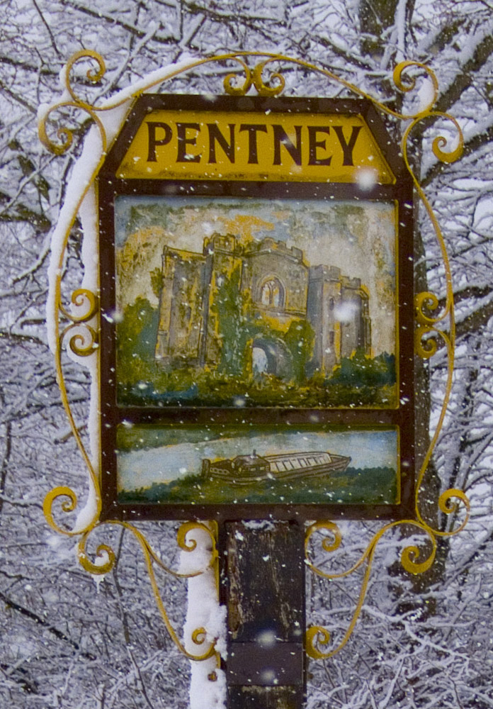
Pentneysign.jpg - PentneySam

Savepentney.jpg - PentneySam

Road Bend on A47 at Magpie Cottages, Pentney, Norfolk - geograph.org.uk - 36710.jpg - GeographBot

Pentney village sign - geograph.org.uk - 422101.jpg - GeographBot

Pentney Park camping and caravan site entrance - geograph.org.uk - 594283.jpg - GeographBot

Pentney cow meadow - geograph.org.uk - 615164.jpg - GeographBot

South of Pentney in autumn - geograph.org.uk - 615162.jpg - GeographBot

Cookes Cottage - geograph.org.uk - 621530.jpg - GeographBot

River Nar - geograph.org.uk - 630805.jpg - GeographBot

Sluice on the river Nar - geograph.org.uk - 630800.jpg - GeographBot

Wind damaged trees - geograph.org.uk - 632728.jpg - GeographBot

Field boundary - geograph.org.uk - 823194.jpg - GeographBot

Footbridge and gate house - geograph.org.uk - 823174.jpg - GeographBot

Footpath junction - geograph.org.uk - 823205.jpg - GeographBot

Nar valley way marker - geograph.org.uk - 823332.jpg - GeographBot

Shady crossing - geograph.org.uk - 823188.jpg - GeographBot

Sluice on the river Nar - geograph.org.uk - 823218.jpg - GeographBot

A shelter for anglers - geograph.org.uk - 1639078.jpg - GeographBot

An alley of ivy-clad trees beside the River Nar - geograph.org.uk - 1639097.jpg - GeographBot

Poplars in pasture - geograph.org.uk - 1639071.jpg - GeographBot

Poplars in pasture south of the River Nar - geograph.org.uk - 1639086.jpg - GeographBot

Uprooted poplars - geograph.org.uk - 1639072.jpg - GeographBot

Trees growing on field boundary west of Paws Lane - geograph.org.uk - 1743571.jpg - GeographBot

View south along Paws Lane - geograph.org.uk - 1743568.jpg - GeographBot

Pentney Barn.JPG - Ironimp

Carrstone 008.JPG - Ironimp

Carrstone 004.JPG - Ironimp

Projects 018.JPG - Ironimp

Jackdaw at Pentney church - geograph.org.uk - 1931843.jpg - GeographBot

New houses in Church Meadow, Pentney - geograph.org.uk - 1936654.jpg - GeographBot

Church Meadow, Pentney - geograph.org.uk - 1936655.jpg - GeographBot

Fields north of Pentney - geograph.org.uk - 1936656.jpg - GeographBot

Nar Valley Green Burials - geograph.org.uk - 1936657.jpg - GeographBot

St Mary Magdalene's church in Pentney - churchyard - geograph.org.uk - 1936659.jpg - GeographBot

St Mary Magdalene's church in Pentney - geograph.org.uk - 1936662.jpg - GeographBot

St Mary Magdalene's church in Pentney - geograph.org.uk - 1936666.jpg - GeographBot

St Mary Magdalene's church in Pentney - geograph.org.uk - 1936667.jpg - GeographBot

St Mary Magdalene's church in Pentney - geograph.org.uk - 1936668.jpg - GeographBot

St Mary Magdalene's church in Pentney - geograph.org.uk - 1936671.jpg - GeographBot

St Mary Magdalene's church in Pentney - view east - geograph.org.uk - 1936673.jpg - GeographBot

St Mary Magdalene's church in Pentney - east window - geograph.org.uk - 1936674.jpg - GeographBot

Clodbuster on the edge of a field - geograph.org.uk - 1936866.jpg - GeographBot

Bench Mark at Pentney church, Norfolk - geograph.org.uk - 1936963.jpg - GeographBot

Pentney, Two tracks leading to separate dwellings - geograph.org.uk - 7503575.jpg - GeographBot

Pentney, Back Road seen from Narborough Road - geograph.org.uk - 7503580.jpg - GeographBot

Pentney, New house and garage on Church Close - geograph.org.uk - 7503586.jpg - GeographBot

Pentney Village sign - geograph.org.uk - 7503590.jpg - GeographBot

Hollow oak tree by the Nar Valley Walk - geograph.org.uk - 2980462.jpg - GeographBot

Bradmoor Plantation, Narford - geograph.org.uk - 3555036.jpg - GeographBot

The Nar Valley Way through Bradmoor Plantation, Narford - geograph.org.uk - 3555046.jpg - GeographBot

Footpath to the River Nar, Narford - geograph.org.uk - 3555050.jpg - GeographBot

The River Nar through Bradmoor Plantation, Narford - geograph.org.uk - 3555057.jpg - GeographBot

The River Nar - geograph.org.uk - 3555060.jpg - GeographBot

Grey Cottages, Low Road, Pentney - geograph.org.uk - 3619288.jpg - GeographBot
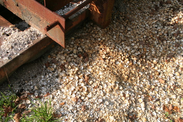
Cockle shells by Denton's Farm - geograph.org.uk - 3678195.jpg - GeographBot

Cross roads among the sand pits - geograph.org.uk - 3678278.jpg - GeographBot

Private woodland near Pentney Lodge - geograph.org.uk - 3770516.jpg - GeographBot

Track to Church Farm, Pentney, Norfolk - geograph.org.uk - 3770518.jpg - GeographBot

Waterwheel at Narborough Bone Mill - geograph.org.uk - 3972488.jpg - GeographBot

Pentney St. Mary Magdalene's church - geograph.org.uk - 4346691.jpg - GeographBot

Cows grazing in the late afternoon sunshine - geograph.org.uk - 4363090.jpg - GeographBot

A47 near Narborough - geograph.org.uk - 4628079.jpg - GeographBot

Eastbound A47, Little Eight Acre Plantation - geograph.org.uk - 4628085.jpg - GeographBot

Eastbound A47 near Narborough - geograph.org.uk - 4628089.jpg - GeographBot

Westbound A47 near to Narborough - geograph.org.uk - 4645065.jpg - GeographBot

Westbound A47 near Pentney - geograph.org.uk - 4645068.jpg - GeographBot

HGV on the A47 near to Pentney - geograph.org.uk - 4645069.jpg - GeographBot

X1 Service to King's Lynn - geograph.org.uk - 4670811.jpg - GeographBot

Minor Junction on the A47 - geograph.org.uk - 4670814.jpg - GeographBot

A47 approaching B1153 junction - geograph.org.uk - 5001266.jpg - GeographBot

Pentney Priory Gatehouse as seen from Nar Valley Way - geograph.org.uk - 5620930.jpg - GeographBot

Sign on Nar Valley Way at junction with Pentney Drove - geograph.org.uk - 5620933.jpg - GeographBot

On the Nar Valley Way alongside sand ^ gravel extraction quarry near Pentney - geograph.org.uk - 5620935.jpg - GeographBot

Petney Lakes - geograph.org.uk - 5949626.jpg - GeographBot

Gravel pit lakes - geograph.org.uk - 5949637.jpg - GeographBot

Tree plantation - geograph.org.uk - 5949643.jpg - GeographBot

Augustinian Priory Gatehouse - geograph.org.uk - 5949649.jpg - GeographBot

Pentney Lane, Pentney - geograph.org.uk - 6124517.jpg - GeographBot

Norfolk Woods Resort ^ Spa - geograph.org.uk - 6124529.jpg - GeographBot

Norfolk Woods Resort - geograph.org.uk - 6124532.jpg - GeographBot

Heaps of aggregate at the Nar Valley sand and gravel quarry - geograph.org.uk - 6169239.jpg - GeographBot

Elevators dropping graded sand into piles for distribution - geograph.org.uk - 6169241.jpg - GeographBot

Road to the sand quarry and the fishing lakes - geograph.org.uk - 6169252.jpg - GeographBot

Entrance to Pentney Lakes and the water ski school - geograph.org.uk - 6169267.jpg - GeographBot

Recently created gated entrance off Abbey Road, Pentney - geograph.org.uk - 6169292.jpg - GeographBot

Western end of Abbey Road, Pentney - geograph.org.uk - 6169293.jpg - GeographBot

Bilney Road just before the entrance to Church Farm - geograph.org.uk - 6169321.jpg - GeographBot

Track to Church Farm, Pentney - geograph.org.uk - 6169323.jpg - GeographBot

A47 towards King's Lynn - geograph.org.uk - 6537039.jpg - GeographBot

A47 towards King's Lynn - geograph.org.uk - 6537047.jpg - GeographBot

A47 towards King's Lynn - geograph.org.uk - 6537064.jpg - GeographBot

Lodge, Norfolk Woods Resort ^ Spa - geograph.org.uk - 6635840.jpg - GeographBot

Norfolk Woods Resort ^ Spa - geograph.org.uk - 6635842.jpg - GeographBot

Pentney village sign - geograph.org.uk - 6643470.jpg - GeographBot

Pentney village sign - geograph.org.uk - 6677645.jpg - GeographBot