Wikimedi'Òc
Modes d'emploi

Cet album fait partie des albums
Cet album photos contient les sous-albums suivants :


Deutsches Reich Historische Karten 1.jpg - SebastianBreier~commonswiki

Peace of Basel.png - LlywelynII

Reichskarte1705.jpg - Finanzer
KBMG1477.png - Odejea
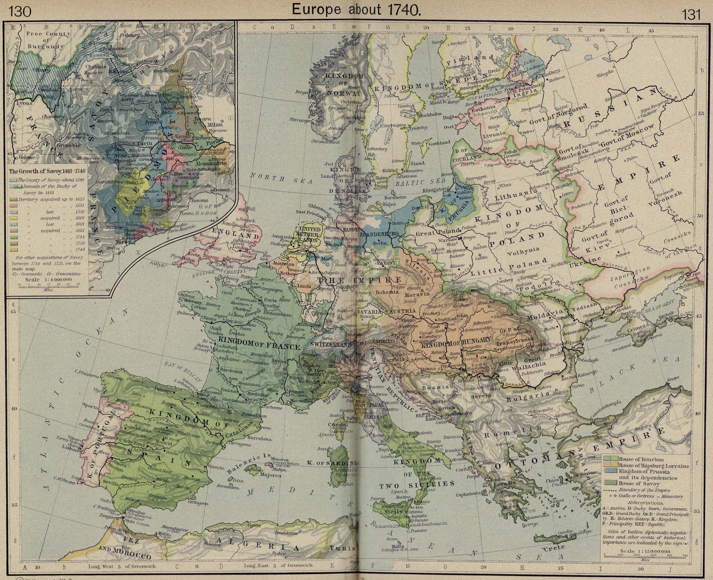
Europe 1740.jpg - Roke~commonswiki

Reichskreise.jpg - Willhelm01

Uebersicht Postmeilensaeulen.jpg - Elsaxo

Preußen 1440-1795 und 1807-1866.jpg - Cherubino

Central Europe religions 1618.jpg - Mahagaja

Europe religions 1560.jpg - F l a n k e r

Uebersicht Postmeilensaeulen.svg - Elsaxo

Western Europe 1700.jpg - F l a n k e r
Etzlaub Romweg 1500 thumb.jpg - I.R. Annie IP.

Karte 1713 Trendelburg.jpg - Presse03
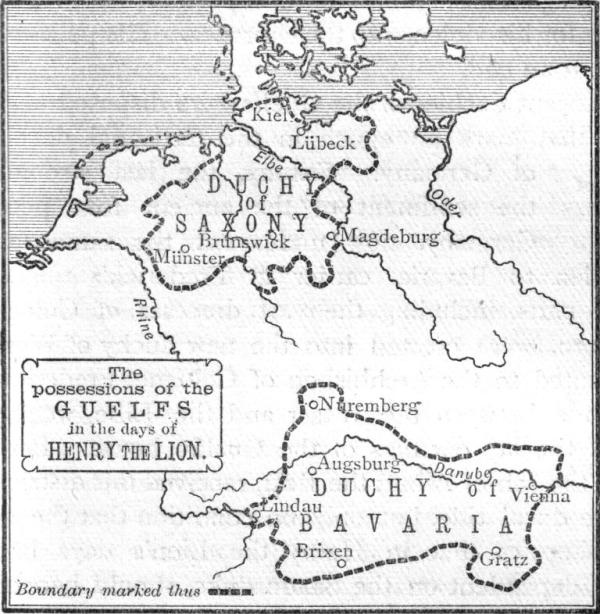
Guelf c12.jpg - Trasamundo
Nassau1547.jpg - SieBot

Central Europe, 919-1125.jpg - Soerfm
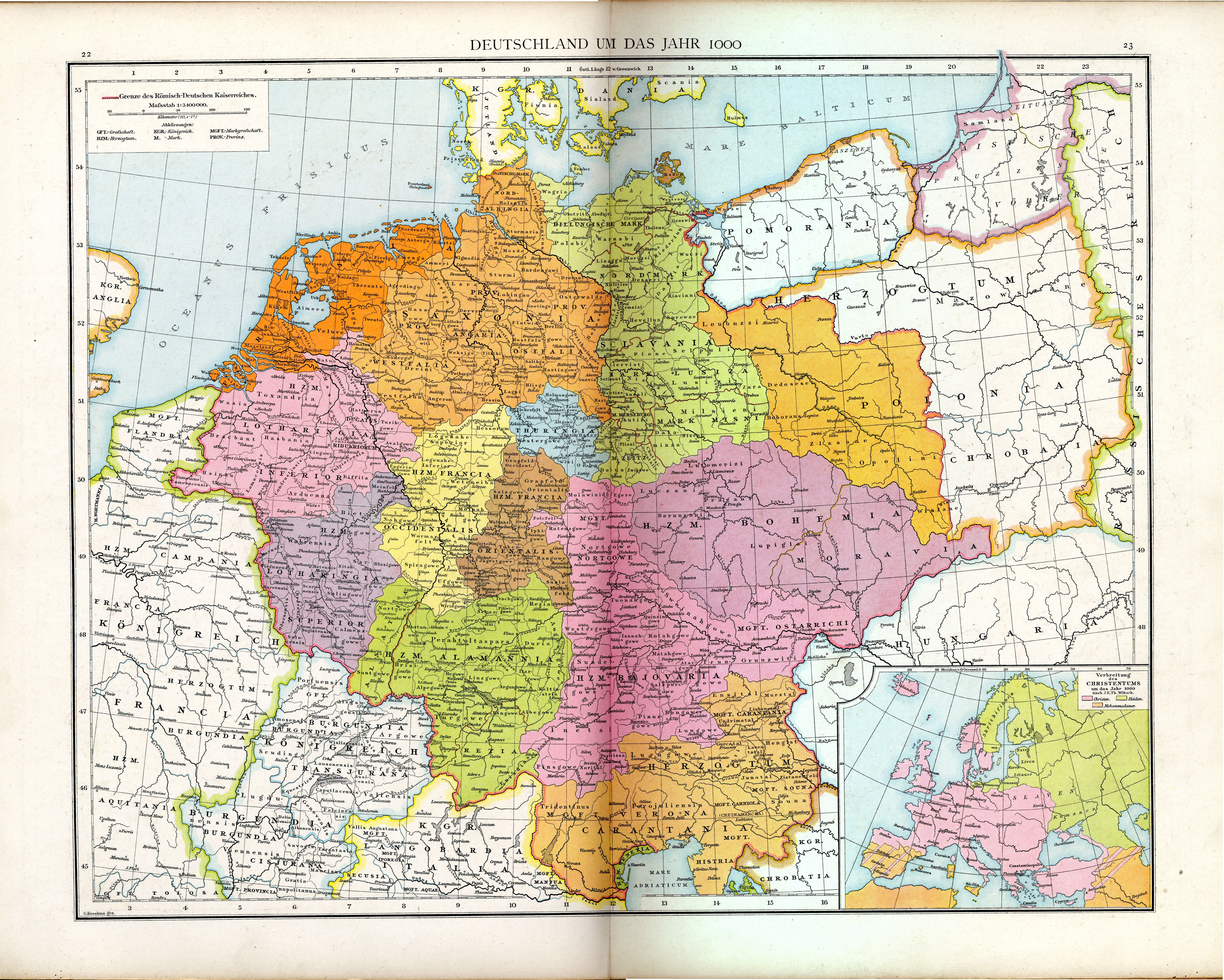
Heiliges Römisches Reich 1000.PNG - Phreneticc
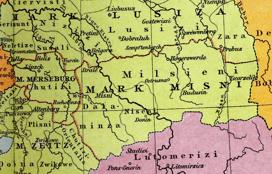
Markgrafschaft Meissen 1000.png - Alma

Lorraine 1000.png - OwenBlacker
Ulm-Wiblingen-Fugger.png - OwenBlacker

Osterland 1250.PNG - Alma

Heiliges Römisches Reich um 1250.png - Alma
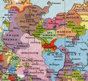
Grafschaft Dannenberg um 1250.PNG - Alma

Peace of Basel and Campo-Formio.png - Ori~
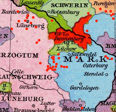
Grafschaft Dannenberg 1250.png - Torsten Bätge
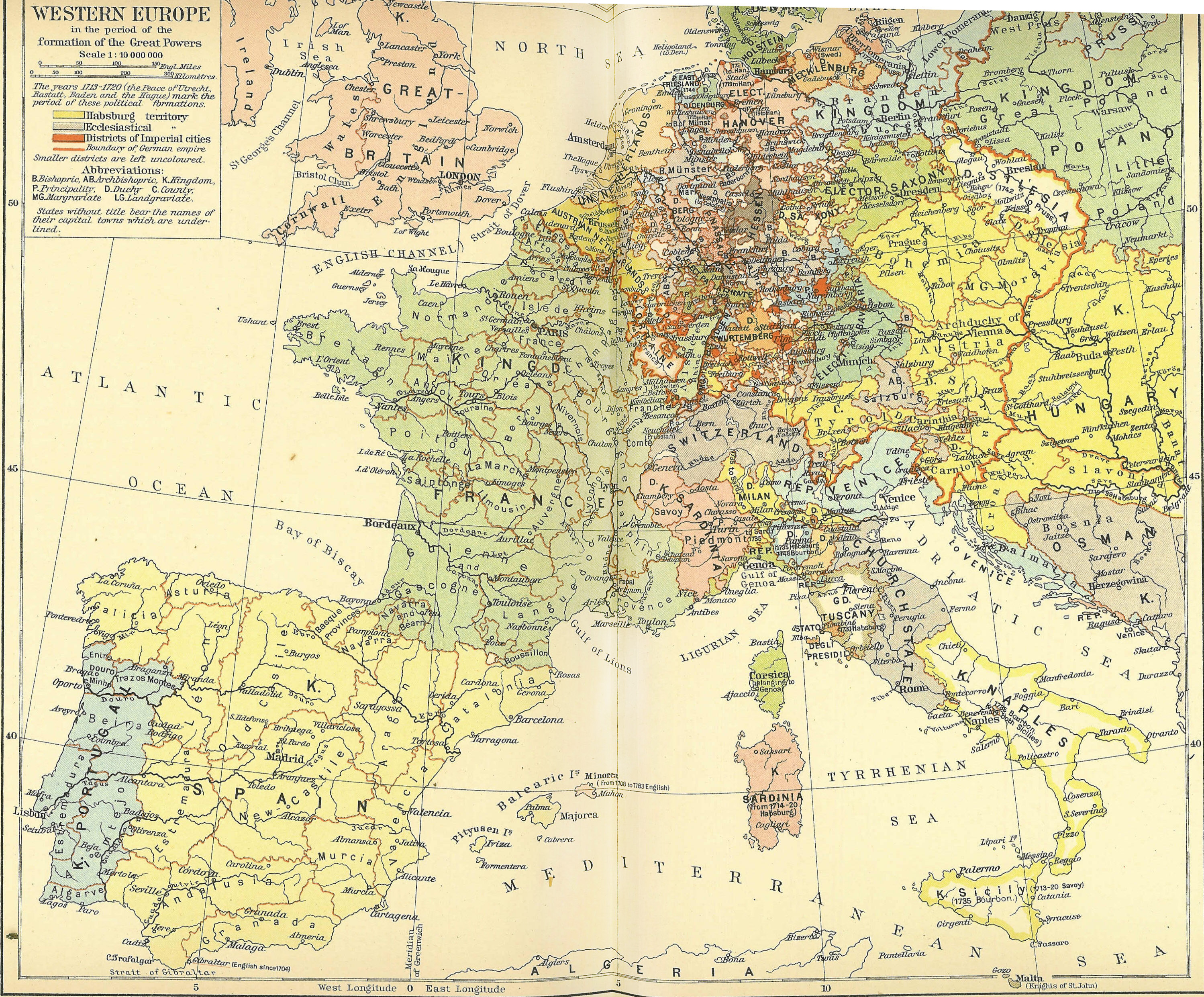
Helmholt - Western Europe early 18th century.jpg - Marekich

Marches on Eastern border the the Holy Roman Empire.jpg - Laurens~commonswiki

Central europe 1786.jpg - Ignacio Icke

OpperSaxiseKreits.gif - Ulamm

Etzlaub Romwegkarte 1.JPG - Neitram

Stollhofener Linien Nordteil.jpg - Milgesch

Stollhofener Linien Mittelteil.jpg - Milgesch

Stollhofener Linien Südteil.jpg - Milgesch
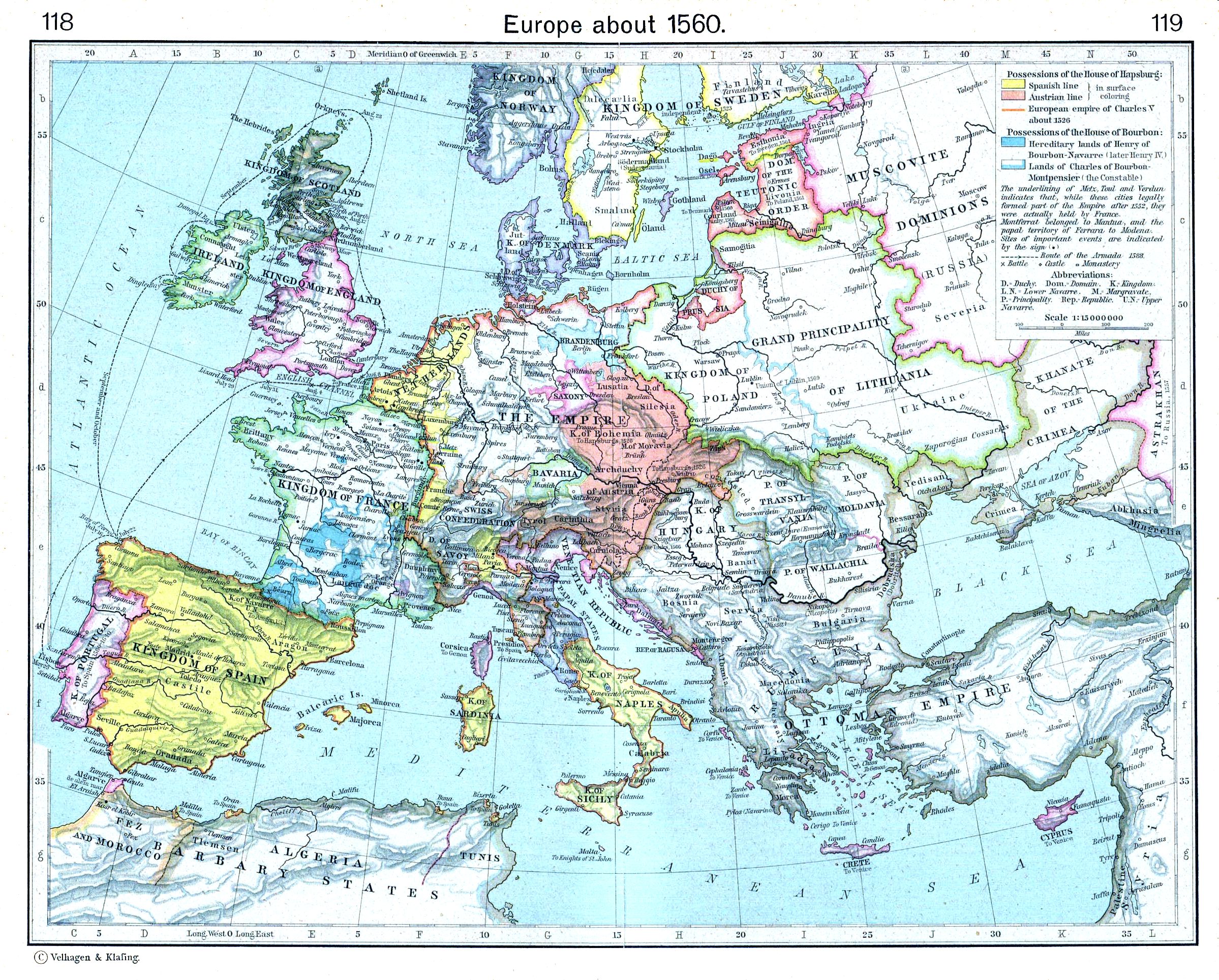
Europe about 1560.jpg - Alex:D

Sanson - Partie du cercle d'Autriche (1681).jpg - Sporti

Shepherd Holy Roman Empire Hohenstaufen 1138-1254.jpg - Matthead

Nova totius Germania descriptio Teutschland.png - EvaK

Maximilian I mit Landkarte.jpg - AndreasPraefcke

Central europe 1648 sheperd.jpg - Matthead
OFrie1477.png - File Upload Bot (Magnus Manske)
Oranje1601.png - File Upload Bot (Magnus Manske)

Rozsah české moci na počátku války třicetileté.jpg - Alfie983

Kerstvloed 1717.jpg - Pieter Kuiper
RheinaWolbeck.jpg - BotMultichill

Maps of Mümpelgard and Homburg in 1795-1796 by Reilly 388.jpg - Ephraim33

Map of the Holy Roman Empire by Reilly 093.jpg - Ephraim33

Niedersaechsicher Kreis Schreiber 9070.jpg - Joergens.mi

Map of the Holy Roman Empire by Reilly 093b.jpg - Ephraim33

Brandenburg-Preußen1688.JPG - File Upload Bot (Magnus Manske)
Hundesrucha (HRR) 1000.png - Fhmann~commonswiki
Gft.en Sponheim, Veldenz und die Rheingft. um 1400.png - File Upload Bot (Magnus Manske)

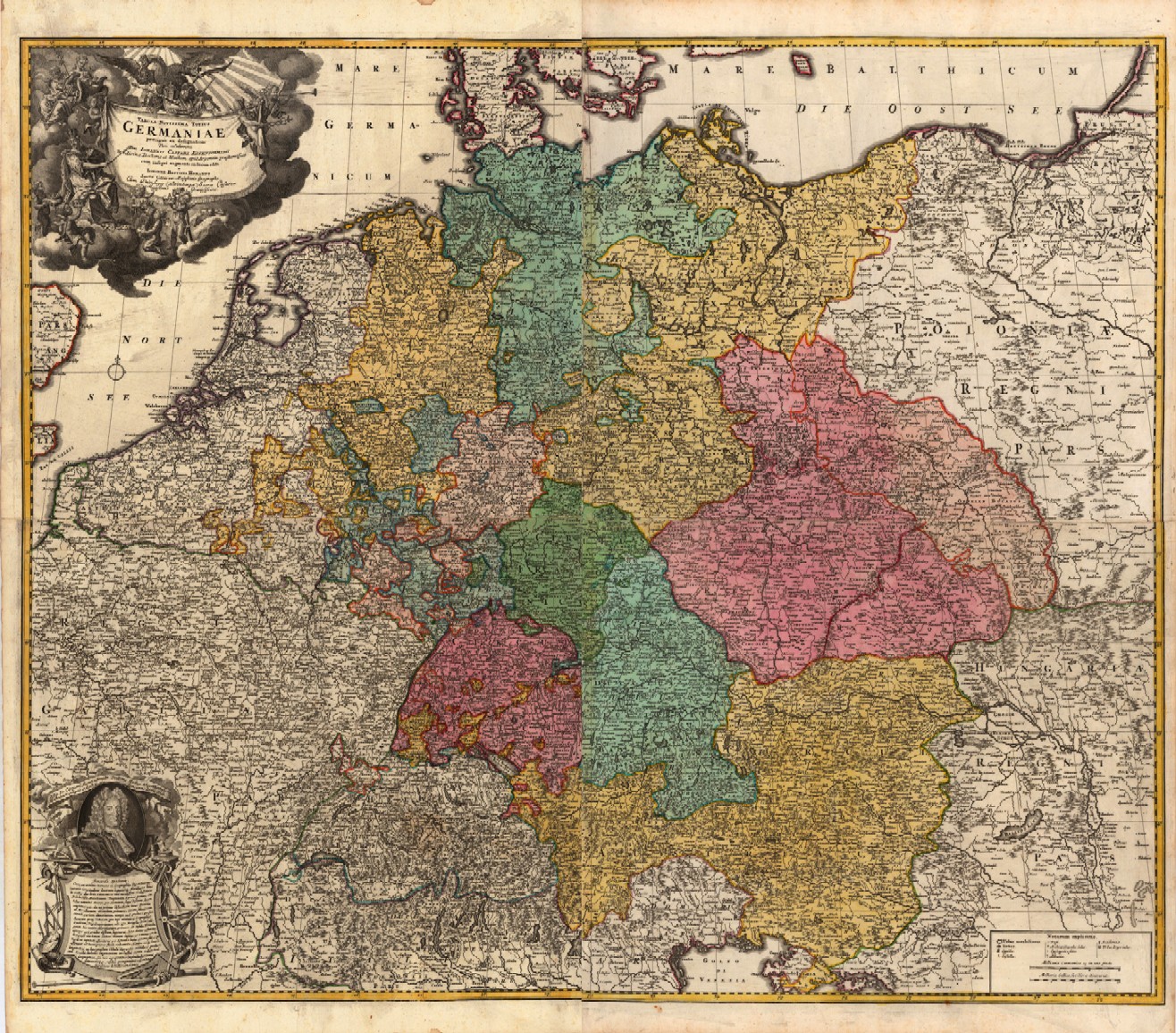
1730 Covens and Mortier Map of Germany ( Folding Case Map ) - Geographicus - Germaniae-covensmortier-1720.jpg - BotMultichillT

Ost Franken Reich 1000.PNG - Markus Schulenburg
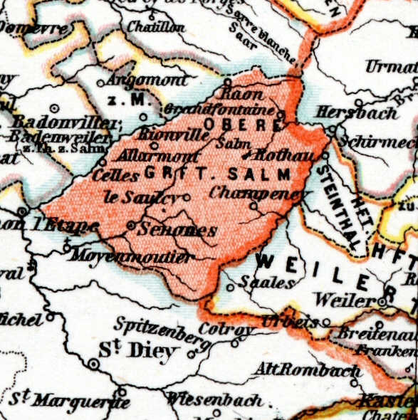
Salm-map.png - Kooij
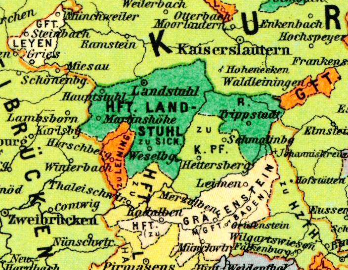
Landstuhl-map.png - Kooij

Freudenburg-map.png - Kooij

Oettingen-map.png - Kooij

Veldenz-map.png - Kooij

Reipoldskirchen-map.png - Kooij

Falkenstein-map.png - Kooij

Murbach-map.png - Kooij
Droysens-22-23.jpg - Maproom

Droysens-26a.jpg - Maproom

Landau Isar 1798.jpg - Ratzer

Electorates of Mainz, Cologne and Trier.jpg - Lubiesque
German divided in its 10 circles.jpg - Lubiesque

Northeastern France and neighboring German states, 1789.jpg - Lubiesque

The Prince-Bishoprics of Würzburg and Bamberg..jpg - Lubiesque

Germania benedictina.jpg - Lubiesque

Nördlingen and Bopfingen (Popingen), Free Imperial Cities in Swabia.jpg - Lubiesque

Nuremberg, first half of 18th century..jpg - Lubiesque

Palatinate of the Rhine.jpg - Lubiesque
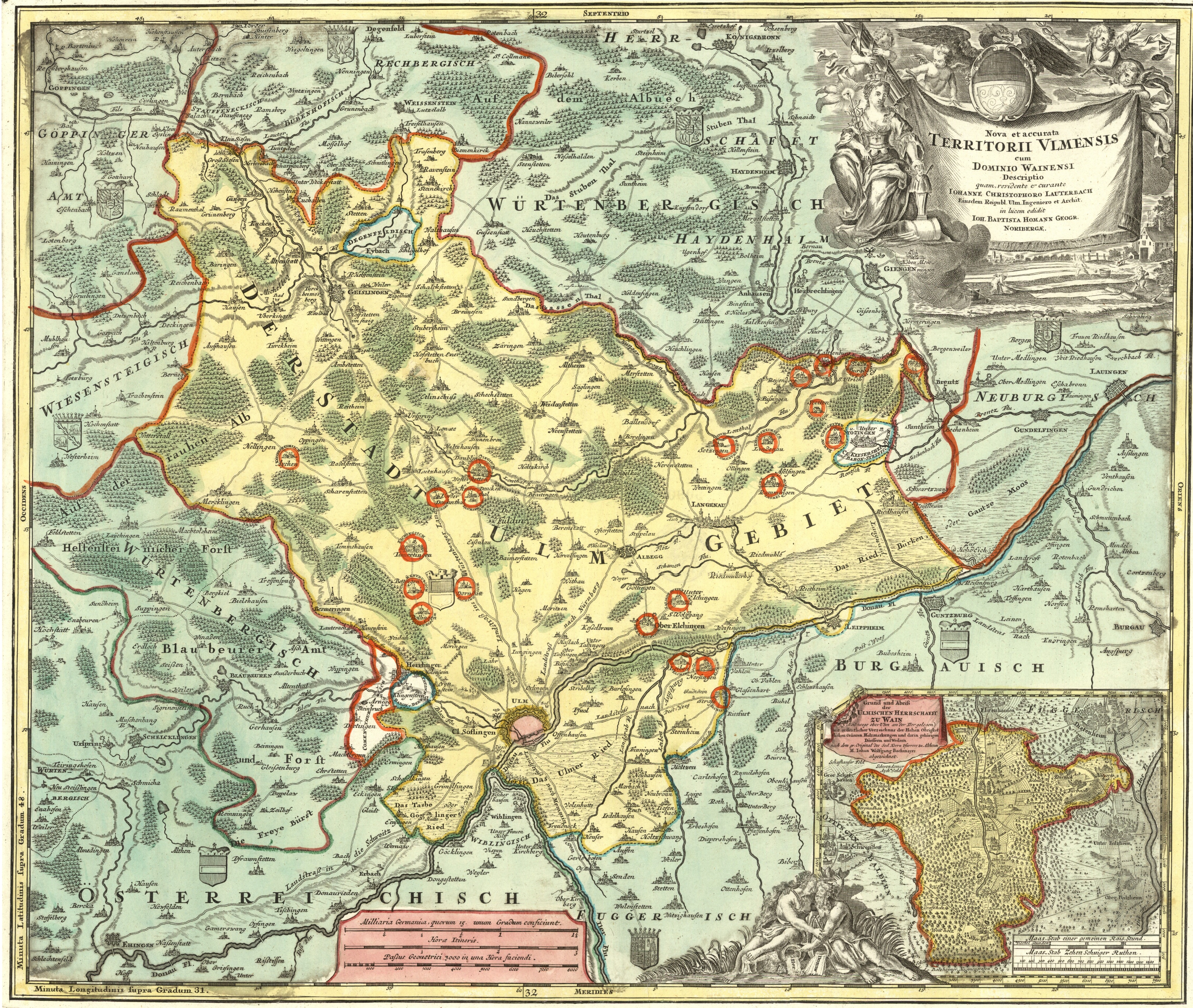
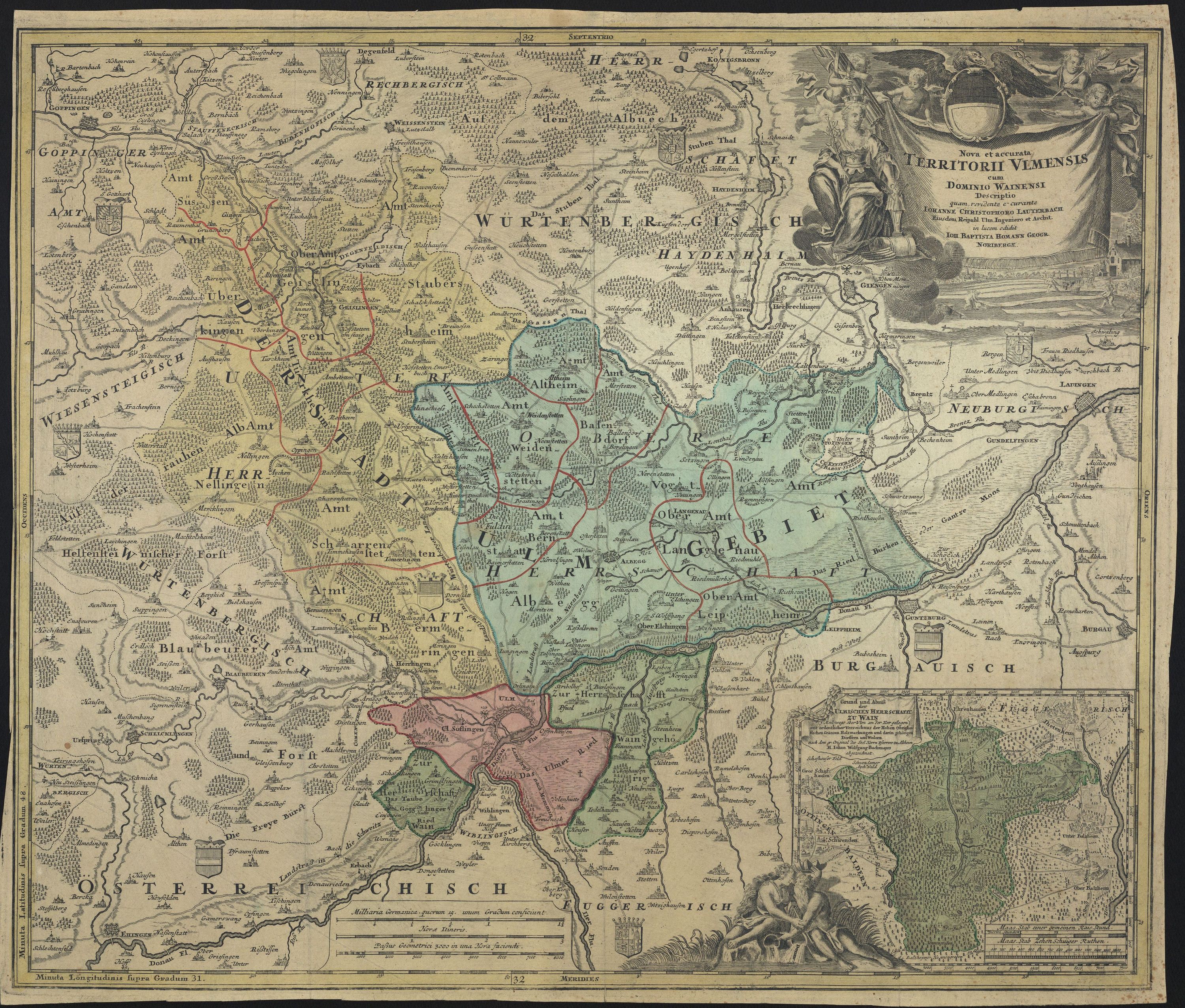
Free Imperial City of Ulm.jpg - Lubiesque

Map of the Electorate of Trier and other Rhineland states. 1685.jpg - Lubiesque

Territory of the Prince-Bishopric of Passau.jpg - Lubiesque

Schlacht bei Minden-1759-Jean de Beaurain.jpg - Histomap

Karte Hohenlohe und Limpurg 1806.jpg - Torana

Meyers b4 s0851a.jpg - Mapmarks

Meyers b4 s0858a.jpg - Mapmarks

Meyers b4 s0870a.jpg - Mapmarks
Karta över Tyska Imperiet, 1678 - Skoklosters slott - 97984.tif - LSHuploadBot
Karta över del av Tyskland, 1780 - Skoklosters slott - 98048.tif - LSHuploadBot
Karta över del av Tyskland, 1780 - Skoklosters slott - 98051.tif - LSHuploadBot
Karta över del av Tyskland, 1780 - Skoklosters slott - 98052.tif - LSHuploadBot
Karta över Neumark och Ukermark i Brandenburg - Skoklosters slott - 98010.tif - LSHuploadBot
Reichsstadt Ulm Homann.jpg - Lubiesque
UBBasel Map Deutschland 1640-1670 Kartenslg Mappe 242-66.tif - Basel University Library

Lands of the Holy Roman Empire 1024–1125 (14594521568).jpg - Fæ

L'Allemagne Dressée sur les Observations de Tycho-Brahé.jpg - Bwwm

Spruner-Menke Handatlas 1880 Karte 43.jpg - A. Wagner
Spruner-Menke Handatlas 1880 Karte 44.jpg - A. Wagner

S. Imperium Romano-Germanicum, oder, Teutschland - CBT 5873279.jpg - Francesco Serra (BIBCOMTN)

Postarum seu veredariorum stationes per Germaniam et provincias adiacentes - CBT 5878399.jpg - Francesco Serra (BIBCOMTN)

Germany at the time of the Saxon and Frankish emperors (Putzger).jpg - FDRMRZUSA

Deutschland im XIV. Jahrhundert.jpg - FDRMRZUSA

Central Europe (1378).jpg - FDRMRZUSA

The Holy Roman Empire under the Hohenstaufen, 1138-1254.jpg - FDRMRZUSA

Europe in 1560.jpg - FDRMRZUSA

Central Europe in 1547.jpg - FDRMRZUSA
Guelf c12-ar.jpg - باسم

426 of 'England under Stuart Rule, etc' (11247657373).jpg - FlickreviewR 2

Deutschland im XIV. Jahrhundert (Putzger).jpg - FDRMRZUSA

Deutschland im XV. Jahrhundert (Putzger).jpg - FDRMRZUSA

Deutschland im XVI. Jahrhundert (Putzger).jpg - Doc Taxon

Deutschland im XVII. Jahrhundert (Putzger).jpg - FDRMRZUSA
Deutschland im XVIII. Jahrhundert (Putzger).jpg - FDRMRZUSA

Central and Western Europe at the time of the Hohenstaufens.jpg - FDRMRZUSA

Deutschland unter den Sächsischsen und Fränkischen Kaisern 919-1125.jpg - FDRMRZUSA

Deutschland beim Tode Kaiser Karls IV., 1378.jpg - FDRMRZUSA

Deutschland nach dem westfälischen Frieden vom Jahre 1648.jpg - FDRMRZUSA

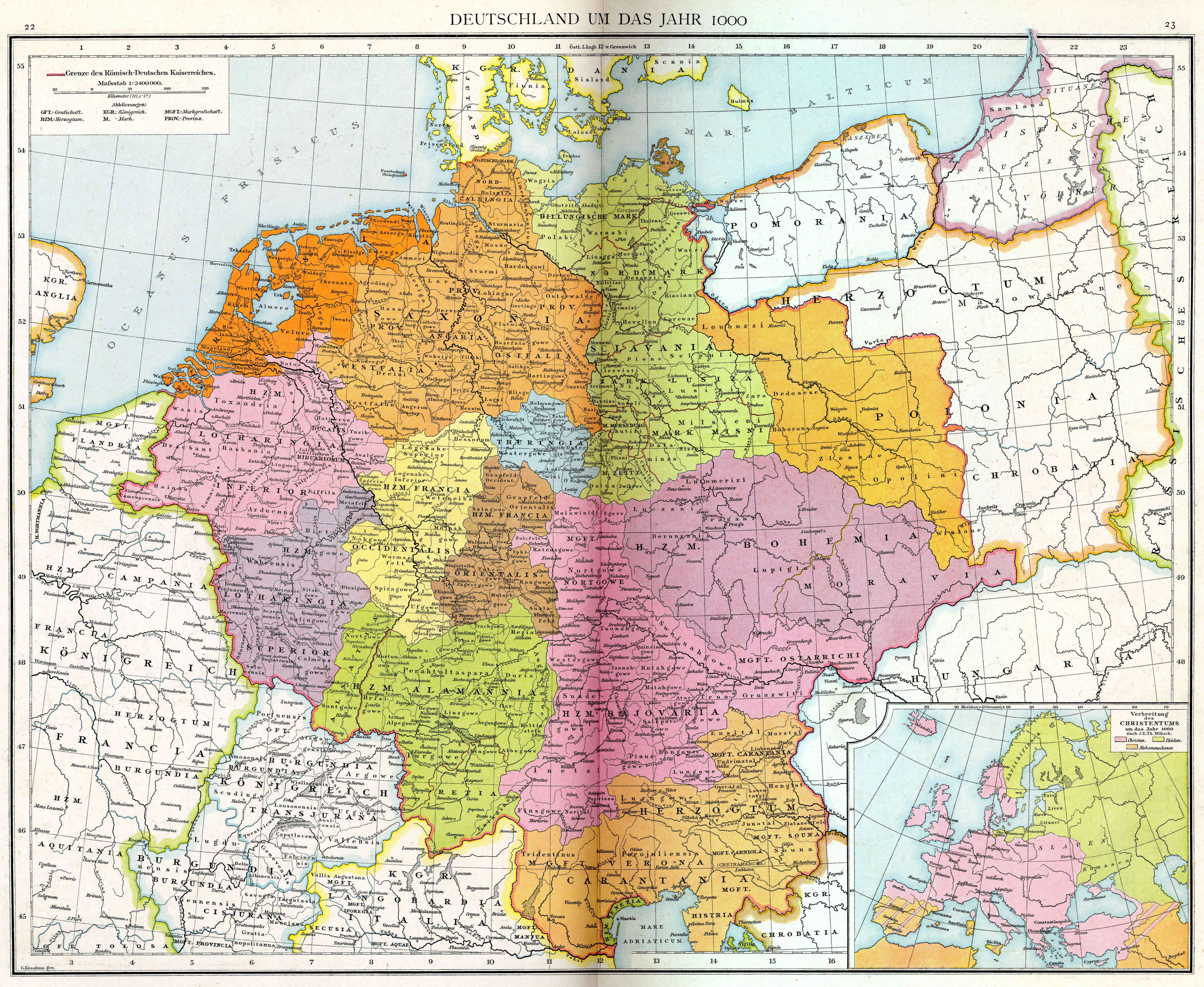
Germany in the year 1000 (Droysen).jpg - FDRMRZUSA

Germany at the time of the Saxon and Frankish emperors (F.W. Putzger).jpg - FDRMRZUSA

Europe at the time of the restoration of the Empire in the west by Otto the Great, 962.jpg - FDRMRZUSA

Germany under the Saxon and Salian dynasties (919-1137).jpg - FDRMRZUSA

Germany under the House of Hohenstaufen, 1138-1254.jpg - FDRMRZUSA

Germany in the Later Middle Ages (1273-1492).jpg - FDRMRZUSA

Germany at the Peace of Westphalia (1648).jpg - FDRMRZUSA

Carte de l'Empire d'Alemagne (Rizzi Zannoni, 1780).jpg - FDRMRZUSA

Holy Roman Empire, 1690.jpg - FDRMRZUSA

Prince-bishopric of Würzburg by J.B. Homann.jpg - Lubiesque

Germany divided into its circles (Cary,1799).jpg - FDRMRZUSA

Carte de l'Empire d'Allemagne divisé en ses dix cercles (Vaugondy, 1756).jpg - FDRMRZUSA

Karte von der Deutschland (Reilly, 1796).jpg - FDRMRZUSA

Carte Statistique de L'Allemagne (Mentelle-Poirson, 1803).jpg - FDRMRZUSA

Map of the Empire of Germany, north side (Delarochette, 1794).jpg - FDRMRZUSA

Germany962.jpg - Evzen M

Angevin Europe 1360.jpg - Chevalier d'Éon

Deutschland im XVI. Jahrhundert (Landgft. Hessen).png - Doc Taxon

L'Empire d'Allemagne (Holy Roman Empire of Germany) 1705 Nicolas de Fer.jpg - Artanisen

L'Empire d'Allemagne (Holy Roman Empire of Germany) Nicolas de Fer 1710 Colored Map.jpg - Artanisen