Wikimedi'Òc
Modes d'emploi

Cet album fait partie des albums
Cet album photos contient les sous-albums suivants :


1755 PlymouthMA detail of map byJohnGreen BPL 12281.png - M2545

1830 map Plymouth Massachusetts byBourne BPL 12878 detail.png - M2545

1882 map Plymouth Massachusetts byBailey BPL 10175.png - M2545

Chart of Plymouth Bay (7557412140).jpg - File Upload Bot (Magnus Manske)

Minots Ledge off Boston Harbor, showing the proposed site of a light house (7537856380).jpg - File Upload Bot (Magnus Manske)

Map of the town of Plymouth, Plymouth Co. Mass. (3886419125).jpg - File Upload Bot (Magnus Manske)

Map of Plymouth settled in 1620 (3720083685).jpg - File Upload Bot (Magnus Manske)

A map of Plymouth Village, 1846 (3720083929).jpg - File Upload Bot (Magnus Manske)

Town of Hingham Plymouth County, Mass. (3369691253).jpg - File Upload Bot (Magnus Manske)

Chart of Plymouth Bay (3045701551).jpg - File Upload Bot (Magnus Manske)
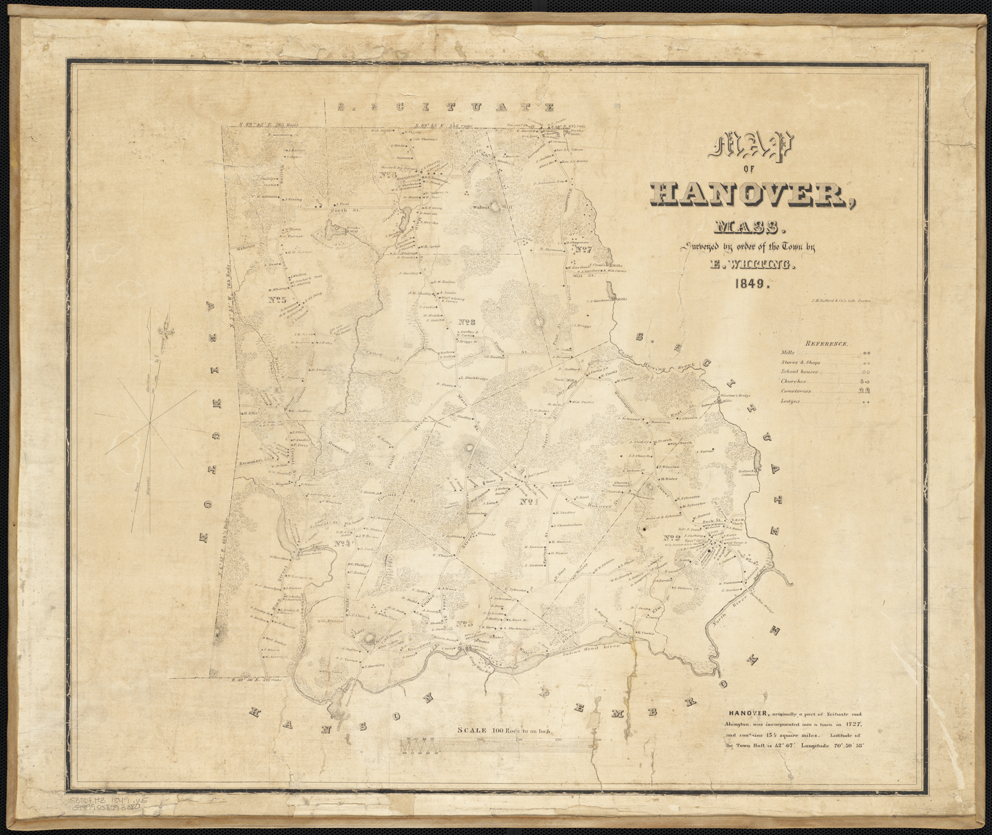
Map of Hanover, Mass. (2674580336).jpg - File Upload Bot (Magnus Manske)

Trolley trips through New England (1900) (14779532552).jpg - Fæ

Histories of the several regiments and battalions from North Carolina, in the great war 1861-'65 (1901) (14760353924).jpg - Fæ

Pilgrim memorials, and guide for visitors to Plymouth Village- with a lithographic map, and seven copperplate engravings (1851) (14577002850).jpg - Fæ

Histories of the several regiments and battalions from North Carolina, in the great war 1861-'65 (1901) (14576063510).jpg - Fæ

Boston, a guide book (1910) (14576610538).jpg - Fæ
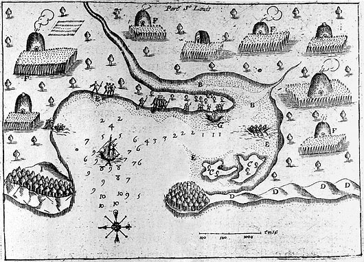
Champlain's Map of Plymouth Harbor.jpg - AnthroMimus

Chart of Plymouth Bay (10295678726).jpg - Fæ

184 of 'Ancient Landmarks of Plymouth. Part I. Historical sketch and titles of estates. Part II. Genealogical register of Plymouth families. (With folding maps.)' (11163798993).jpg - Artix Kreiger 2
1882 bird's-eye view map of Plymouth, Massachusetts LOC 2011589144.tif - Fæ

1882 bird's-eye view map of Plymouth, Massachusetts.jpg - Fæ
Chart of Plymouth Bay. LOC 77693976.tif - Fæ

Chart of Plymouth Bay. LOC 77693976.jpg - Fæ
Town of Hingham, Plymouth County, Mass. 1885. LOC 75694579.tif - Fæ

Plymouth Harbor, Massachusetts LOC 79695321.jpg - Fæ
The Atlantic Neptune, published for the use of the Royal Navy of Great Britain, LOC 75332515-10.tif - Fæ

The Atlantic Neptune, published for the use of the Royal Navy of Great Britain, LOC 75332515-10.jpg - Fæ

Admiralty Chart No 2486 Plymouth Harbour (Massachusetts), Published1857.jpg - Kognos
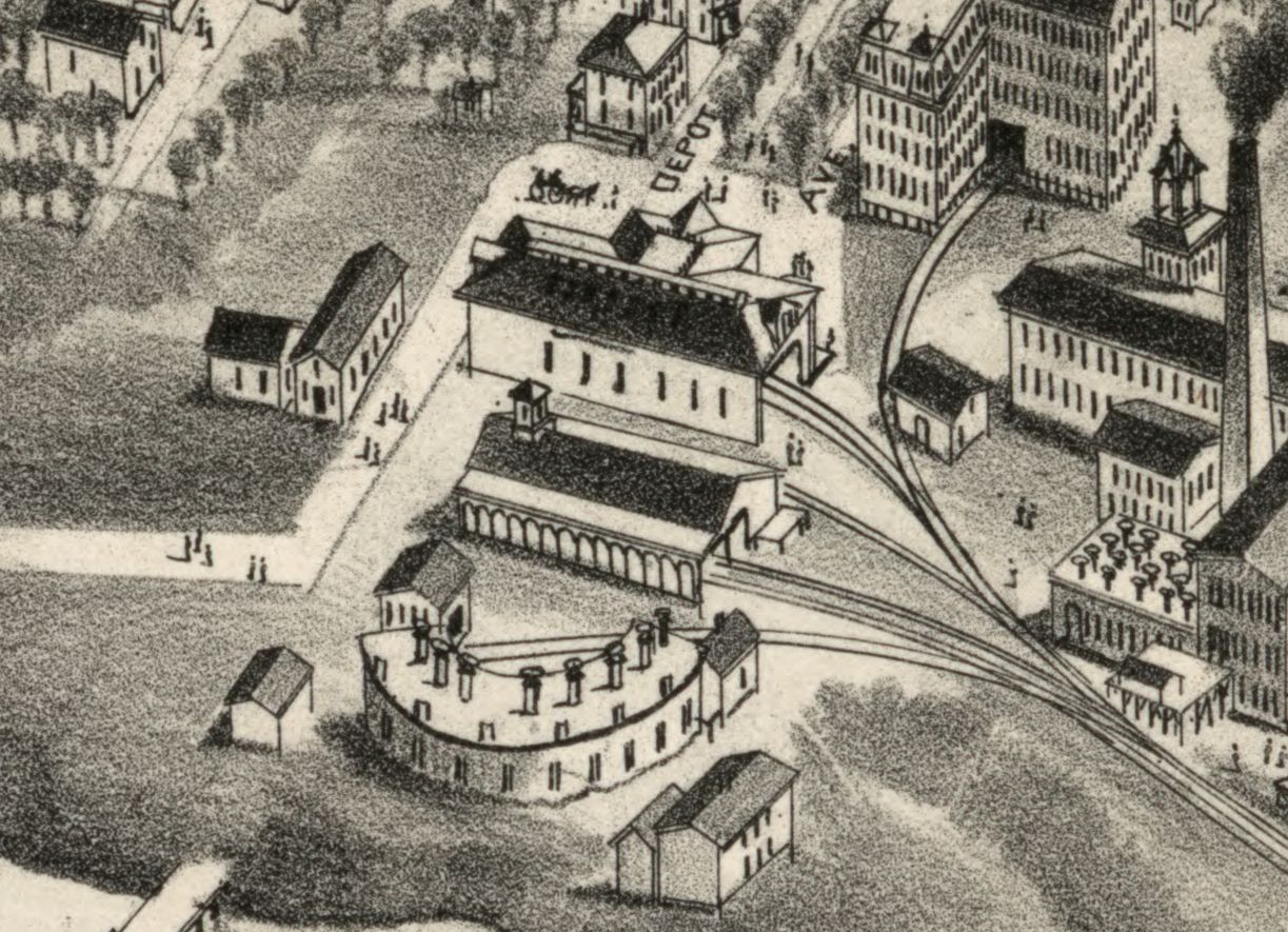
Plymouth station on 1882 bird's-eye view map.jpg - Pi.1415926535
America, East Coast - Plymouth Harbour (IA McGillLibrary-rbsc map bayfield-145-19322).pdf - Fæ

1830 Map of Plymouth settled in 1620, by S. Bourne, from the Digital Commonwealth - commonwealth x059cb56h.jpg - Daderot