×

Karte Plymouth UK MKL1888.png - ¡0-8-15!

Plymouth OS 1 inch 1936.JPG - Smalljim

Devonport & Plymouth RJD 61.jpg - Irate

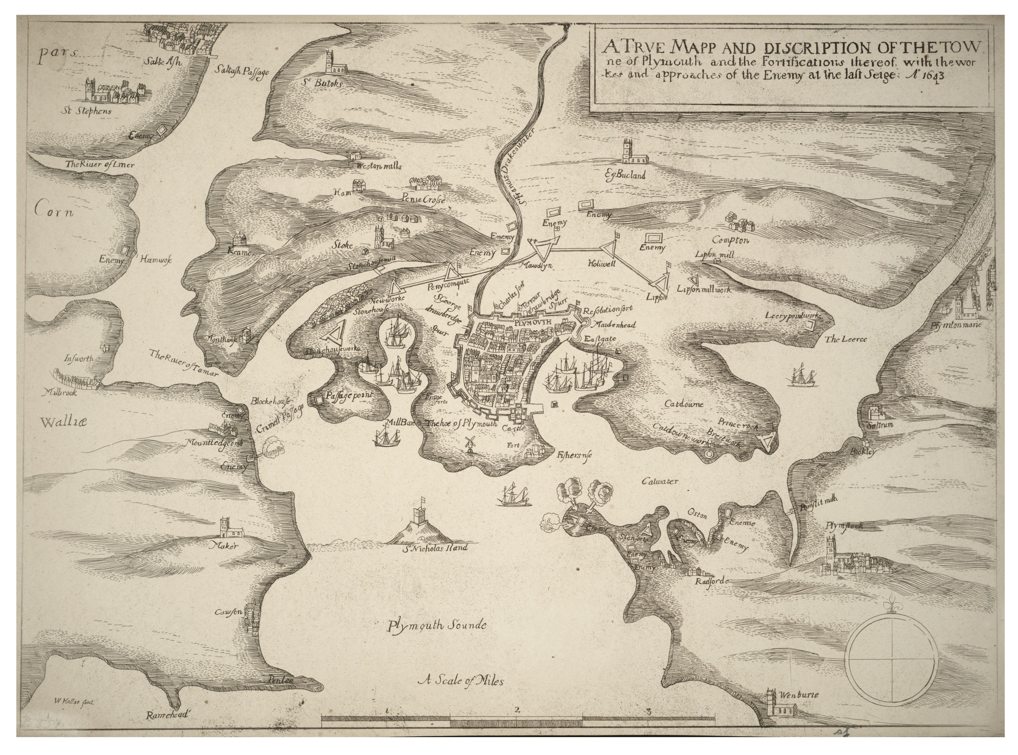
Plymouth siege map 1643.gif - Smalljim

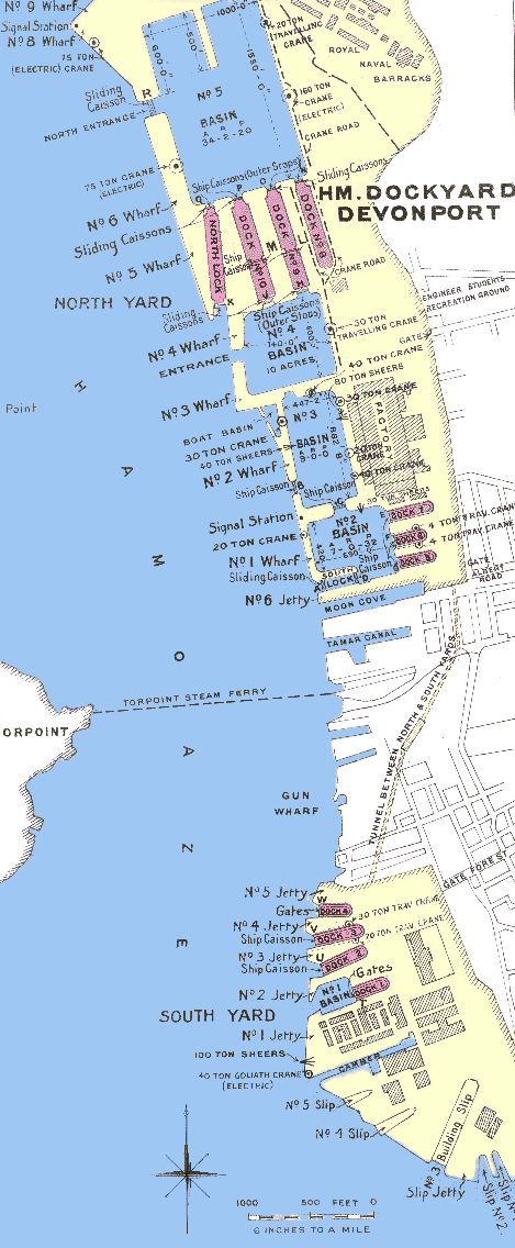
Devonport Dockyard in 1909 plan.png - Hohum

Devonport Dockyard in 1909 plan original.jpg - File Upload Bot (Magnus Manske)

Wenceslas Hollar - Siege of Plymouth.jpg - Dcoetzee

New Passage Map.jpg - WikiPedant

To the Right Honorable the Master, Wardens & Elder Brethren of the Trinity House, this Chart of Plymouth Sound is ... dedicated (8250654010).jpg - File Upload Bot (Magnus Manske)

A new and correct large draught PLYMOUTH SOUND catt-water and ham-owse NYPL1640575.tiff - Fæ

EW(1884) p.191 - Plymouth, Devenport and Stonehouse - A + C Black (pub).jpg - Jheald

Plan of the Town and Citadel of Plymouth, Benjamin Donn, 1765.jpg - Jheald

Plan of Stoke Town and Plymouth Dock - Benjamin Donn, 1765.jpg - Jheald

A pictorial and descriptive guide to Plymouth, Stonehouse and Devonport with excursions by river, road and sea (1914) (14595794607).jpg - Fæ

Plymouth 1540.png - Alansplodge

MountWise PlymouthMap 1851.png - Lobsterthermidor

Plymouth Map 1765.jpg - Ratzer

Plymouth siege map 1643.jpg - Ratzer

Nieuwe aftekening van het inkoomen van Plymouth en Salcombe Rievier geleegen int' Canaal van de zuyd kust van Engeland. RMG F0375.tiff - Fæ

Plymouth RMG F0253.tiff - Fæ

Image taken from page 197 of 'Black's Road and Railway Guide to England and Wales. Fourteenth edition' (11170617965) (2).jpg - FlickreviewR 2

29 of 'English Channel Ports and the estate of the East and West India Dock Co. ... Reprinted from the London “Daily Telegraph.”' (11167743934).jpg - Artix Kreiger 2

18 of 'English Channel Ports and the estate of the East and West India Dock Co. ... Reprinted from the London “Daily Telegraph.”' (11167321345).jpg - Artix Kreiger 2

150 of 'Ancient Landmarks of Plymouth. Part I. Historical sketch and titles of estates. Part II. Genealogical register of Plymouth families. (With folding maps.)' (11164090703).jpg - Artix Kreiger 2

20 of 'Ancient Landmarks of Plymouth. Part I. Historical sketch and titles of estates. Part II. Genealogical register of Plymouth families. (With folding maps.)' (11160827094).jpg - FlickreviewR 2

671 of '(The Imperial Gazetteer; a general dictionary of geography, physical, political, statistical and descriptive ... Edited by W. G. Blackie ... With ... illustrations, etc.)' (11105685806).jpg - Artix Kreiger 2

191 of 'The International Geography. ... Edited by H. R. Mill' (11161883935).jpg - Kilom691

87 of 'The Round World ... New edition, revised, etc' (11114981383).jpg - Artix Kreiger 2

36 of 'The Earth and its Inhabitants. The European section of the Universal Geography by E. Reclus. Edited by E. G. Ravenstein. Illustrated by ... engravings and maps' (11127687463).jpg - Artix Kreiger 2

118 of 'The Earth and its Inhabitants. The European section of the Universal Geography by E. Reclus. Edited by E. G. Ravenstein. Illustrated by ... engravings and maps' (11125608724).jpg - Artix Kreiger 2

Карта к статье «Плимут». Военная энциклопедия Сытина. Том № 18. (Санкт-Петербург, 1911-1915).jpg - Schekinov Alexey Victorovich

Ordnance Survey Half-inch Sheet 36 South Devon, Published 1925.jpg - Kognos

Admiralty Chart No 2620 Eddystone to Portland, Pubished 1880.jpg - Kognos

Meyers b13 s0141 b1.png - Mapmarks

Admiralty Chart No 2675a English channel. Western sheet, Milford Haven to Plymouth, Published 1885.jpg - Kognos

Admiralty Chart No 2675b English Channel. Middle sheet, Plymouth to Portsmouth, Published 1885.jpg - Kognos

Pierre-Charles Canot - Near Plymouth with the Ordinance Wharfe... - B1977.14.1286 - Yale Center for British Art.jpg - SmartifyBot

PLAN OF THE TOWN, CITADEL, DOCK and COUNTRY round PLYMOUTH, John Manson, 1756.jpg - Barabbas1312

PLAN of the LINES round PLYMOUTH DOCK, 1756.jpg - Barabbas1312

The SOUTH PART of An Accurate Survey and Measurement Of PLYMOUTH and DOCK TOWNS, 1784-86.jpg - Barabbas1312

A geometrical plan and West elevation of H.M. dock-yard near Plymouth... - btv1b530105313.jpg - Gzen92Bot

Tableau hidrographique qui contient le détail maritime des principaux ports qui se trouvent représentés dans la carte de la Manche - d'après des manuscrits (...) de Beaurain - btv1b53052864r.jpg - Gzen92Bot

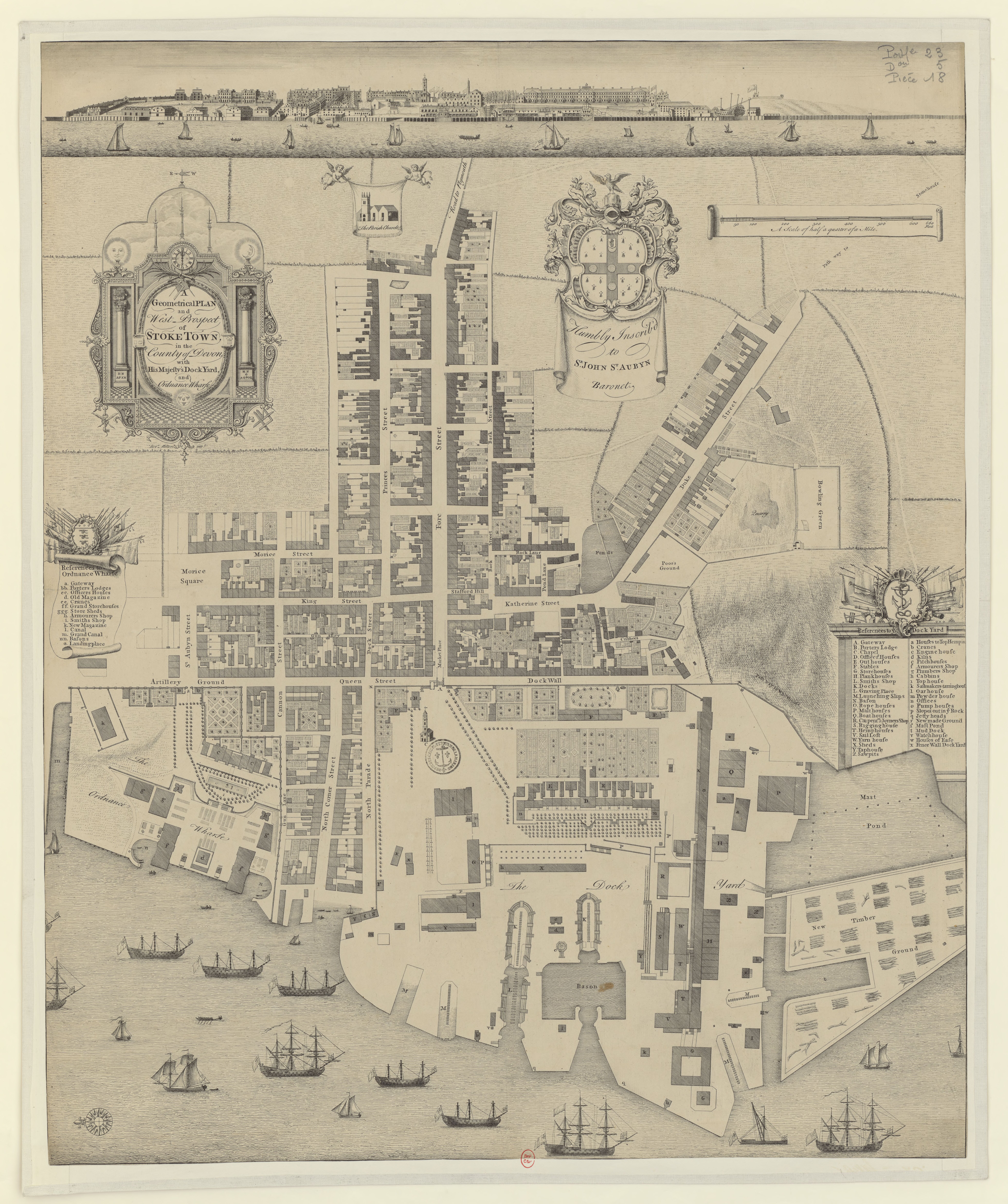
A geometrical plan and West-prospect of Stoke Town... - btv1b53010306b.jpg - Gzen92Bot

A geometrical plan... of H.M dock-yard near Portsmouth... - btv1b53010503r.jpg - Gzen92Bot

Plymouth sound, Hamoaze and Catwater - btv1b53010404t (1 of 2).jpg - Gzen92Bot

Angliae orae maritimae inter Plemoutham et Portlandiam simul et praecipuorum portuum, vera effigies et delineati - Lucas Iansz Waghenaer van Enchuijsen Inventor ; Ioannes à Doetecum fecit - btv1b53225456c (2 of 3).jpg - Enyavar

Zee Caerte van Engelants Eijndt, Alsoe hem tselfde Landt verthoont beginnende van Sorlinges tot Pleijmondt - Doer Lucas Iansz Wagenaer - btv1b53225455x (2 of 3).jpg - Gzen92Bot

A Map of the County of Devon, with the City & County of Exeter - Delineated from an actual Survey, by Benjamin Donn ; Engraved by Tho(ma)s Jefferys, Geographer to his Majesty ; To John Baring of... - btv1b53056953n (12 of 12).jpg - Gzen92Bot

A new and correct large draught PLYMOUTH SOUND catt-water and ham-owse (NYPL b13909432-1640575).jpg - Fæ
❮
❯


