Wikimedi'Òc
Modes d'emploi

Cet album fait partie des albums
Cet album photos contient les sous-albums suivants :


Arequipa 1957.jpg - Marsonmars

Cajamarca 1865.jpg - Marsonmars

Huancavelica 1865.jpg - Marsonmars

Moyobamba Peru 1865.jpg - Marsonmars

Ica Peru 1865.jpg - Marsonmars
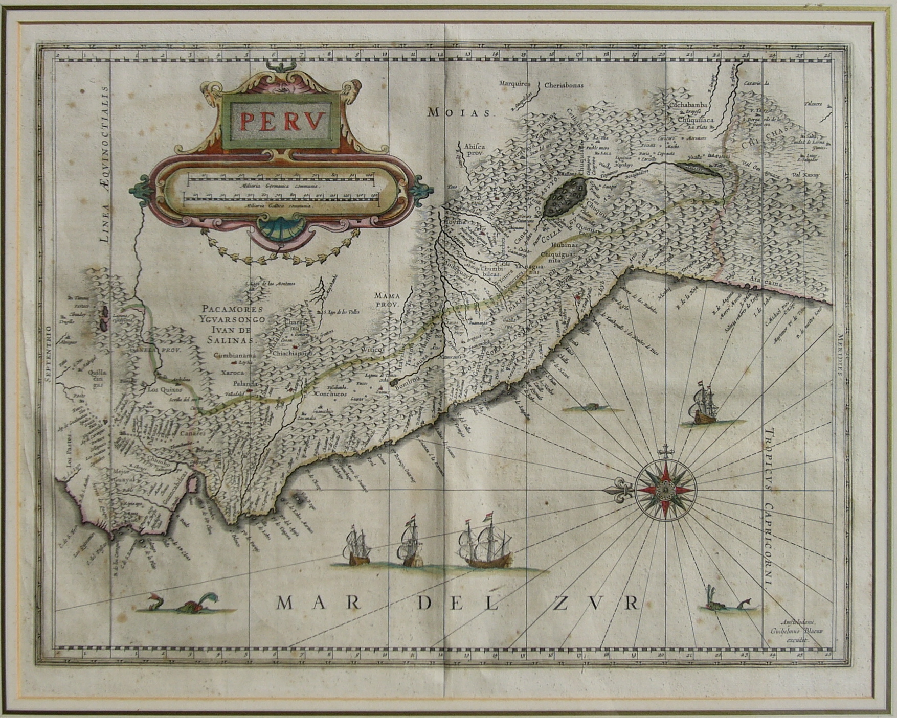
Perv-Guiljelmus Blaeuw.JPG - Manuel González Olaechea

AmériqueMéridionale.JPG - Igor Zyx

RíoAmazonas(1).JPG - Yakoo

Plano de la Batalla de Yungay.jpg - Jjrt
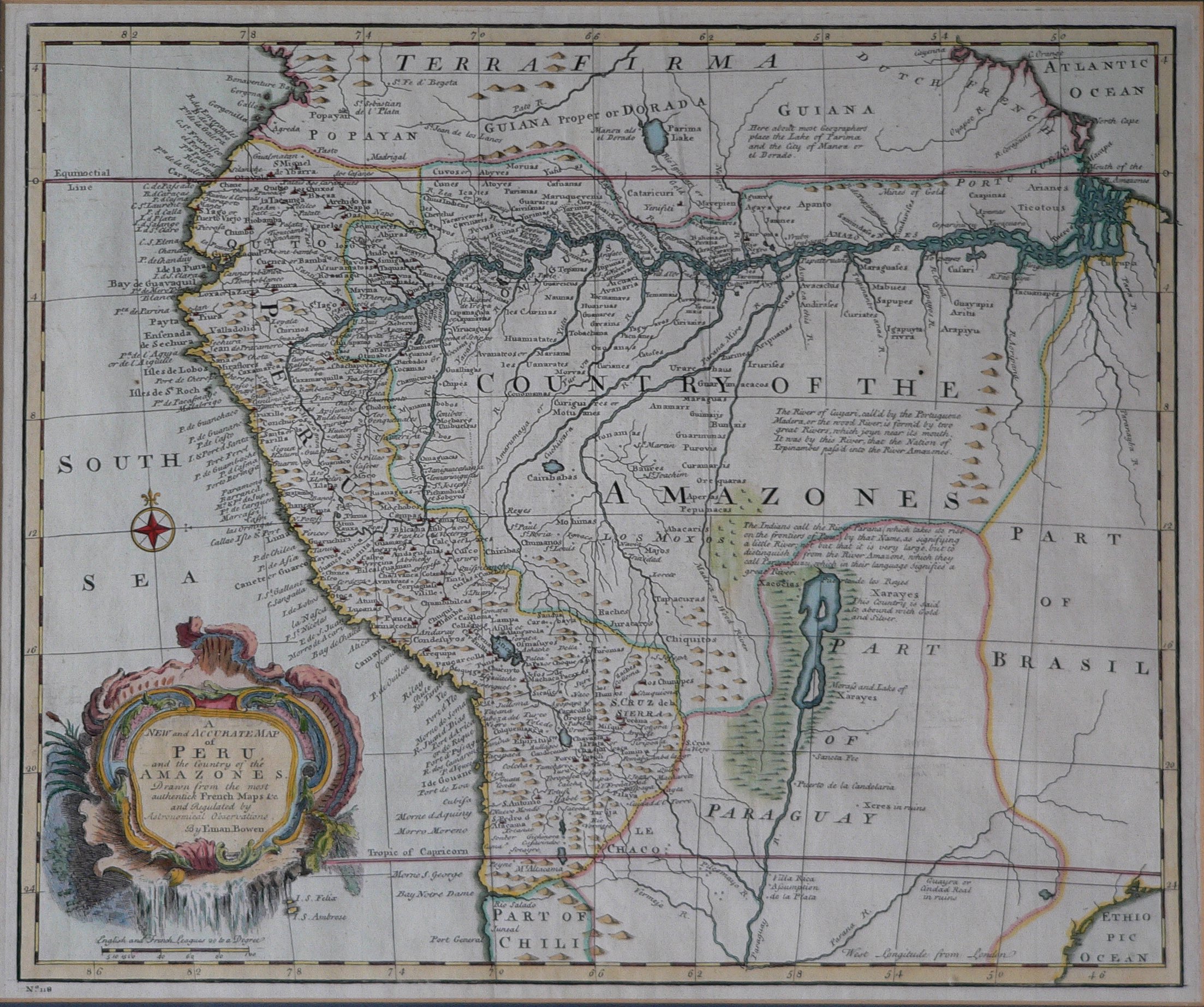
MapaPerú.EmanBowen.JPG - Yakoo

MapaPerú.EmanBowen2.JPG - Manuel González Olaechea

MapaPerú.HermannMoll2.JPG - Manuel González Olaechea

Peruvani Regni Descriptio.jpg - Fbaltra

MapaPerú.RigobertBonne1.JPG - Manuel González Olaechea

Peruviae Auriferae Regionis Typus.jpg - Manuel González Olaechea
Gonzalo Pizarro sailing in Peru.JPG - Manuel González Olaechea
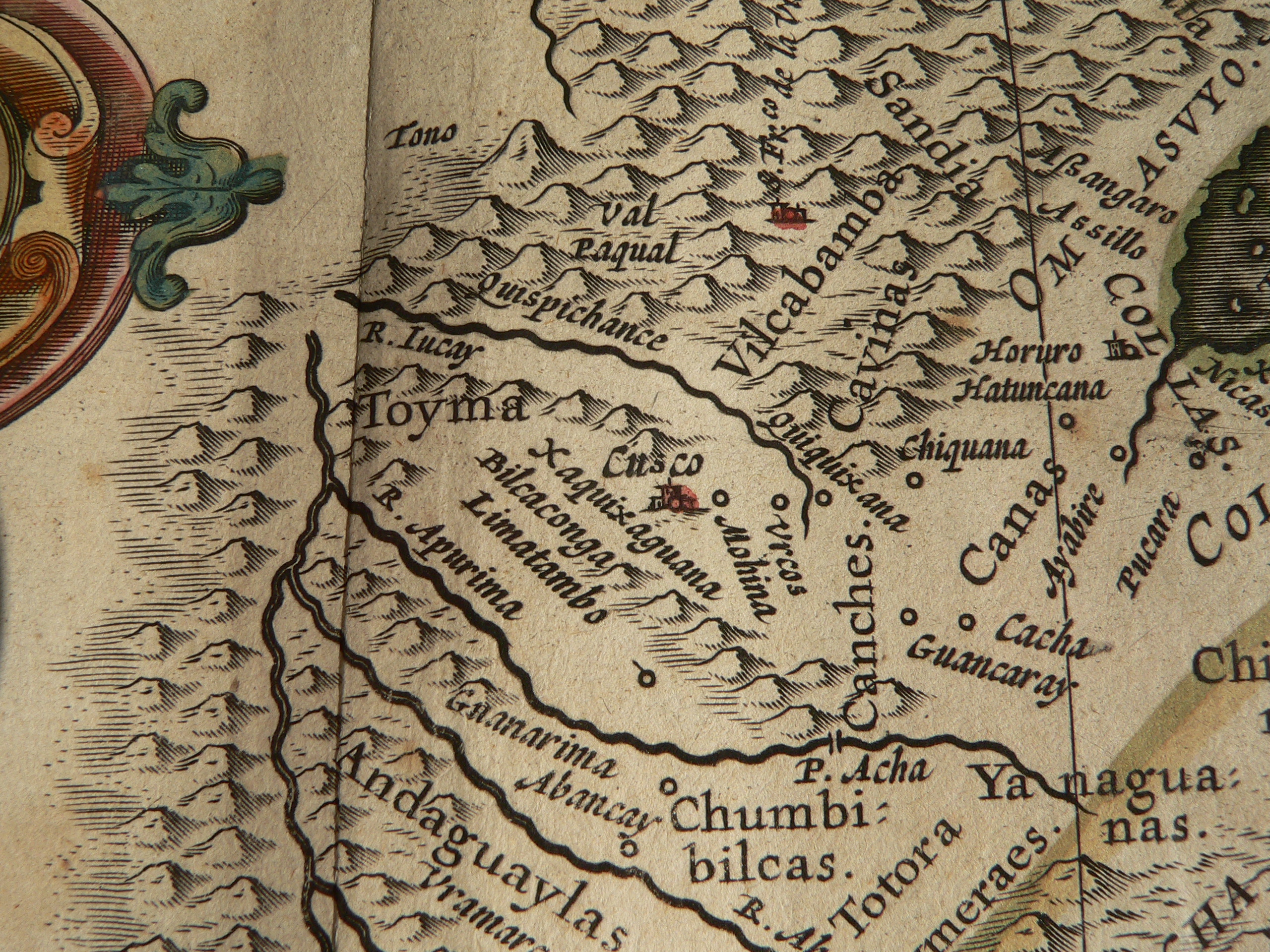
Cusco con S.jpg - Manuel González Olaechea
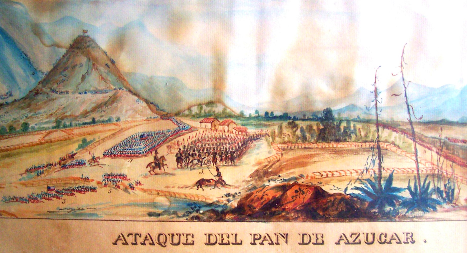
Ataque al Pan de Azucar.jpg - Rec79
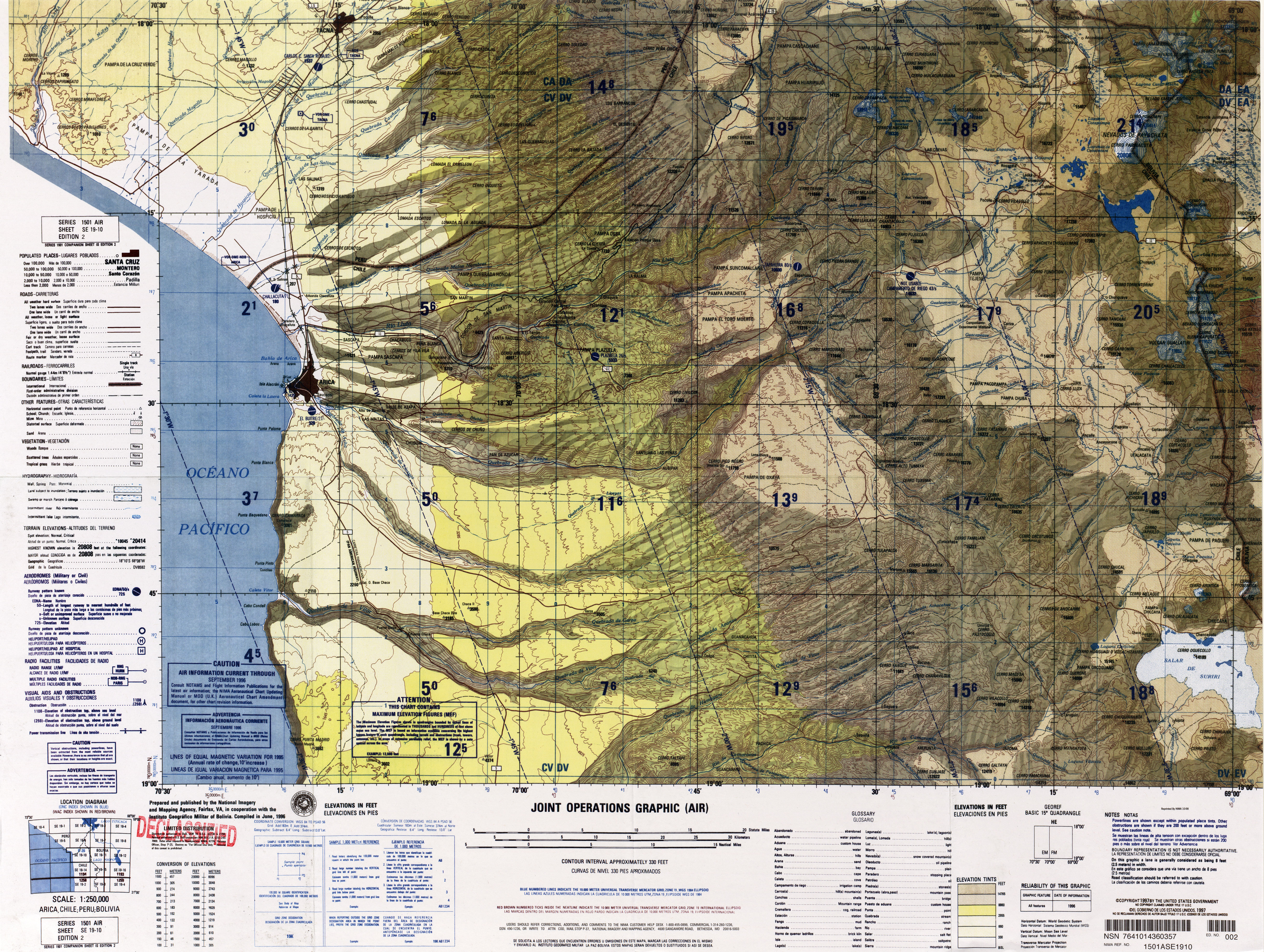
Txu-oclc-224571178-se19-10.jpg - Keysanger
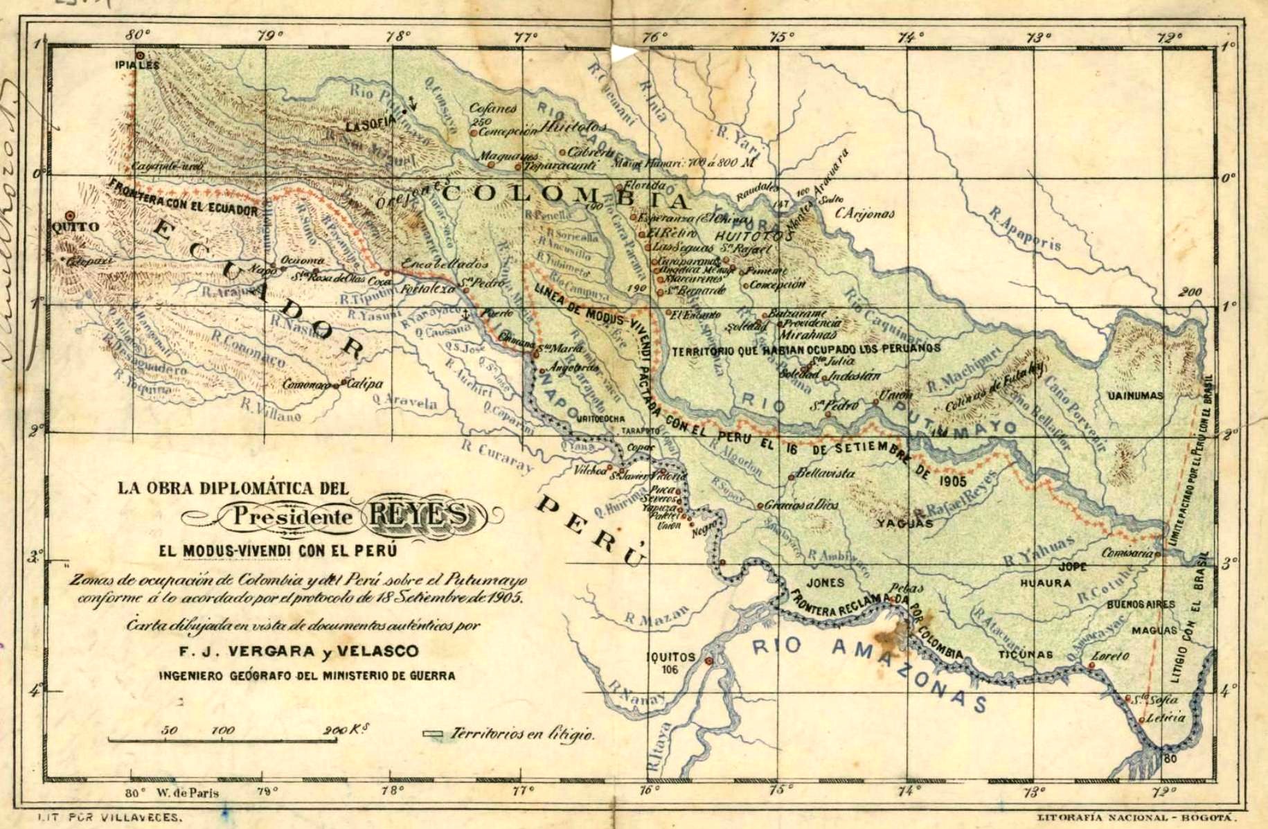
Mapa del Modus-Vivendi entre Perú y Colombia.jpg - Milenioscuro

El Reino del Perú y los cursos de la riviera amazónica - AHG.jpg - Jojagal

D469- N° 394. Pérou méridional. - liv3-ch13.png - Vieux têtard

Peru (8431021916).jpg - File Upload Bot (Magnus Manske)

Carte du Perou, pour servir à lhistoire des Incas et à celle de letat present de cette province (4578785065).jpg - File Upload Bot (Magnus Manske)

Ttahuantin-Suyu or the empire of the Yncas (except Quito and Chile) ... conquerers (2674940001).jpg - File Upload Bot (Magnus Manske)

Antiguo plano de Cajamarca durante el Virreinato.jpg - John PC

Topography; A map of part of Peru. Wellcome L0027590.jpg - Fæ

Atlas Van der Hagen-KW1049B13 088-PERV.jpeg - OlafJanssen
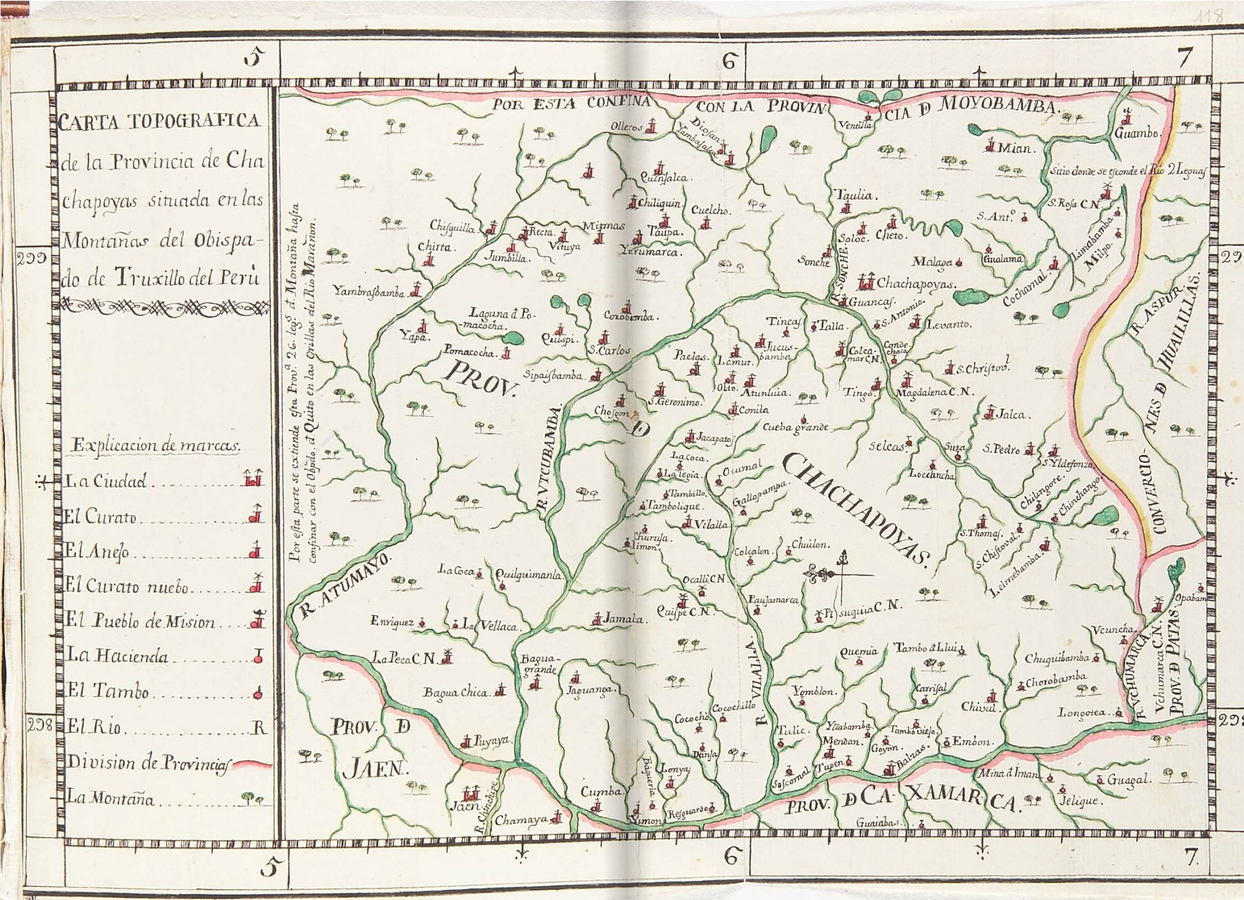
Carta-topográfica-provincia-Chachapoyas-Martinez-de-Compañón.jpg - Jaimruiz

The earth and its inhabitants (1894) (14579779198).jpg - Fæ

A survey of ancient Peruvian art BHL24283473.jpg - Fæ

Incas of Peru -map (pg 414).png - Akme
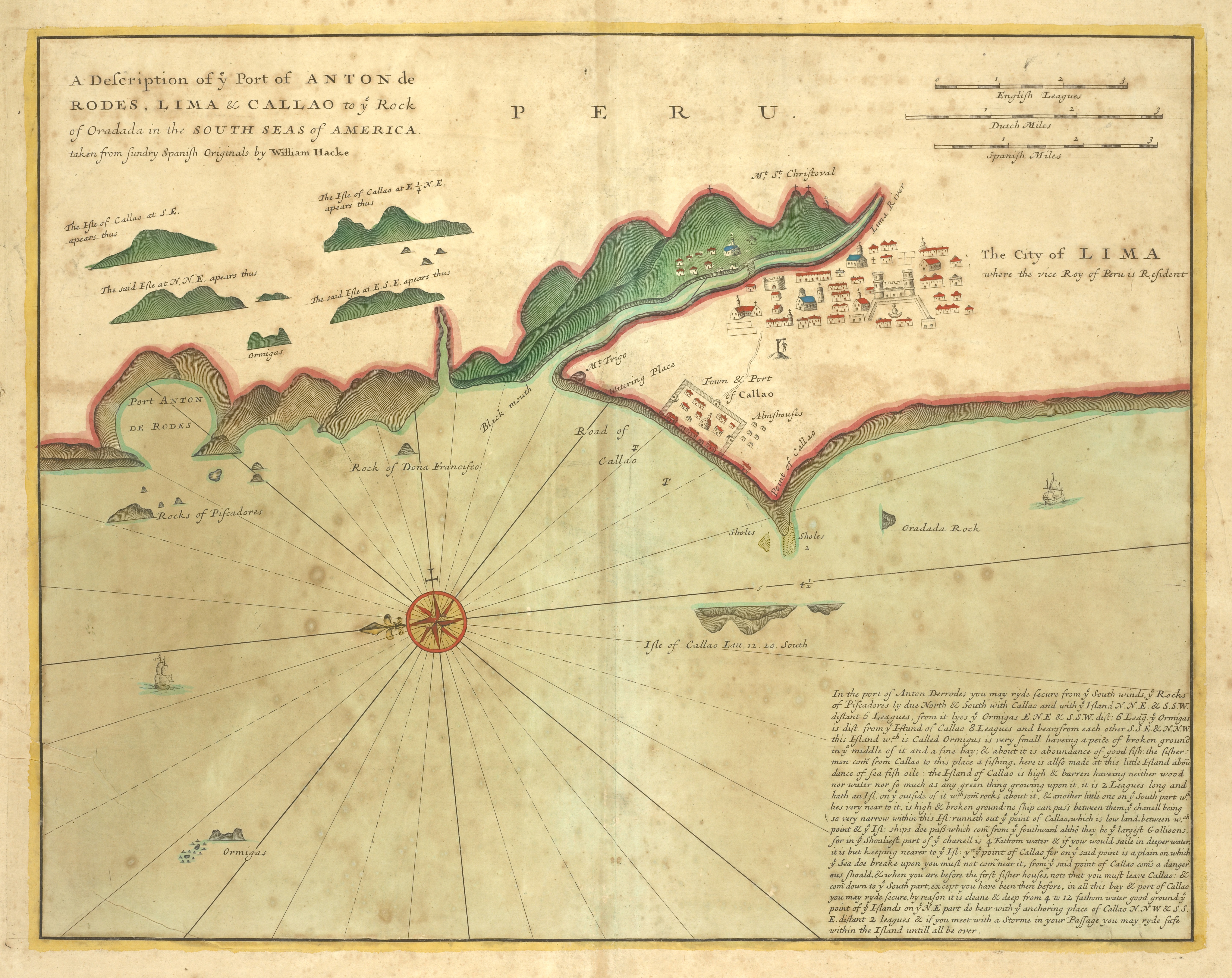
The city of LIMA where the vice Roy of Peru is Resident (NYPL b13909432-1640610).jpg - Fæ

Peru (NYPL b15376638-1404016).jpg - Fæ

"Pl. XXV". Le port de Callao (20045123682).jpg - Tm

LIMITE SEGUN MAPA LEY SAMANCO.png - Olidel13

LIMITE TERRITORIAL ENTRE SAMANCO Y CASMA SEGUN MAPA LEY 12294 CREACION DE SAMANCO.png - Olidel13
Map of Peru.jpg - Baddu676

Mapa płaskowyżu Gran Pajonal.jpg - Piotrlop

539 of 'Peru- incidents of ravel and exploration in the Land of the Incas. ... With illustrations' (11265726066).jpg - Artix Kreiger 2

89 of 'Informe al Supremo Gobierno del Perú sobre una espedicion al interior de la República' (11084654335).jpg - FlickreviewR 2

50 of 'History of the Conquest of Peru, with a preliminary view of the civilization of the Incas' (11027065294).jpg - Artix Kreiger 2

48 of 'History of the Conquest of Peru, with a preliminary view of the civilization of the Incas' (11027332045).jpg - Artix Kreiger 2

Combate del 2 de mayo en la prensa española 10.jpg - Juan Villalobos

Combate del 2 de mayo en la prensa española 11.jpg - Juan Villalobos

Meyers b10 s0792 b1.png - Mapmarks
Peru LOC 2002624024.tif - Fæ

Peru LOC 2002624024.jpg - Fæ
Peru LOC 2002624025.tif - Fæ
Peru LOC 2002624025.jpg - Fæ

Carte Particuliere Du Perou, Plan De La Ville De Lima, Description De Quelques Plantes, Animaux, & Machines Du Pays.jpg - Higgenhorscht

Railway From Tacna To The Frontier.jpg - Higgenhorscht

Mapa Del Peru.jpg - Higgenhorscht

Ferrocarril Central Trasandino 02.jpg - Higgenhorscht

Ferrocarril Central Trasandino 03.jpg - Higgenhorscht

Ferrocarril Central Trasandino 01.jpg - Higgenhorscht

Camino De Cuzco A Paucartambo, I El Propuesto Al Puerto Fluvial.jpg - Higgenhorscht

Mapa De Las Vias A Vapor En El Perú I Sus Relaciones Con Otras.jpg - Higgenhorscht

Plan Topografico De Moquegua Y Torata.jpg - Higgenhorscht

Mapa De Los Valles De Paucartambo, Lares, Ocobamba Y La Quebrada Del Vilcanota.jpg - Higgenhorscht

Karte Von Perú.jpg - Higgenhorscht

Cours Du Fleuve Maragnon autrement dit Des Amazones.jpg - Higgenhorscht

Ferrocarril Central Trasandino.jpg - Higgenhorscht

Departamento de Tacna, Chile Alberto Martín, editor.png - Janitoalevic

Histoire des deux Indes-Atlas-d47-C26c-Pérou-Audience de Lima.png - Vieux têtard

Mapa-los-yauyos-1.jpg - Job Cayetano

Provincia de Hualgayoc. Cuerpo de ingenieros de minas del Peru, Boletin n° 6. F. Málaga Santolalla - btv1b8444437t.jpg - Gzen92Bot

Map of the Santa valley railway (Republic of Peru) - btv1b8445957m.jpg - Gzen92Bot

Mapa de una parte de la hoya del Amazonas, con el objeto de esclarecer la cuestion de limites entre el Peru y el Brasil - por Manuel Rouaud ; y Paz Soldan... - btv1b8441062k.jpg - Gzen92Bot

Plano general del Reyno del Perú en la America Meridional de Andrés Baleato (1796).jpg - Janitoalevic

Límite entre Chile y Perú en el río Loa, Plano General del Reyno del Perú en la América Meridional de Andrés Baleato (1796).jpg - Janitoalevic

Linha Cunha Gomes e Paralelo 10°20' Sul.jpg - Yuri radd
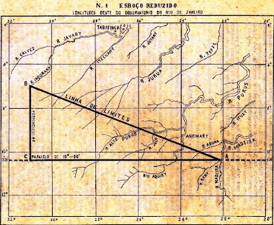
Figura 01 - Esboço Reduzido.jpg - Yuri radd

Figura 02 - Linha de Limites n° 2.jpg - Yuri radd

Galvez.jpg - Yuri radd

Peru, 1938.jpg - Universalis
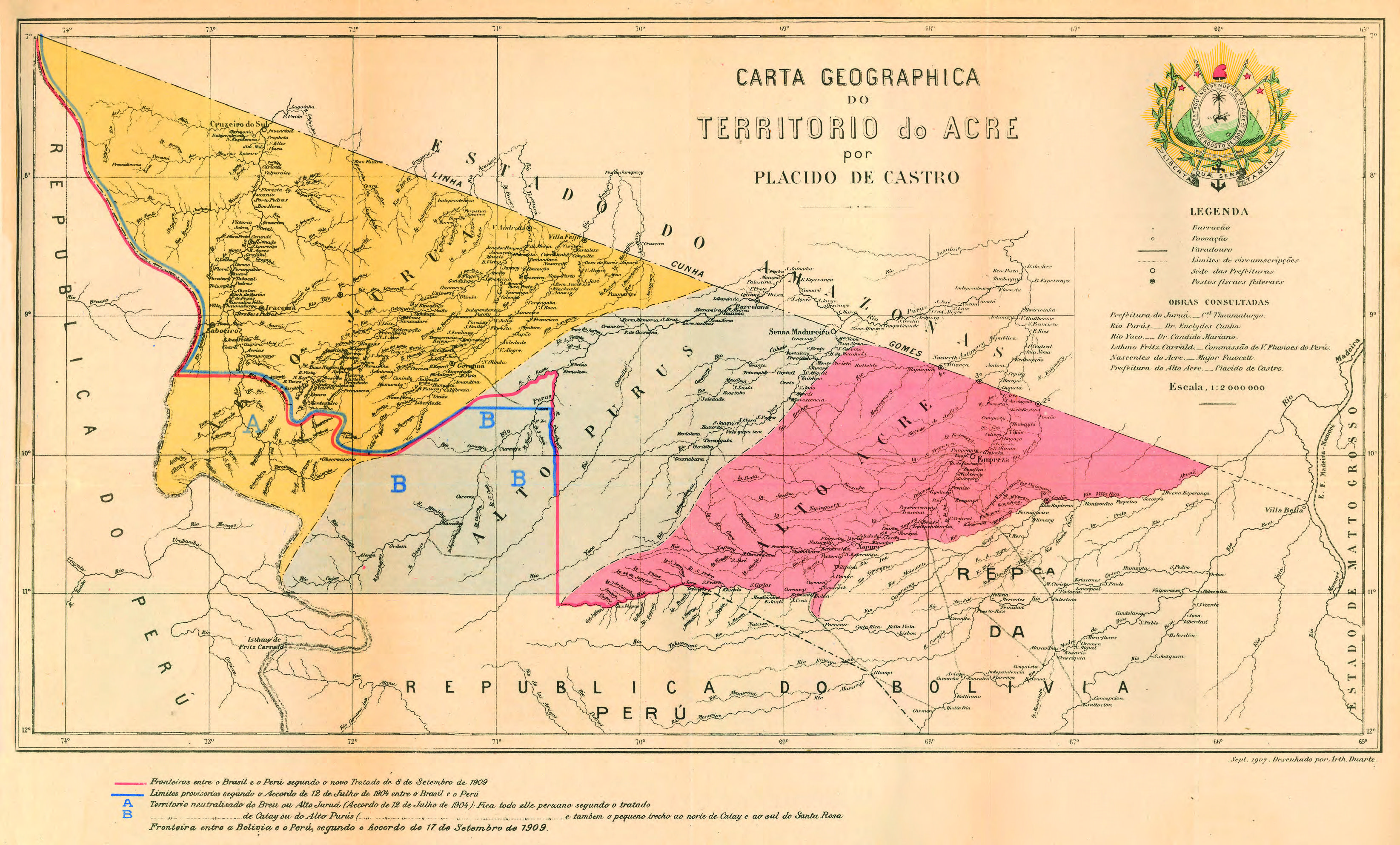
Território do Acre por Plácido de Castro.jpg - Yuri radd

Mapa mostrando o Território do Acre dividido pelo Paralelo 10°20'.jpg - Yuri radd

Esboço da Região Litigiosa Peru-Boliviana.jpg - Yuri radd

Mapa De Los Valles De Paucartambo, Lares, Ocobamba Y La Quebrada Del Vilcanota (cropped).jpg - JustEMV

Plano general del Reyno del Perú en la America Meridional de Andrés Baleato (1796) (recortado y rotado).jpg - Janitoalevic