Wikimedi'Òc
Modes d'emploi

Cet album fait partie des albums
Cet album photos contient les sous-albums suivants :


Sebastião Lopes 1575.jpg - Alvesgaspar

Morocco 1634, Gerardus Mercator (4172298-verso).jpg - Martin H.

Morocco 1635, Abraham Ortelius (4172299-verso).jpg - Martin H.

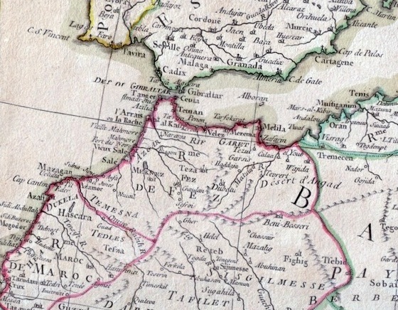
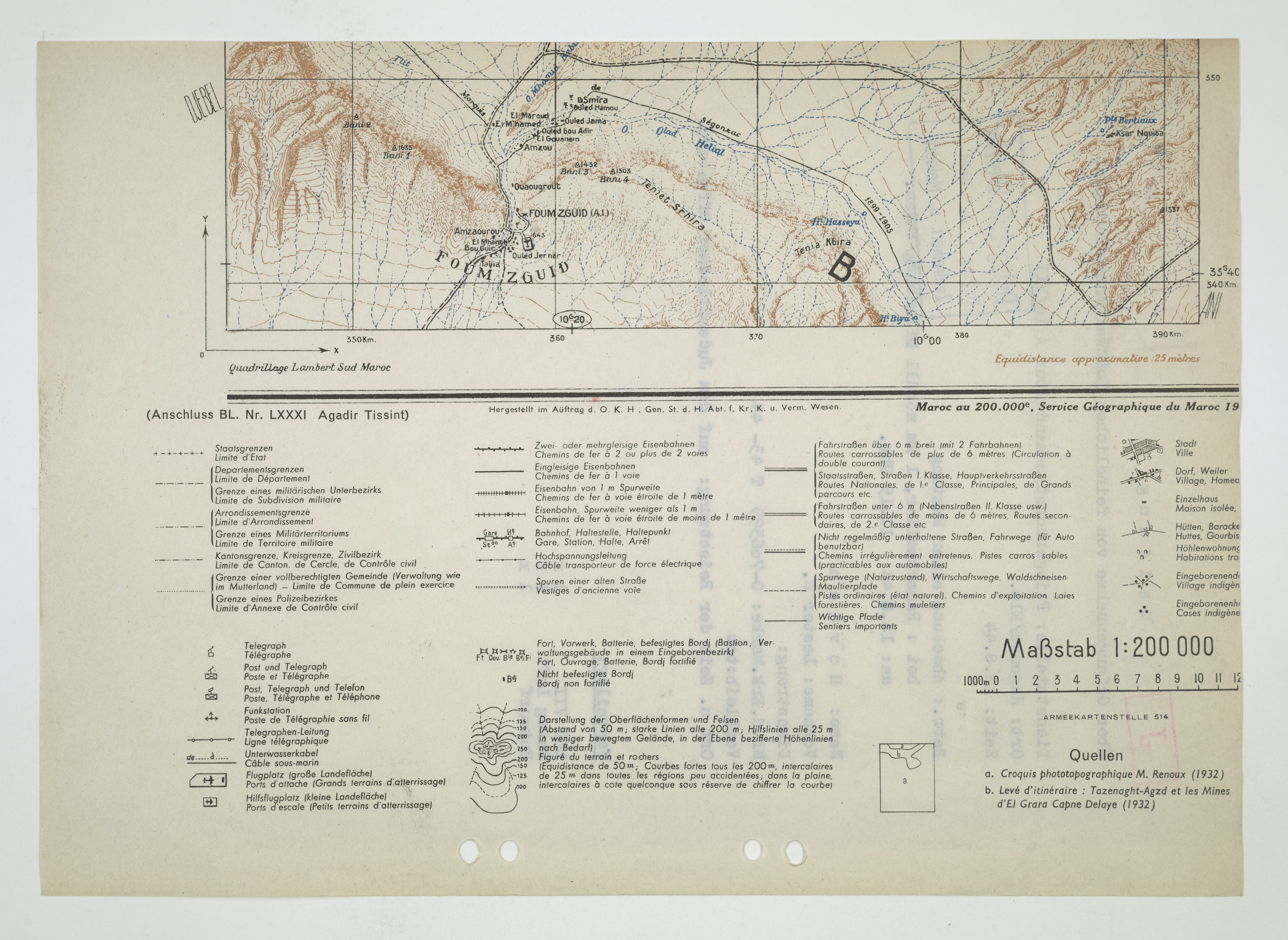
Maptams.JPG - Tartessano

Tangier Zone txu-oclc-6949452-ni30-1.jpg - ديفيد عادل وهبة خليل 2

089 algerien-marokko-und-tunis (1905).png - 14nu5
Kingdom of Fez.jpg - Flad

T K Empire of Morocco.jpg - Flad

Vesconte Maggiolo. World chart, from eastern coasts of America to India. PORTOLAN CHART. Naples, 1516.L.jpg - Geagea
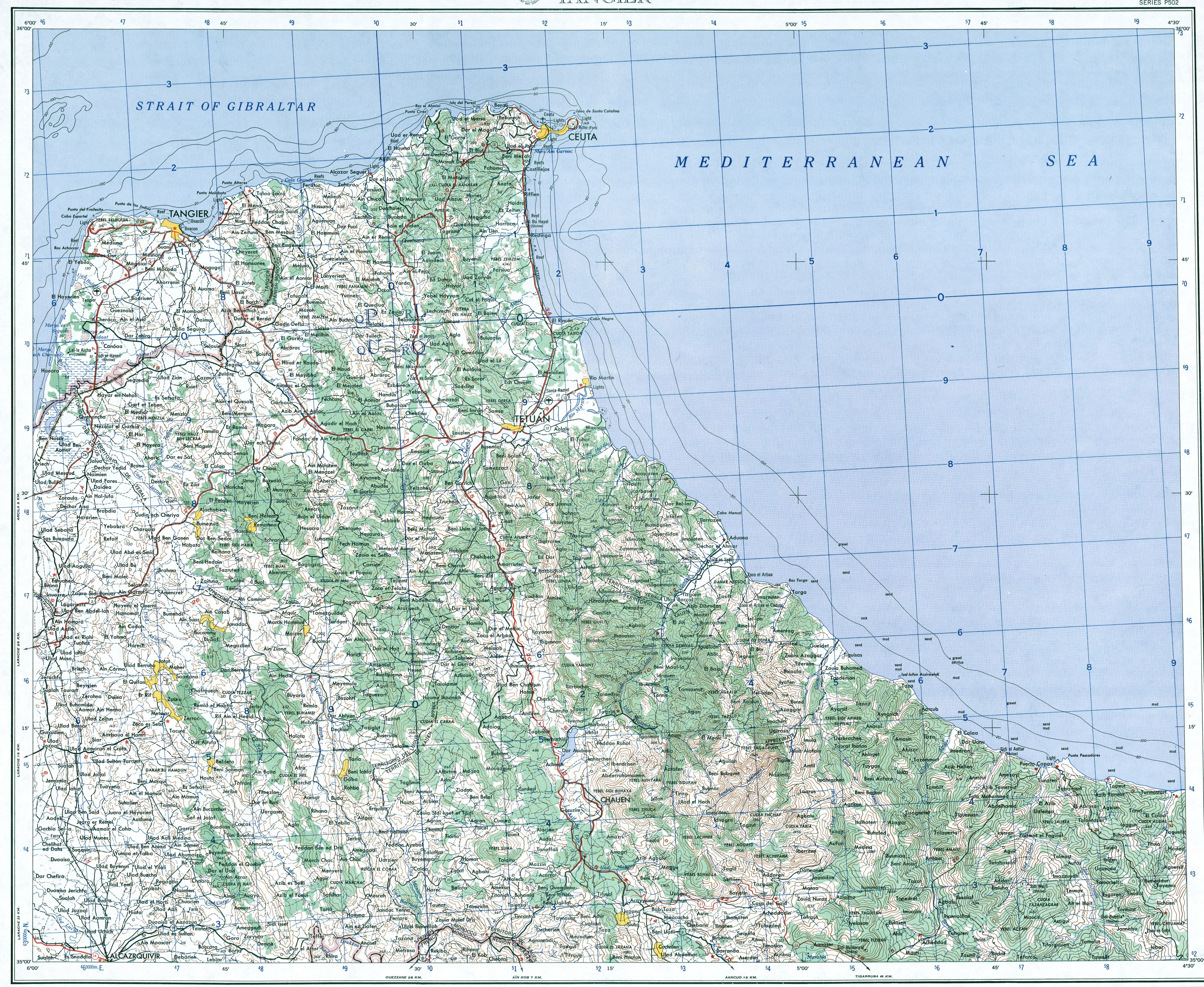
Map of Tangier Zone (Morocco).jpg - Walrasiad
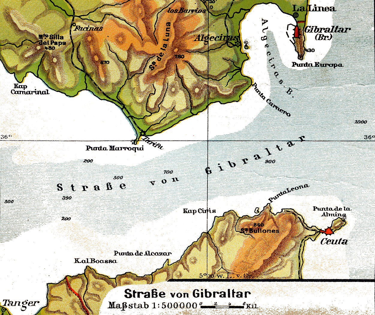
Lange diercke sachsen europaeische landschaften gibraltar.jpg - Bananenfalter

Kingdom of Fez, Northern Morocco and Iberia.jpg - Flad

1873 Stieler's Map of Ibiza and Spanish and African Coasts - Geographicus - Ibiza-s-73.jpg - BotMultichill

Marokko Küste 003.jpg - Katharinaiv

Homann - Marocca - 1726.jpg - Räydän

De cust van Barbaryen van out Mamora tot Capo Blanco, en van Capo Blanco tot Capo de Geer (1672).jpg - DarwIn
Guillaume Delisle Morocco 1707.jpg - Omar-toons

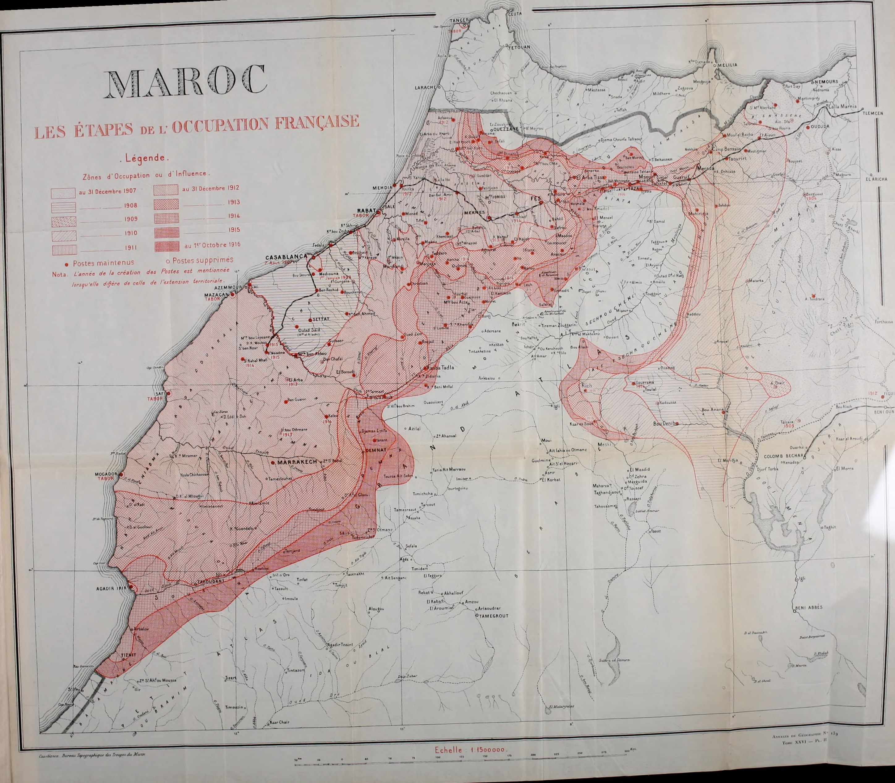
État actuel de l'occupation du Maroc, Mai 1913.jpg - Hadrajsaid

Barbariae et Guineae maritimi à freto Gibraltar ad fluvium Gambiae cum Insulis Salfis Flandrisis et Canaricis (3121049820).jpg - File Upload Bot (Magnus Manske)
Rigobert-Bonne-Atlas-de-toutes-les-parties-connues-du-globe-terrestre MG 0025.tif - Hansmuller
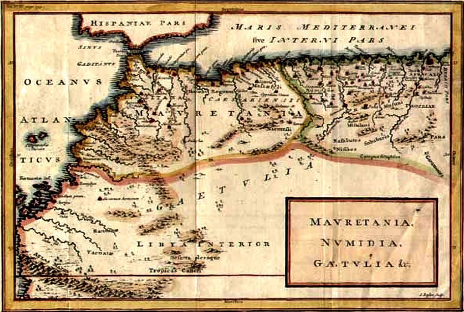
Maurétanie et Numidie.jpg - JPS68

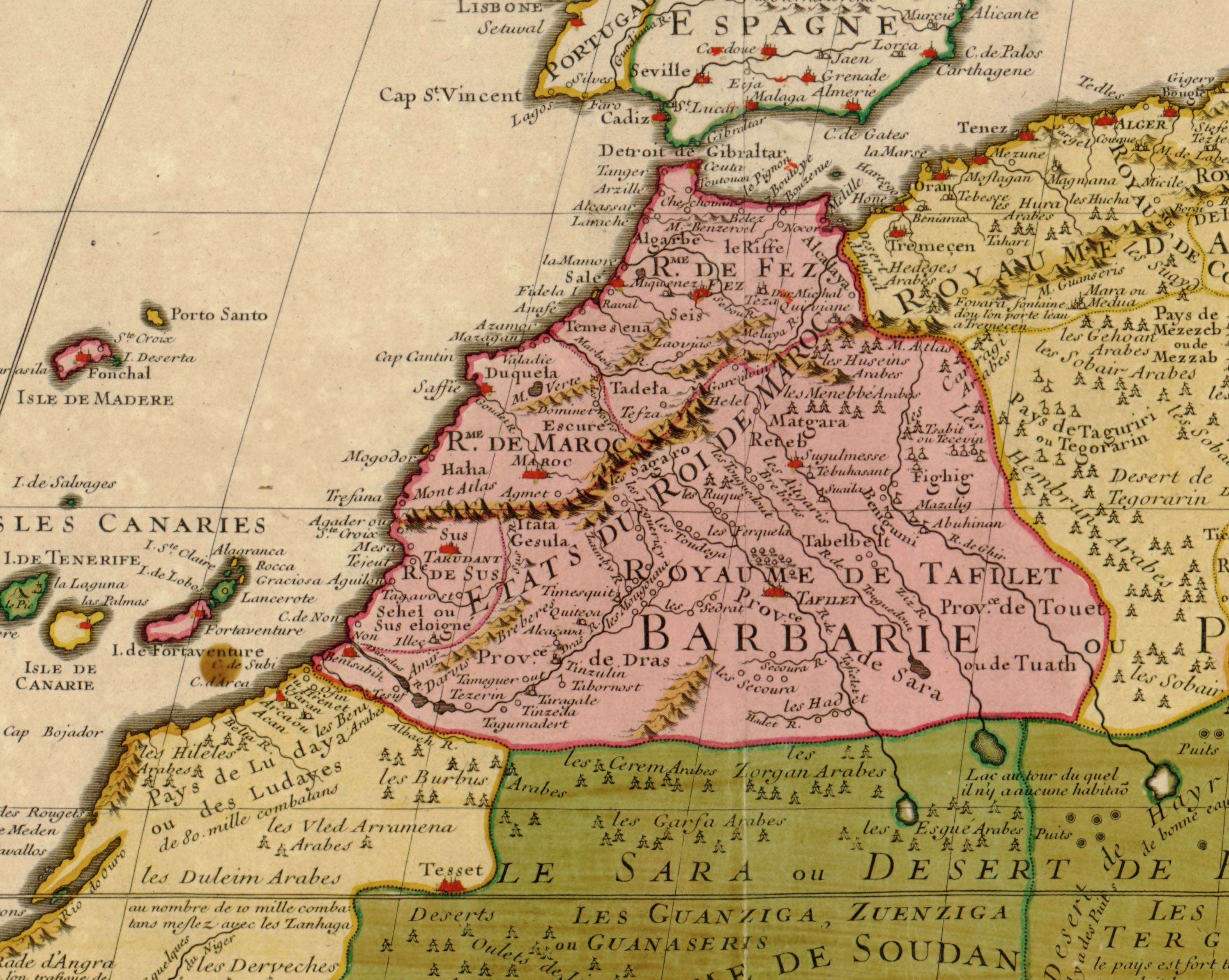
(1810) Map of the EMPIRE OF MAROCCO.jpg - Metilsteiner

TROTTER(1881) MAP OF MAROCCO.jpg - Metilsteiner
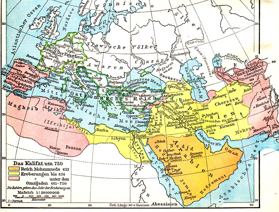
Arab Caliphate.jpg - Taron Saharyan~commonswiki

Atlas Van der Hagen-KW1049B13 059-FEZZAE ET MAROCCHI REGNA AFRICAE CELEBERRIMA,.jpeg - OlafJanssen

Tagmadert.JPG - Deadstar

Bulletin de la Société de Géographie (1832) (20424628382).jpg - Fæ

Journal of a tour in Marocco and the Great Atlas (1878) (20585946120).jpg - Fæ

Journal of a tour in Marocco and the Great Atlas (1878) (20585944280).jpg - Fæ

Journal of a tour in Marocco and the Great Atlas (1878) (20585942530).jpg - Fæ

Book of Roger MS. Greaves 42 119b.jpg - MartinPoulter
Annales de géographie (1891) (14595479047).jpg - Fæ

Geography rectified; or, A description of the world, in all its kingdoms, provinces, countries As also their commodities, coins, weights, and measures, compared with those at London. Illustrated with (14777013191).jpg - Fæ

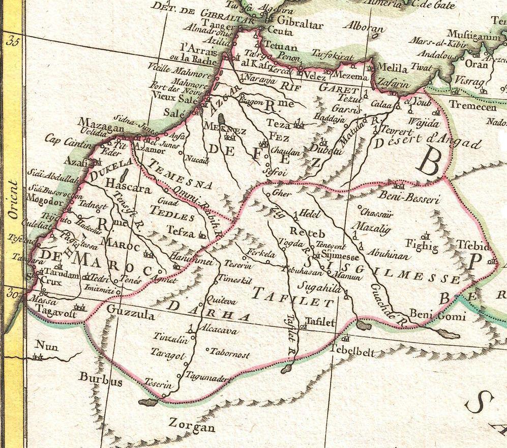
Map of the kingdoms of Fes and Morocco and inset map of the Kingdom of Kongo by Abraham Ortelius.jpeg - File Upload Bot (Kaldari)

Bijzondere Collecties UvA HB-KZL 33.18.40.jpg - Marikevanroon20
Morocco1771.jpg - Joan Valls82

A Map of the Empire of Morocco Comprehending the Kingdom of Fez, Morocco etc. By T. Kitchin Geogr. RMG L8467.jpg - Fæ
ETH-BIB-Plan von Fès-Dia 247-02351-1.tif - ETH-Bibliothek
ETH-BIB-Plan von Marrakech-Dia 247-02349-1.tif - ETH-Bibliothek
ETH-BIB-Plan von Meknès-Dia 247-02350.tif - ETH-Bibliothek
ETH-BIB-Karte Marokko-Dia 247-02356-1.tif - ETH-Bibliothek
ETH-BIB-Plan von Fès, Übersicht-Dia 247-02403.tif - ETH-Bibliothek
ETH-BIB-Plan von Fès, Detail (Medina)-Dia 247-02404.tif - ETH-Bibliothek
ETH-BIB-Maroc, Reliefkarte-Dia 247-10250.tif - ETH-Bibliothek
Descripción de la costa de Salé que comprende desde Cavo Blanco ... LOC 90683784.tif - Fæ

Descripción de la costa de Salé que comprende desde Cavo Blanco ... LOC 90683784.jpg - Fæ

خريطة موغادور عام 1942.jpg - إيان

خريطة السكك الحديدية في المغرب 1924.jpg - Riad Salih

خريطة الطرق في المغرب 1919.jpg - إيان

خريطة عسكرية وإدارية للمغرب 1921.jpg - إيان

خريطة لمراحل احتلال المغرب 1920.jpg - إيان
J-1903 - NARA - 131503695 (page 7).jpg - US National Archives bot

Admiralty Chart No 1228 Cape Spartel to Cape Ghir, Published 1897.jpg - Kognos

Admiralty Chart No 1226 Africa west coast Strait of Gibraltar to the River Gambia, Published 1887.jpg - Kognos

Admiralty Chart No 1229 Africa west coast Cape Ghir to Garnet Head including the Canary Islands, Published 1898.jpg - Kognos

Admiralty Chart No 1230 Africa west coast Garnet Head to Cape Verde, Published 1898.jpg - Kognos

Kaart van Marokko Royaume de Maroc divisé en sept Provinces (titel op object), BI-B-FM-090-106.jpg - Mr.Nostalgic

Carte Baie de Fedhala.png - Ailicis07

Admiralty Chart No 92 Cape St Vincent to the Strait of Gibraltar, Published 1905.jpg - Kognos

Carte de la Régence d'Alger en 1650 (Algérie) et du Royaume de Fès.jpg - Askelaadden

Mouette's map of part of Morocco.jpg - AvaBrandon2000

Plan des Isles Zafarines à la côte de Barbarie - btv1b59663785 (1 of 2).jpg - Gzen92Bot
اقليم تامسنا.png - اسامة شروقي

Plan des Isles Zafarines a la coste de Barbarie - btv1b5966379k (1 of 2).jpg - Gzen92Bot

Afbeeldinge nae't leven der Zeecusten van Barbarien van de C. Cantin zuijdwaert tot verbij de C. de Geer, mitsgaders de gelegentheijt van't eijlant Mogodor, alles op zijne rechte strekinge en hoochte gestelt - btv1b8595428s.jpg - Gzen92Bot

Plan des Albozènes dans le Royaume de Fez en Barbarie - btv1b59663963 (1 of 2).jpg - Gzen92Bot

Arab Caliphate.svg - Smasongarrison

Carte portugaise du Maroc (Mauretania).jpg - أيوب

Admiralty Chart No 820 Cap de Fedala to Cap Blanc du Nord, Published 1910.jpg - Kognos

Admiralty Chart No 1 Portsmouth to Canary Islands (Islas Canarias) and the Azores (Açôres), Published 1946.jpg - Kognos

Admiralty Chart No 1227 Cape Spartel to Mazighan, Published 1840.jpg - Kognos

Admiralty Chart No 1228 Azamor to Sta. Cruz, Published 1844.jpg - Kognos

Admiralty Chart No 1229 Sta. Cruz to Cape Bojador, Published 1844.jpg - Kognos

Map of Marocco Washington 1831.jpg - Kognos

Tab. I. Africæ, in qua Mauritania Tingitana et Cæsariensis. Medius meridianus 16, reliqui ad hunc inclinati sunt pro ratione parellelorum 29 et 34 ad circulum maximum. R 2= 22. Pièce 2.jpg - BFT - Bibliothèque Interuniversitaire de la Sorbonne

Fezzæ et Marocchi regna Africæ celeberrima, describebat Abrah. Ortelius. R 2= 22. Pièce 9.jpg - BFT - Bibliothèque Interuniversitaire de la Sorbonne

1917-03-17 IBÉRICA 04.jpg - LBM1948

Admiralty Chart No 1228 Cabo de Sao Vicente to Cap Ghir, Published 1962, New Edition 1969.jpg - Kognos

Admiralty Chart No 1229 Cap Ghir to Cabo Bojador, Published 1956.jpg - Kognos

Admiralty Chart No 1229 Cape Ghir to Garnet Head including the Canary Islands, Published 1898, Large Corrections 1953.jpg - Kognos