Wikimedi'Òc
Modes d'emploi

Cet album fait partie des albums
Cet album photos contient les sous-albums suivants :


CAUCASIA~Vegetation Land Cover with ethnic borders~2.jpg - Armanum Luwian

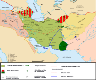
Map Iran 1900-fr.png - Fabienkhan
South East Iraq , 586 B.C..png - Chuck Marean

Old map of Shiraz.jpg - Amin pedia

Soviet Theater Forces in Areas Adjacent to Iran, November 1986.png - Serdechny

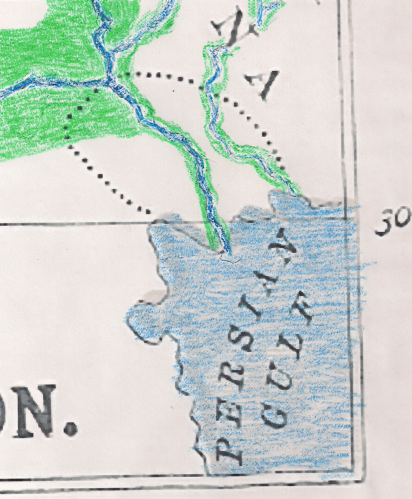
The Helmund River WDL12995.png - Fæ

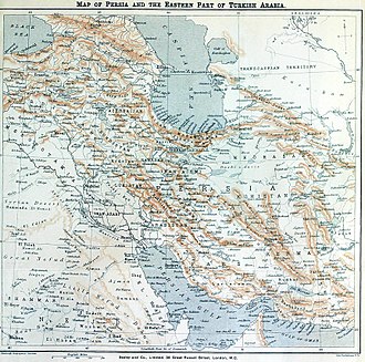
Persia 1909.jpg - Mazandar
Carte des itinéraires suivis dans la Turquie d'Asie et la Perse par l'Ambassade française (NYPL b12482496-1542706).tiff - Fæ

Carte des itinéraires suivis dans la Turquie d'Asie et la Perse par l'Ambassade française (NYPL b12482496-1542706).jpg - Fæ
Persia RMG F1728.tiff - Fæ

Iran et Touran.jpg - SlowManifesto

Iran historique Exode des Iraniens.jpg - SlowManifesto
Iran. LOC 96686655.tif - Fæ

Iran. LOC 96686655.jpg - Fæ
Iran. LOC 2011588109.tif - Fæ

Iran. LOC 2011588109.jpg - Fæ
Iran. LOC 91684731.tif - Fæ

Iran. LOC 91684731.jpg - Fæ
Iran. LOC 96686654.tif - Fæ

Iran. LOC 96686654.jpg - Fæ
Map of Persia, Turkey in Asia - Afghanistan, Beloochistan. LOC 2013593018.tif - Fæ

Map of Persia, Turkey in Asia - Afghanistan, Beloochistan. LOC 2013593018.jpg - Fæ
Bokhara, Kabool, Beloochistan, etc. LOC 2004629035.tif - Fæ
Iran. LOC 2011588108.tif - Fæ

Iran. LOC 2011588108.jpg - Fæ
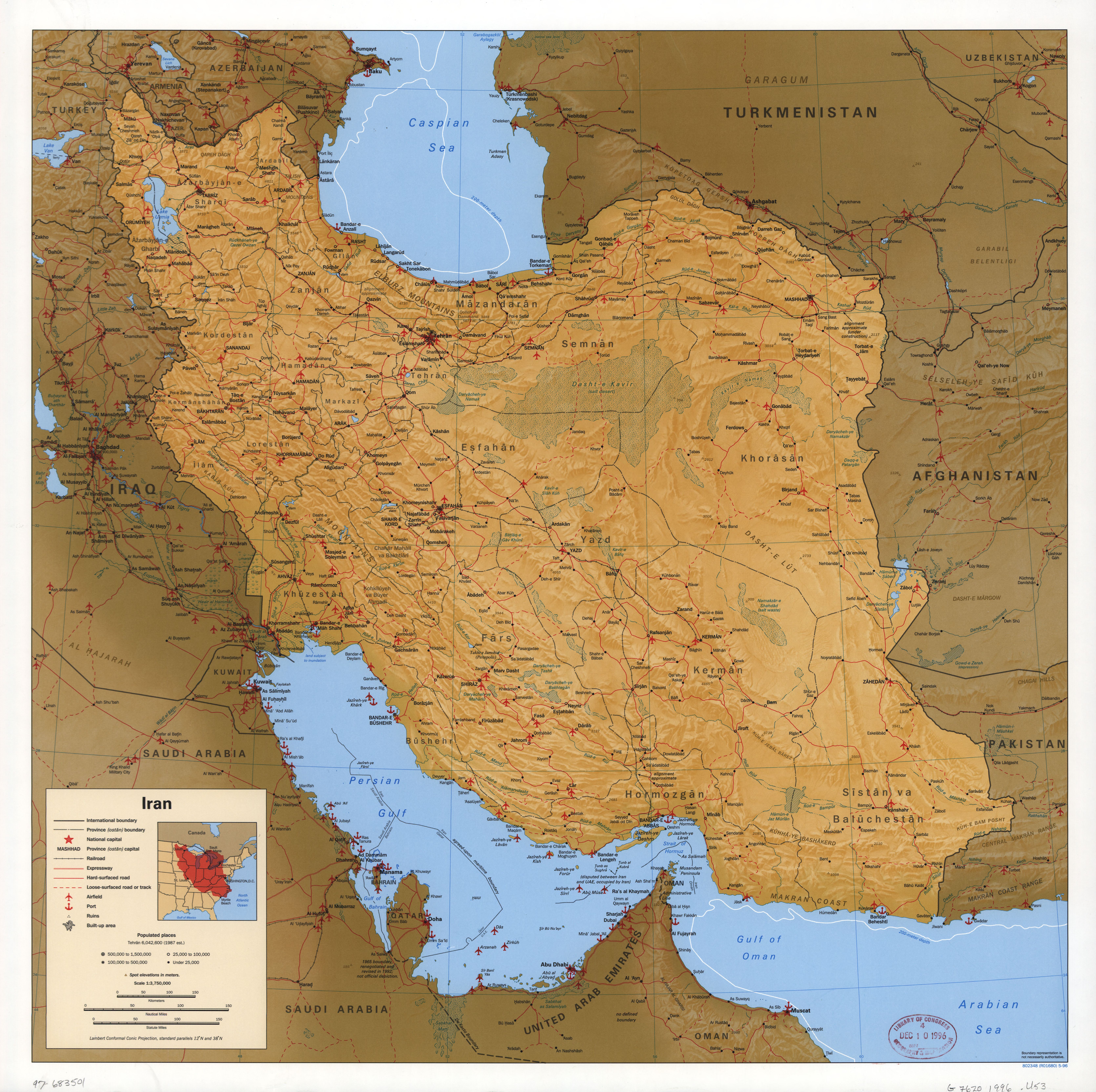
Iran. LOC 97683502.tif - Fæ

Iran. LOC 97683502.jpg - Fæ
Major Muslim ethnic groups in Armenia, Iran, and the Islamic Commonwealth states. LOC 92683743.tif - Fæ

Major Muslim ethnic groups in Armenia, Iran, and the Islamic Commonwealth states. LOC 92683743.jpg - Fæ
Iran. LOC 91684730.tif - Fæ

Iran. LOC 91684730.jpg - Fæ

Persia-and-map-of-ancient-iran.jpg - Thesupermat
Iran. LOC 97683501.tif - Fæ
Iran. LOC 97683501.jpg - Fæ

Vorder-Asien. LOC 2013593006.jpg - Fæ

Persian Gulf western sheet.jpg - Elspamo4

Map of Persian Gulf - Amsterdam -1640.jpg - Koa-public

Map of the region bounded by the Saudi Peninsula, Red Sea.jpg - Koa-public
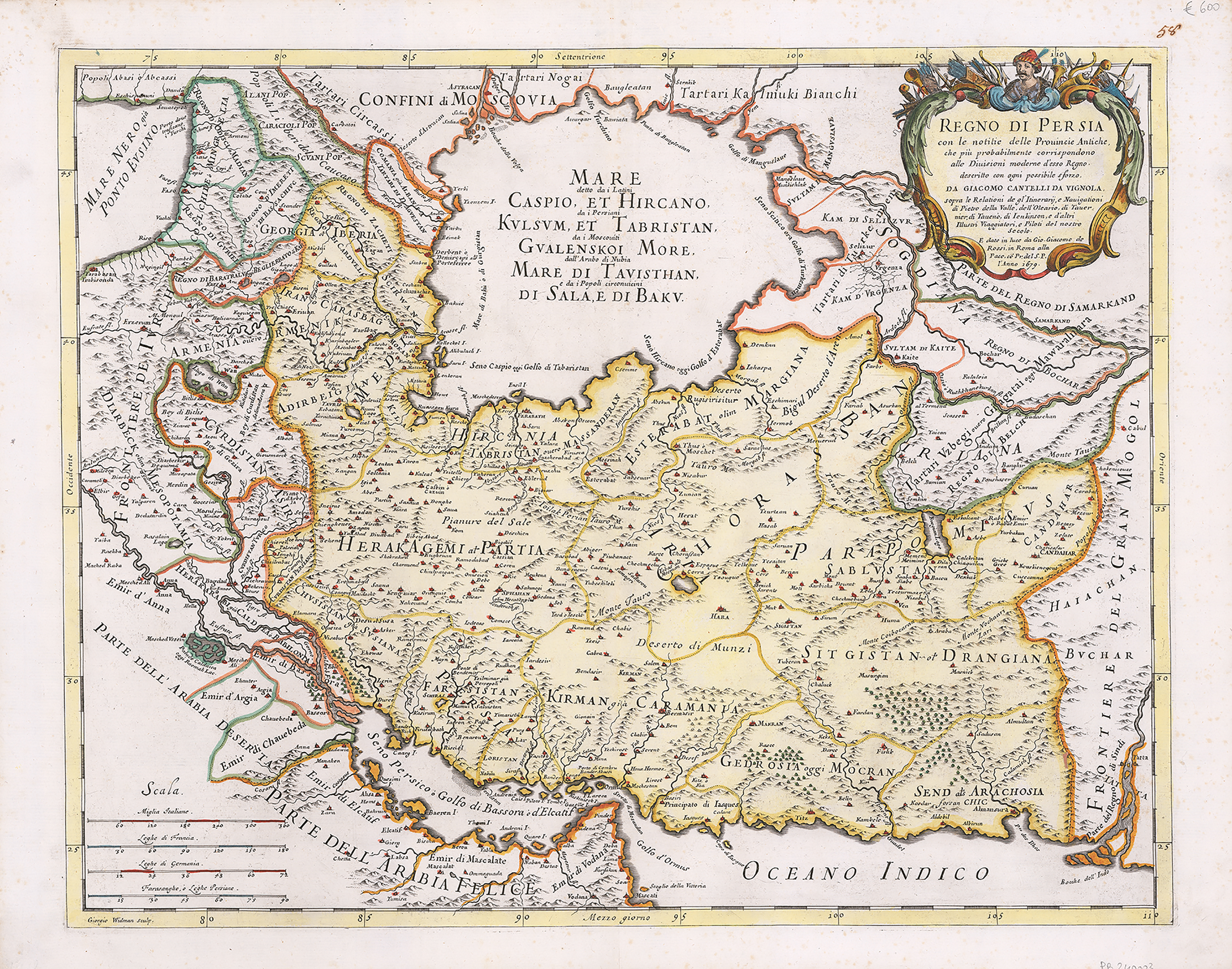
Regno di Persia con le notitie delle ... Publication Date 1679 Scarce map extending from the Eufrate to the Indo.Showing major rivers, mountains and cities. From Il Mercurio Geografico, printed by De Rossi.jpg - Koa-public

Perse Turquie Asiatique et Arabie old map Desnos 1766.jpg - Koa-public

Persian Gulf antique map La Perse Bellin 1764.jpg - Koa-public
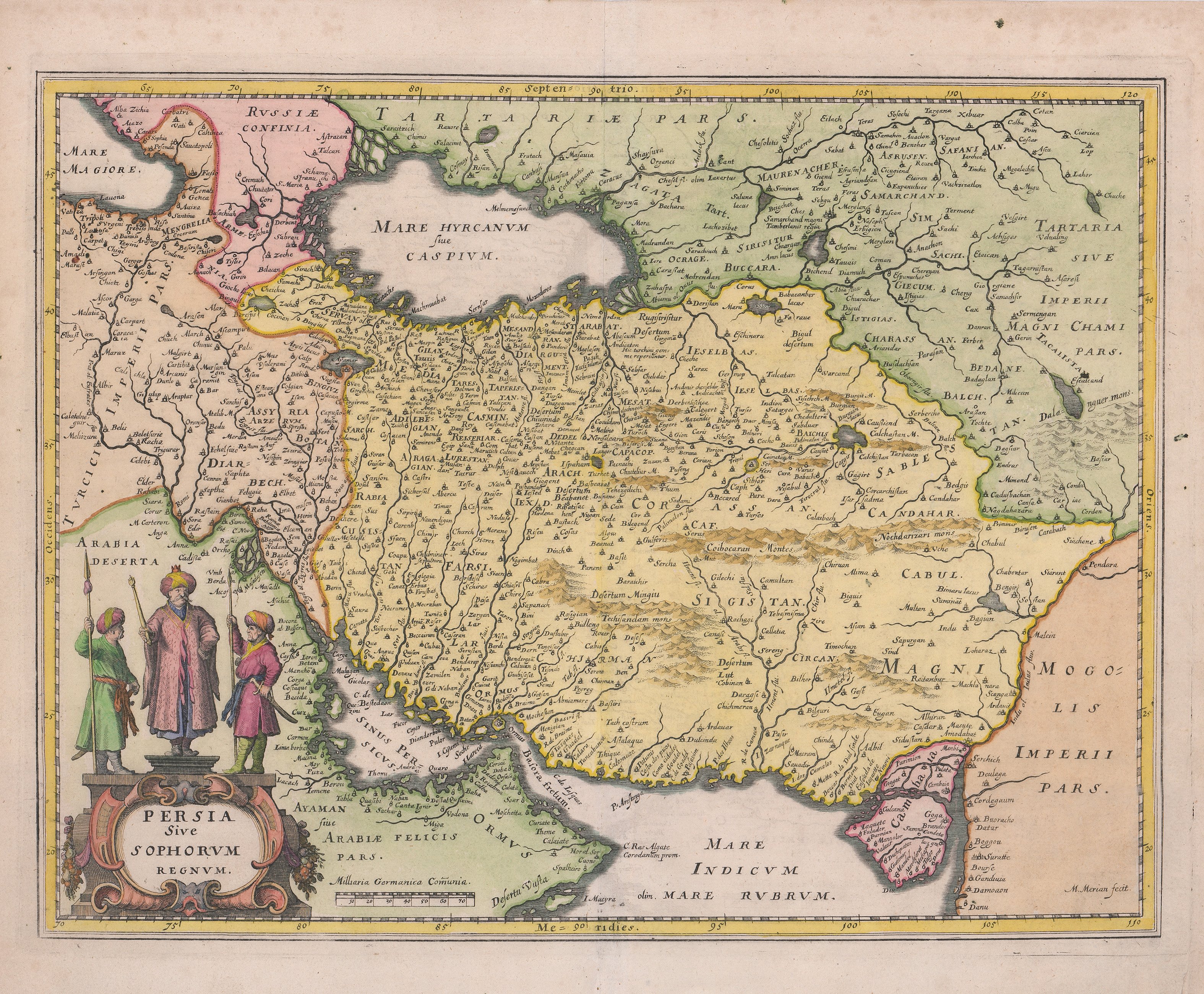
Persia Sive Sophorum regnum Old map Persia Merian 1638.jpg - Koa-public

A.K. Johnston -1850-Edinburg.jpg - Koa-public

George Rollos ,1770 published in london.jpg - Koa-public

George Rollos 1770 London.jpg - Koa-public

Map of persia published in London 1847.jpg - Koa-public

P. Santini- 1779-Venice.jpg - Koa-public

Robert- 1760- Paris.jpg - Koa-public

The London Geographical Institute 1890, Published by George Philip & Son.jpg - Koa-public

V. Levasseur - Paris- 1838.jpg - Koa-public

Rigobert Bonne- 1771 Paris.jpg - Koa-public

Persia, Caspian Sea, done by ye Czar, and Part of Independent Tartary.jpg - Koa-public

Middle East Antique map Babylon Assyriens Philippe 1787.jpg - Koa-public

Imperium Turcicum in Europa, Asia, et Africa Regiones Proprias, Tributarias, Clientelares sicut et omens ejusdem.jpg - Koa-public

Carte De La Turquie De L'Arabie et De La Perse, Dressee sur les Memoires les plus recens rectifiez par les Observations de Mrs. de l'Academie Royule, des Sciences-Amsterdam-1720.jpg - Koa-public

Provinces of Iran in 1939 by Erwin Raisz.jpg - Ted hamiltun

Le Tour du monde-04-p275.png - Bzhqc

NI 38-8 Kermanshah.jpg - Hanooz

NI 38-7 Khanaqin.jpg - Hanooz
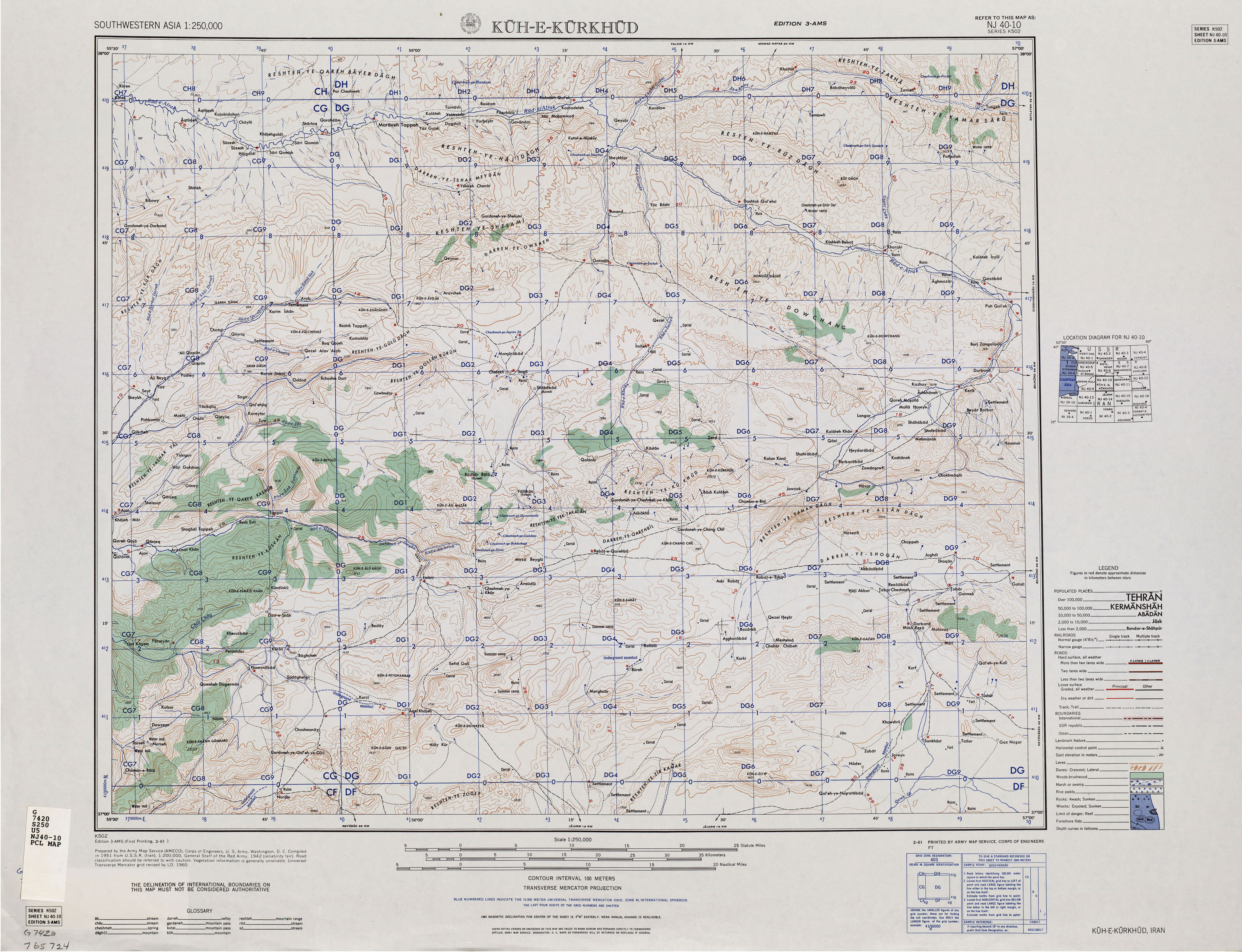
NJ 40-10 Kuh-e-Kurkhud.jpg - Hanooz

NJ 40-11 Ashkhabad.jpg - Hanooz

Kaart van Perzië, objectnr A 16211.jpg - Mr.Nostalgic

Bartholomew's map of Asia Minor, Egypt, Mesopotamia and Persia (5007987).jpg - Jason.nlw

Iran Pakistan boundary.png - WisDom-UK

"FIGHTING CLANS" of the British Indian Empire, 1918 — North East.jpg - Rnrctg

"FIGHTING CLANS" of the British Indian Empire, 1918 — North West.jpg - Rnrctg

"FIGHTING CLANS" of the British Indian Empire, 1918 — South West.jpg - Rnrctg

"FIGHTING CLANS" of the British Indian Empire, 1918 — South East.jpg - Rnrctg

Map of the Sayfo in Urmia.png - Buidhe

Mashhad and merw on tabula Peutingeriana.png - Aay1373

Khalili Collection Islamic Art mss 0972 fol 40b.jpg - MartinPoulter (KC WIR)
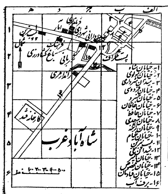
Shahabad-e gharb map (1330).jpg - Parsa 2au

Ghasr-e Shirin map (1330).jpg - Parsa 2au
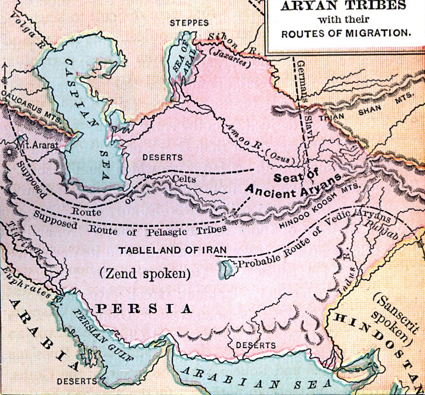
Aryan Tribes Original Home and migration routes.jpg - Culminatio

Atlas Universel de Geographie construit d'après les sources originales et les documents les plus récents, cartes, voyages, mémoires, travaux géodésiques, etc. - nouvelle édition conforme aux... - btv1b52513644d (245 of 369).jpg - Gzen92Bot

Persian southern coast of the Caspian ~1014.jpg - Kenech Kermian
ARTAZ L' EMPIRE De PERSE 1779 d’Anville P.Santini ~3.jpg - Kenech Kermian

PERSIA in EUROPE and ASIA ~ North-West of IRAN.jpg - Kenech Kermian

Provinciarum persicarum Kilaniae nempe Chirvaniae Dagestaniae aliarumque vicinarum regionum partium.jpg - Smpad

Arrowsmith's Map of Persia, 1819.jpg - Broichmore

Reduced map from the plane-table sections of Kohistan of the Sindh Sagar Doab, by H. Horst (F11-14).jpg - MaplesyrupSushi