Wikimedi'Òc
Modes d'emploi

Cet album fait partie des albums


1866 Johnson Map of Prussia and Germany - Geographicus - Germany-johnson-1866.jpg - BotMultichill
German Confederation.jpg - Donatus

Preußen 1440-1795 und 1807-1866.jpg - Cherubino

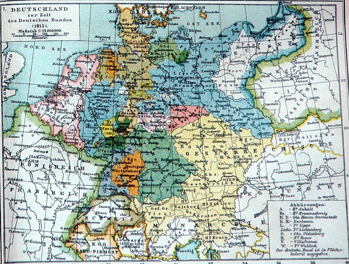
Der Deutsche Bund 1828.jpg - Olahus
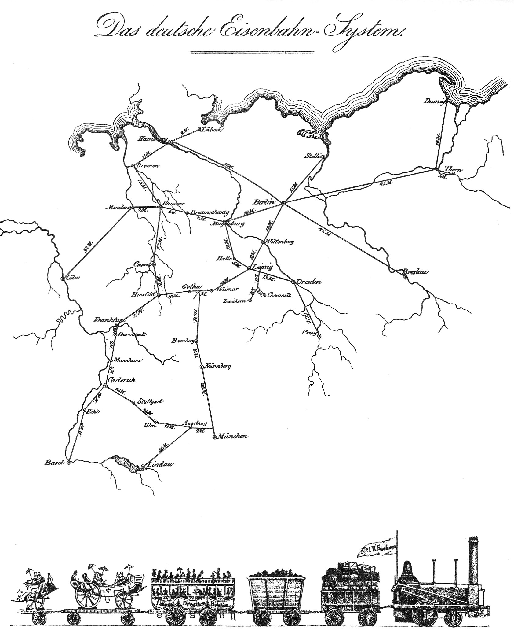
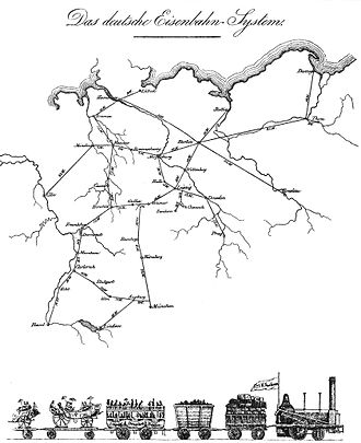
Friedrich List und die erste grosse Eisenbahn 2.jpg - Mauerquadrant

Carte Allemagne 1838.jpg - Claude Zygiel
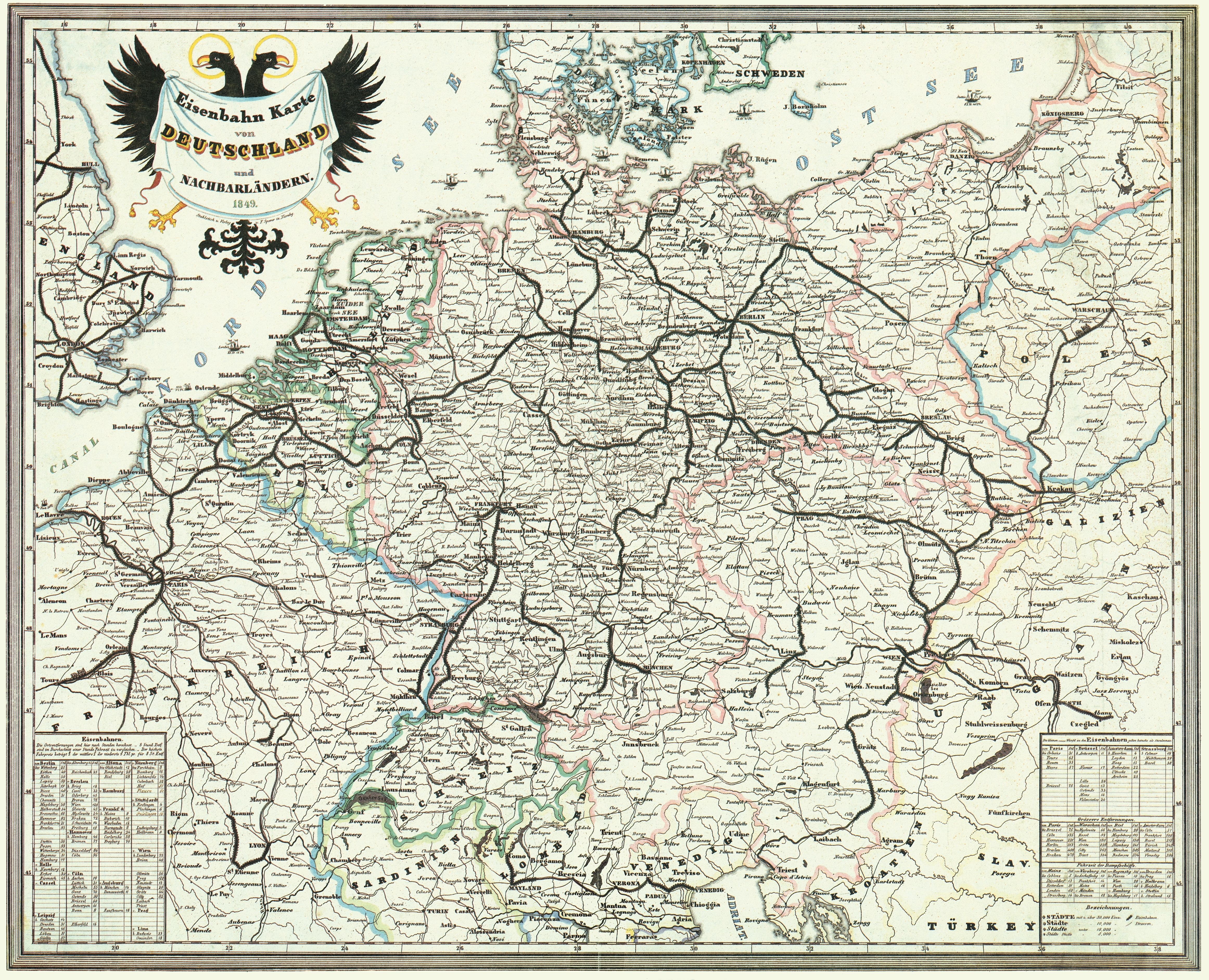
Bahnkarte Deutschland 1849.jpg - Jom
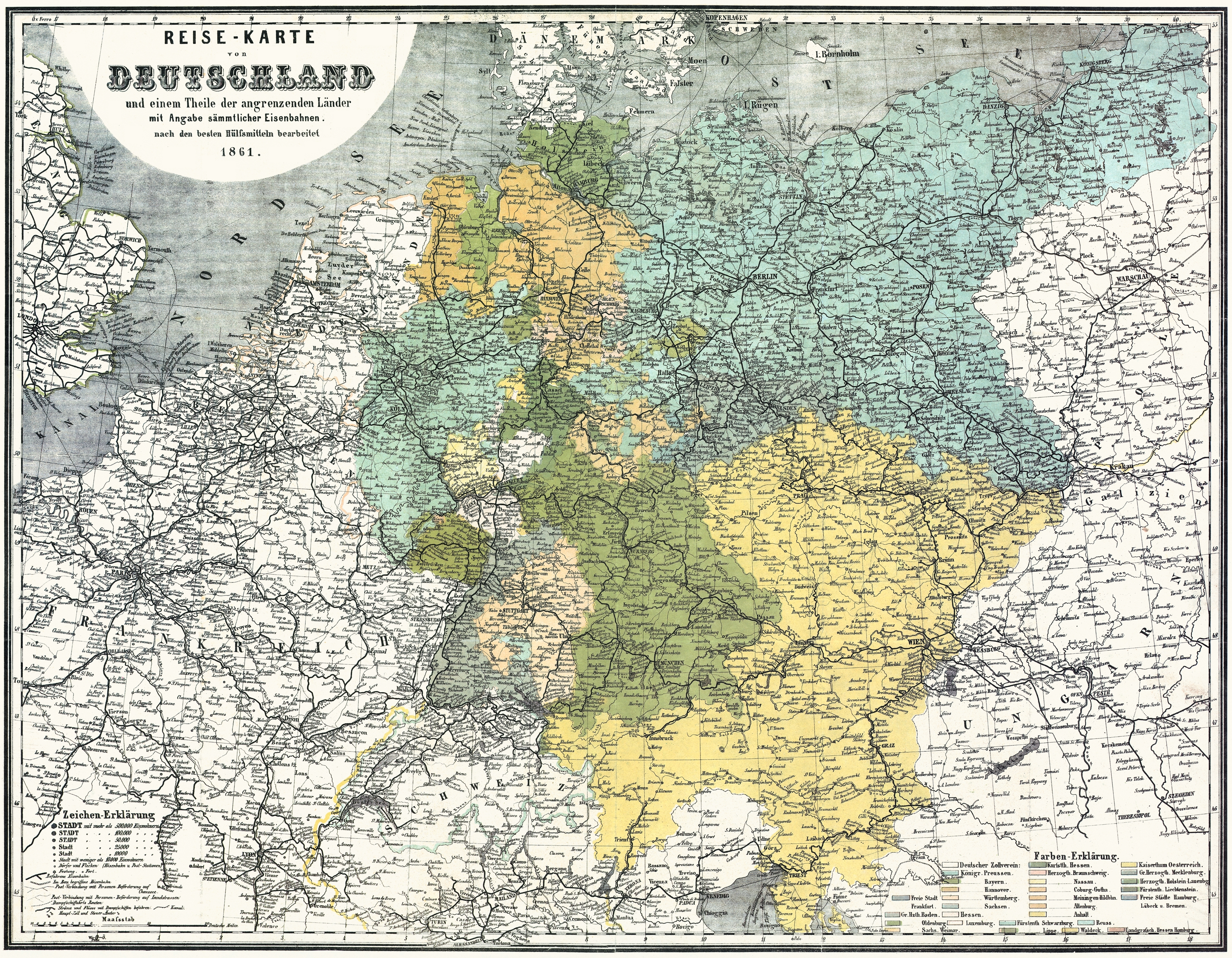
Bahnkarte Deutschland 1861.jpg - Jom

Schurz Map of Germany of the Reminiscences.png - Bob Burkhardt

Rheinkarte.JPG - Knipptang

1837 Malte-Brun Map of Germany - Geographicus - GermanyNorth-mb-1837.jpg - BotMultichill

1840 S.D.U.K. Map of Germany - Geographicus - Germany-sduk-1840.jpg - BotMultichillT
Deutsche Bundesstaaten Platt 1848.pdf - Ws-KuLa

Meyers b4 s0772a.jpg - Mapmarks

The modern world, from Charlemagne to the present time; with a preliminary survey of ancient times (1919) (14780778762).jpg - SteinsplitterBot

The modern world, from Charlemagne to the present time; with a preliminary survey of ancient times (1919) (14594621807).jpg - SteinsplitterBot

Grenze zwischen den Herzogthümern.png - Amelie79

Spruner-Menke Handatlas 1880 Karte 49.jpg - A. Wagner

1835 Malte-Brun Map of the German Confederation.jpg - Chumwa

(Putzger) Germany and German Confederation, 1815-1866.jpg - FDRMRZUSA

(Meyer) Germany and German Confederation, 1815-1866.jpg - FDRMRZUSA

(Spruner-Menke) Germany at the time of the German Federation, 1815 to 1866.jpg - FDRMRZUSA
Carte générale de l'Empire d'Autriche du Royaume de Prusse de la Confédération Germanique et du Royaume de Pologne.pdf - Balkanique

Carte de l'Allemagne ou confédération germanique - dressée par Pierre Tardieu... - btv1b53085896v.jpg - Gzen92Bot

Carte de l'Allemagne ou confédération germanique - dressée par Pierre Tardieu... - btv1b53085895d.jpg - Gzen92Bot

Carte de l'Allemagne ou confédération germanique - dressée par Pierre Tardieu... - btv1b530858922.jpg - Gzen92Bot

Carte de l'Allemagne ou confédération germanique - dressée par Pierre Tardieu... - btv1b53085891m.jpg - Gzen92Bot