Wikimedi'Òc
Modes d'emploi

Cet album fait partie des albums
Cet album photos contient les sous-albums suivants :


Joppen1907BritishBengalBritishBurmaA.jpg - MALLUS

1834 S.D.U.K. Map of North India, Nepal, and Allahabad - Geographicus - IndiaX-sduk-1834.jpg - BotMultichill

1780 Bonne Map of Northern India - Geographicus - IndiaNorth-bonne-1780.jpg - BotMultichillT

1786 - A map of Bengal, Bahar, Oude & Allahabad - James Rennell - William Faden.jpg - JFHJr

Bodhgaya(1878) p283 T01.jpg - Metilsteiner

Bodhgaya(1878) p289 T03.jpg - Metilsteiner

Bodhgaya(1878) p291 T04.jpg - Metilsteiner
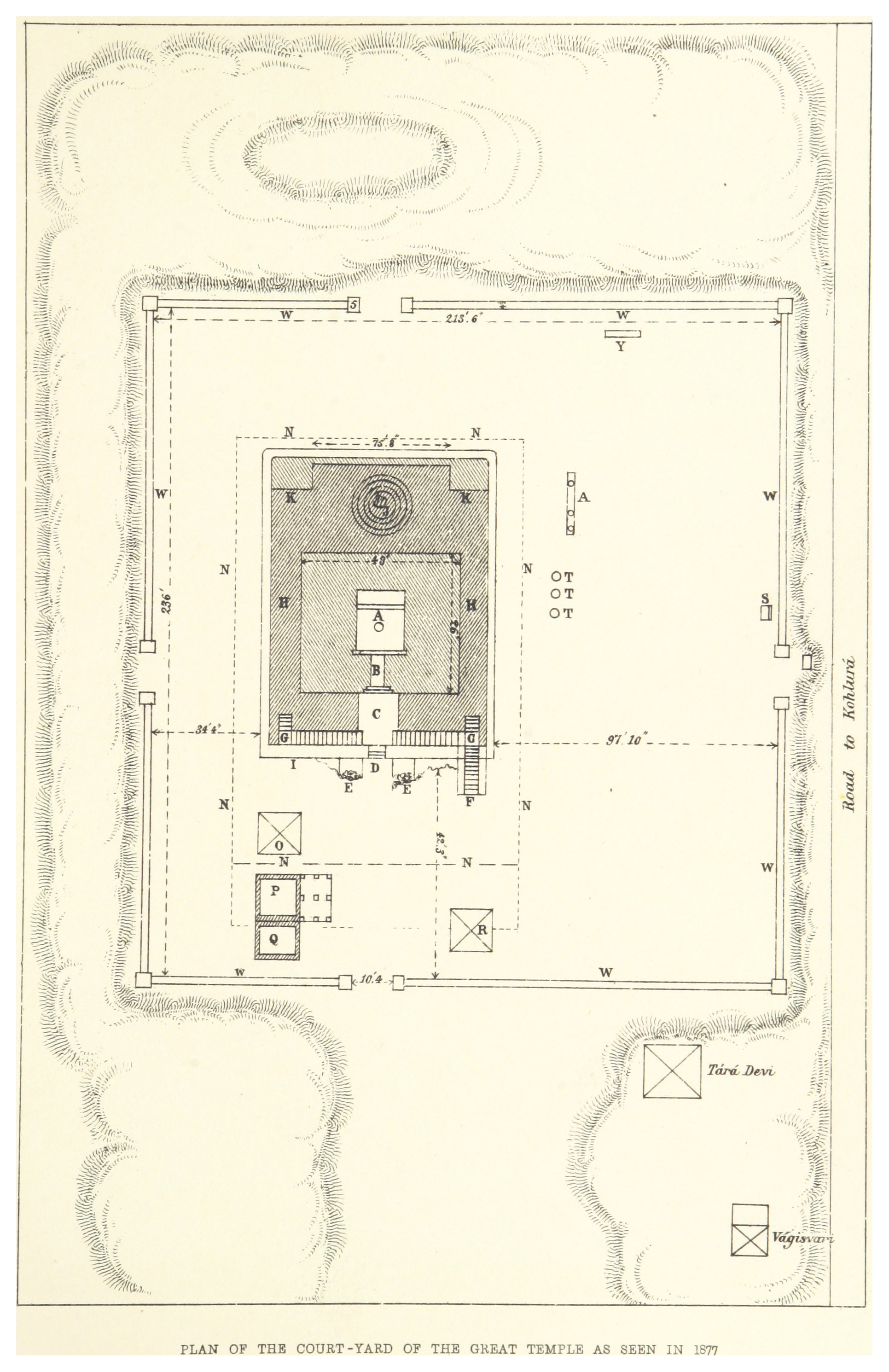
Bodhgaya(1878) p293 T05.jpg - Metilsteiner

British India 1940 Assam Bihar Sikkim Arunachal Pradesh Mizoram Nagaland Tripura Burma Bhutan Map.jpg - Flickr upload bot

Jungleterry District Map.jpg - Xufanc

GRIERSON(1885) p008 MAP.jpg - Metilsteiner

Provincial Geographies of India Volume 2 0013.jpg - Moondyne

Provincial Geographies of India Volume 2 0096.jpg - Moondyne

Bihar and Orissa province.jpg - Ivecos

Carte du Bihar p153.jpg - Yann

Barh.png - Anupamsinghbarh

Barhbuch.png - Anupamsinghbarh
Bihār. 7-69. LOC gm70003327.tif - Fæ
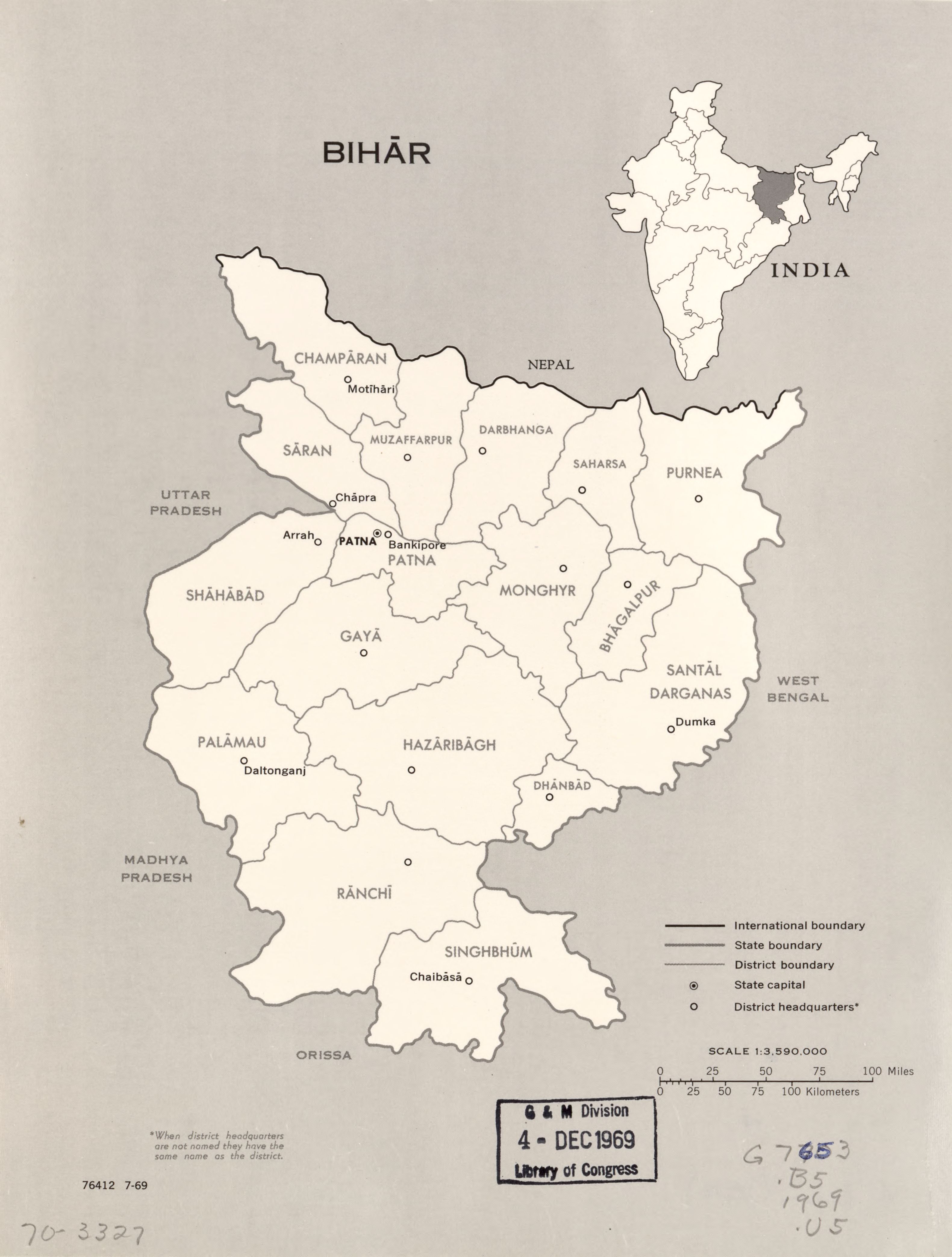
Bihār. 7-69. LOC gm70003327.jpg - Fæ

Txu-oclc-6654394-ng-45-8th-ed.jpg - Geographyinitiative

1841 - 60 - 27(D) 1860 Sheet No. 5 Rough Thak Bust Map of Boundary between Nepal and British Territory.jpg - Raju Babu

Bihar-Orissa-Province.png - BELLSHOA

Map of Patna with Dinapore, Bankipore & Patna - J. H. Menphrey, Deputy Director of Surveys - btv1b53081349v.jpg - Gzen92Bot

19s Bengal province map.jpg - MaxA-Matrix

South Bihar map by James Rennell.jpg - MaxA-Matrix

Bihar and Bengal 1776.png - Bongan