Wikimedi'Òc
Modes d'emploi

Cet album fait partie des albums
Cet album photos contient les sous-albums suivants :


1940 Census Enumeration District Maps - Indiana - Adams County - Decatur - ED 1-11, ED 1-12, ED 1-13, ED 1-14, ED 1-15 - NARA - 5830764 (page 1).jpg - US National Archives bot

1940 Census Enumeration District Maps - Indiana - Adams County - Decatur - ED 1-11, ED 1-12, ED 1-13, ED 1-14, ED 1-15 - NARA - 5830764 (page 2).jpg - US National Archives bot

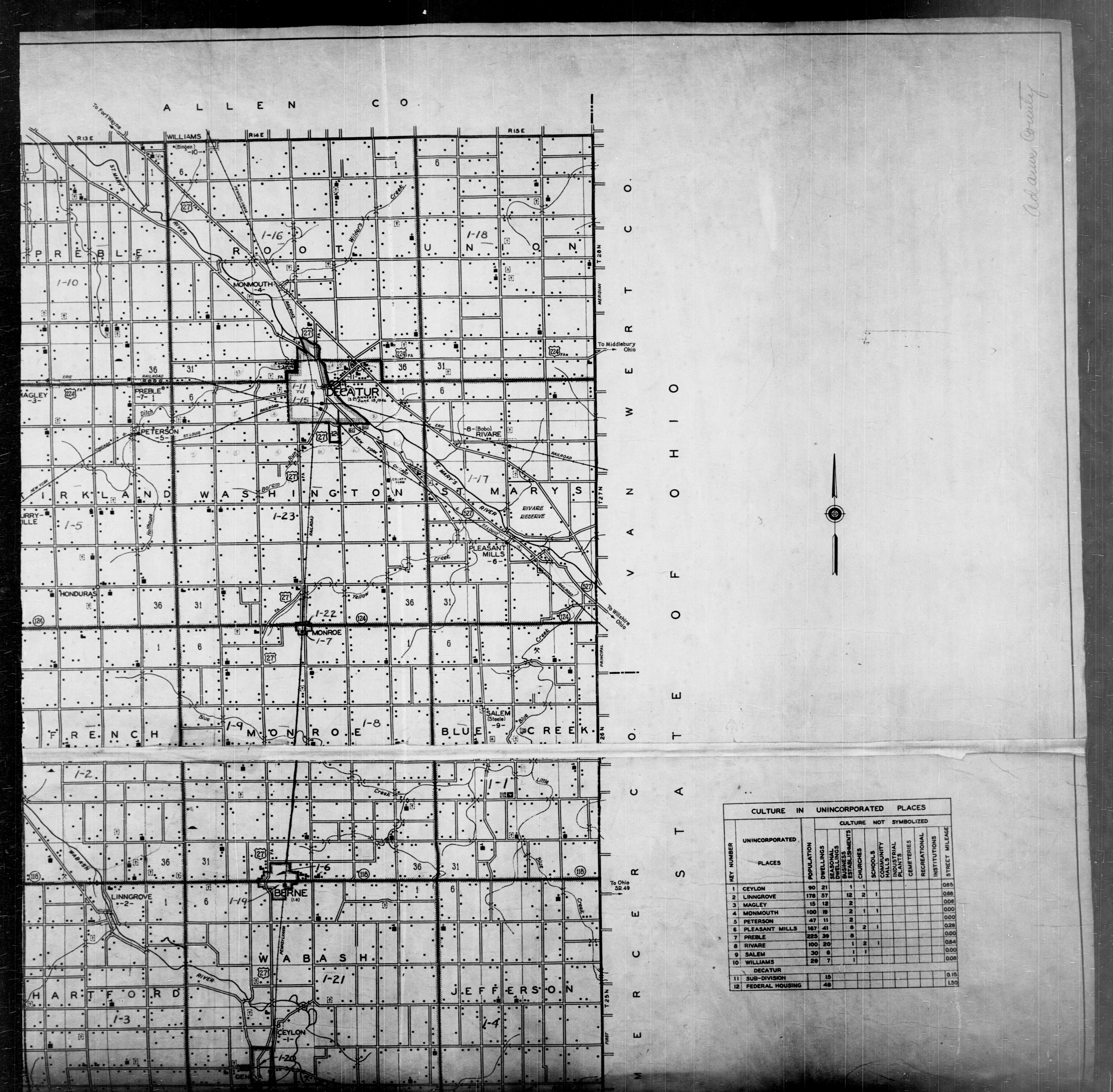
1940 Census Enumeration District Maps - Indiana - Adams County - ED 1-1 - ED 1-23 - NARA - 5830765 (page 1).jpg - US National Archives bot
1940 Census Enumeration District Maps - Indiana - Adams County - ED 1-1 - ED 1-23 - NARA - 5830765 (page 2).jpg - US National Archives bot

1940 Census Enumeration District Maps - Indiana - Adams County - ED 1-1 - ED 1-23 - NARA - 5830765 (page 3).jpg - US National Archives bot

1940 Census Enumeration District Maps - Indiana - Adams County - ED 1-1 - ED 1-23 - NARA - 5830765 (page 4).jpg - US National Archives bot

1950 Census Enumeration District Maps - Indiana (IN) - Adams County - Adams County - ED 1-1 to 29 - NARA - 12031742.jpg - US National Archives bot

1950 Census Enumeration District Maps - Indiana (IN) - Adams County - Decatur - ED 1-14 to 21 - NARA - 12031744.jpg - US National Archives bot

Map of Adams County, Indiana - DPLA - 0c195a7344a07897c4c8320294c2b687.jpg - DPLA bot

Map of Adams County, Indiana - DPLA - 07eab2c62532227defc0367e1c3538c2.jpg - DPLA bot

Map of Adams County, Indiana showing rural delivery service - DPLA - 6a926c9fa861499a4b52d8b1e8e03cda.jpg - DPLA bot