Wikimedi'Òc
Modes d'emploi

Cet album fait partie des albums
Cet album photos contient les sous-albums suivants :


Moar Village Site from south.jpg - Nyttend

Royce-areas-ohio.jpg - Bkonrad

Zanesfield-ohio-limits.jpg - Tysto

Kane Lake Huron Oil.jpg - Alonso de Mendoza

NativeTowns Pittsburgh.png - Tomcool~commonswiki

Frontier of NY in Revolution2.png - Tomcool~commonswiki

The Village of White Hair mural 2006-07-03.jpg - Moverton
Sandusky sites.PNG - SalomonCeb

DumontMemoiresLouisianeMap.jpg - Angusmclellan

Ohio Country de.png - Nikater
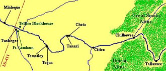
Overhill-cherokee-little-tennessee.jpg - BrineStans

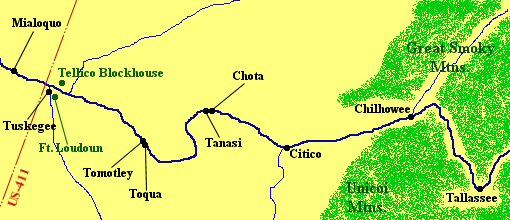
Great-hiwassee-site-411.jpg - BrineStans

Virginia-Algonkin.png - Nikater
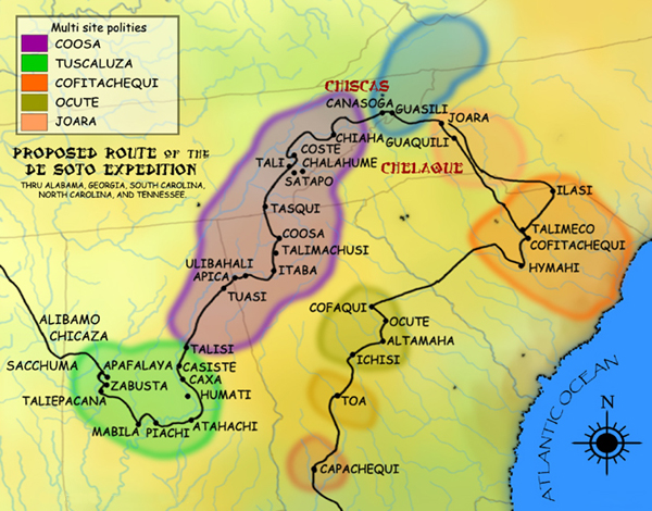
DeSoto Map Leg 2 HRoe 2008.jpg - Ras67

Parkin phase sites HRoe 2008.jpg - Ras67

2009-0618-StIgnace-MuseumMission.jpg - Bobak

Illinois 1718.jpg - Jeangagnon
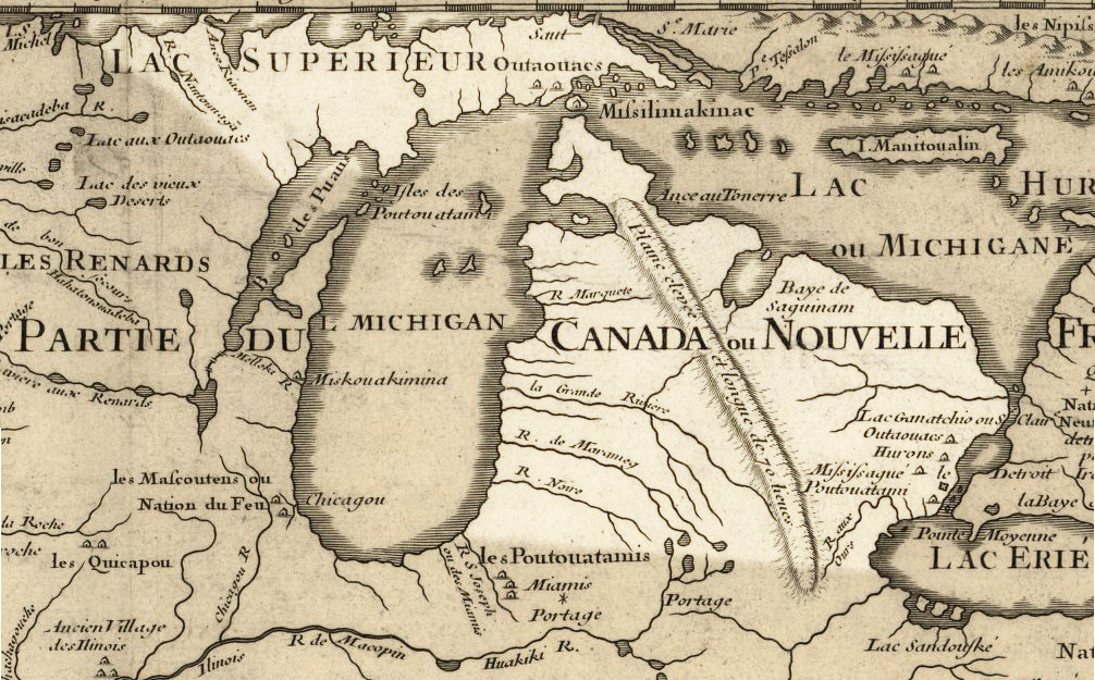
Michigan 1718.jpg - Jeangagnon

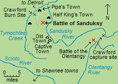
Pickaway Settlements Battlesite.jpg - Nyttend

HuffIndianVillageND.jpg - Plazak
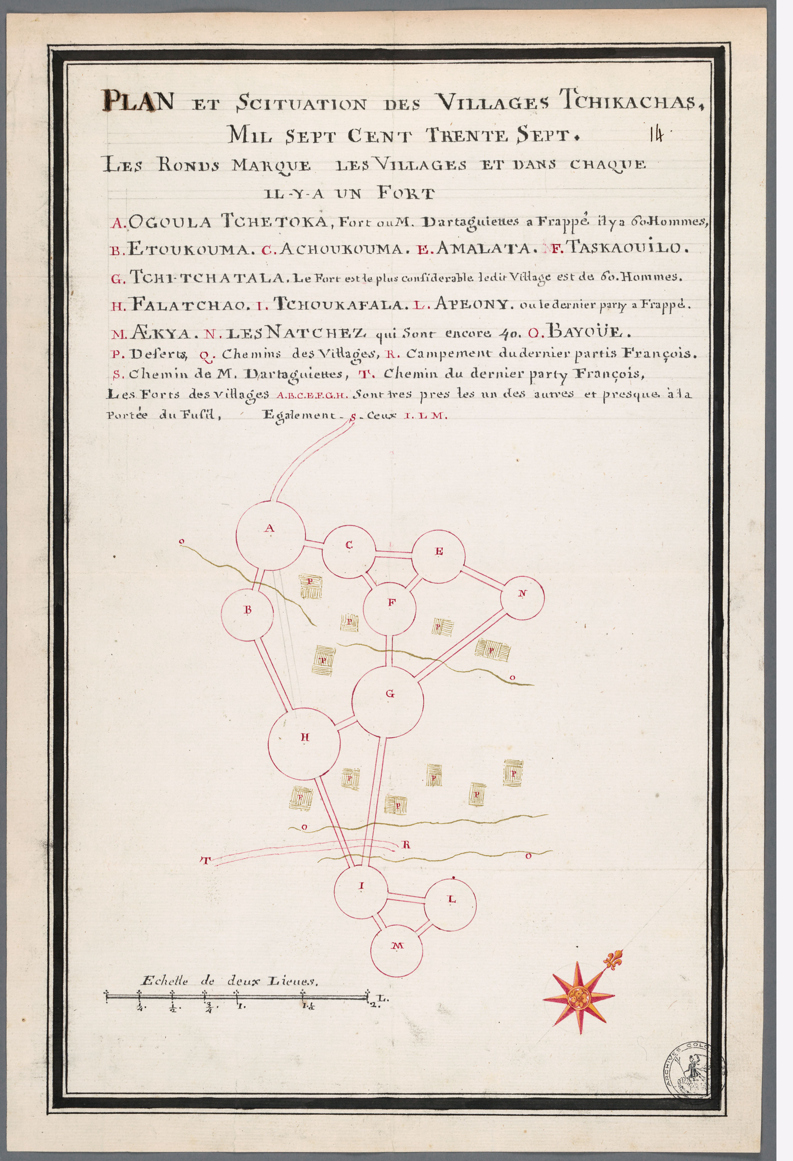
Batz-ChickasawVillages1736 SEM236C F329014.jpg - File Upload Bot (Magnus Manske)

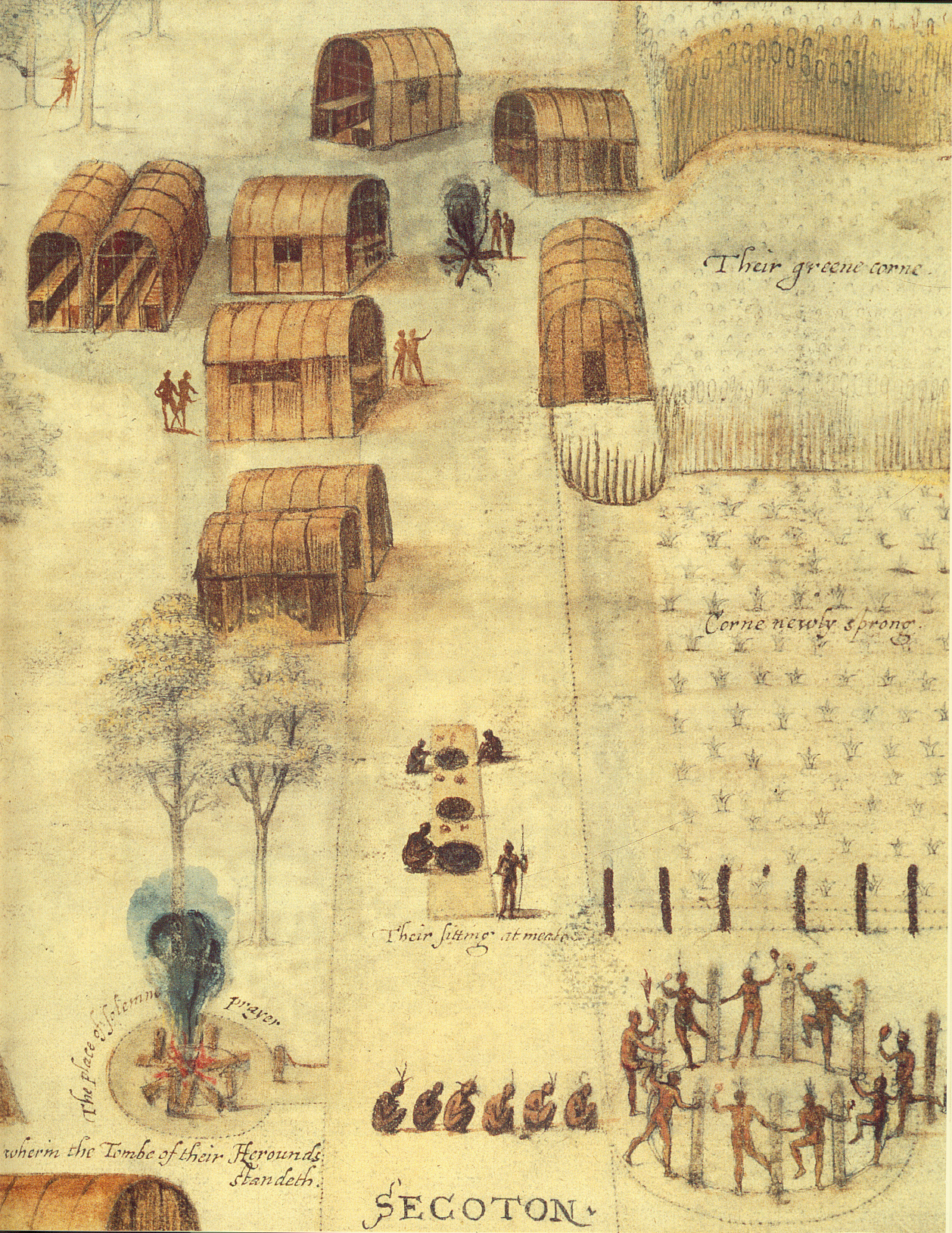
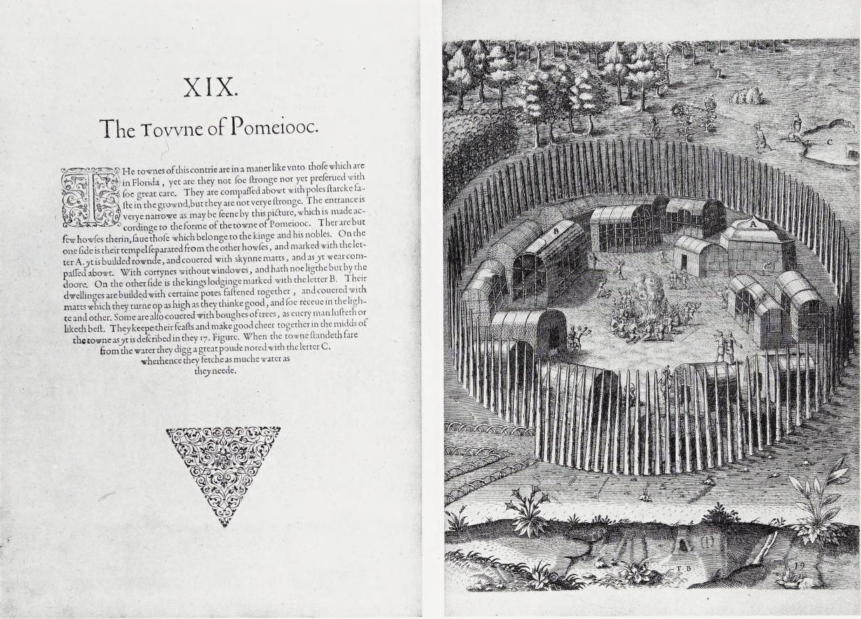
Indian Village of Pomeiooc Theodor de Bry 1590.jpg - MarmadukePercy

Mission San Luis.jpg - Urbantallahassee
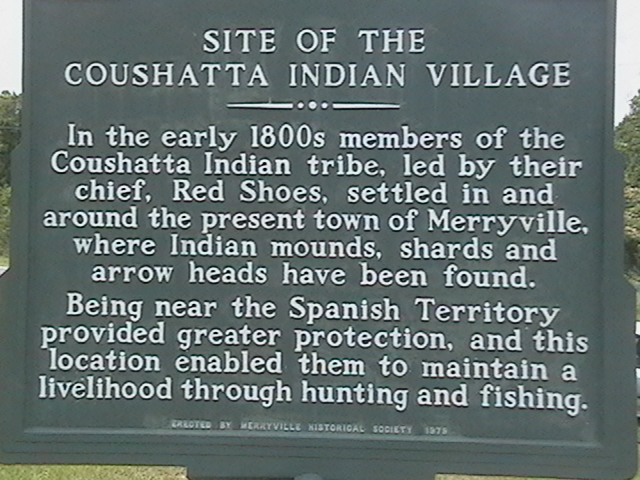
Coushatta Indian Village Merryville,Louisiana 470.JPG - Otr500

Parkin Archeological State Park Parkin AR 29.jpg - DoxTxob
North carolina algonkin-dorf.jpg - Nikater

BattleOfFlintRiver.jpg - Magicpiano

1591 De Bry and Le Moyne Map of Florida and Cuba - Geographicus - Florida-debry-1591.jpg - BotMultichillT

SusquehannockFort sm.jpg - Colin P. Varga

1747 Bowen Map of the Southeastern United States (Carolina, Georgia, Florida) - Geographicus - CarolinaGeorgia-bowen-1747.jpg - BotMultichillT
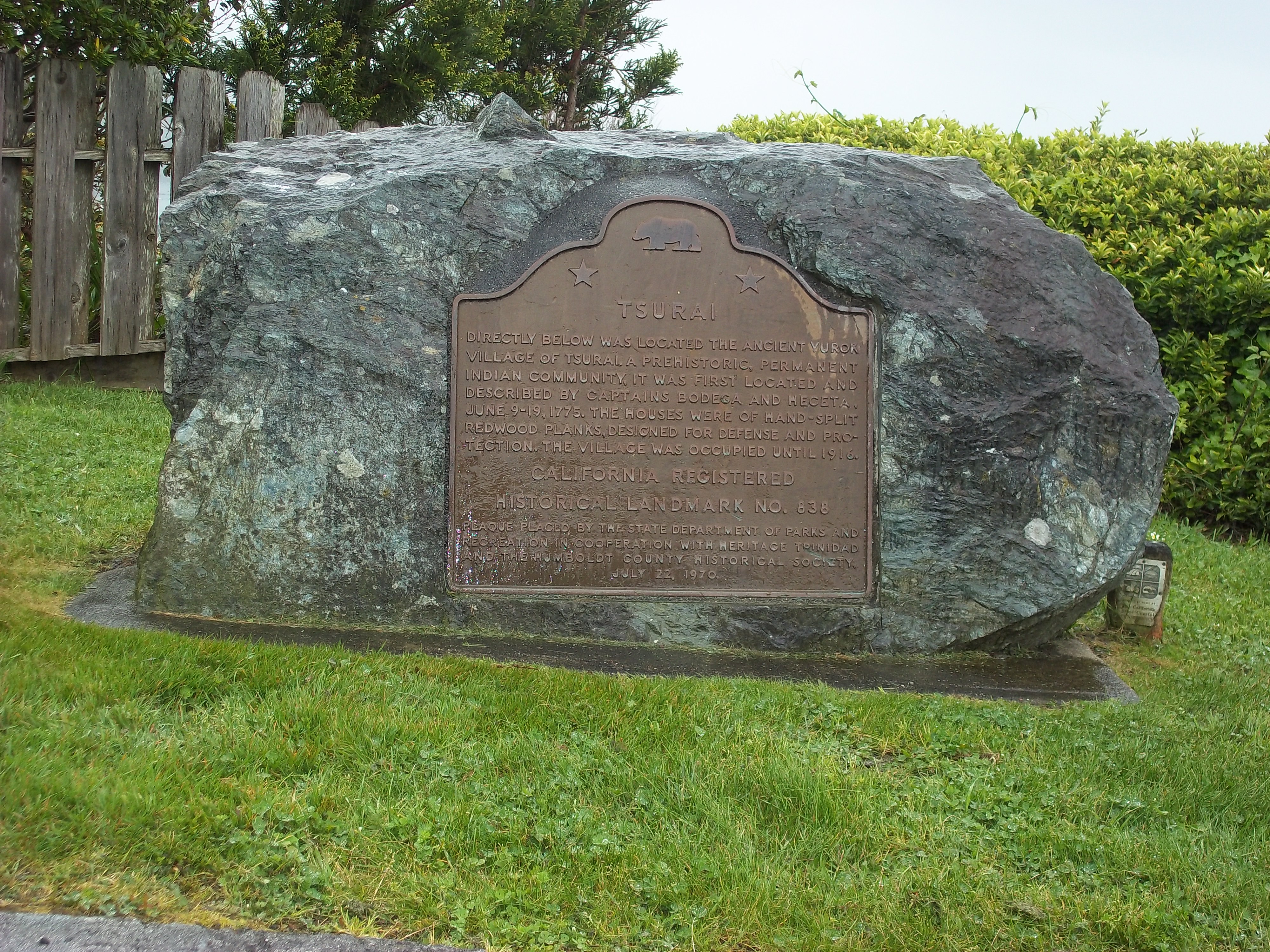
Tsurai Plaque.JPG - Nytasi

ChickasawWars.jpg - SreeBot

"Villa of Brule. The great hostile Indian camp on River Brule near Pine Ridge, S. D." By Grabill, 1891 - NARA - 530890.jpg - US National Archives bot

Solomon's Town historical marker.jpg - Nyttend

Site of Solomon's Town.jpg - Nyttend

TolowaIndianSettlement Crescent City, CA.jpg - Ellin Beltz
Picture III 213.jpg - Aesopposea
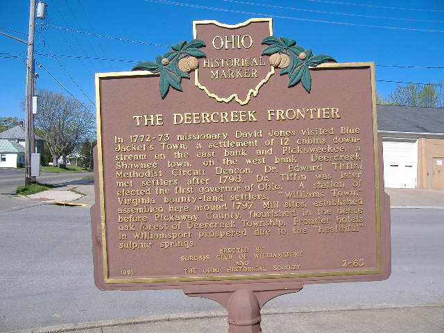
The Deercreek Frontier.JPG - Aesopposea

Cornstalk Town.JPG - Aesopposea

RamapoughVillage.jpg - Fredlyfish4

PickawayPlains3.JPG - Aesopposea

Map of northern la Florida 1584.png - Cdtew

Shikellamys Stone (7497900788).jpg - Steinsplitter

Monasukapanough - Monacan village historical marker, Dec 2013.jpg - Deeahbz

Cottonport - Williamson County Historical Society sign.JPG - Skyrunner75

Archives nationales d’outre-mer - Louisiane - Jacques-Nicolas Bellin - 1744 - 001.jpg - Thesupermat

1813 Map of the Rapids of Miami, showing Fort Meigs.jpg - Scewing

Narratives of the Indian wars, 1675-1699 (1913) (14598000359).jpg - Fæ

Das illustrirte Mississippithal - dargestellt in 80 nach der natur aufgenommenen ansichten vom wasserfalle zu St. Anthony an bis zum gulf von Mexico (1857) (14776624422).jpg - SteinsplitterBot

The wilderness trail; or, The ventures and adventures of the Pennsylvania traders on the Allegheny path, with some new annals of the Old West, and the records of some strong men and some bad ones (14594836028).jpg - SteinsplitterBot

The wilderness trail; or, The ventures and adventures of the Pennsylvania traders on the Allegheny path, with some new annals of the Old West, and the records of some strong men and some bad ones (14758414386).jpg - Fæ

The wilderness trail; or, The ventures and adventures of the Pennsylvania traders on the Allegheny path, with some new annals of the Old West, and the records of some strong men and some bad ones (14758411456).jpg - SteinsplitterBot

History of Beaver County, Pennsylvania and its centennial celebration, (1904) (14784263142).jpg - SteinsplitterBot

The wilderness trail; or, The ventures and adventures of the Pennsylvania traders on the Allegheny path, with some new annals of the Old West, and the records of some strong men and some bad ones (14781389645).jpg - SteinsplitterBot

Footprints of the red men. Indian geographical names in the valley of Hudson's river, the valley of the Mohawk, and on the Delaware- their location and the probable meaning of some of them (1906) (14578482980).jpg - SteinsplitterBot

Collections - State Historical Society of Wisconsin (1854) (14773023821).jpg - SteinsplitterBot

Moravian Indian Village near where General Proctor was Defeated in 1812.jpg - Jeangagnon

Battle of Horseshoe Bend.jpg - Pi3.124

Nearby Communities P9121104.jpg - Chris Light
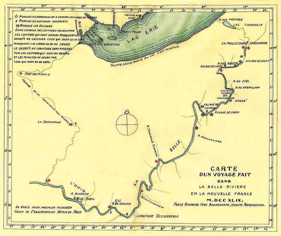
Carte d un voyage fait dans la Belle Riviere en la Nouvelle France M.DCC XLIX. Par le Reverend Pere Bonnecamps Jesuite Mathematicien.jpg - Jeangagnon
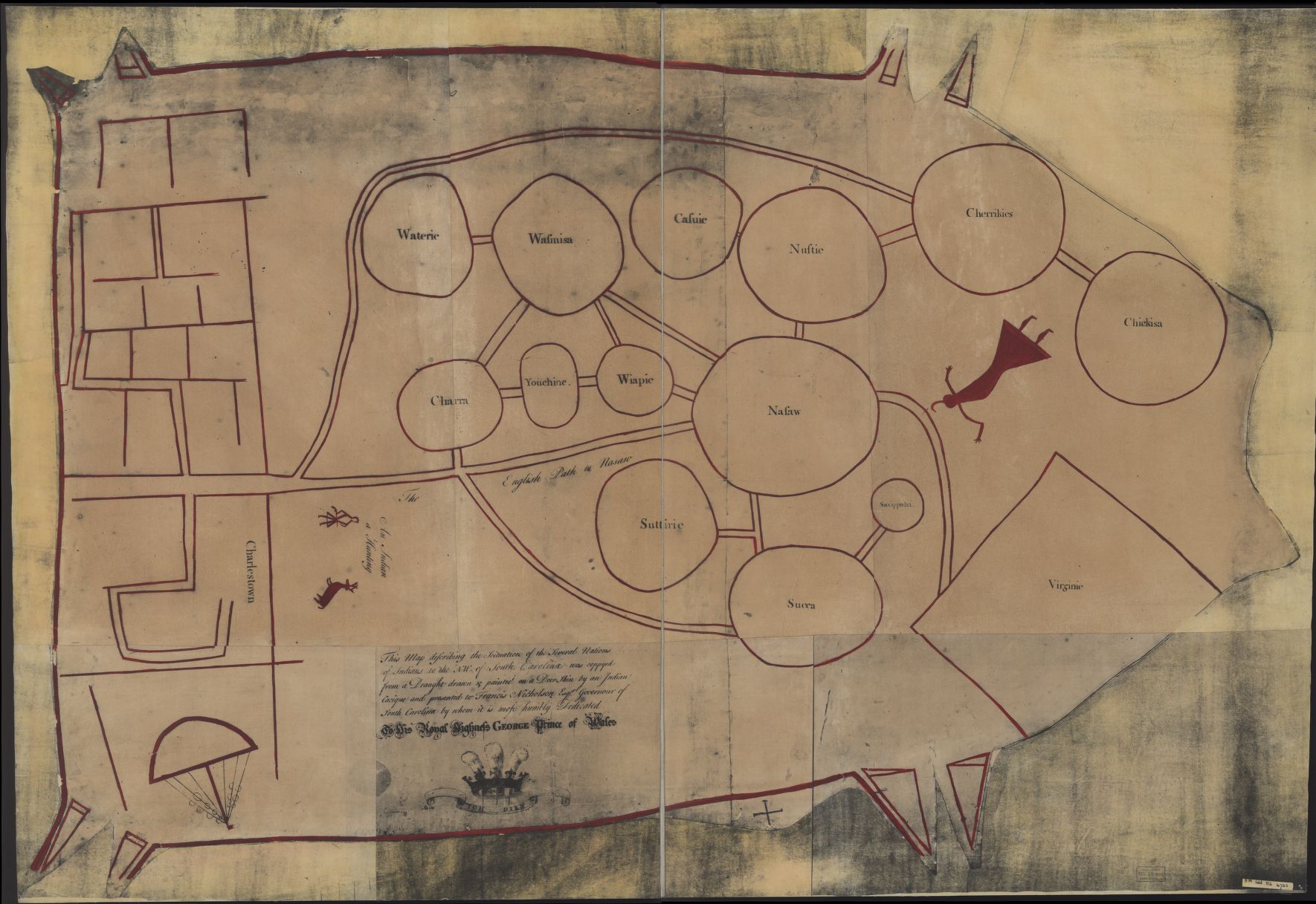
Indians NW of South Carolina.jpg - LlywelynII

Arikara Village, (plate 80) from Illustrations of the manners, customs, and condition of the North American Indians. (1866 ed.).jpg - Fæ

A Plan of the several Villages in the Illinois Country with Part of the River Mississippi and c. by Tho. Hutchins.jpg - Fæ

An Indian Town, Residence of a Chief.jpg - Carlstak

Washington and Gist visit Queen Aliquippa (1754) LCCN2007681711.jpg - Fæ

Map of the former territorial limits of the Cherokee "Nation of" Indians ; Map showing the territory originally assigned Cherokee "Nation of" Indians. LOC 99446145.jpg - Fæ

Americæ pars, nunc Virginia dicta - primum ab Anglis inuenta, sumtibus Dn. Walteri Raleigh, Equestris ordinis Viri, Anno Dn̄i. MDLXXXV regni Vero Sereniss. nostræ Reginæ Elisabethæ XXVII, hujus vero LOC 78694920.jpg - Fæ

A plan of part of the rivers Tombecbe, Alabama, Tensa, Perdido, & Scambia in the province of West Florida; with a sketch of the boundary between the nation of upper Creek Indians and that part of the LOC 73691550.jpg - Fæ
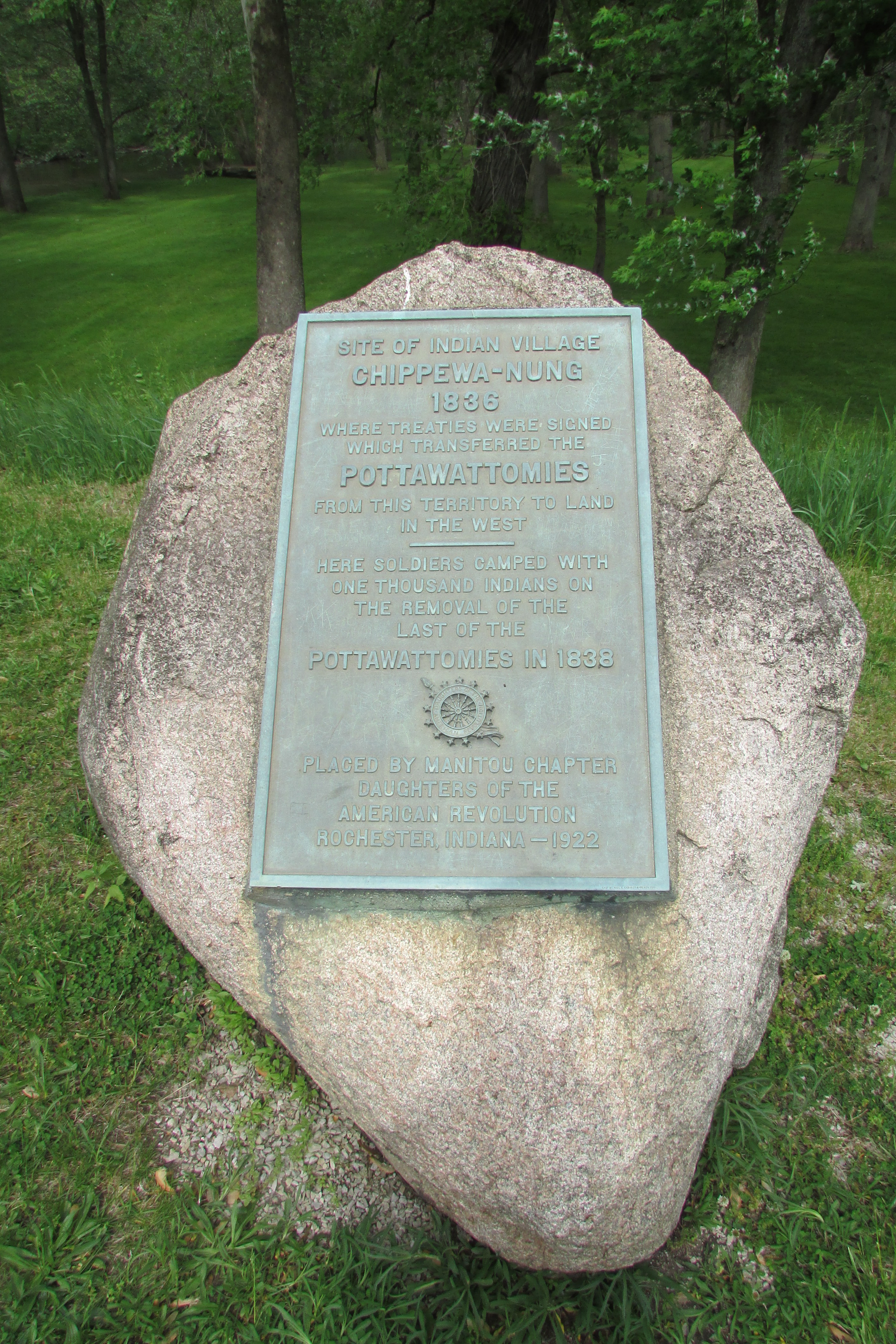
Indian Village Chippewa-nung 1836 2017-05-17 135.jpg - Chris Light

Tlingit Indian Village with Russian warehouse in foreground, Sitka, Alaska, between 1885 and 1895 (AL+CA 2085).jpg - BMacZeroBot

Cupeño village of Cupa.png - Noahedits

Cupeño map svg.svg - Noahedits

A Map of the Western parts of the Colony of Virginia, 1754.jpg - Pierre5018

Yurok Geography (Waterman) map 9.png - Noahedits

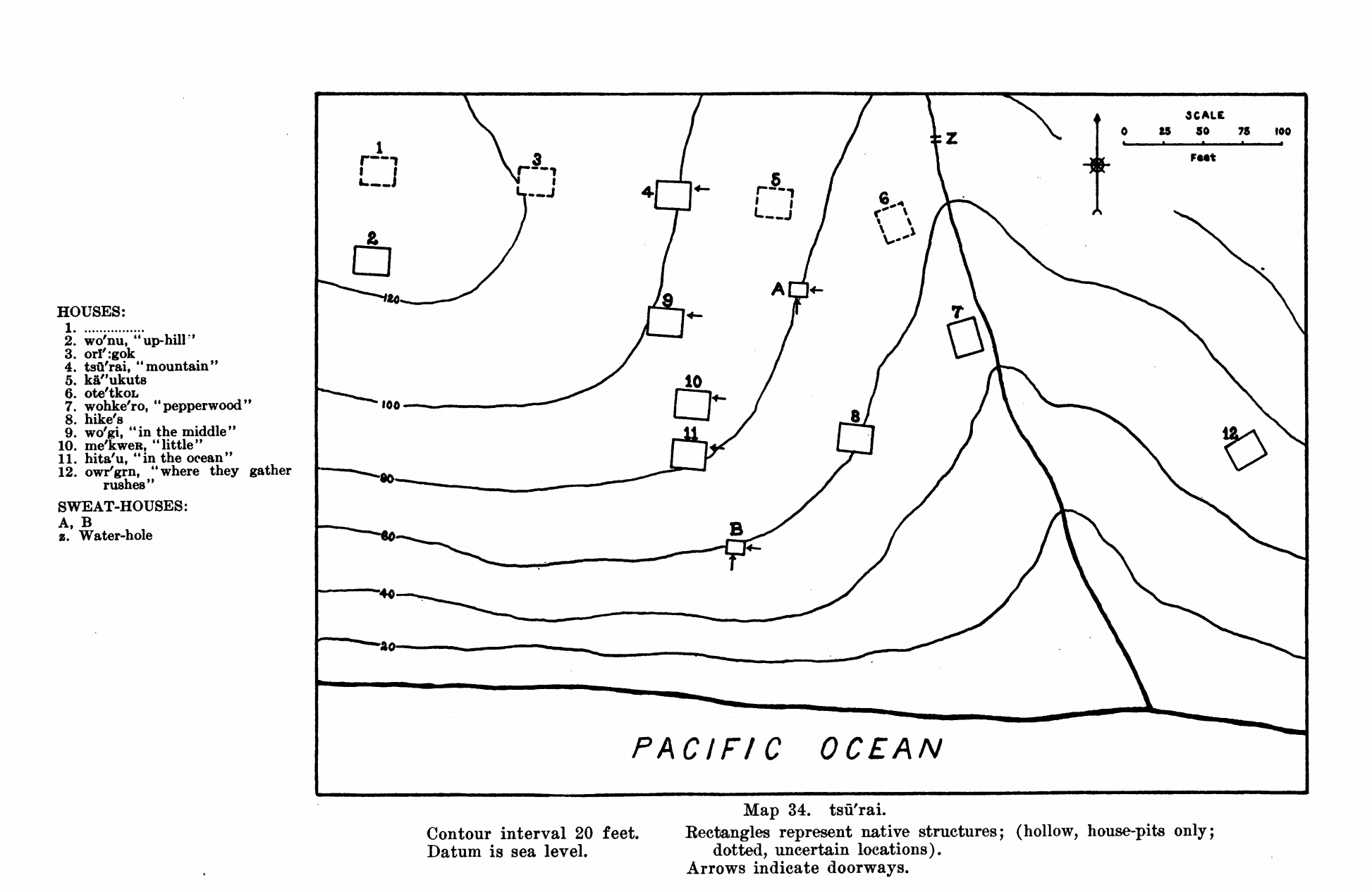
Yurok Geography (Waterman) map 16.png - Noahedits
Yurok Geography (Waterman) map 31.png - Noahedits

Yurok Geography (Waterman) map 32.png - Noahedits
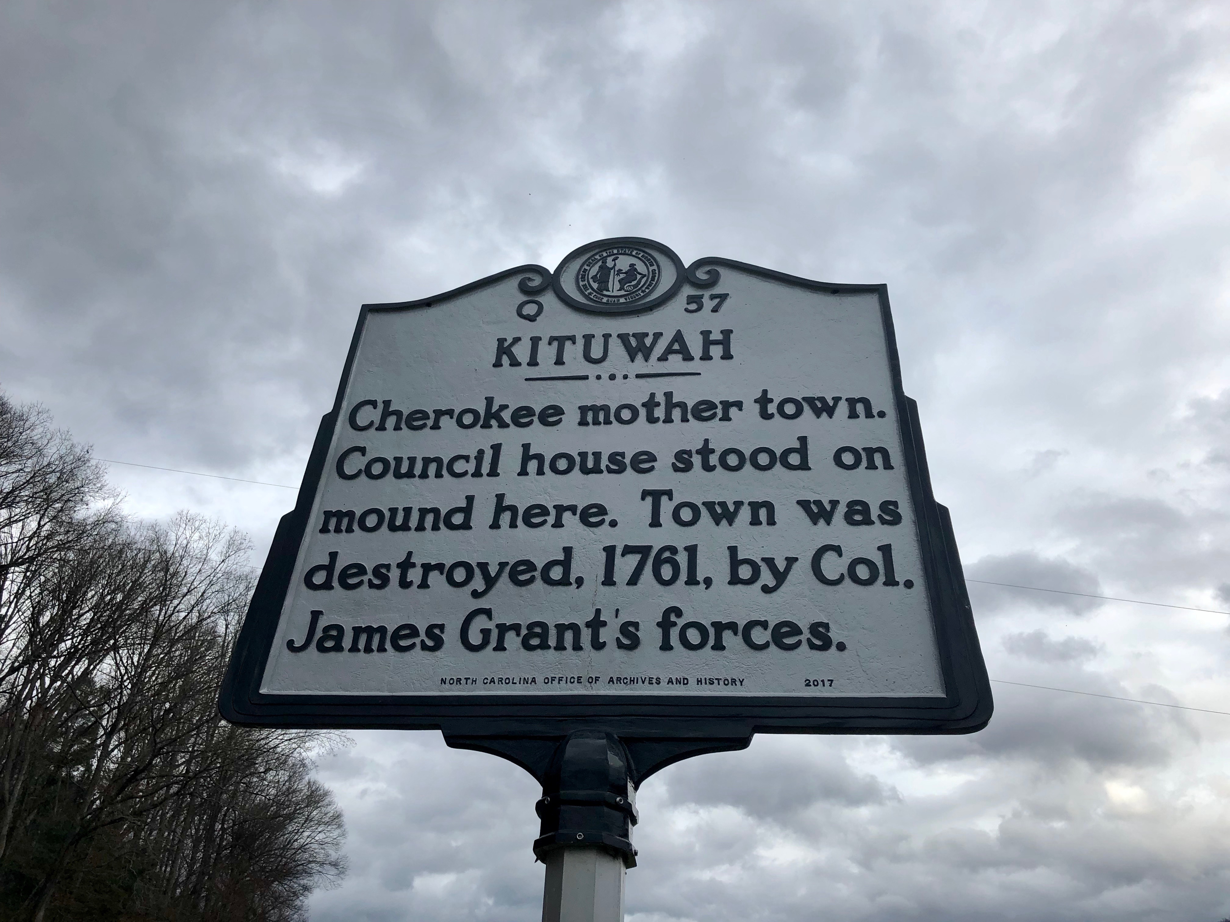
Kituwah Historical Marker, Ela, NC (45922084404).jpg - Ser Amantio di Nicolao

Wiyot map with locator.svg - Noahedits

Chaussée et village des Hurons, Jeune-Lorette (Canada) (BAnQ 2630205).jpg - RachCel

Bub gb IGk3AQAAMAAJ 0030.jpg - Gamaliel

Cultural-center-village.jpg - HungryHighway

Goiogouen Historical Marker.png - EmeraldRange

Little Crow's Village on the Mississippi.jpg - Cielquiparle

Fort Hull map.jpg - Dofftoubab
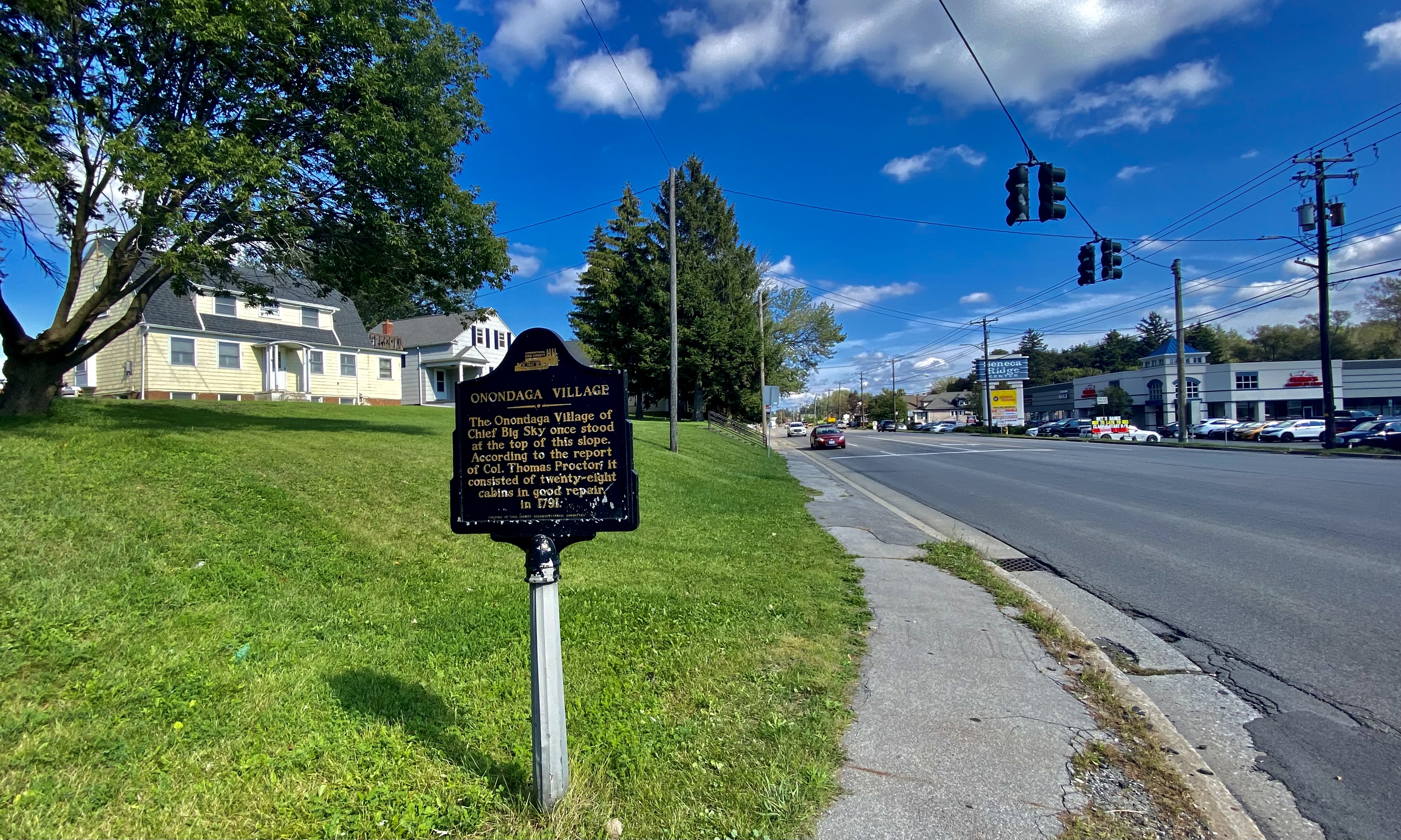
Onondaga Village historic marker, Seneca Street at Ridge Road, West Seneca, New York - 20210918.jpg - Andre Carrotflower

Heckewelder Map.jpg - Languageseeker
View of Mendota Seth Eastman 1848.jpg - Cielquiparle

Olentangy Battle Monument.jpg - JBTHEMILKER
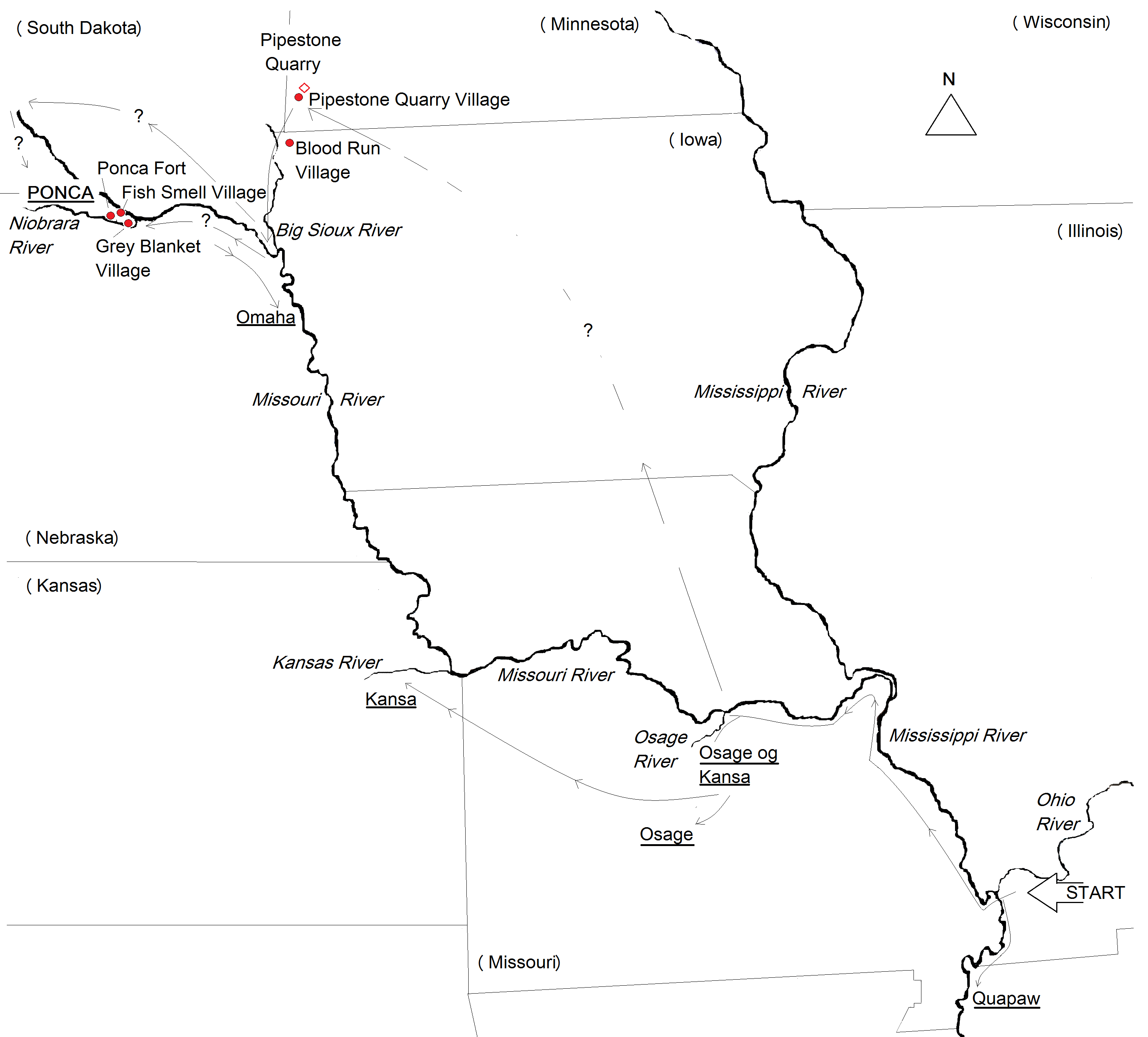
Ponca-stammens vandring - Ponca migration.png - Indianertosset

Indianer-byer brændt af siouxer (Some Indian villages burned by the Sioux, cirka 1780-1862 (Danish edition)).png - Indianertosset
White - Hulton 1984, fig. 023.jpg - Maltaper

Map of Huff (32MO11), an early Mandan village in North Dakota.jpg - Indianertosset

Guashna village recognition, Tongva populated place, Southern California.jpg - Jengod

Map of On A Slant Village (32MO26), a Mandan village in North Dakota.png - Indianertosset

Huff, North Dakota - 3825328211.jpg - Ser Amantio di Nicolao

John White - The town of Pomeiooc, 1906,0509.1.8.jpg - Maltaper

Historically accurate recreation of a traditional Chickasaw village at the Chickasaw Cultural Center during the 2012 Trail of (e9070ee1-88c5-40c6-990c-f09a797f3d10).JPG - BMacZeroBot

Map of the Indian Country including parts of Michigan Territory, Illinois, Ohio, and Indiana as well as Lake Michigan - DPLA - d3074ec52db3458476c7aca4a0cb9560.jpg - DPLA bot
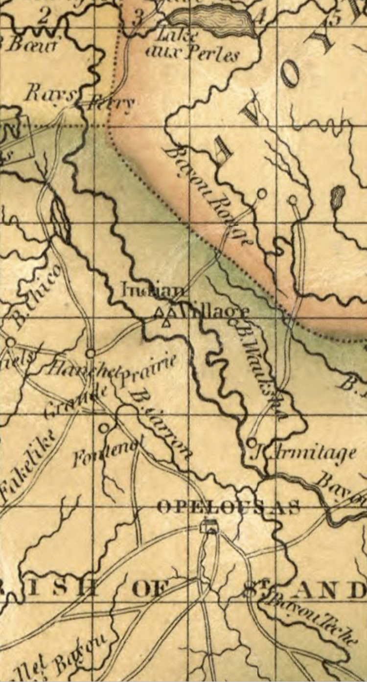
Indian village north of Opelousas on 1820 map of Louisiana.jpg - Jengod

Tallapoosa County - Horseshoe Bend National Military Park - 20220711145800.jpg - Riis2602

PiNpa, California.png - Oona Wikiwalker