Wikimedi'Òc
Modes d'emploi

Cet album fait partie des albums
Cet album photos contient les sous-albums suivants :


Standing Rock logo.png - BrillLyle
ReZpect Our Water logo.png - BrillLyle

Floris White Bull "Brave Heart Woman" NO DAPL!.jpg - Balkowitsch

Arikara, Hidatsa and Mandan 1851 treaty territory. (Area 529, 620 and 621 south of the Missouri).png - Naawada2016

Treaty of Fort Laramie (1851). Map (circa).png - Naawada2016

Early Indian treaty territories, North Dakota - an overview map.png - Naawada2016

Early Indian treaty territories, North Dakota. Map 1 (1851-1891).png - Naawada2016

Early Indian treaty territories, North Dakota. Map and overview.png - Naawada2016

Indian territories, North Dakota. Map 2 (1875-1889).png - Naawada2016

Indian territories, North Dakota. Map 3 (1880-1892).png - Naawada2016

Turtle Mountain Chippewa reserve, 1882 and 1884.png - Naawada2016

Assiniboine on bison hunt.jpg - Naawada2016

Mounted Assiniboine warrior attacking a Blackfoot.jpg - Naawada2016

Victory dance of the Assiniboine.jpg - Naawada2016
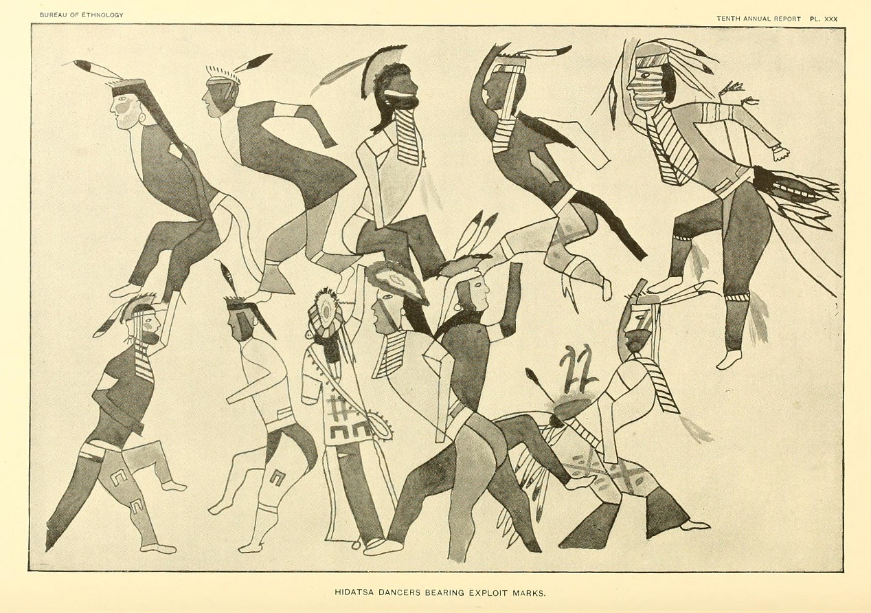
Dancing Hidatsa warriors with exploit marks.jpg - Naawada2016

Garden Coulee village of Hidatsa chief Crow Flies High.png - Naawada2016

Crow Flies High village (1884) and the Fort Berthold reservation.png - Naawada2016

The outline of the 1851 Sioux territory. Crow 1851 territory (yellow 517, grey 619 and pink 635).jpg - Naawada2016

Fort Laramie Treaty (1851). Definition of Crow territory west of Powder River enlarged.jpg - Naawada2016

Arikara chief Son of the Star.jpg - Naawada2016

Hidatsa (Gros Ventre) chiefs Crow's Breast and Poor Wolf.jpg - Naawada2016

Map with the route of a Crow Indian camp and Francois-Antoine Larocque in 1805.png - Naawada2016

De Smet map of the 1851 Fort Laramie Indian territories (the light area). PNG.png - Naawada2016

Photograph of the trading post Fort Union, North Dakota.jpg - Naawada2016

Indian Sign left by the Dakotas on their Trail.jpg - Naawada2016

Some Arikara Indian villages and military forts in the Dakotas, 1795-1886.png - Naawada2016

Arikara Indian scouts in the U.S. Army. From left it is Red Star, Boy Chief and Red Bear.jpg - GreenMeansGo

Indian Sign left by the Dakotas on their Trail (cropped).jpg - GreenMeansGo

Three Affiliated Tribes Chairman Tex Hall, Secretary Gale Norton, and Yurok Tribe Chairwoman Susan Masten, far right to left, among officials leadingthe Bismarck, North Dakota meeti - DPLA - 2a974993ad8b25c2effb99e073550698.jpg - DPLA bot

Map of Huff (32MO11), an early Mandan village in North Dakota.jpg - Indianertosset

Bad Gun (Charging Eagle), Mandan, son of chief Four Bears. Ferrotype 1872.png - Indianertosset