Wikimedi'Òc
Modes d'emploi

Cet album fait partie des albums
Cet album photos contient les sous-albums suivants :


DeSoto Map Leg 2 HRoe 2008.jpg - Ras67
1815m4.jpg - Avaghnn

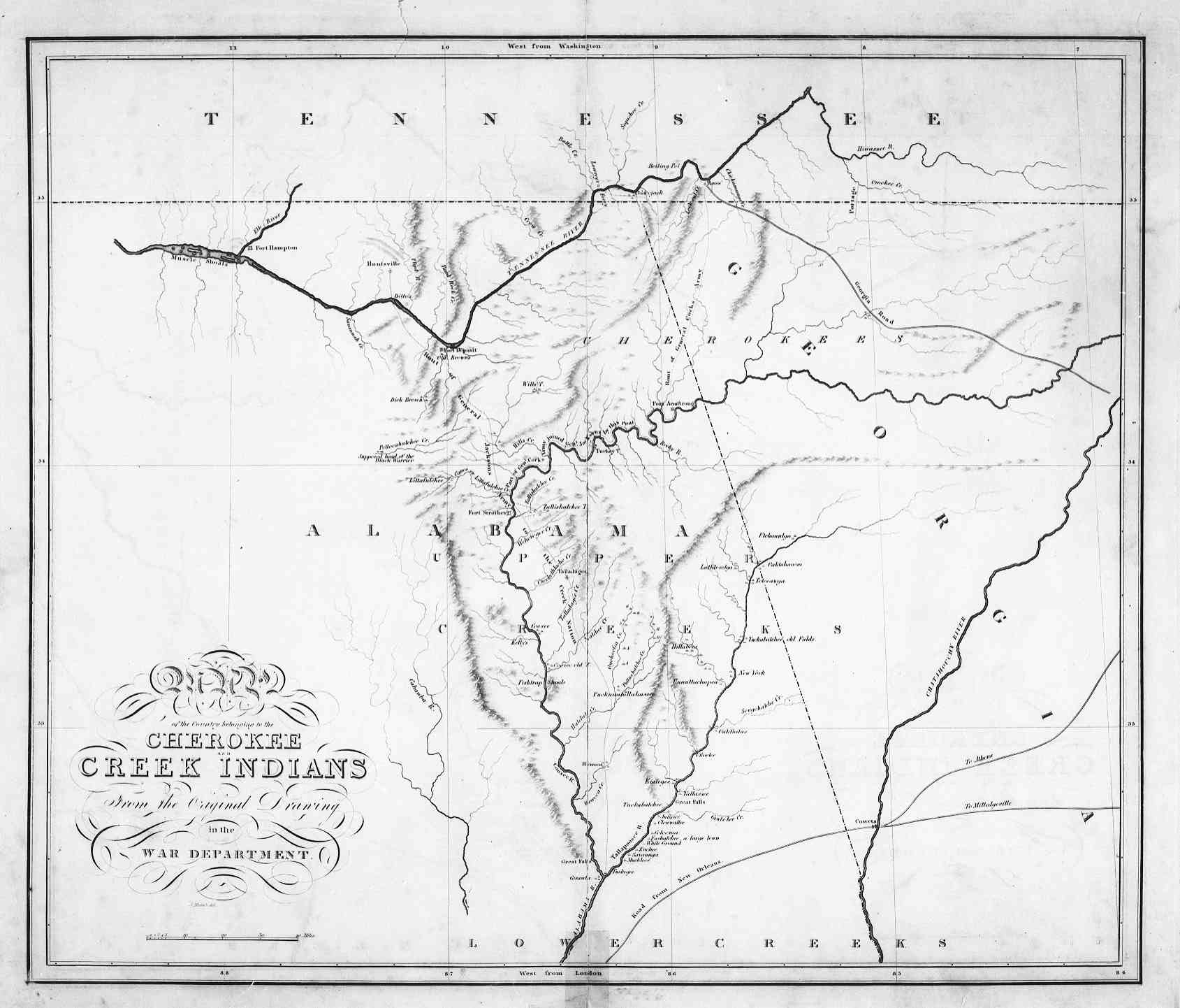
Cherokeenation1830map.jpg - SreeBot
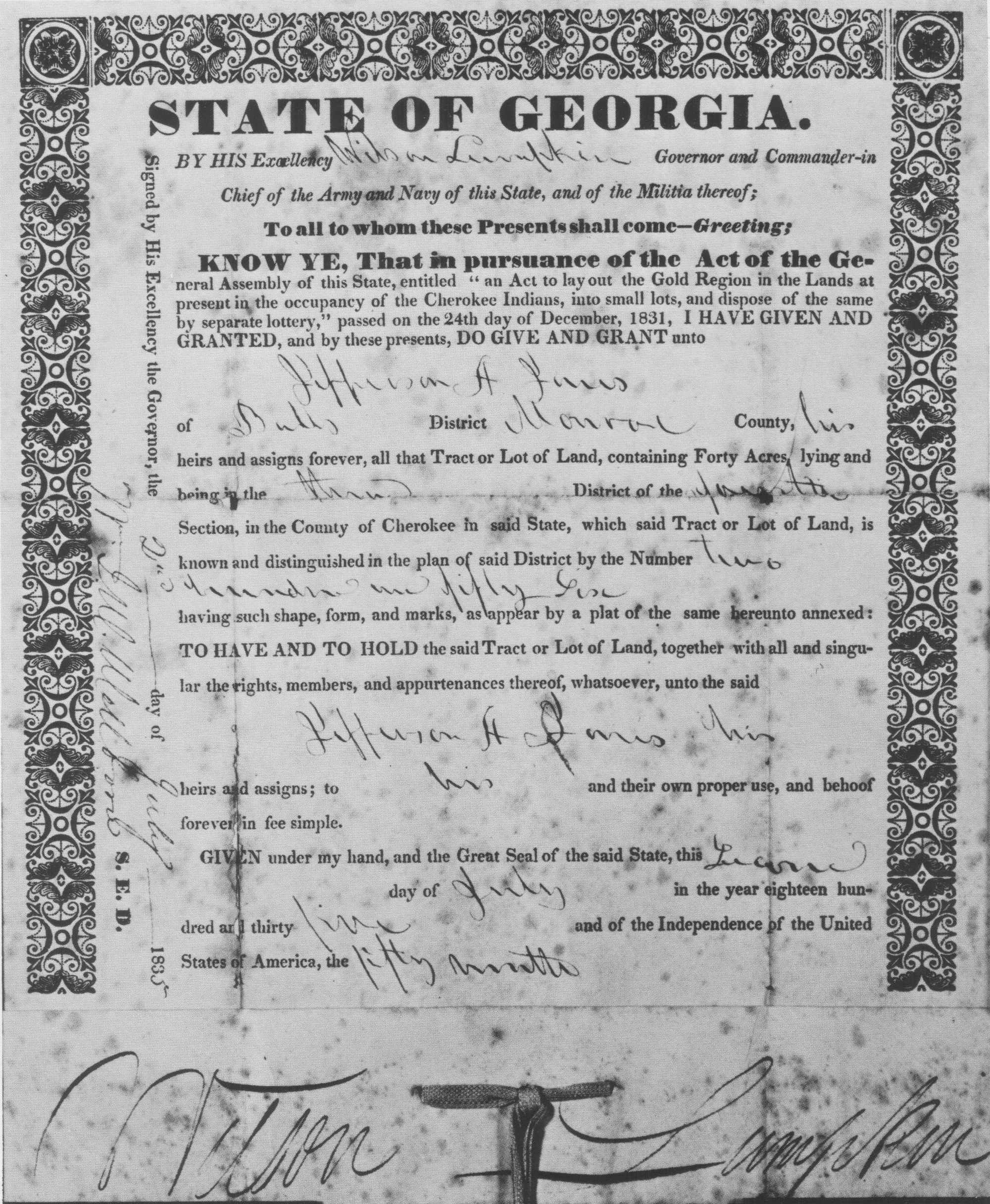
CherokeeLotteryLandDeed.jpg - SreeBot

Fort Walton and Leon-Jefferson cultures map HRoe 2012.jpg - Heironymous Rowe

Seminole County Historical Marker.JPG - Mjrmtg

Butts County Historical Marker.JPG - Mjrmtg

Collections of the Georgia Historical Society (1916) (14598015370).jpg - Fæ

Fort Hughes historical marker, Bainbridge.JPG - Mjrmtg

16 14 061 indian springs.jpg - Dsdugan

Creek Cessions of the Treaty of Indian Springs (1825).jpg - Dallyripple

"Florida et Regiones Vicinae" (9124298123).jpg - Fæ

Martin-Red-Hollow-Road-marker-ga.jpg - BrineStans

Land ceded by the Chiefs of the Cherokee nation of Indians to the United States for the Use of State of Georgia, at the Treaty of the 8th of July, 1817 - NARA - 102279404.jpg - US National Archives bot

19-26-266-sign.jpg - Dsdugan

Seminole State Park - Sabacola El Menor (front).jpg - The Bushranger
21-03-107-indian.jpg - Dsdugan

Fort Hull map.jpg - Dofftoubab

Tomo-chi-chi's Grave.jpg - Greghenderson2006

Cessions Southeastern Tribes- Andrew Jackson.jpg - Wtfiv

Plan of Territory Lying North of the Carroll County Line up to the True Line Between the Creek and Cherokee Tribes of Indians - DPLA - 4f97edf1c83fe67f0908b405610485ca.jpg - DPLA bot

Timucua-And-Surrounding-Groups.png - KiwiNova
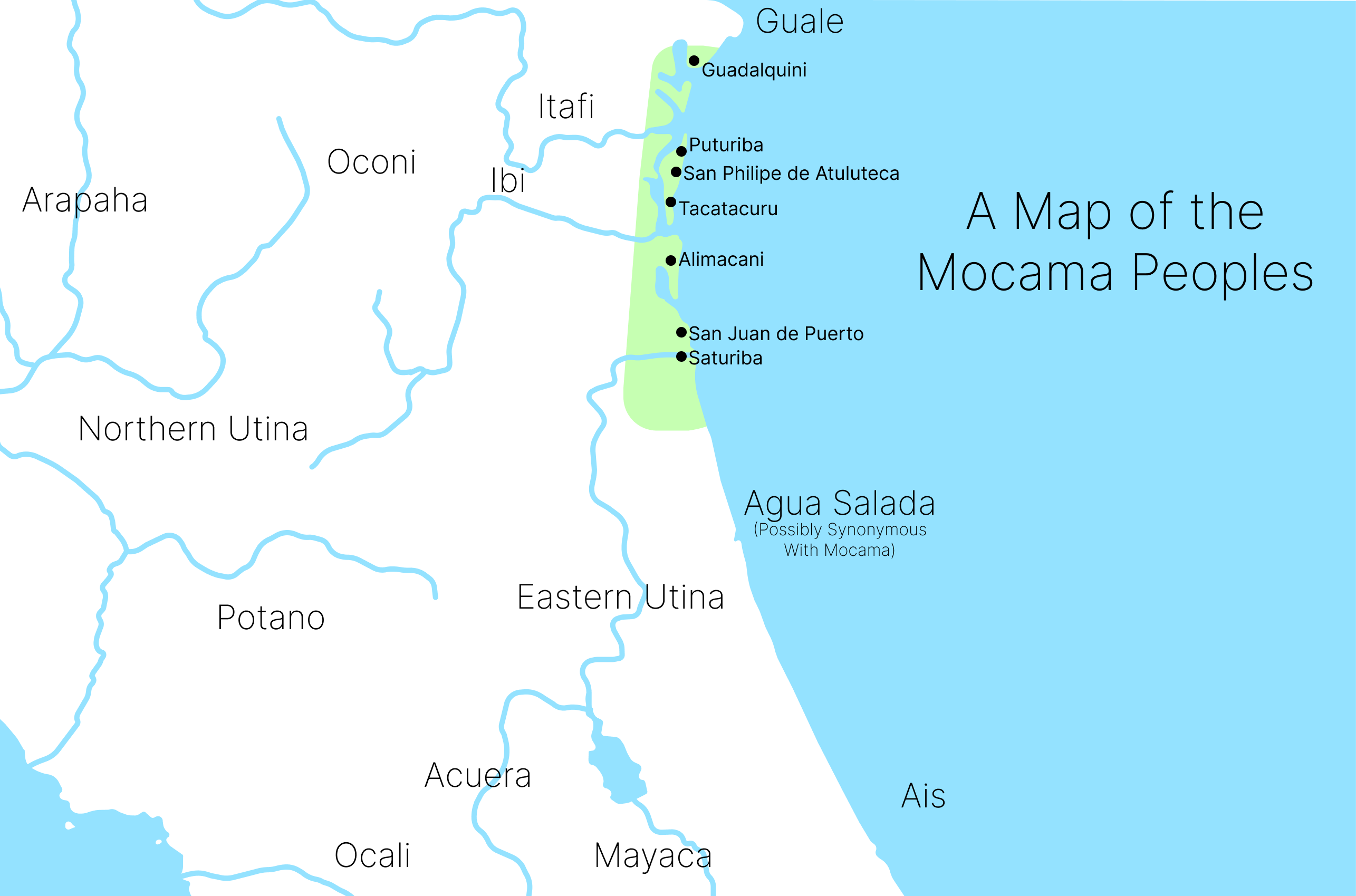
Mocama-People-Map.png - KiwiNova

The Springplace Moravian Mission, Georgia Historical Commission marker, near Chatsworth, Georgia (8337e5ca-1270-4ca2-a011-407f52e7e78b).JPG - BMacZeroBot

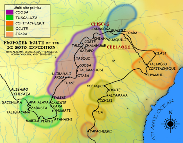
Paramountcy of Coosa.jpg - Dodolulupepe

Negus, Portrait of William McIntosh, Chief of the Lower Creek Indians in Georgia, 1821.jpg - Kreuz und quer